
MA
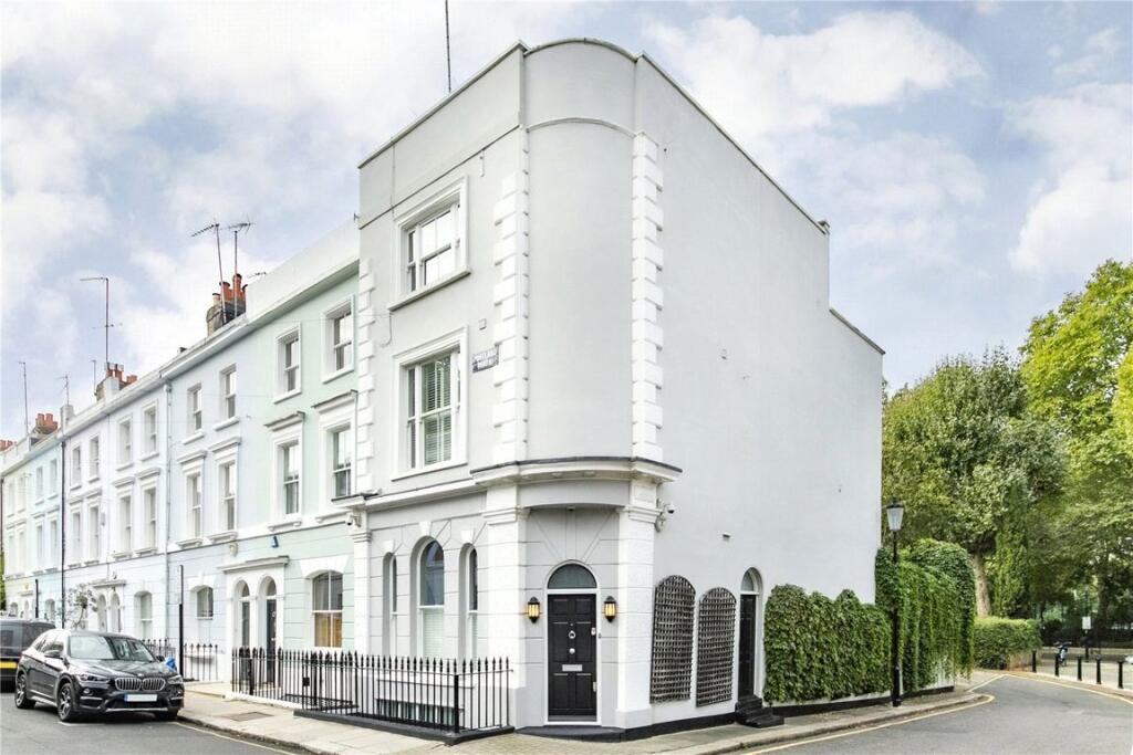
Portland Road, Holland Park
By Marsh & Parsons
£ 2,500
Marsh & Parsons says ..
No summary available.
- Bedrooms
- 4
- Bathrooms
- 3
The heatmap indicates the level of crime in the area. The color of the heatmap indicates the crime severity and recency.
Metrics Year-on-Year
- Average area value
- 312,574.00 £Increased by 1.14 %
- Average area rental value
- 1,096.00 £/moIncreased by 18.74 %
- Est rental Yield
- 4.21 %Increased by 17.60 %
- Crime Rate
- 2.00 %Unchanged by 0.00 %
from 309,063.00 £
from 923.00 £/mo
from 3.58 %
from 2.00 %
Agent Activity
Marsh & Parsons created the listing.
Nearby Schools
| Name | Type | Ofsted | Distance |
|---|---|---|---|
| St Clement And St James Cofe Primary School | Voluntary Aided School | Good | 0.23 KM |
| Avondale Park Primary School | Community School | Good | 0.28 KM |
| St Anne'S & Avondale Park Nursery School | Local Authority Nursery School | Outstanding | 0.28 KM |
| Thomas Jones Primary School | Community School | Outstanding | 0.52 KM |
| Norland Place School | Other Independent School | 0.55 KM |
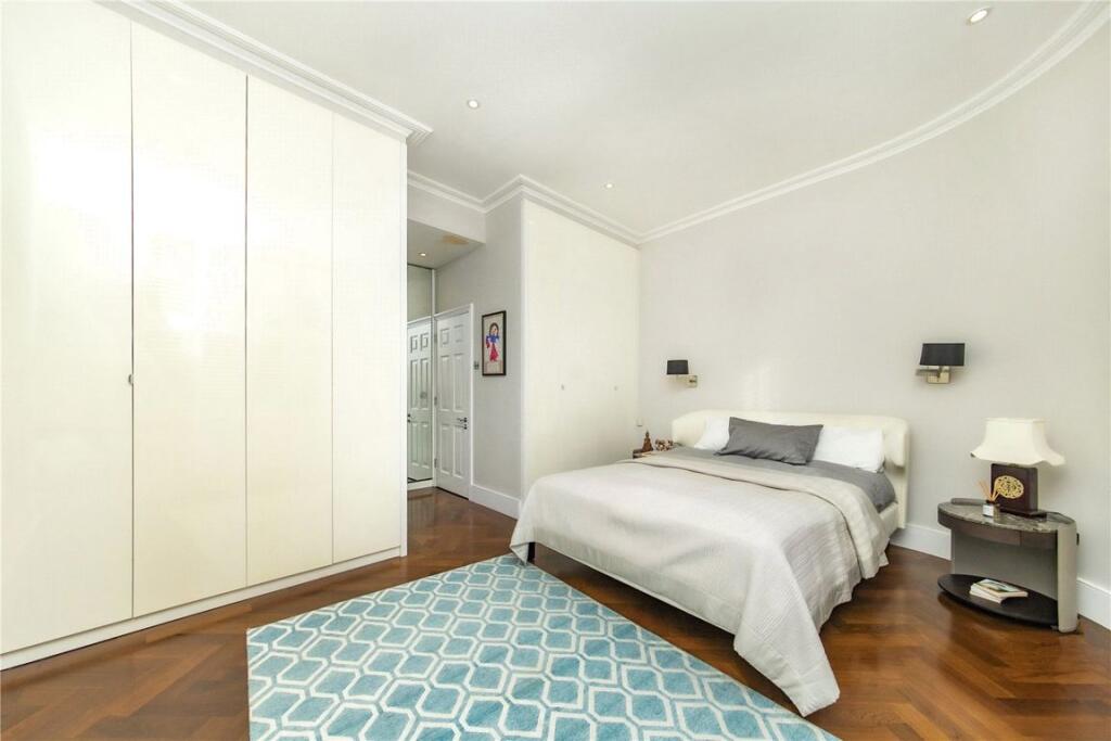
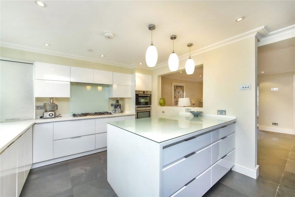
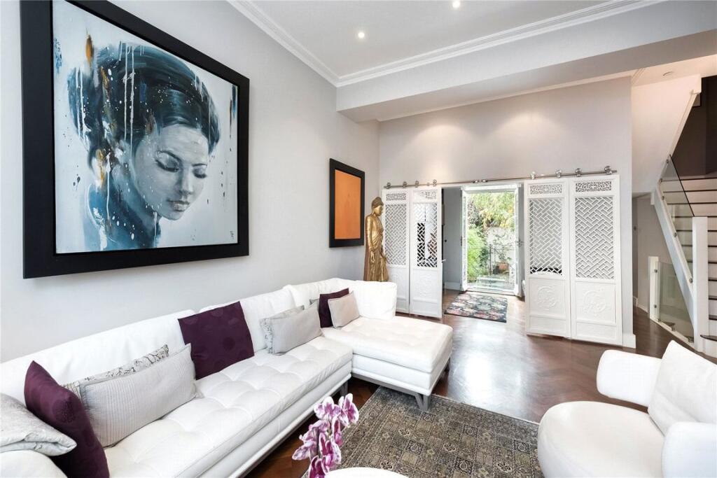
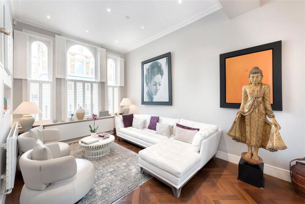
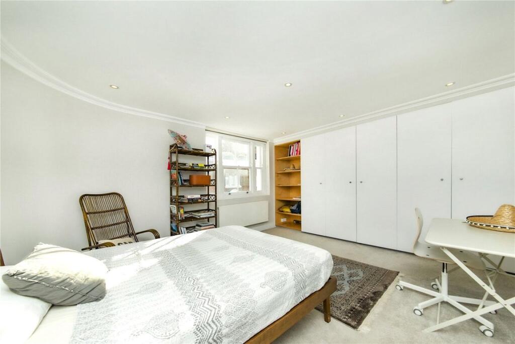
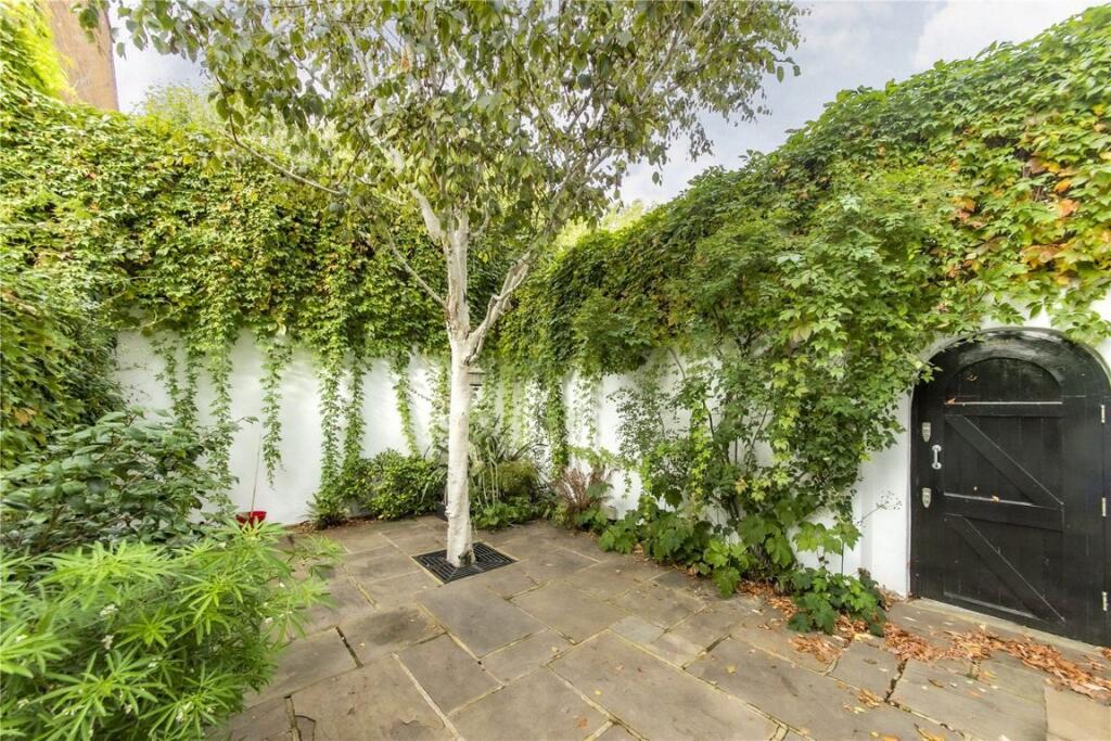
Images


Nearby Streets
| Name | Average Price | Average Sqft | Distance |
|---|---|---|---|
| Clarendon Cross | £ 3,650,000 | 0 | 0.00 KM |
| Runcorn Place | £ 750,000 | 0 | 0.00 KM |
| Rosmead Road | £ 0 | 0 | 0.00 KM |
| Blenheim Crescent | £ 0 | 0 | 0.00 KM |
| St Anns Road | £ 950,000 | 0 | 0.00 KM |
Nearby Transport
| Name | NLC | TLC | Distance |
|---|---|---|---|
| Shepherd'S Bush | 9587 | SPB | 0.96 KM |
| Kensington (Olympia) | 3092 | KPA | 1.47 KM |
| Queens Park (London) | 1419 | QPW | 2.64 KM |
| Kensal Green | 1447 | KNL | 2.65 KM |
| Kensal Rise | 1448 | KNR | 2.78 KM |
Nearby Listings
| Address | Price | Type | Score | Distance |
|---|---|---|---|---|
| Portland Road, Holland Park | £ 2,500 | RENT | Unknown | 0.00 KM |
| Hippodrome Mews, Notting Hill | £ 1,038 | RENT | Unknown | 0.03 KM |
| Portland Road, London, W11 | £ 2,850 | RENT | Unknown | 0.04 KM |
| Clarendon Rd | £ 7,000 | RENT | Unknown | 0.10 KM |
| Clarendon Road, Holland Park, London, W11 | £ 3,142 | RENT | Unknown | 0.10 KM |
Nearby Properties
| Address | Price | Distance |
|---|---|---|
| 120 Portland Road | £ 1,560,000 | 0.06 KM |
| 179 Portland Road | £ 1,850,000 | 0.06 KM |
| 155 Portland Road | £ 2,275,000 | 0.06 KM |
| 157 Portland Road | £ 2,375,000 | 0.06 KM |
| 143 Portland Road | £ 3,250,000 | 0.06 KM |