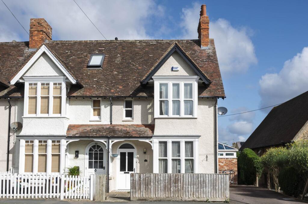

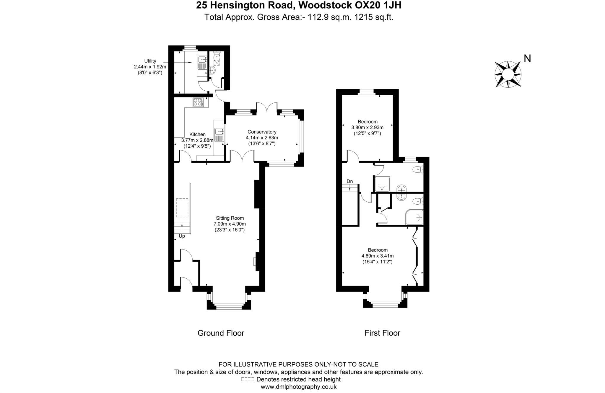
Hensington Road, Woodstock
By Maxwell Douglas
£ 2,000
Maxwell Douglas says ..
A charming end of terrace house with parking & garden in a central position within walking distance of the town`s amenities.
- Bedrooms
- 2
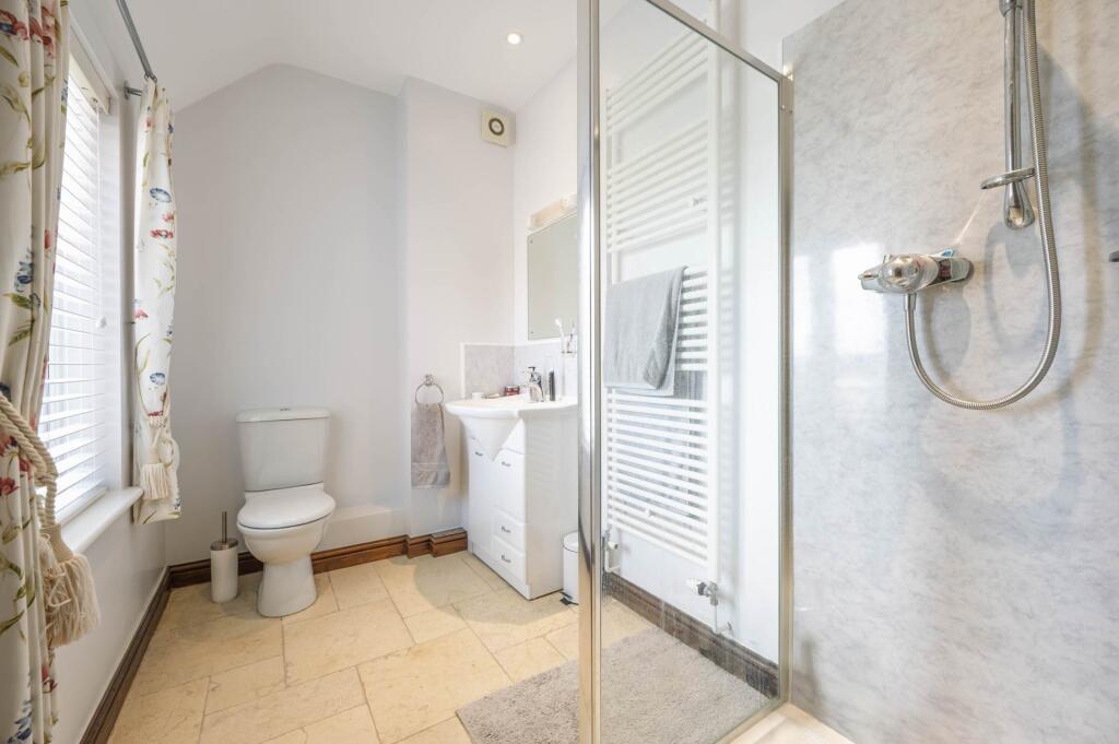
- Bathrooms
- 2
The heatmap indicates the level of crime in the area. The color of the heatmap indicates the crime severity and recency.
Metrics Year-on-Year
- Average area value
- 270,000.00 £Increased by 41.58 %
- Average area rental value
- 936.00 £/moDecreased by 3.51 %
- Est rental Yield
- 4.16 %Decreased by 31.80 %
- Crime Rate
- 51.00 %Unchanged by 0.00 %
from 190,711.00 £
from 970.00 £/mo
from 6.10 %
from 51.00 %
Agent Activity
Maxwell Douglas created the listing.
Nearby Schools
| Name | Type | Ofsted | Distance |
|---|---|---|---|
| Woodstock Church Of England Primary School | Voluntary Controlled School | Outstanding | 0.59 KM |
| The Marlborough Church Of England School | Academy Converter | Good | 1.04 KM |
| Bladon Church Of England Primary School | Voluntary Controlled School | Good | 2.09 KM |
| Wootton-By-Woodstock Church Of England Primary School | Academy Converter | 3.30 KM | |
| Lvs Oxford | Other Independent Special School | 4.22 KM |
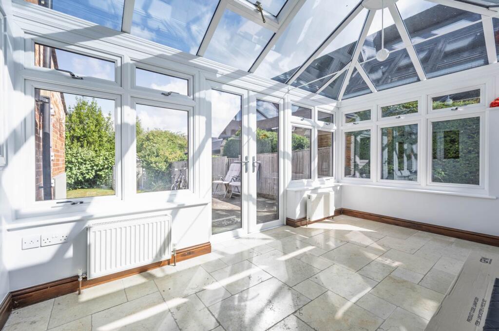
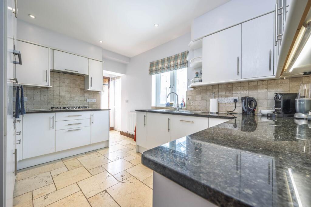
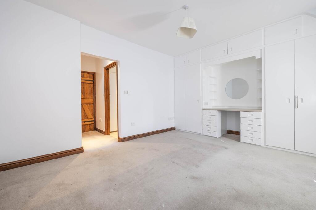
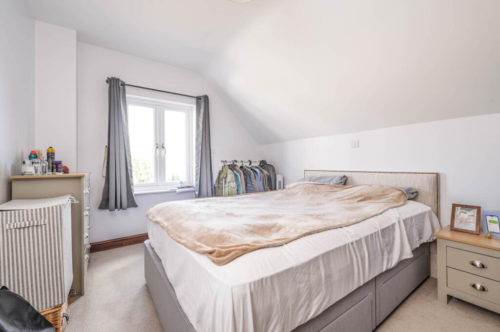
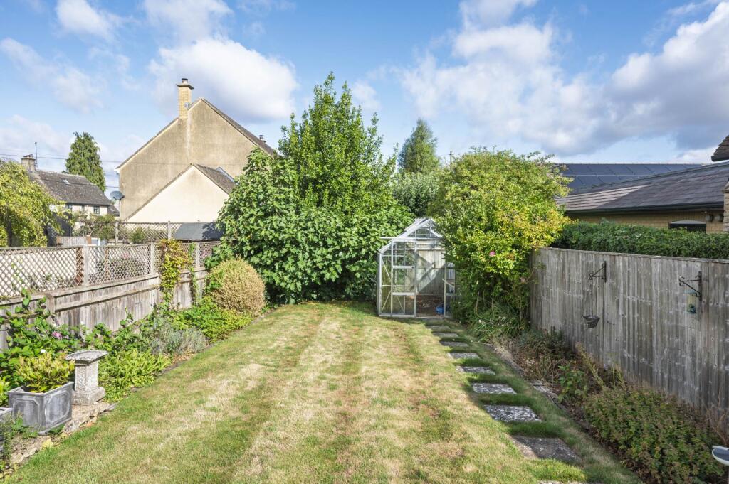
Images


Nearby Streets
| Name | Average Price | Average Sqft | Distance |
|---|---|---|---|
| Glover Mews | £ 1,500,000 | 0 | 0.00 KM |
| Chaucer's Lane | £ 470,000 | 0 | 0.00 KM |
| Ryegrass | £ 0 | 0 | 0.00 KM |
| Youngs Way | £ 250,000 | 0 | 0.00 KM |
| Rose Drive | £ 0 | 0 | 0.00 KM |
Nearby Transport
| Name | NLC | TLC | Distance |
|---|---|---|---|
| Hanborough | 3007 | HND | 3.60 KM |
| Combe (Oxon) | 3005 | CME | 5.10 KM |
| Tackley | 3195 | TAC | 6.94 KM |
| Heyford | 3194 | HYD | 9.73 KM |
| Oxford Parkway | 3121 | OXP | 9.77 KM |
Nearby Listings
| Address | Price | Type | Score | Distance |
|---|---|---|---|---|
| Hensington Road, Woodstock | £ 2,000 | RENT | Unknown | 0.00 KM |
| Hensington Road, Woodstock | £ 1,300 | RENT | Unknown | 0.04 KM |
| Hensington Road | £ 1,295 | RENT | Unknown | 0.04 KM |
| Hensington Road | £ 1,295 | RENT | Unknown | 0.05 KM |
| New Road, Woodstock | £ 1,500 | RENT | Unknown | 0.13 KM |
Nearby Properties
| Address | Price | Distance |
|---|---|---|
| 18 Hensington Road | £ 300,000 | 0.04 KM |
| 60 Hensington Road | £ 235,000 | 0.04 KM |
| 32 Hensington Road | £ 220,000 | 0.04 KM |
| 64 Hensington Road | £ 515,000 | 0.04 KM |
| 44 Hensington Road | £ 195,000 | 0.04 KM |