Wotton Road, Rangeworthy, Bristol, Gloucestershire, BS37
By DJ&P Newland Rennie
£ 342,000
Reviews
3 out of 5 stars
DJ&P Newland Rennie says ..
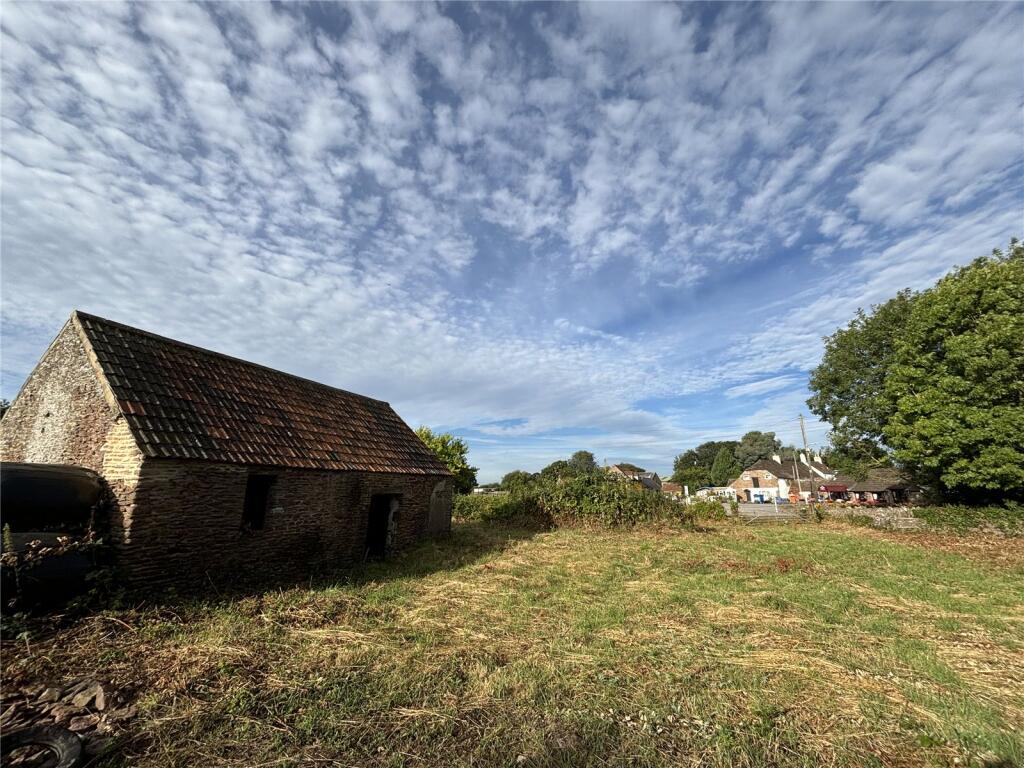
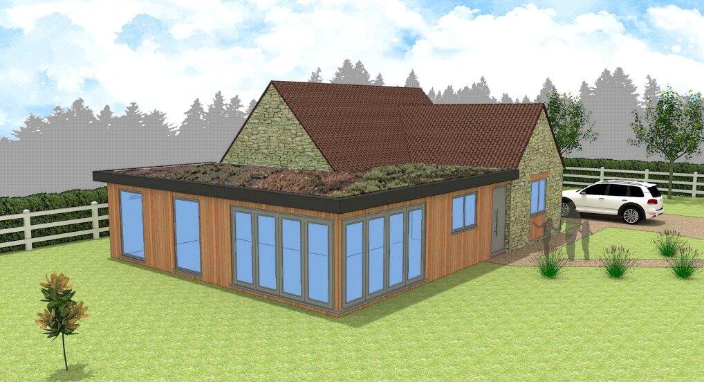
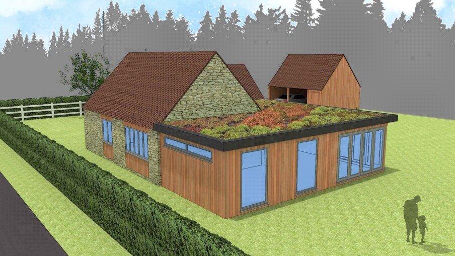
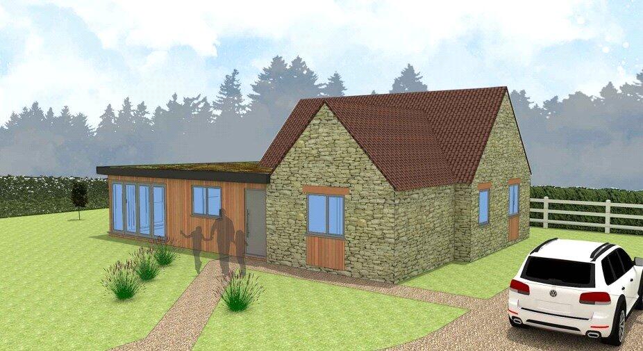
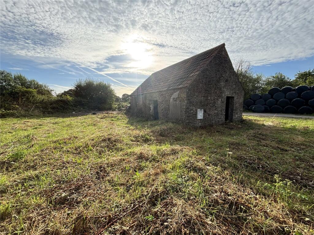
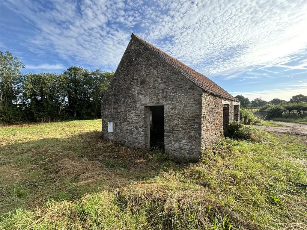
Stone barn with full planning permission for conversion and extension to provide a substantial architecturally designed house with double garage and ancillary accommodation.
Property Oracle says ..
The property is a barn conversion located in Rangeworthy, Gloucestershire. The location benefits from being close to Rangeworthy Church of England Primary School (0.42km), which is rated ‘Good’ by Ofsted. Other nearby schools include North Road Community Primary School and Iron Acton Church of England Primary School, also rated ‘Good’. Yate railway station is approximately 3.89km away, providing access to public transportation.
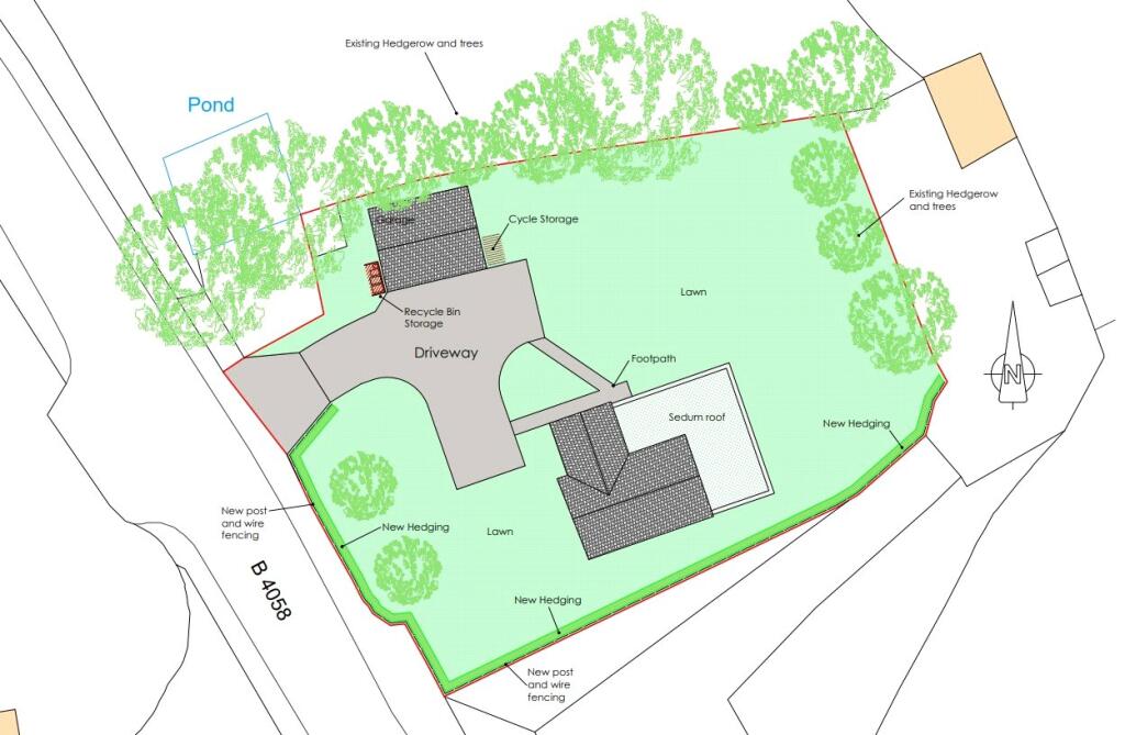
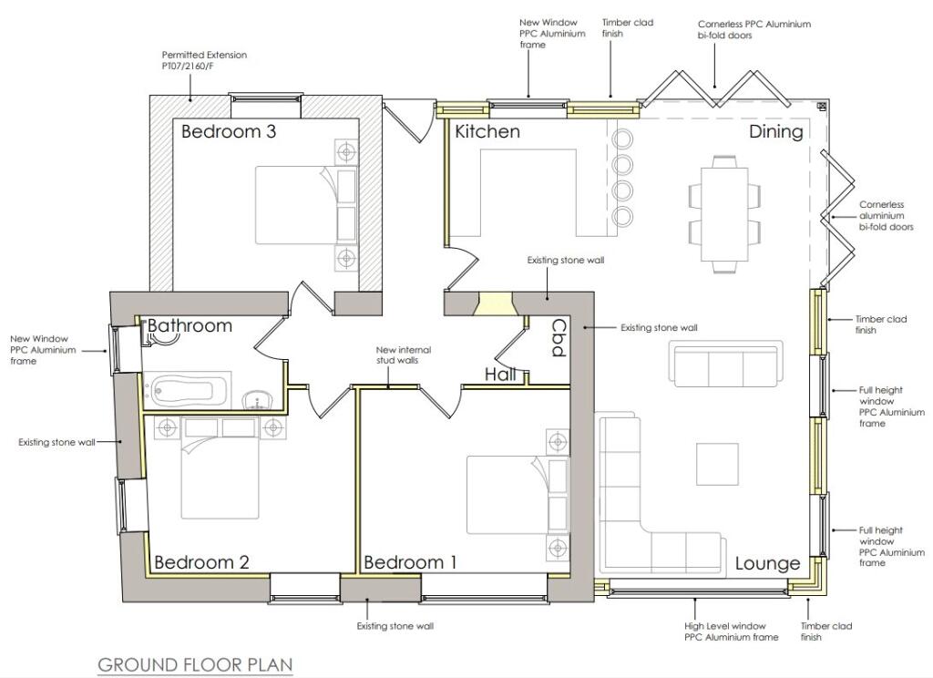
Based on the provided images, the property appears to be under construction or recently completed. The exterior is a mix of stone and modern materials, suggesting a contemporary design. The images show a significant amount of land surrounding the property. The plot appears to be large enough to accommodate the building and offer ample outdoor space. The design plans show a well-thought-out layout, including a kitchen, dining area, lounge, three bedrooms, and a bathroom.
Considering the average house price in the area is £563,346, and the average price per sqft is £315, the list price of £342,000 for this barn conversion appears relatively low, especially given the apparent size of the plot and the modern design. However, without knowing the final square footage of the completed property, a definitive conclusion on the price-to-value ratio cannot be made. The nearby properties are significantly more expensive, ranging from £455,000 to £1,250,000. This suggests that the property might be undervalued, but more information is required to confirm this.
Therefore, we give this property 7 / 10. *Disclaimer: This is our option and does constitute a recommendation or financial advice. Do your own research. *
- Price
- 6
- Condition
- 0
- Location
- 7
- Land
- 8
- Bedrooms
- 0
- Bathrooms
- 0
The heatmap indicates the level of crime in the area. The color of the heatmap indicates the crime severity and recency.
Metrics Year-on-Year
- Average area value
- 477,492.00 £Decreased by 9.28 %
- Average area rental value
- 1,915.00 £/moIncreased by 20.52 %
- Est rental Yield
- 4.81 %Increased by 32.87 %
- Crime Rate
- 0.00 %
Agent Activity
DJ&P Newland Rennie created the listing.
Nearby Schools
| Name | Type | Ofsted | Distance |
|---|---|---|---|
| Rangeworthy Church Of England Primary School | Voluntary Controlled School | Good | 0.42 KM |
| North Road Community Primary School | Community School | Good | 2.65 KM |
| Iron Acton Church Of England Primary School | Voluntary Controlled School | Good | 2.83 KM |
| Brimsham Green School | Community School | Good | 3.32 KM |
| Vinney Green Secure Unit | Secure Units | 3.64 KM |
Images
Nearby Streets
| Name | Average Price | Average Sqft | Distance |
|---|---|---|---|
| Rangeworthy Park | £ 0 | 0 | 0.00 KM |
| Redmay Grove | £ 795,000 | 0 | 0.00 KM |
| Manor Road | £ 0 | 0 | 0.00 KM |
| B4058 | £ 808,750 | 0 | 0.00 KM |
Nearby Transport
| Name | NLC | TLC | Distance |
|---|---|---|---|
| Yate | 3380 | YAE | 3.89 KM |
Nearby Listings
| Address | Price | Type | Score | Distance |
|---|---|---|---|---|
| Wotton Road, Rangeworthy, Bristol, Gloucestershire, BS37 | £ 342,000 | BUY | 7 / 10 | 0.00 KM |
| House 1, Rangeworthy Park, Wotton Road, Rangeworthy, Bristol, BS37 | £ 895,000 | BUY | 7 / 10 | 0.10 KM |
| House 3, Rangeworthy Park, Wotton Road, Rangeworthy, Bristol, BS37 | £ 1,250,000 | BUY | 7 / 10 | 0.10 KM |
| House 2, Rangeworthy Park, Wotton Road, Rangeworthy, Bristol, BS37 | £ 1,050,000 | BUY | 8 / 10 | 0.10 KM |
| House 5, Rangeworthy Park, Wotton Road, Rangeworthy, Bristol, BS37 | £ 1,100,000 | BUY | 9 / 10 | 0.10 KM |
Nearby Properties
| Address | Price | Distance |
|---|---|---|
| Greenfield House | £ 533,000 | 0.10 KM |
| Lilac Cottage | £ 535,000 | 0.14 KM |
| Orchard House | £ 465,000 | 0.14 KM |
| Cotswold House | £ 530,000 | 0.14 KM |
| 12 Gifford Close | £ 336,500 | 0.28 KM |