Oxlynch Lane, Oxlynch, GL10 3DE
By DSB Estate Agents
£ 325,000
Reviews
2 out of 5 stars
DSB Estate Agents says ..
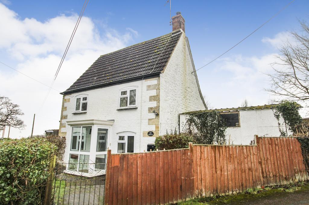
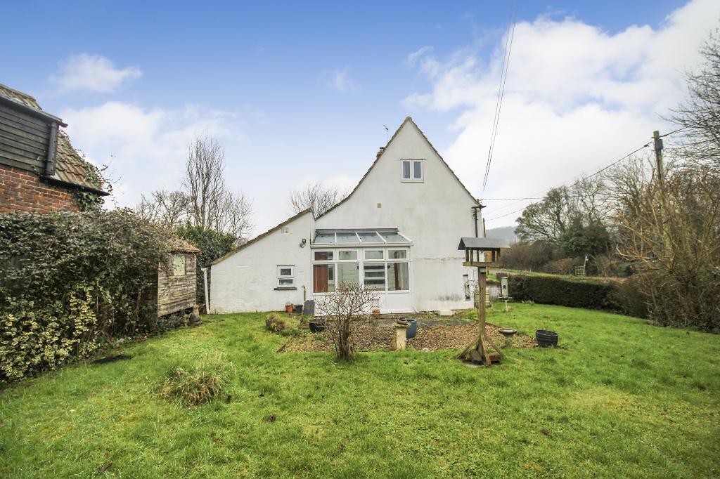
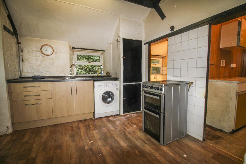
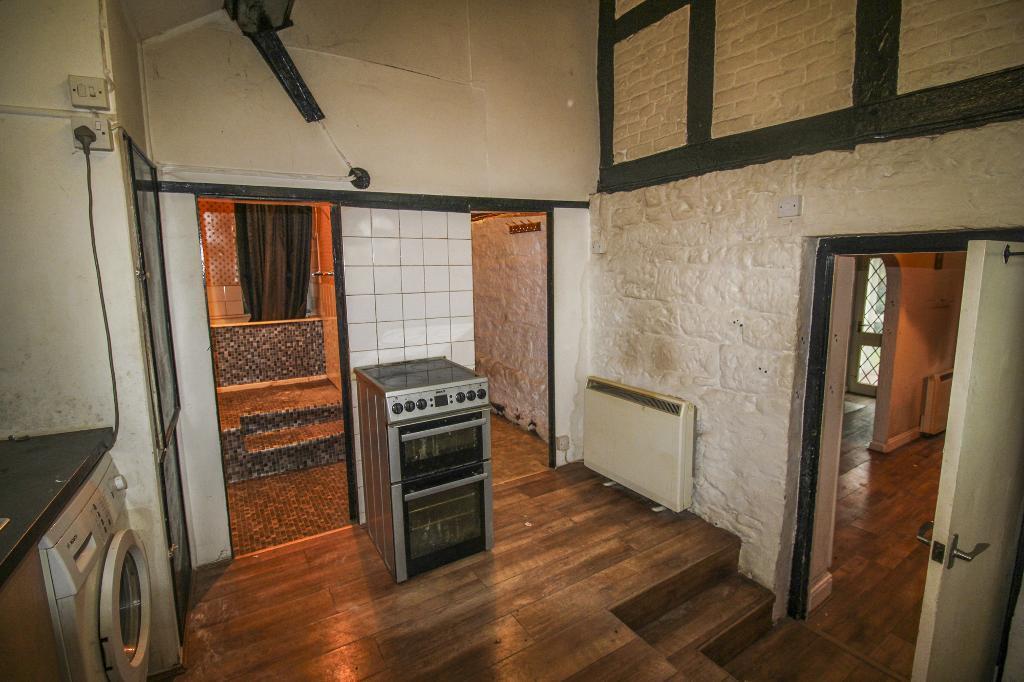
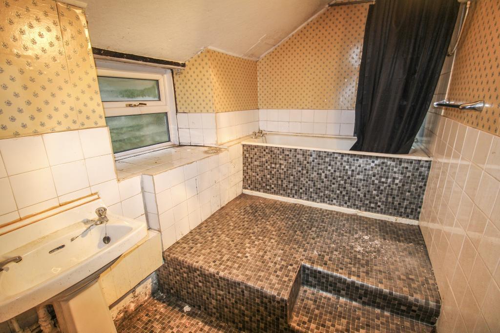
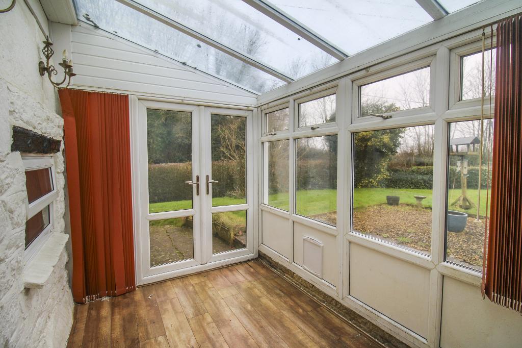
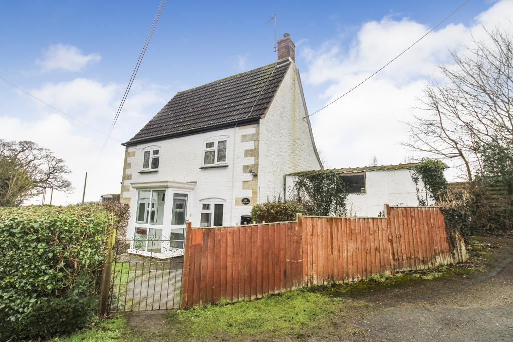
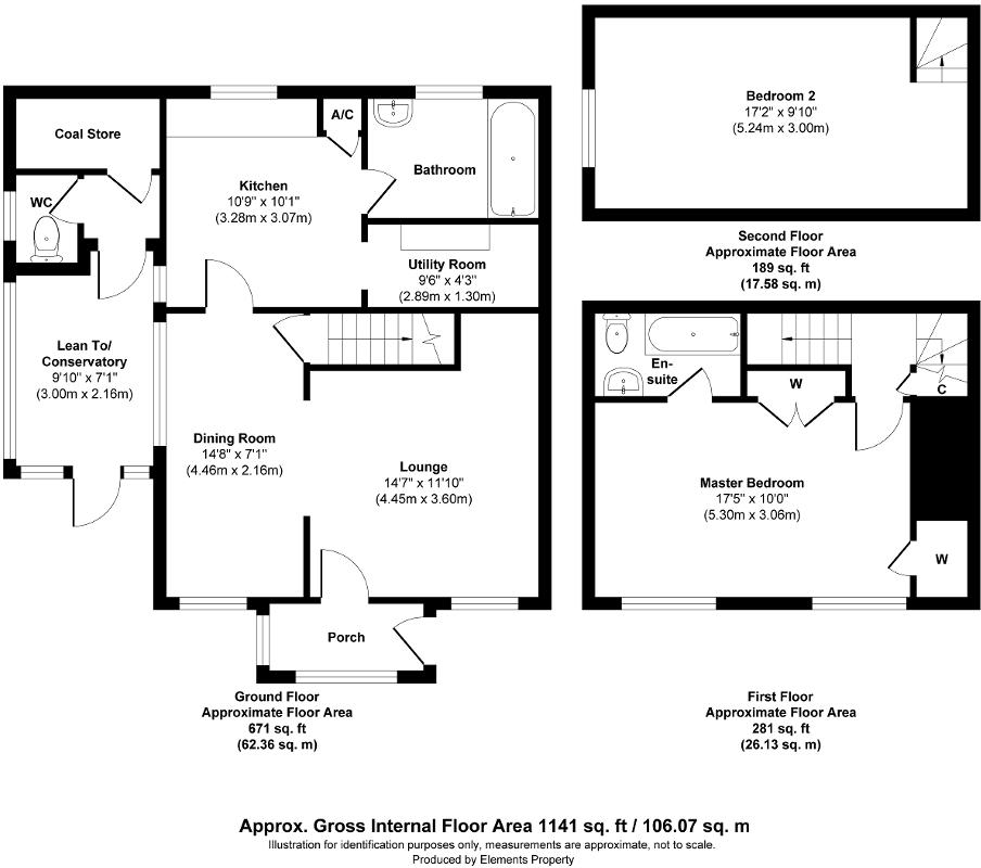
DSB Estate Agents are pleased to bring to the market this two bedroom detached cottage nestled away in the Cotswolds. To the ground floor this property comprises of an entrance porch, an op...
Property Oracle says ..
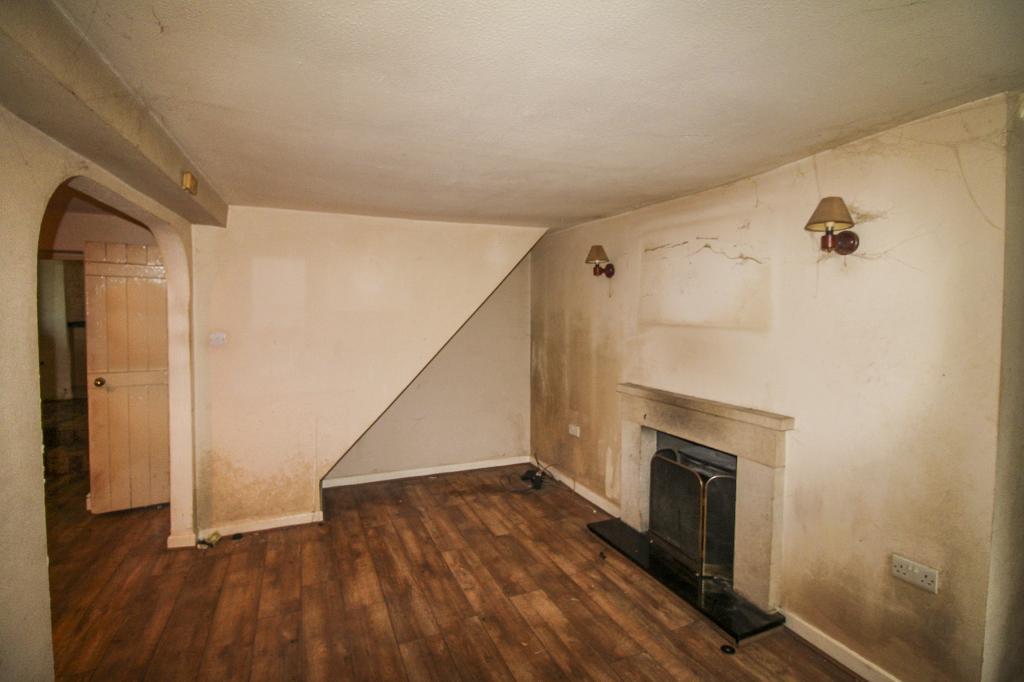
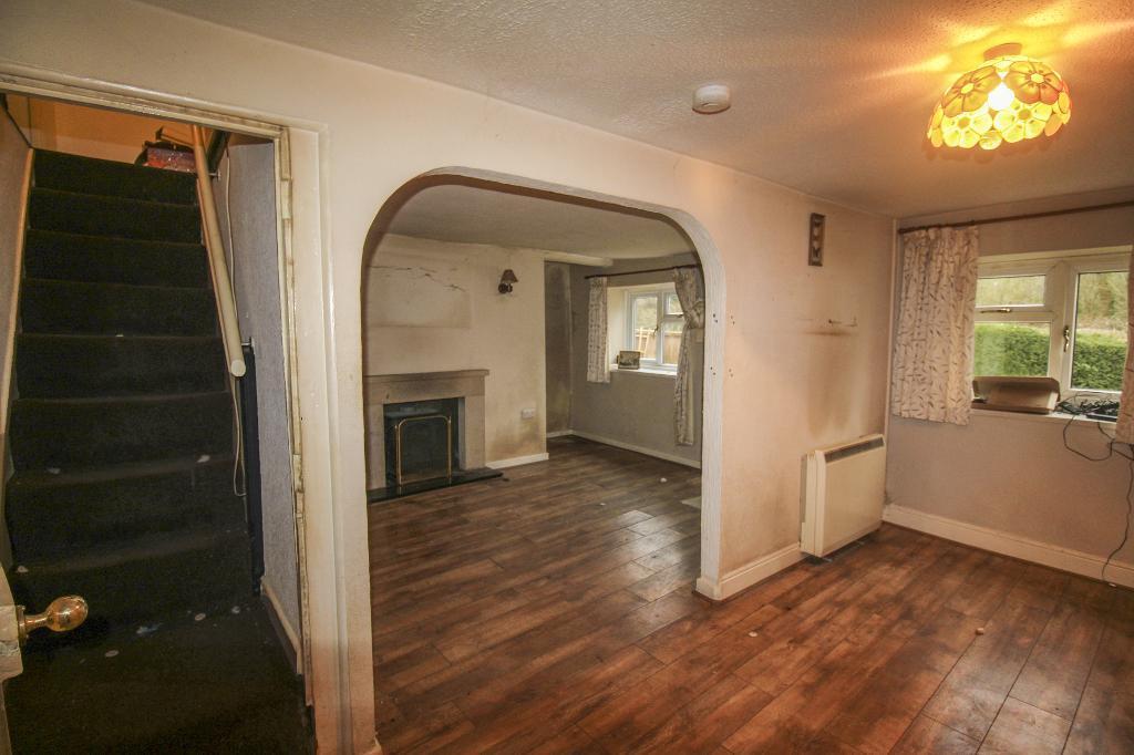
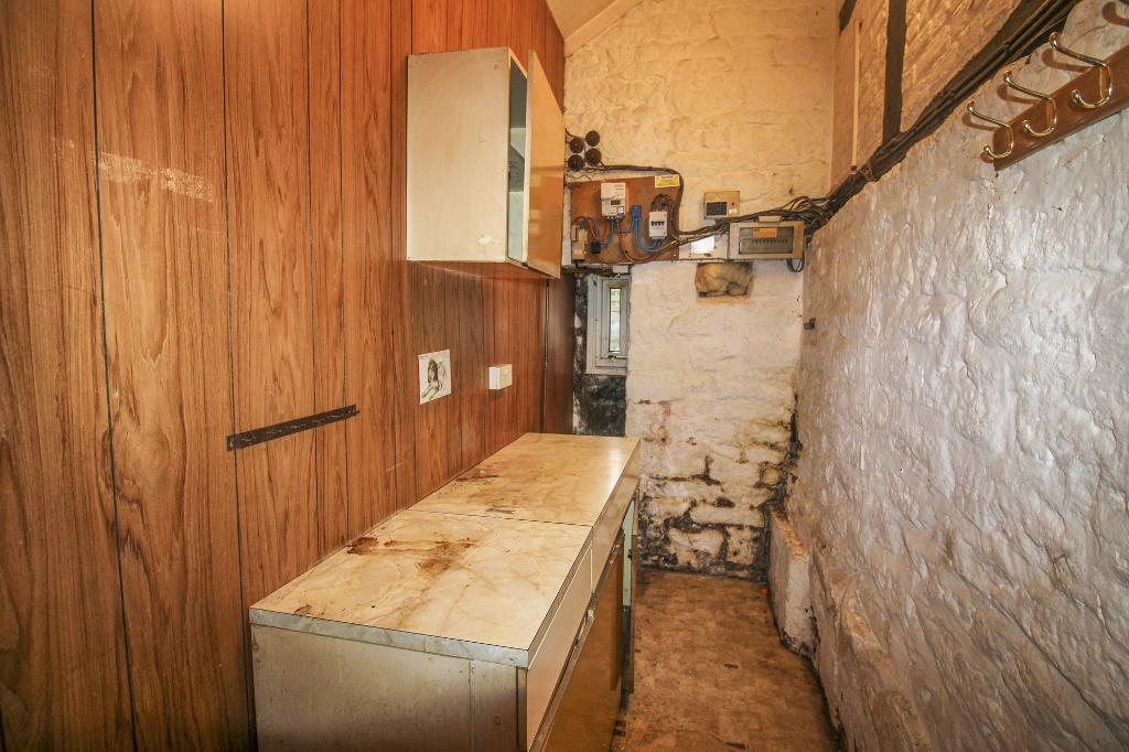
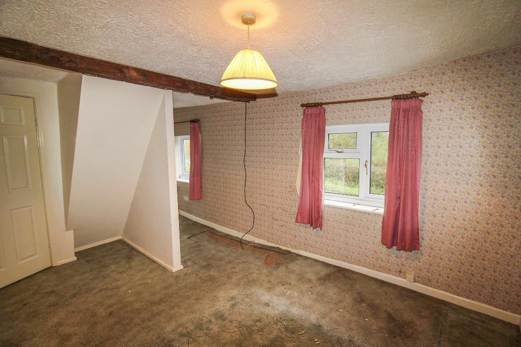
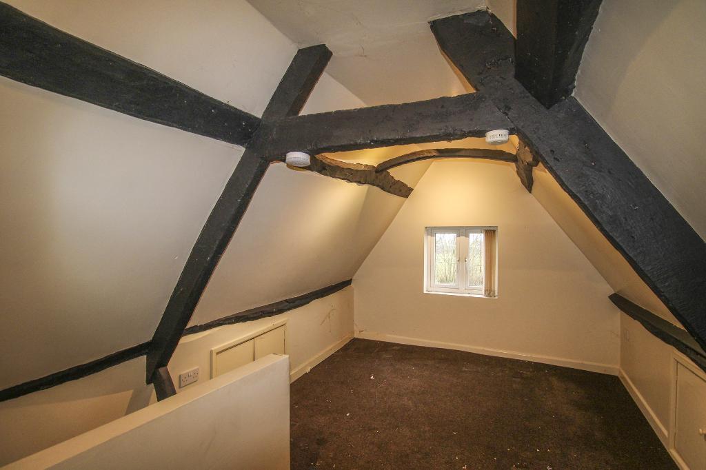
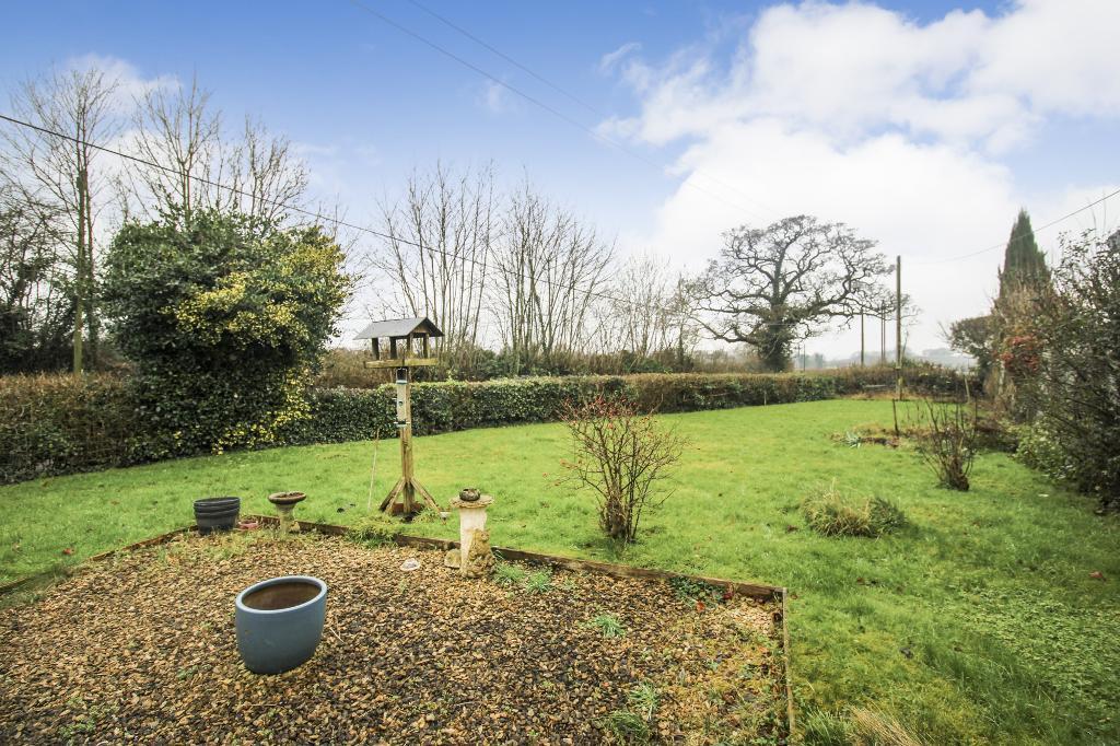
The property is located in Oxlynch, Stroud, Gloucestershire, and is a detached house. The list price is £325,000. The area has an average house price of £245,826 and an average price per square foot of £251. However, the property’s square footage is not provided, making a precise price per square foot comparison impossible. Nearby properties range significantly in price, from £314,000 to £805,000, indicating a variable market. The proximity to Stonehouse and Stroud train stations offers convenient transportation links. Several schools with good Ofsted ratings are within a reasonable distance, which is beneficial for families. The property itself appears to have a garden. Based on the images, the property is in need of significant renovation. The walls show signs of damp, the interior finishes are dated and worn, and the overall condition suggests a considerable amount of work would be required to bring it up to a modern standard. The property has some character features but requires substantial modernisation. Considering the need for extensive renovation, the lack of square footage data, and the price range of comparable properties, a conclusive assessment of the property’s value is challenging. However, the list price of £325,000 seems potentially high given the required renovations, unless the plot size is exceptionally large or the location offers unique advantages not fully reflected in the available data.
Therefore, we give this property 4 / 10. *Disclaimer: This is our option and does constitute a recommendation or financial advice. Do your own research. *
- Price
- 4
- Condition
- 3
- Location
- 7
- Land
- 5
- Bedrooms
- 2
- Bathrooms
- 3
- Sqft (est)
- 1,141.00
The heatmap indicates the level of crime in the area. The color of the heatmap indicates the crime severity and recency.
Metrics Year-on-Year
- Average area value
- 251,538.00 £Increased by 21.55 %
- Est sale value
- 236,187.00 £Decreased by 4.17 %
- Average area rental value
- 754.00 £/moDecreased by 18.22 %
- Est letting value
- 0.00 £/mo
- Est rental Yield
- 3.60 %Decreased by 32.71 %
- Crime Rate
- 0.00 %
Agent Activity
DSB Estate Agents created the listing.
Nearby Schools
| Name | Type | Ofsted | Distance |
|---|---|---|---|
| Randwick Church Of England Primary School | Voluntary Controlled School | Outstanding | 1.85 KM |
| Maidenhill School | Foundation School | Good | 1.90 KM |
| Cashes Green Primary School | Community School | Good | 2.23 KM |
| Five Ways Children'S Centre | Children's Centre | 2.25 KM | |
| Foxmoor Primary School | Community School | Good | 2.26 KM |
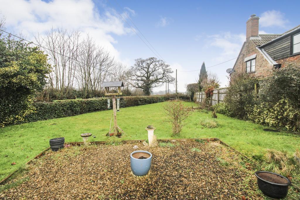
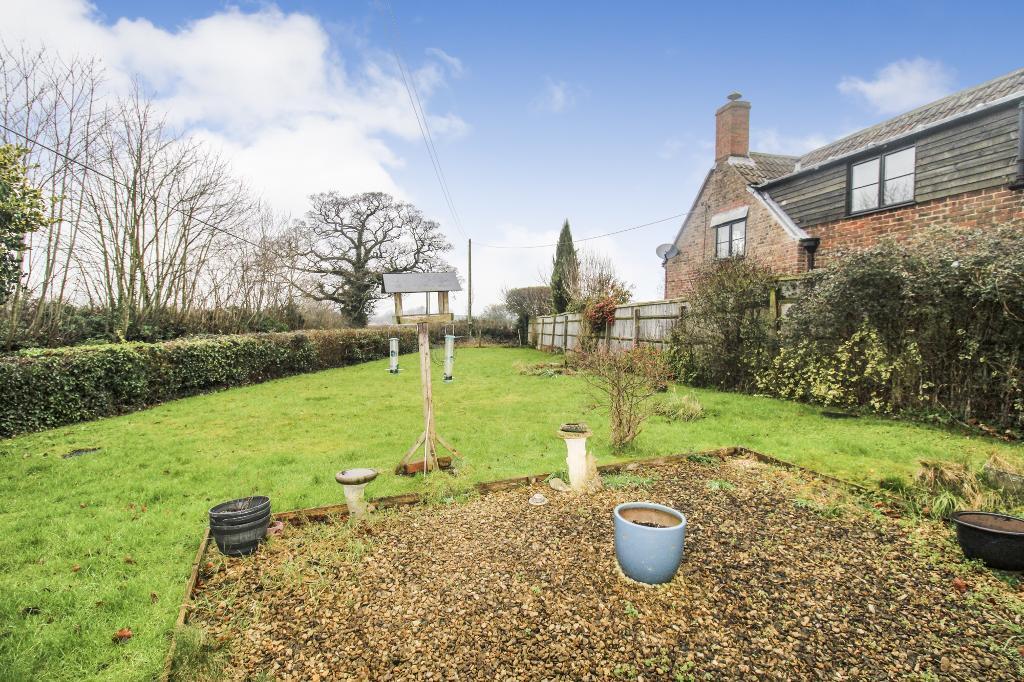
Images


Nearby Streets
| Name | Average Price | Average Sqft | Distance |
|---|---|---|---|
| Beatrice Webb Lane | £ 447,500 | 0 | 0.00 KM |
| Mary King Close | £ 0 | 0 | 0.00 KM |
| Arlebrook | £ 0 | 0 | 0.00 KM |
| The Stocks | £ 1,300,000 | 0 | 0.00 KM |
| Blenheim Cottages | £ 600,000 | 0 | 0.00 KM |
Nearby Transport
| Name | NLC | TLC | Distance |
|---|---|---|---|
| Stonehouse | 4770 | SHU | 2.39 KM |
| Stroud (Gloucs) | 4771 | STD | 5.38 KM |
Nearby Listings
| Address | Price | Type | Score | Distance |
|---|---|---|---|---|
| Oxlynch Lane, Oxlynch, GL10 3DE | £ 325,000 | BUY | 4 / 10 | 0.00 KM |
| Beatrice Webb Lane, Stonehouse, GL10 3WE | £ 440,000 | BUY | Unknown | 0.22 KM |
| Beatrice Webb Lane, Standish, Stonehouse, Gloucestershire, GL10 | £ 375,000 | BUY | 6 / 10 | 0.23 KM |
| Beatrice Webb Lane, Standish, Stonehouse, Gloucestershire, GL10 | £ 425,000 | BUY | 8 / 10 | 0.23 KM |
| Beatrice Webb Lane, Standish, Stonehouse, Gloucestershire, GL10 | £ 400,000 | BUY | 6 / 10 | 0.24 KM |
Nearby Properties
| Address | Price | Distance |
|---|---|---|
| The Coach House | £ 342,500 | 1.55 KM |
| Avalon | £ 412,000 | 1.56 KM |
| Highwood | £ 805,000 | 1.58 KM |
| Ash House | £ 314,000 | 1.58 KM |
| Robin Hill | £ 365,000 | 1.58 KM |