TO
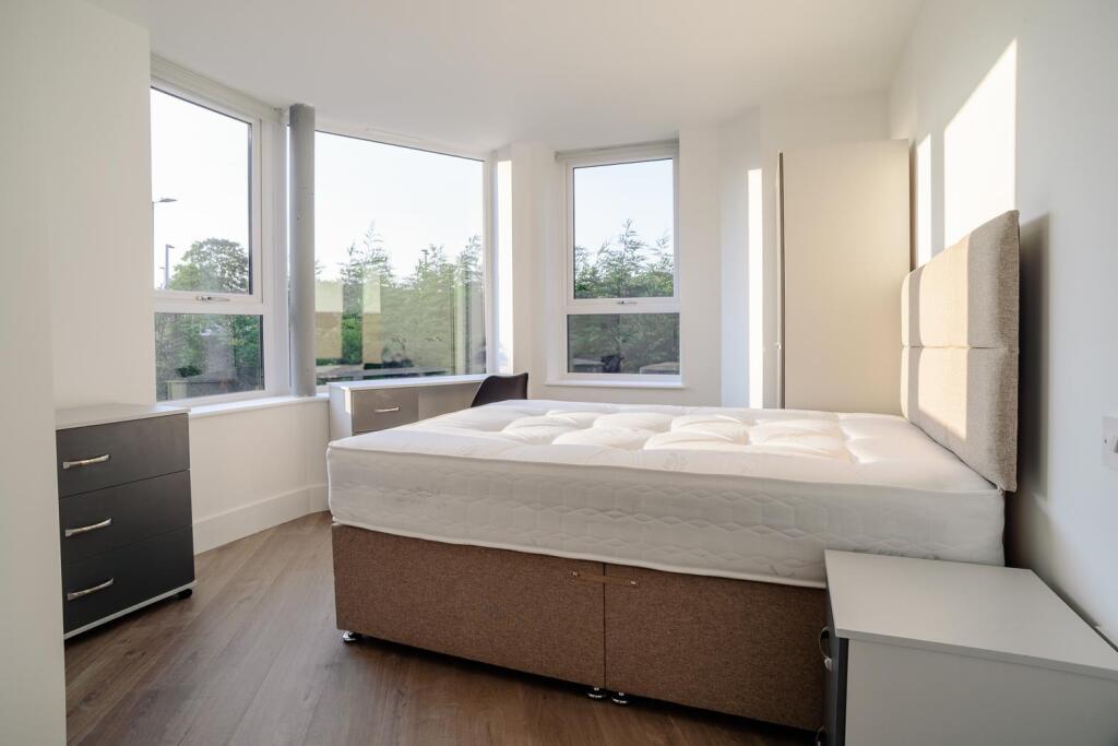
**£170 PPPW BILLS INCLUDED** Queens Road East, Beeston, Nottingham
By Top 365 Ltd
£ 3,693
Top 365 Ltd says ..
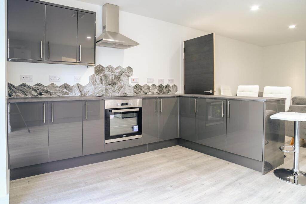
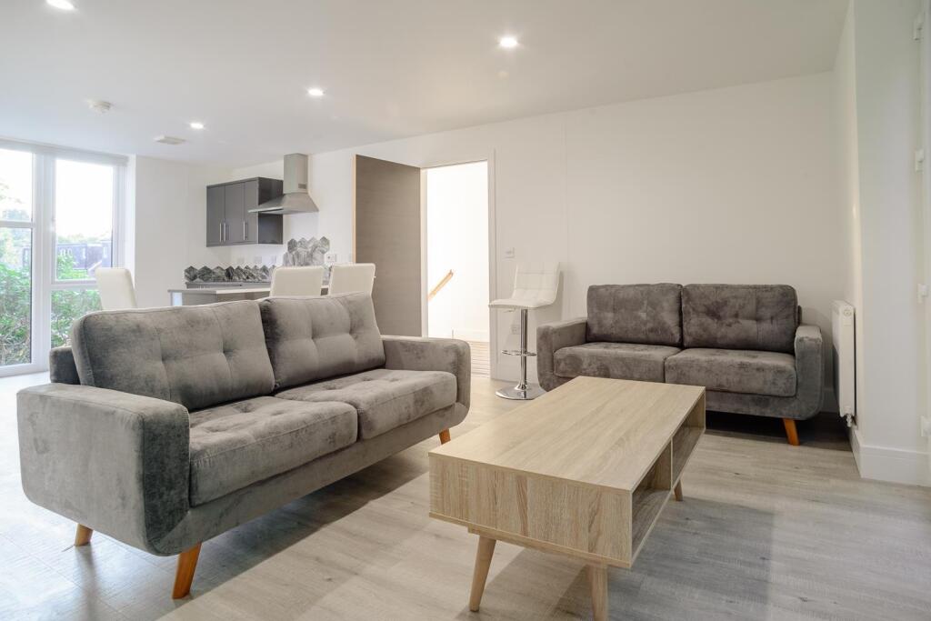
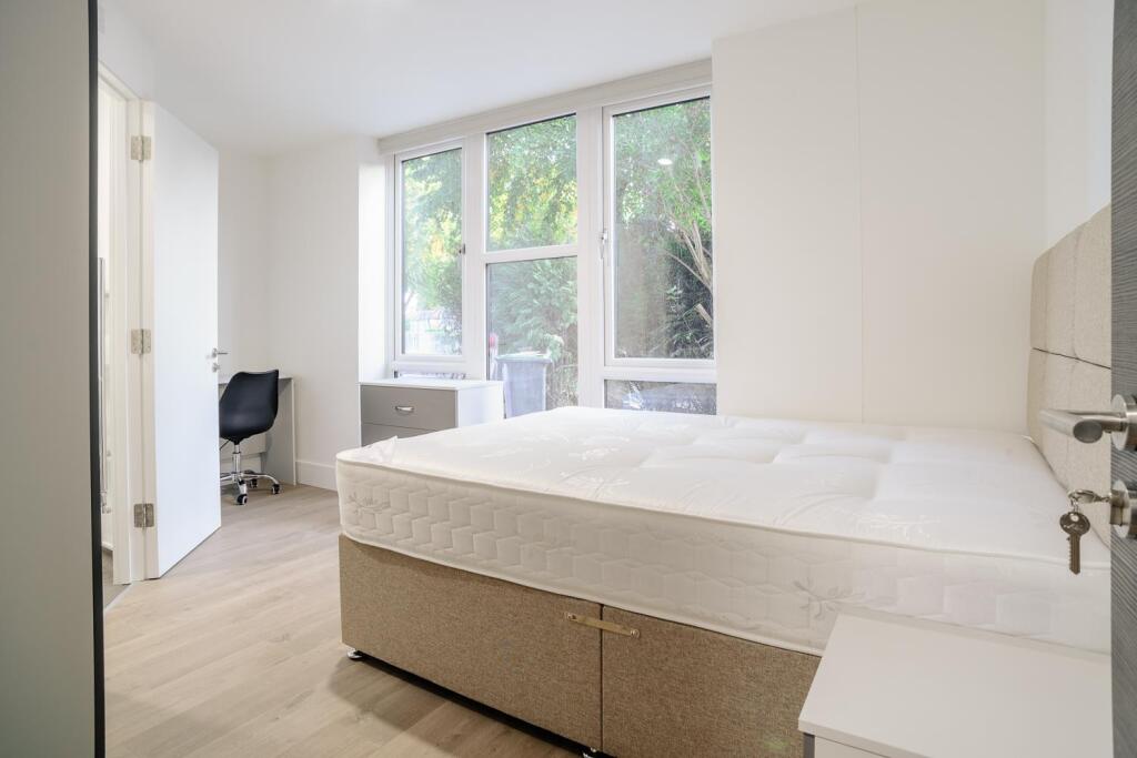
**£170 PPPW BILLS INCLUDED** NOTHING TO PAY UNTIL OCTOBER 2025! **FREE PARKING** **MONTHLY CLEANER** AVAILABLE ACADEMIC YEAR 2025/26 5 ENSUITE BEDROOMS
- Bedrooms
- 5
- Bathrooms
- 5
The heatmap indicates the level of crime in the area. The color of the heatmap indicates the crime severity and recency.
Metrics Year-on-Year
- Average area value
- 321,000.00 £Increased by 22.65 %
- Average area rental value
- 1,250.00 £/moIncreased by 35.28 %
- Est rental Yield
- 4.67 %Increased by 10.14 %
- Crime Rate
- 4.00 %Unchanged by 0.00 %
from 261,717.00 £
from 924.00 £/mo
from 4.24 %
from 4.00 %
Agent Activity
Top 365 Ltd created the listing.
Nearby Schools
| Name | Type | Ofsted | Distance |
|---|---|---|---|
| John Clifford Primary School | Academy Converter | 0.98 KM | |
| Beeston Fields Primary School And Nursery | Academy Sponsor Led | Good | 1.60 KM |
| Trent Vale Infant School | Community School | Good | 1.66 KM |
| Beeston Rylands Junior School | Community School | Good | 1.67 KM |
| Round Hill Primary School | Community School | Good | 1.83 KM |
Images


Nearby Streets
| Name | Average Price | Average Sqft | Distance |
|---|---|---|---|
| Lower Court | £ 0 | 0 | 0.00 KM |
| Kays Meadow | £ 0 | 0 | 0.00 KM |
| Bridge Court | £ 295,000 | 0 | 0.00 KM |
| Queens Drive | £ 337,500 | 0 | 0.00 KM |
| Turnpike Lane | £ 0 | 0 | 0.00 KM |
Nearby Transport
| Name | NLC | TLC | Distance |
|---|---|---|---|
| Beeston | 1625 | BEE | 1.33 KM |
| Attenborough | 1624 | ATB | 4.24 KM |
| Nottingham | 1826 | NOT | 6.49 KM |
| Bulwell | 1865 | BLW | 7.60 KM |
Nearby Listings
| Address | Price | Type | Score | Distance |
|---|---|---|---|---|
| **£180 PPPW BILLS INCLUDED** Queens Road East, Beeston, Nottingham, NG9 2GN | £ 4,693 | RENT | Unknown | 0.00 KM |
| **£170PPPW BILLS INCL** Queens Road East, Beeston, Nottingham | £ 4,431 | RENT | Unknown | 0.00 KM |
| **£170 PPPW BILLS INCLUDED** Queens Road East, Beeston, Nottingham | £ 3,693 | RENT | Unknown | 0.00 KM |
| **£170 PPPW BILLS INCLUDED** The Cave, Queens Road East, Beeston, Nottingham | £ 5,909 | RENT | Unknown | 0.01 KM |
| **£175PPPW BILLS INCLUDED** Queens Road East, Beeston, Nottingham | £ 3,801 | RENT | Unknown | 0.01 KM |
Nearby Properties
| Address | Price | Distance |
|---|---|---|
| 7 Queens Road East | £ 168,000 | 0.07 KM |
| 3 Queens Road East | £ 480,000 | 0.07 KM |
| 9 Queens Road East | £ 76,000 | 0.07 KM |
| 14 Lower Road | £ 53,000 | 0.09 KM |
| 10 Lower Road | £ 75,000 | 0.09 KM |