The Knapp, Cossington
By Smiths Property Experts
£ 699,950
Reviews
3 out of 5 stars
Smiths Property Experts says ..
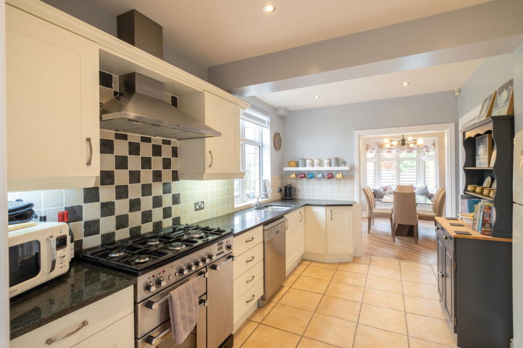
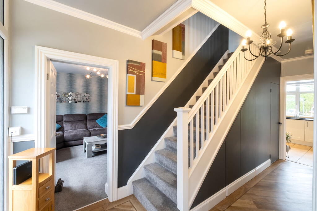
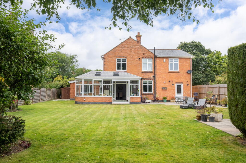
Impressive and extensively remodelled 1930s detached family home set in manicured grounds extending to approximately 1/4 of an acre. The property features a private driveway and an attached garage with power and lighting.
Property Oracle says ..
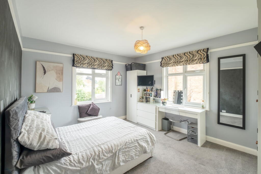
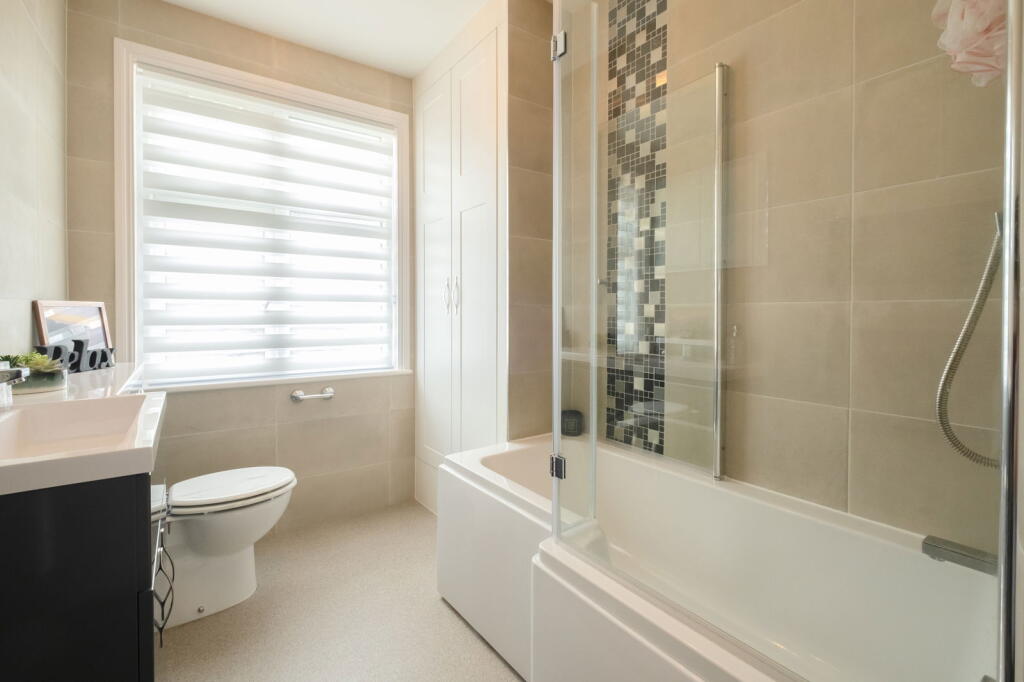
The property is a 5 bedroom, 2 bathroom detached house located in Cossington, Leicestershire. It is listed at £699,950 and has a plot size of 2,234 sqft and internal area of 2,065.85 sqft.
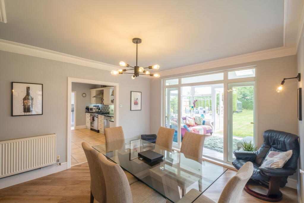
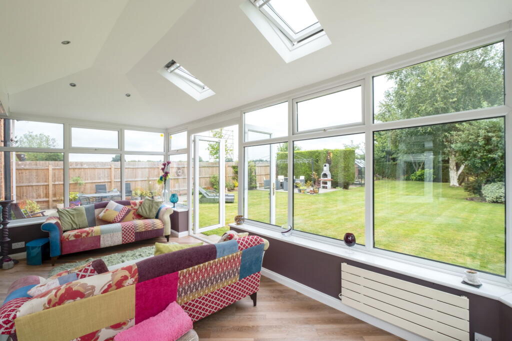
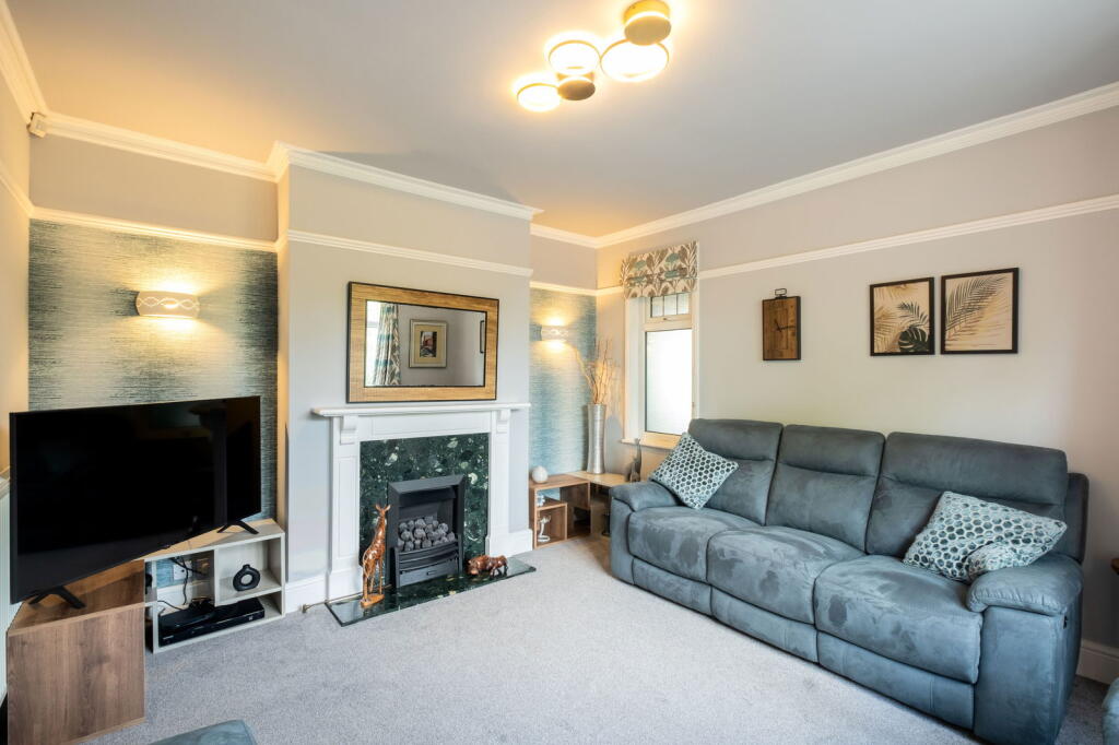
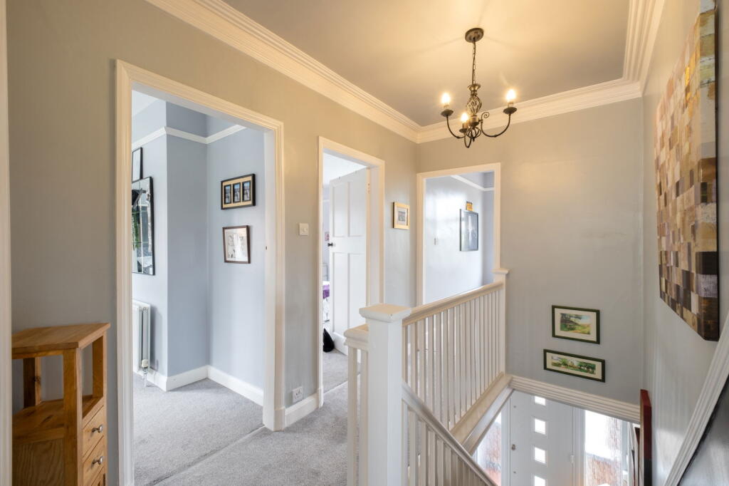
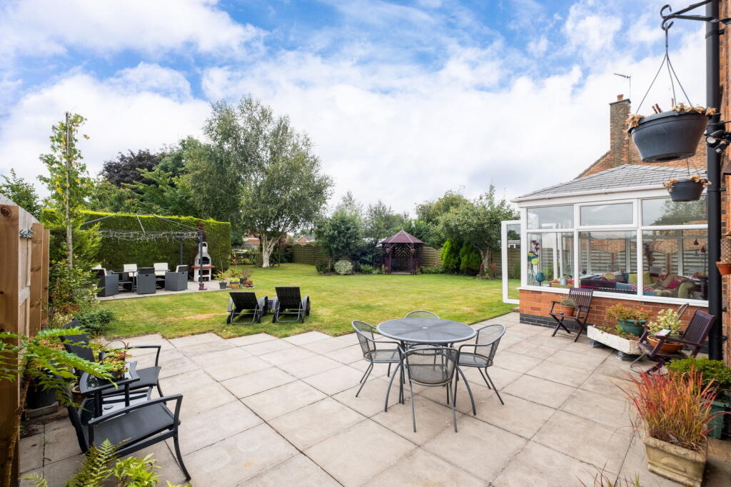
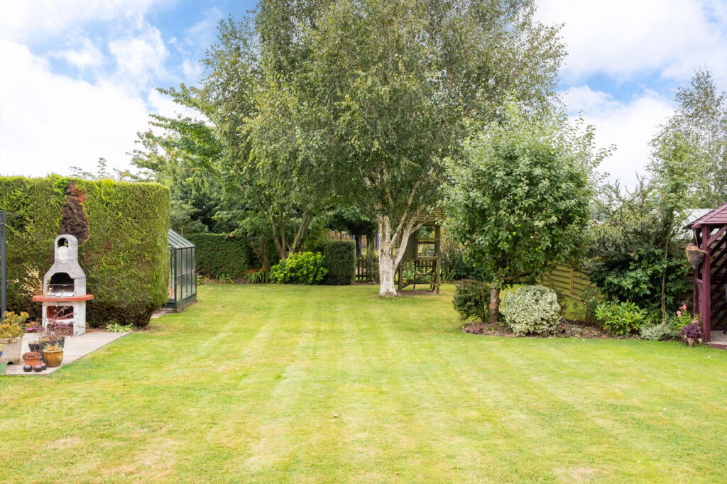
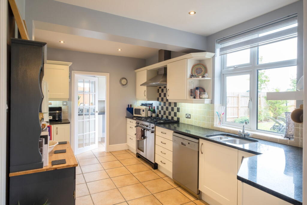
The property appears to be in good condition, having undergone some modernisation while retaining traditional character. The kitchen and bathrooms look recently updated. The property benefits from a conservatory extension overlooking a well-maintained garden. The location is within easy reach of Cossington Church of England Primary School (0.31km), and other schools are within a reasonable distance. The proximity to Sileby, Syston and Barrow-Upon-Soar train stations provides convenient access to transportation links.
The average house price in the area is £549,850, significantly lower than the list price of this property. However, this property is larger than average (2,065.85 sqft vs 1,260 sqft average) and benefits from a larger plot size. The average price per sqft in the area is £436, while this property is listed at approximately £338 per sqft. Considering its size, condition, features (conservatory, garden), and location, the list price is arguably at the higher end of the market but not unreasonable. More comparable data on nearby properties of similar size and condition would be helpful to further assess the price.
Therefore, we give this property 7 / 10. *Disclaimer: This is our option and does constitute a recommendation or financial advice. Do your own research. *
- Price
- 7
- Condition
- 8
- Location
- 7
- Land
- 8
- Bedrooms
- 5
- Bathrooms
- 2
- Sqft (est)
- 2,065.85
- Lot (est)
- 2,234.00
The heatmap indicates the level of crime in the area. The color of the heatmap indicates the crime severity and recency.
Metrics Year-on-Year
- Average area value
- 607,500.00 £Increased by 4.15 %
- Est sale value
- 1,867,528.40 £Increased by 164.33 %
- Average area rental value
- 1,328.00 £/moDecreased by 13.15 %
- Est letting value
- 2,065.85 £/mo
- Est rental Yield
- 2.62 %Decreased by 16.83 %
- Crime Rate
- 1.00 %Unchanged by 0.00 %
Agent Activity
Smiths Property Experts created the listing.
Nearby Schools
| Name | Type | Ofsted | Distance |
|---|---|---|---|
| Cossington Church Of England Primary School | Voluntary Controlled School | Good | 0.31 KM |
| Sileby Redlands Community Primary School | Academy Converter | Good | 1.61 KM |
| Highgate Primary School | Academy Sponsor Led | 2.13 KM | |
| Rothley Church Of England Primary School | Academy Converter | Good | 3.19 KM |
| Ratcliffe College | Other Independent School | 3.37 KM |
Images


Nearby Streets
| Name | Average Price | Average Sqft | Distance |
|---|---|---|---|
| Fisher Close | £ 0 | 0 | 0.00 KM |
| Barnett Close | £ 0 | 0 | 0.00 KM |
| Platts Lane | £ 0 | 0 | 0.00 KM |
| Stevens Road | £ 0 | 0 | 0.00 KM |
| Excelsior Way | £ 0 | 0 | 0.00 KM |
Nearby Transport
| Name | NLC | TLC | Distance |
|---|---|---|---|
| Sileby | 1902 | SIL | 1.49 KM |
| Syston | 1900 | SYS | 3.73 KM |
| Barrow-Upon-Soar | 1903 | BWS | 5.54 KM |
Nearby Listings
| Address | Price | Type | Score | Distance |
|---|---|---|---|---|
| The Knapp, Cossington | £ 699,950 | BUY | 7 / 10 | 0.00 KM |
| Main Street, Cossington, Leicester | £ 600,000 | BUY | 7 / 10 | 0.18 KM |
| Homestead Close, Leicester, LE7 4UN | £ 500,000 | BUY | 8 / 10 | 0.20 KM |
| Main Street, Cossington, Leicester, LE7 4UU | £ 650,000 | BUY | Unknown | 0.21 KM |
| Main Street, Cossington | £ 335,000 | BUY | 6 / 10 | 0.27 KM |
Nearby Properties
| Address | Price | Distance |
|---|---|---|
| 5 Homestead Close | £ 472,500 | 0.19 KM |
| 18 Homestead Close | £ 712,000 | 0.19 KM |
| 11 Homestead Close | £ 330,000 | 0.19 KM |
| 10 Homestead Close | £ 337,500 | 0.19 KM |
| 20 Main Street | £ 397,500 | 0.22 KM |