MA
Bridge Street, Birmingham
By MasonKnight Properties
£ 1,250
MasonKnight Properties says ..
No summary available.
- Bedrooms
- 0
- Bathrooms
- 0
The heatmap indicates the level of crime in the area. The color of the heatmap indicates the crime severity and recency.
Metrics Year-on-Year
- Average area value
- 265,066.00 £Increased by 22.85 %
- Average area rental value
- 1,330.00 £/moIncreased by 2.94 %
- Est rental Yield
- 6.02 %Decreased by 16.27 %
- Crime Rate
- 7.00 %Unchanged by 0.00 %
from 215,770.00 £
from 1,292.00 £/mo
from 7.19 %
from 7.00 %
Agent Activity
MasonKnight Properties created the listing.
Nearby Schools
| Name | Type | Ofsted | Distance |
|---|---|---|---|
| City Academy | Free Schools | 0.41 KM | |
| St Thomas Cofe Academy | Academy Converter | 0.60 KM | |
| University College Birmingham | Higher Education Institutions | Good | 0.65 KM |
| St Thomas Centre Nursery School | Local Authority Nursery School | Outstanding | 0.75 KM |
| James Brindley School | Academy Special Converter | Good | 0.75 KM |
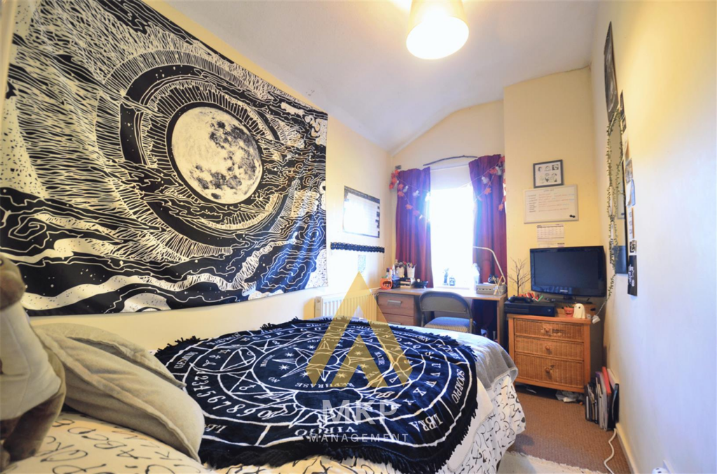
Images

Nearby Streets
| Name | Average Price | Average Sqft | Distance |
|---|---|---|---|
| King Alfred's Place | £ 0 | 0 | 0.00 KM |
| Centenary Way | £ 0 | 0 | 0.00 KM |
| Lyon Queensway | £ 0 | 0 | 0.00 KM |
| New Street Station Subway to Sorting Office | £ 0 | 0 | 0.00 KM |
| Ernest Street | £ 0 | 0 | 0.00 KM |
Nearby Transport
| Name | NLC | TLC | Distance |
|---|---|---|---|
| Birmingham New Street | 1127 | BHM | 0.78 KM |
| Five Ways | 4503 | FWY | 0.86 KM |
| Birmingham Snow Hill | 1006 | BSW | 1.19 KM |
| Jewellery Quarter | 1097 | JEQ | 1.63 KM |
| Birmingham Moor Street | 4515 | BMO | 1.65 KM |
Nearby Listings
| Address | Price | Type | Score | Distance |
|---|---|---|---|---|
| Bridge Street, Birmingham | £ 1,250 | RENT | Unknown | 0.00 KM |
| Bridge Street, Birmingham | £ 1,090 | RENT | Unknown | 0.00 KM |
| Queens Court, Bridge Street | £ 925 | RENT | Unknown | 0.02 KM |
| Queens Court, Birmingham City Centre | £ 925 | RENT | Unknown | 0.03 KM |
| Queens Court, City Centre | £ 925 | RENT | Unknown | 0.03 KM |
Nearby Properties
| Address | Price | Distance |
|---|---|---|
| 11 Washington Wharf | £ 182,000 | 0.20 KM |
| 1 Washington Wharf | £ 151,000 | 0.20 KM |
| 21 Washington Wharf | £ 185,000 | 0.20 KM |
| 4 Washington Wharf | £ 235,000 | 0.20 KM |
| 52 Washington Wharf | £ 87,500 | 0.20 KM |