WA
Sheringham
By Watsons
£ 850
Watsons says ..
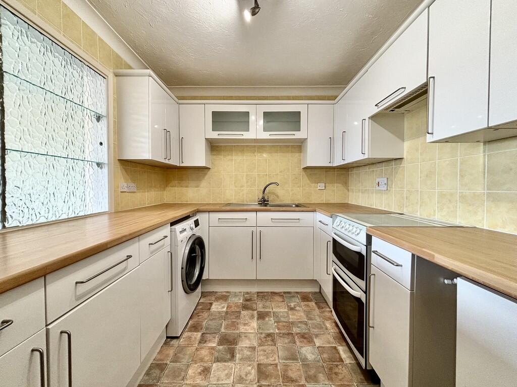
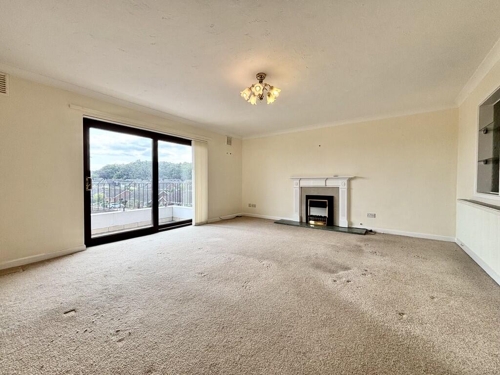
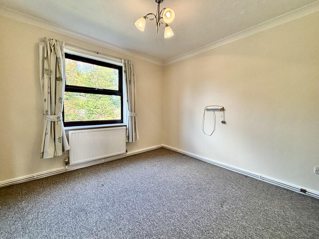
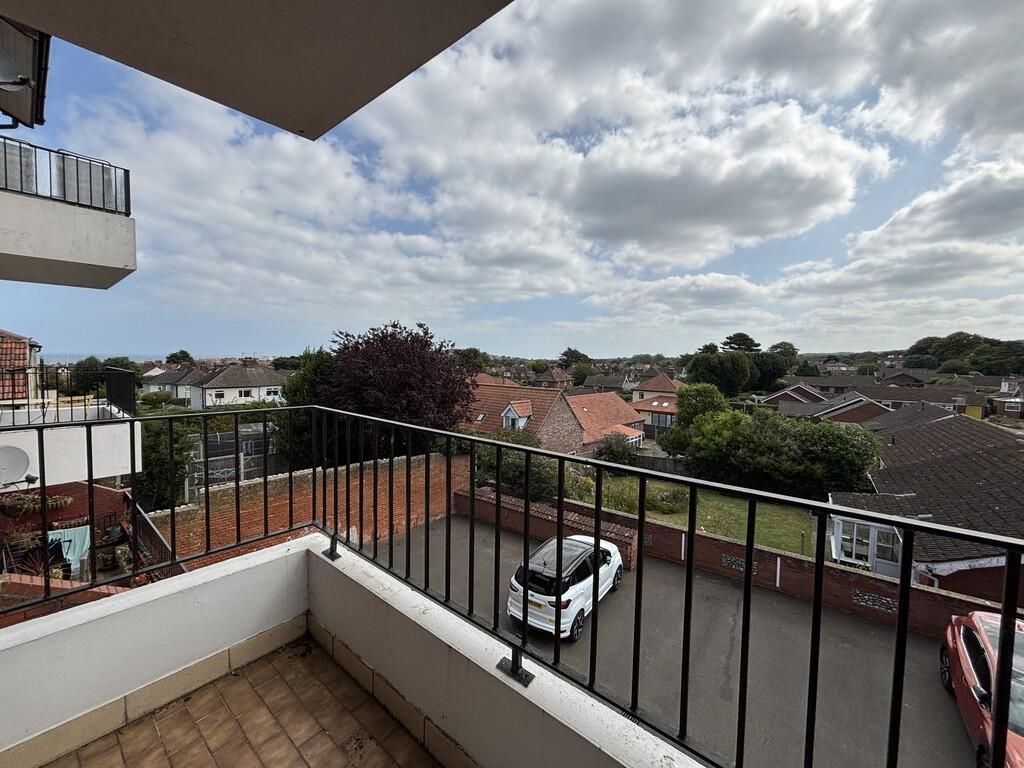
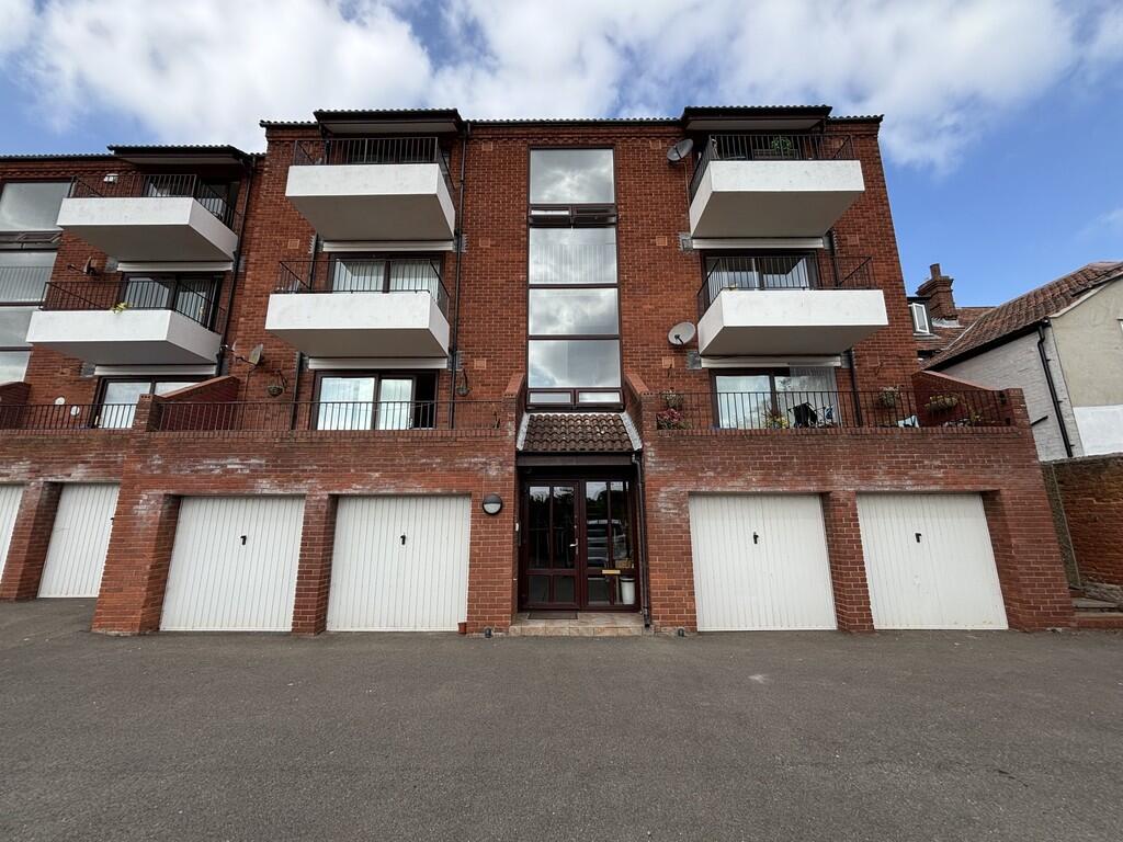
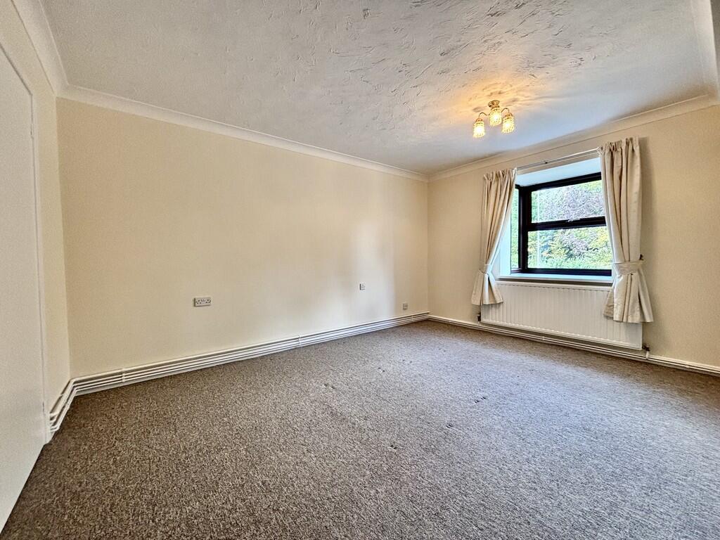
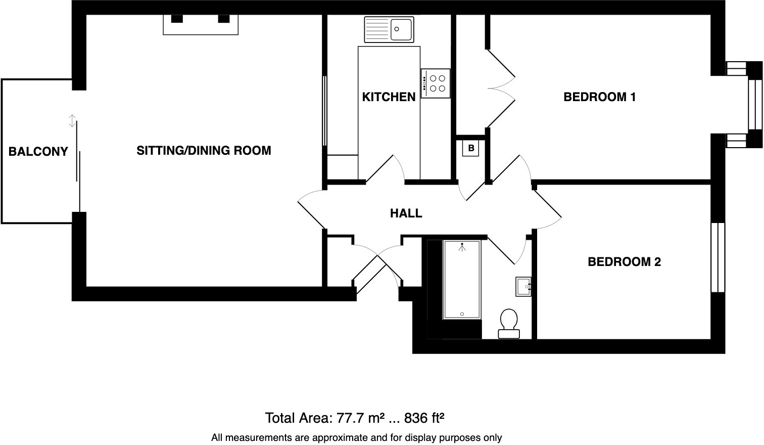
A well presented, second floor purpose-built apartment offering generous accommodation, GARAGE and beautiful views over Sheringham to the woodland and the sea, from the balcony.
- Bedrooms
- 2
- Bathrooms
- 1
The heatmap indicates the level of crime in the area. The color of the heatmap indicates the crime severity and recency.
Metrics Year-on-Year
- Average area value
- 337,772.00 £Decreased by 14.97 %
- Average area rental value
- 950.00 £/moIncreased by 2.70 %
- Est rental Yield
- 3.38 %Increased by 21.15 %
- Crime Rate
- 10.00 %Unchanged by 0.00 %
from 397,237.00 £
from 925.00 £/mo
from 2.79 %
from 10.00 %
Agent Activity
Watsons created the listing.
Nearby Schools
| Name | Type | Ofsted | Distance |
|---|---|---|---|
| Sheringham Community Primary School | Community School | Good | 0.81 KM |
| Sheringham Woodfields School | Foundation Special School | Outstanding | 1.07 KM |
| Sheringham High School | Academy Converter | Good | 1.10 KM |
| St Andrew'S School | Other Independent Special School | Good | 2.83 KM |
| Beeston Hall School | Other Independent School | 2.87 KM |
Images

Nearby Streets
| Name | Average Price | Average Sqft | Distance |
|---|---|---|---|
| Garden Road | £ 0 | 0 | 0.00 KM |
| Abbey Road | £ 170,000 | 0 | 0.00 KM |
| Heath Road | £ 0 | 0 | 0.00 KM |
| Poplar Grove | £ 0 | 0 | 0.00 KM |
| Chestnut Grove | £ 390,000 | 0 | 0.00 KM |
Nearby Transport
| Name | NLC | TLC | Distance |
|---|---|---|---|
| Sheringham | 7319 | SHM | 0.47 KM |
| West Runton | 7329 | WRN | 4.15 KM |
| Cromer | 7295 | CMR | 9.42 KM |
Nearby Listings
| Address | Price | Type | Score | Distance |
|---|---|---|---|---|
| Sheringham | £ 850 | RENT | Unknown | 0.00 KM |
| Sheringham | £ 850 | RENT | Unknown | 0.00 KM |
| Holway Road, Sheringham, NR26 | £ 1,000 | RENT | Unknown | 0.06 KM |
| Holway Road, SHERINGHAM | £ 1,700 | RENT | Unknown | 0.08 KM |
| Sheringham | £ 1,500 | RENT | Unknown | 0.14 KM |
Nearby Properties
| Address | Price | Distance |
|---|---|---|
| 51 Holway Road | £ 285,000 | 0.02 KM |
| 67 Holway Road | £ 540,000 | 0.02 KM |
| 59 Holway Road | £ 322,500 | 0.02 KM |
| 53 Holway Road | £ 220,000 | 0.03 KM |
| 65 Holway Road | £ 245,000 | 0.03 KM |