RE
Staverton
By Rendells
£ 85,000
Rendells says ..
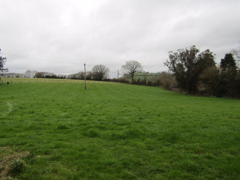
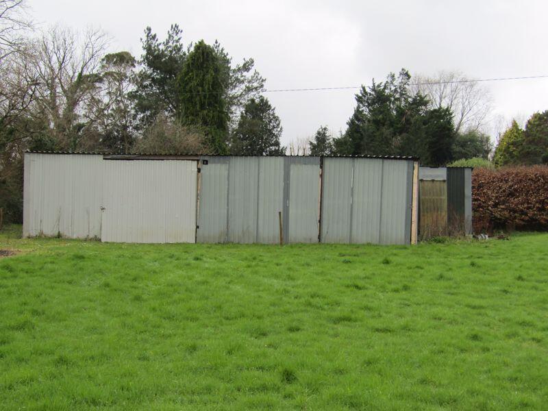
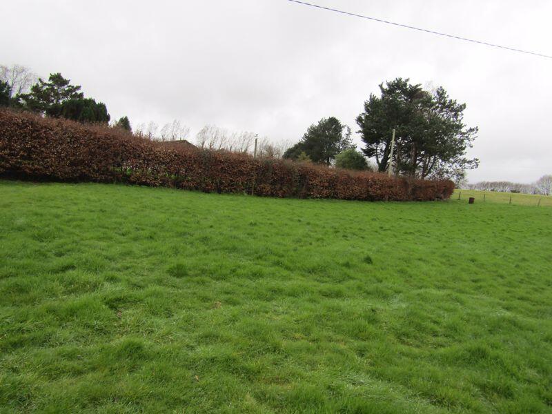
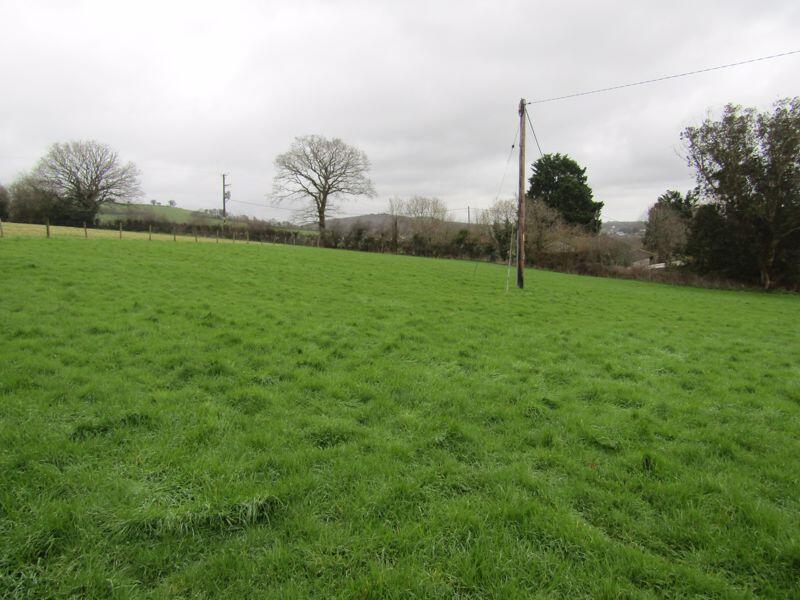
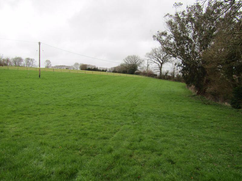
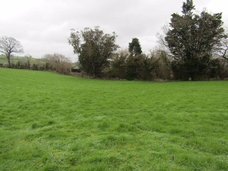
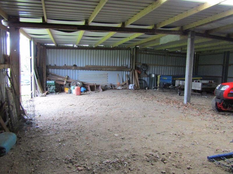
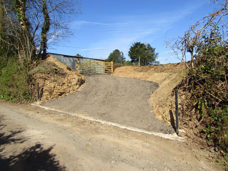
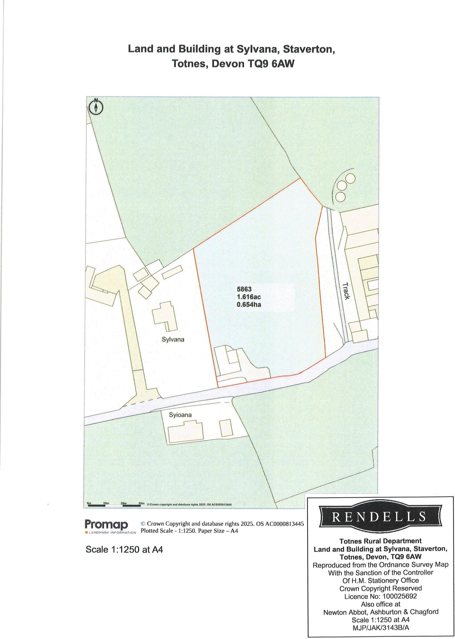
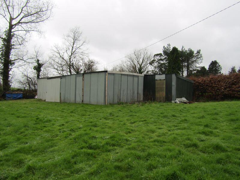
Agricultural Building with lean to and 1.616 acres (0.654 hectares) of pasture land with good access.
- Bedrooms
- 0
- Bathrooms
- 0
The heatmap indicates the level of crime in the area. The color of the heatmap indicates the crime severity and recency.
Metrics Year-on-Year
- Average area value
- 216,225.00 £Decreased by 4.32 %
- Average area rental value
- 863.00 £/moDecreased by 37.87 %
- Est rental Yield
- 4.79 %Decreased by 35.09 %
- Crime Rate
- 0.00 %
from 225,977.00 £
from 1,389.00 £/mo
from 7.38 %
from 0.00 %
Agent Activity
Rendells created the listing.
Nearby Schools
| Name | Type | Ofsted | Distance |
|---|---|---|---|
| Landscove Church Of England Primary School | Academy Converter | Good | 1.98 KM |
| Broadhempston Village Primary School | Academy Converter | 2.51 KM | |
| St Christophers School | Other Independent School | 2.75 KM | |
| South Devon Steiner School | Other Independent School | Inadequate | 3.01 KM |
| Bidwell Brook School | Foundation Special School | Good | 3.21 KM |
Images
Nearby Streets
| Name | Average Price | Average Sqft | Distance |
|---|---|---|---|
| Kingston House West Drive | £ 0 | 0 | 0.00 KM |
| Apple Orchard | £ 0 | 0 | 0.00 KM |
| Barton Lane | £ 0 | 0 | 0.00 KM |
| Croft Cottages | £ 850,000 | 0 | 0.00 KM |
| Kingston Workshops | £ 0 | 0 | 0.00 KM |
Nearby Transport
| Name | NLC | TLC | Distance |
|---|---|---|---|
| Totnes | 3558 | TOT | 5.29 KM |
Nearby Listings
| Address | Price | Type | Score | Distance |
|---|---|---|---|---|
| Staverton | £ 85,000 | BUY | Unknown | 0.00 KM |
| Staverton, Totnes | £ 625,000 | BUY | 7 / 10 | 0.45 KM |
| Apple Orchard, Staverton, Totnes | £ 350,000 | BUY | Unknown | 0.45 KM |
| Apple Orchard, Staverton | £ 600,000 | BUY | 7 / 10 | 0.45 KM |
| Apple Orchard, Staverton, Totnes | £ 379,950 | BUY | 7 / 10 | 0.45 KM |
Nearby Properties
| Address | Price | Distance |
|---|---|---|
| 2 Barkingdon Court | £ 470,000 | 1.18 KM |
| 3 Barkingdon Court | £ 560,000 | 1.18 KM |
| 1 Fursdon Cottages | £ 84,000 | 1.21 KM |
| 4 Bakers Orchard | £ 520,000 | 1.40 KM |
| 2 Bakers Orchard | £ 465,000 | 1.40 KM |