
Mundaydean Lane, Marlow, SL7
By Barney Estates and Auctioneers
£ 200,000
Reviews
4 out of 5 stars
Barney Estates and Auctioneers says ..
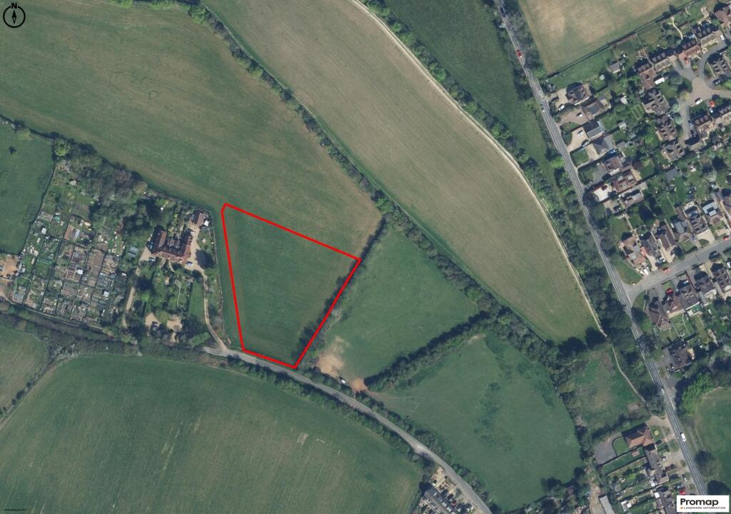
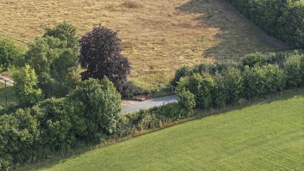
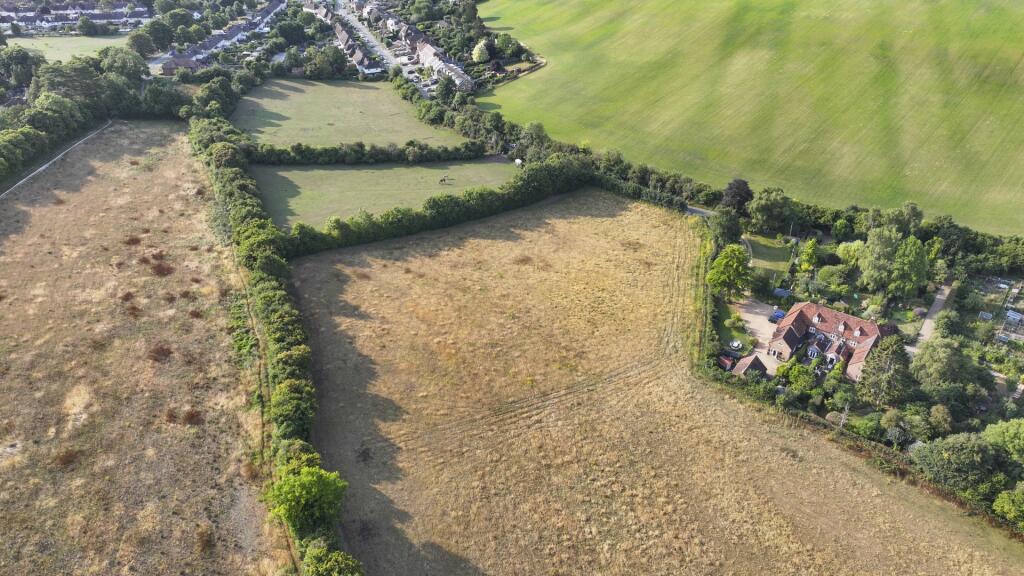
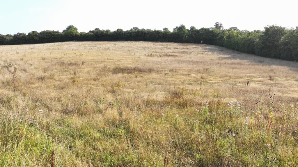
A rare 1.5-acre parcel lying just north of Marlow town, accessed securely via gated vehicular entrance off Mundaydean Lane.Positioned under 1 mile from Marlow Station, offering rail links to London Paddington and surrounding areas, and situated within easy reach of the M40, M4, and M25 corridor
Property Oracle says ..
The subject property is a plot of land located on Mundaydean Lane, Marlow. The location is in the Chiltern Villages, Buckinghamshire. Several schools are within a kilometer, including St Peter’s Catholic Primary School, Spinfield School, and Burford School. Marlow railway station is approximately 2.54 km away. Based on the images, the land appears to be undeveloped and consists of fields. The listing price for the land is £200,000. The average property price in the area is £898,990, with an average price per square foot of £731. Considering the listing is for land, the price seems reasonable. There are also similar listings for land on the same street priced at the same amount.
Therefore, we give this property 8 / 10. *Disclaimer: This is our option and does constitute a recommendation or financial advice. Do your own research. *
- Price
- 8
- Condition
- 0
- Location
- 7
- Land
- 9
- Bedrooms
- 0
- Bathrooms
- 0
The heatmap indicates the level of crime in the area. The color of the heatmap indicates the crime severity and recency.
Metrics Year-on-Year
- Average area value
- 898,990.00 £Increased by 15.55 %
- Average area rental value
- 2,471.00 £/moDecreased by 13.30 %
- Est rental Yield
- 3.30 %Decreased by 25.00 %
- Crime Rate
- 0.00 %
Agent Activity
Barney Estates and Auctioneers created the listing.
Nearby Schools
| Name | Type | Ofsted | Distance |
|---|---|---|---|
| St Peter'S Catholic Primary School | Academy Converter | 0.83 KM | |
| Spinfield School | Community School | Good | 0.95 KM |
| Burford School | Community School | Good | 0.98 KM |
| Marlow Church Of England Infant School | Voluntary Aided School | Outstanding | 1.05 KM |
| Holy Trinity Church Of England (Aided) School | Voluntary Aided School | Outstanding | 1.27 KM |
Images
Nearby Streets
| Name | Average Price | Average Sqft | Distance |
|---|---|---|---|
| Balfour Place | £ 1,295,000 | 0 | 0.00 KM |
| May Tree Close | £ 0 | 0 | 0.00 KM |
| Hill Top Drive | £ 1,050,000 | 0 | 0.00 KM |
| White Lodge Close | £ 795,000 | 0 | 0.00 KM |
| Westwood Road | £ 0 | 0 | 0.00 KM |
Nearby Transport
| Name | NLC | TLC | Distance |
|---|---|---|---|
| Marlow | 3021 | MLW | 2.54 KM |
| High Wycombe | 3054 | HWY | 7.13 KM |
| Cookham | 3019 | COO | 7.65 KM |
| Furze Platt | 3144 | FZP | 8.39 KM |
| Bourne End | 3018 | BNE | 8.49 KM |
Nearby Listings
| Address | Price | Type | Score | Distance |
|---|---|---|---|---|
| Mundaydean Lane, Marlow, SL7 | £ 200,000 | BUY | 5 / 10 | 0.00 KM |
| Mundaydean Lane, Marlow, SL7 | £ 200,000 | BUY | 8 / 10 | 0.00 KM |
| Mundaydean Lane, Marlow, SL7 | £ 150,000 | BUY | Unknown | 0.00 KM |
| Mundaydean Lane, Marlow, SL7 | £ 80,000 | BUY | 8 / 10 | 0.00 KM |
| Mundaydean Lane, Marlow, SL7 | £ 150,000 | BUY | 6 / 10 | 0.00 KM |
Nearby Properties
| Address | Price | Distance |
|---|---|---|
| 81 Berwick Road | £ 578,000 | 0.45 KM |
| 73 Berwick Road | £ 350,000 | 0.45 KM |
| 77 Berwick Road | £ 545,000 | 0.45 KM |
| 69 Berwick Road | £ 342,500 | 0.45 KM |
| 59 Berwick Road | £ 520,000 | 0.45 KM |