Holloway Close, St Andrews Ridge, Swindon
By Resides Swindon
£ 250,000
Reviews
3 out of 5 stars
Resides Swindon says ..
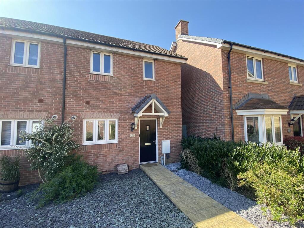
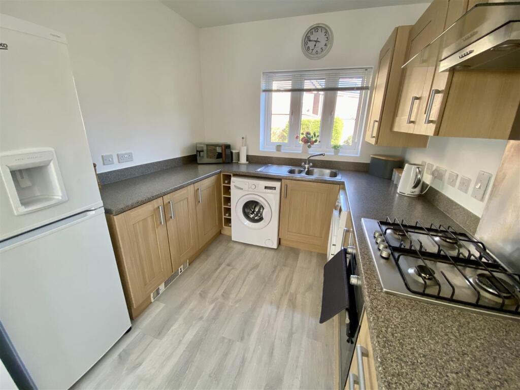
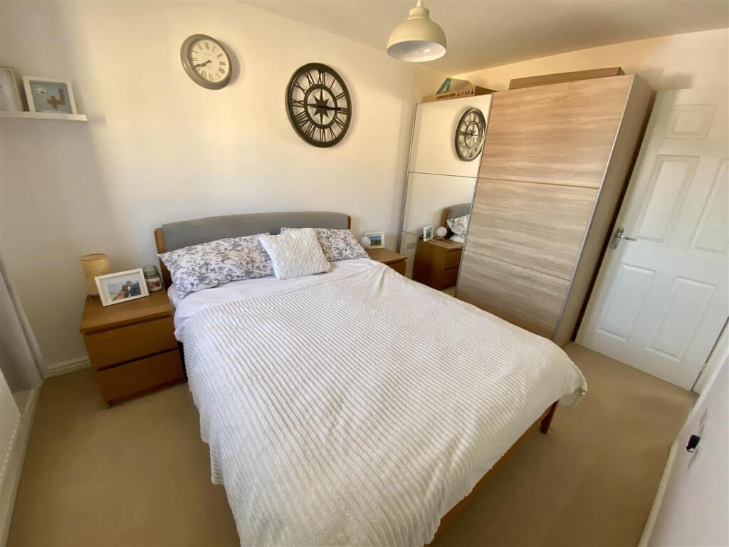
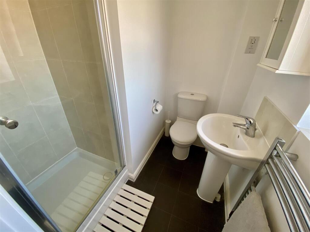
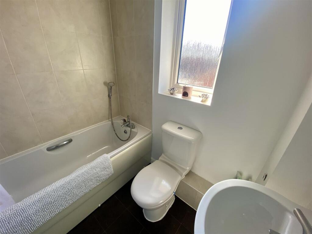
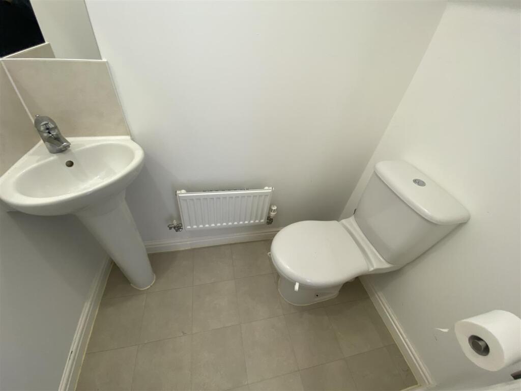
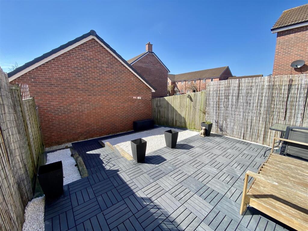
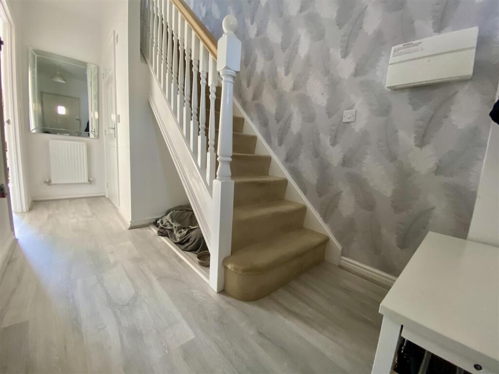
NO ONWARD CHAIN.......Resides Swindon are delighted to be marketing this stylish, light and airy two bedroom end of terrace property set in the sought after location of St Andrews Ridge. This home has a spacious feel with a modern open plan design the accommodation comprises, entrance hall, downs...
Property Oracle says ..
The property is a 2-bedroom, 2-bathroom end of terrace house located in St Andrews Ridge, Swindon. The list price is £250,000. The property has a plot size of 678 sqft and is 459.17 sqft in size. The property appears to be in excellent condition. The interior is modern and well-maintained, with updated flooring and fixtures. The exterior is also in good condition, with a well-maintained garden. The location is good, with nearby schools and transportation links. Abbey Meads Community Primary School is within a 0.72 KM radius, and Swindon train station is 4.59 KM away. However, the average house price in the area is significantly higher than the list price of this property. The property has a relatively small garden but it is well-maintained and offers a private outdoor space. Considering the condition, location, and land size, the list price of £250,000 appears to be significantly below the average price for the area. The average house price in the area is £436,766, and the average price per square foot is £358. This property is priced considerably lower than comparable properties in the area, suggesting it may represent good value for money. However, further investigation into the specifics of comparable properties (especially those with similar square footage) would be beneficial to confirm this.
Therefore, we give this property 7 / 10. *Disclaimer: This is our option and does constitute a recommendation or financial advice. Do your own research. *
- Price
- 8
- Condition
- 9
- Location
- 7
- Land
- 4
- Bedrooms
- 2
- Bathrooms
- 2
- Sqft (est)
- 459.17
- Lot (est)
- 678.00
The heatmap indicates the level of crime in the area. The color of the heatmap indicates the crime severity and recency.
Metrics Year-on-Year
- Average area value
- 424,643.00 £Increased by 10.49 %
- Est sale value
- 201,116.46 £Increased by 29.97 %
- Average area rental value
- 1,206.00 £/moIncreased by 0.50 %
- Est letting value
- 459.17 £/moUnchanged by 0.00 %
- Est rental Yield
- 3.41 %Decreased by 9.07 %
- Crime Rate
- 5.00 %Unchanged by 0.00 %
Agent Activity
Resides Swindon created the listing.
Nearby Schools
| Name | Type | Ofsted | Distance |
|---|---|---|---|
| Abbey Meads Community Primary School | Academy Converter | 0.72 KM | |
| Bridlewood Primary School | Community School | Requires improvement | 1.20 KM |
| Catherine Wayte Primary School | Academy Converter | 1.44 KM | |
| St Leonard'S Church Of England Primary Academy | Academy Converter | 1.57 KM | |
| Seven Fields Primary School | Academy Converter | Requires improvement | 2.05 KM |
Images


Nearby Streets
| Name | Average Price | Average Sqft | Distance |
|---|---|---|---|
| Byers Close | £ 0 | 0 | 0.00 KM |
| Blunsdon Bypass | £ 0 | 0 | 0.00 KM |
| Flora Close | £ 590,000 | 0 | 0.00 KM |
| Smithy Close | £ 397,667 | 0 | 0.00 KM |
| Blunsdon Bypass | £ 0 | 0 | 0.00 KM |
Nearby Transport
| Name | NLC | TLC | Distance |
|---|---|---|---|
| Swindon (Wilts) | 3333 | SWI | 4.59 KM |
Nearby Listings
| Address | Price | Type | Score | Distance |
|---|---|---|---|---|
| Holloway Close, St Andrews Ridge, Swindon | £ 250,000 | BUY | 7 / 10 | 0.00 KM |
| Kilby Crescent, St Andrews Ridge, Swindon, SN25 | £ 550,000 | BUY | 6 / 10 | 0.11 KM |
| Kilby Crescent, St Andrews Ridge, Swindon, SN25 | £ 425,000 | BUY | 8 / 10 | 0.11 KM |
| Kilby Crescent, St Andrews Ridge, Swindon | £ 530,000 | BUY | 7 / 10 | 0.14 KM |
| Richardson Road, Swindon, Wiltshire, SN25 | £ 475,000 | BUY | 7 / 10 | 0.14 KM |
Nearby Properties
| Address | Price | Distance |
|---|---|---|
| 28 Richardson Road | £ 335,000 | 0.14 KM |
| 24 Richardson Road | £ 282,995 | 0.14 KM |
| 16 Hewlett Place | £ 302,000 | 0.16 KM |
| 11 Hewlett Place | £ 167,500 | 0.16 KM |
| 18 Hewlett Place | £ 400,000 | 0.16 KM |