
LA
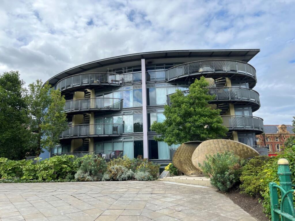
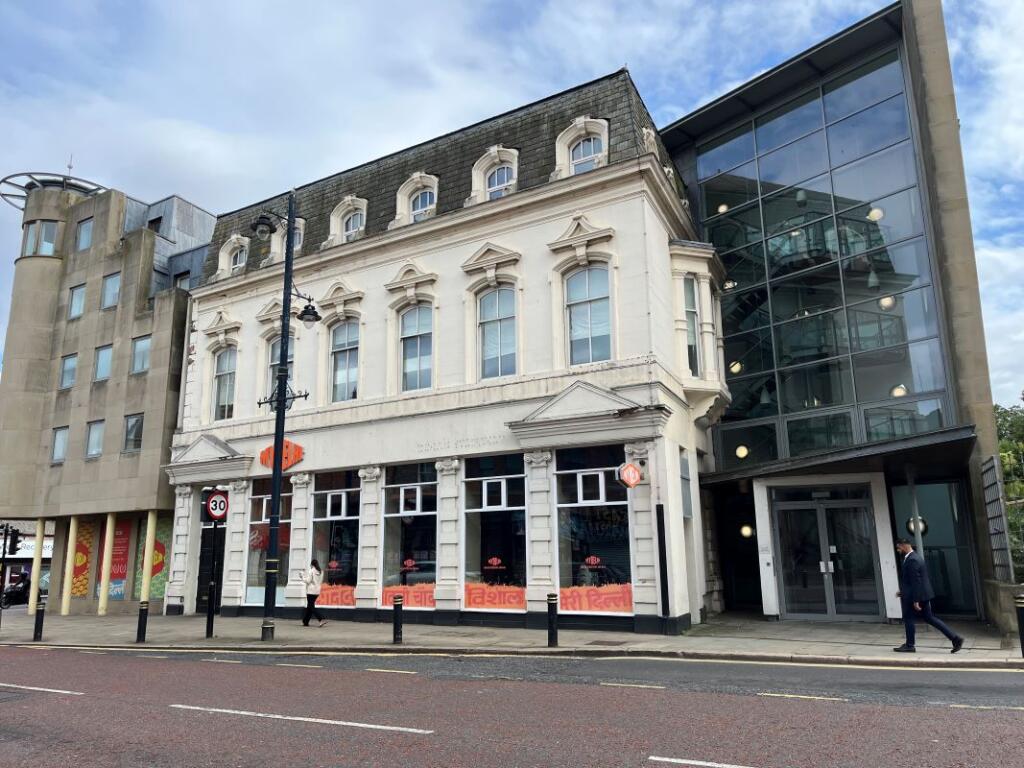
Flat 7 The Mowbray, Borough Road, Sunderland, Tyne and Wear, SR1 1PS
By Landwood Group
£ 45,000
Reviews
2 out of 5 stars
Landwood Group says ..
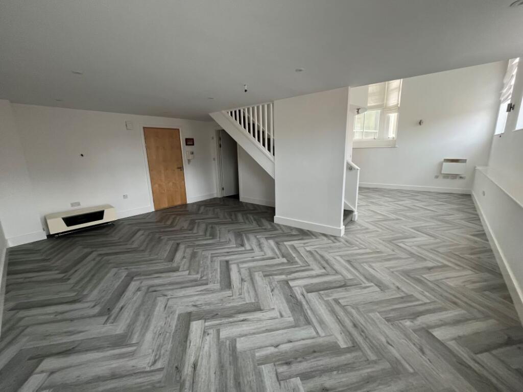
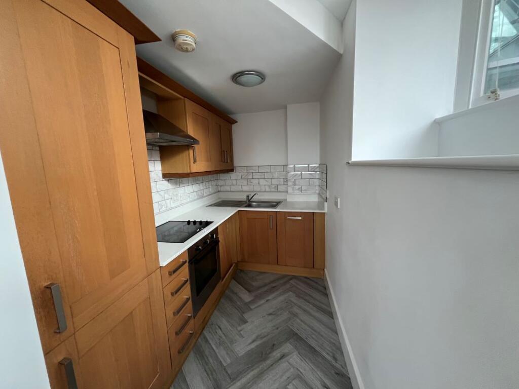
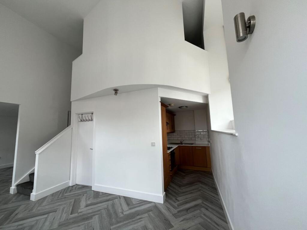
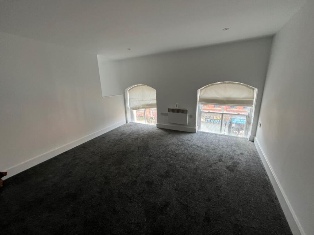
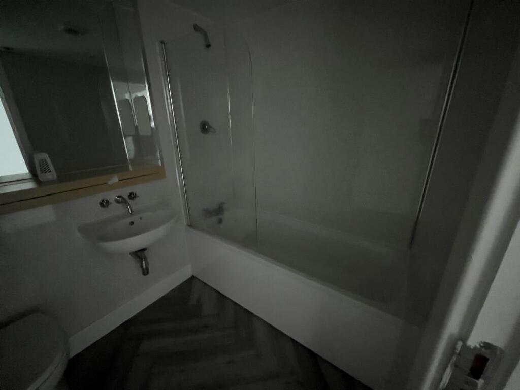
TO BE OFFERED BY ONLINE AUCTION ON THE 20/08/2025 11:00 - Vacant 2 bedroom duplex apartment within a purpose built block The property comprises a vacant 2 bedroom apartment duplex within a purpose built block. The property is arranged over the first and second floors and has two bathrooms. We u...
Property Oracle says ..
Therefore, we give this property 5 / 10. *Disclaimer: This is our option and does constitute a recommendation or financial advice. Do your own research. *
- Price
- 8
- Condition
- 5
- Location
- 7
- Land
- 1
- Bedrooms
- 2
- Bathrooms
- 2
The heatmap indicates the level of crime in the area. The color of the heatmap indicates the crime severity and recency.
Metrics Year-on-Year
- Average area value
- 502,893.00 £Increased by 16.71 %
- Average area rental value
- 1,587.00 £/moDecreased by 12.80 %
- Est rental Yield
- 3.79 %Decreased by 25.25 %
- Crime Rate
- 15.00 %Unchanged by 0.00 %
from 430,903.00 £
from 1,820.00 £/mo
from 5.07 %
from 15.00 %
Agent Activity
Landwood Group created the listing.
Nearby Schools
| Name | Type | Ofsted | Distance |
|---|---|---|---|
| Sunderland Children'S Centre East | Children's Centre | 0.25 KM | |
| Hudson Road Primary School | Community School | Good | 0.33 KM |
| Dame Dorothy Primary School | Community School | Good | 1.08 KM |
| Ashbrooke School | Other Independent Special School | Good | 1.27 KM |
| Valley Road Academy | Academy Converter | 1.32 KM |
Images


Nearby Streets
| Name | Average Price | Average Sqft | Distance |
|---|---|---|---|
| Pauls Road | £ 0 | 0 | 0.00 KM |
| Salem Road | £ 0 | 0 | 0.00 KM |
| William Street | £ 150,000 | 0 | 0.00 KM |
| Lambton Street | £ 0 | 0 | 0.00 KM |
| Athaneum Street | £ 99,950 | 0 | 0.00 KM |
Nearby Transport
| Name | NLC | TLC | Distance |
|---|---|---|---|
| Sunderland | 7640 | SUN | 0.64 KM |
| Seaham | 7814 | SEA | 8.07 KM |
Nearby Listings
| Address | Price | Type | Score | Distance |
|---|---|---|---|---|
| Flat 7 The Mowbray, Borough Road, Sunderland, Tyne and Wear, SR1 1PS | £ 45,000 | BUY | 5 / 10 | 0.00 KM |
| Borough Road, Sunderland, Tyne and Wear, SR1 | £ 50,000 | BUY | 6 / 10 | 0.00 KM |
| 402 Horizon House Borough Road, Sunderland, SR1 1HR | £ 15,000 | BUY | Unknown | 0.00 KM |
| 202 Horizon House Borough Road, Sunderland, SR1 1HR | £ 20,000 | BUY | Unknown | 0.00 KM |
| Apartment 907, Horizon House, Borough Road, Sunderland, SR1 1HS | £ 35,000 | BUY | 5 / 10 | 0.00 KM |
Nearby Properties
| Address | Price | Distance |
|---|---|---|
| 37 Norfolk Street | £ 25,000 | 0.09 KM |
| 31 Norfolk Street | £ 125,000 | 0.09 KM |
| 33 Norfolk Street | £ 150,000 | 0.09 KM |
| 16 Nile Street | £ 87,500 | 0.09 KM |
| 12a Foyle Street | £ 70,000 | 0.14 KM |