
UK
Patcham Terrace
By UKmate
£ 3,466
UKmate says ..
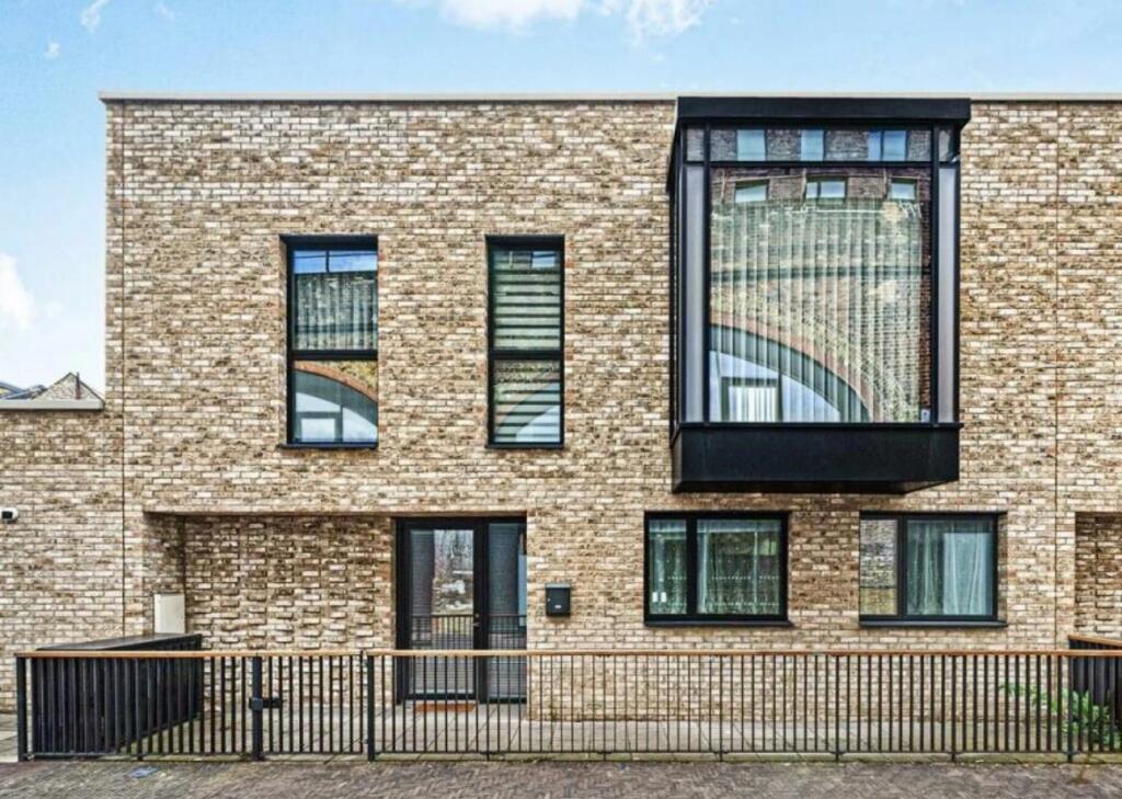
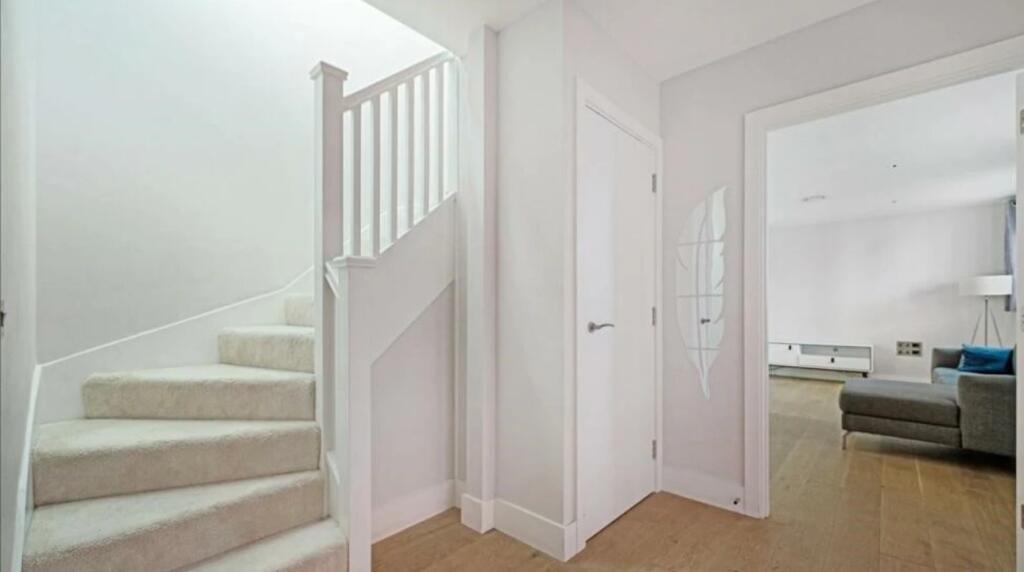
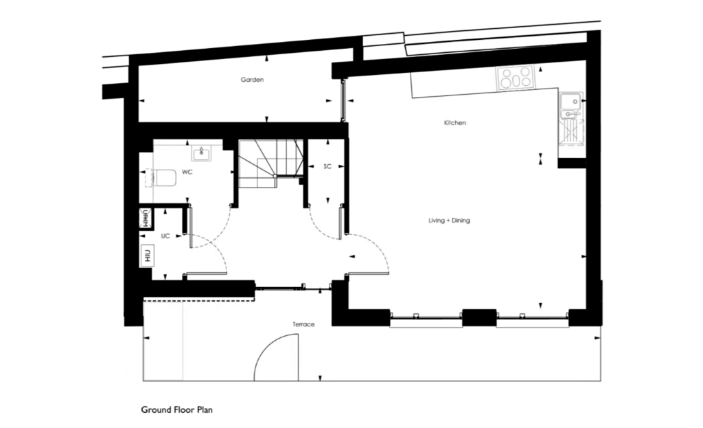
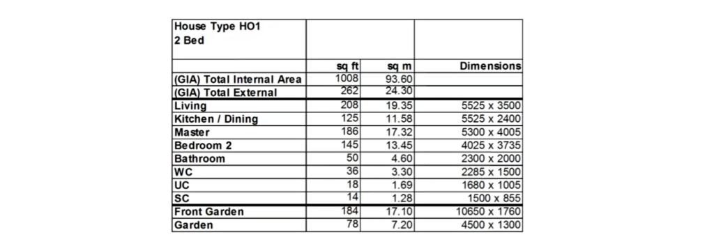
Beautiful, spacious, Property in SW8
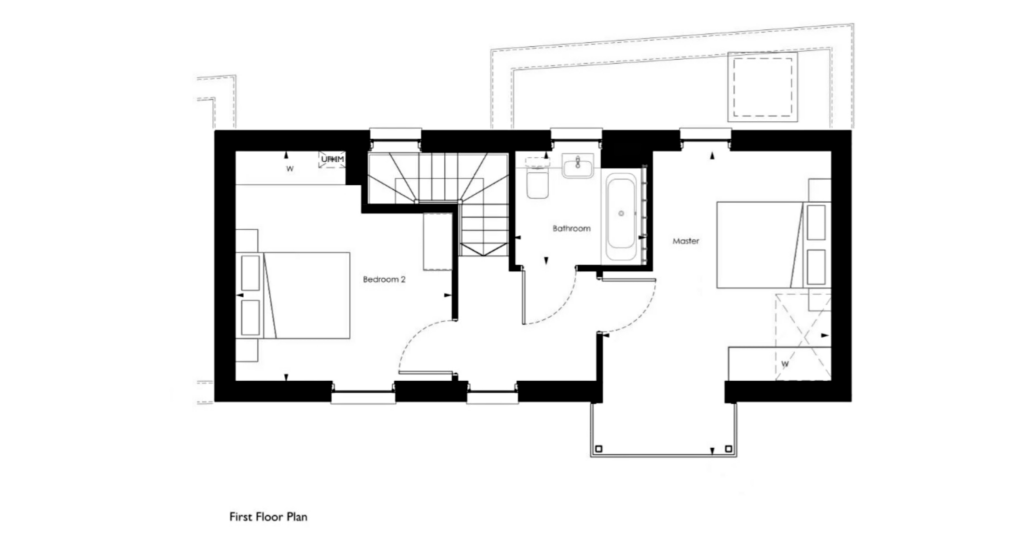
- Bedrooms
- 2
- Bathrooms
- 1
The heatmap indicates the level of crime in the area. The color of the heatmap indicates the crime severity and recency.
Metrics Year-on-Year
- Average area value
- 1,364,463.00 £Increased by 19.24 %
- Average area rental value
- 3,454.00 £/moIncreased by 15.21 %
- Est rental Yield
- 3.04 %Decreased by 3.18 %
- Crime Rate
- 8.00 %Unchanged by 0.00 %
from 1,144,255.00 £
from 2,998.00 £/mo
from 3.14 %
from 8.00 %
Agent Activity
UKmate created the listing.
Nearby Schools
| Name | Type | Ofsted | Distance |
|---|---|---|---|
| St Mary'S Rc Voluntary Aided Primary School | Voluntary Aided School | Good | 0.12 KM |
| Newton Preparatory School | Other Independent School | 0.17 KM | |
| Heathbrook Primary School | Community School | Good | 0.78 KM |
| Heathbrook Primary School & Children'S Centre | Children's Centre | 0.84 KM | |
| St George'S Cofe Primary School | Voluntary Aided School | Good | 0.86 KM |
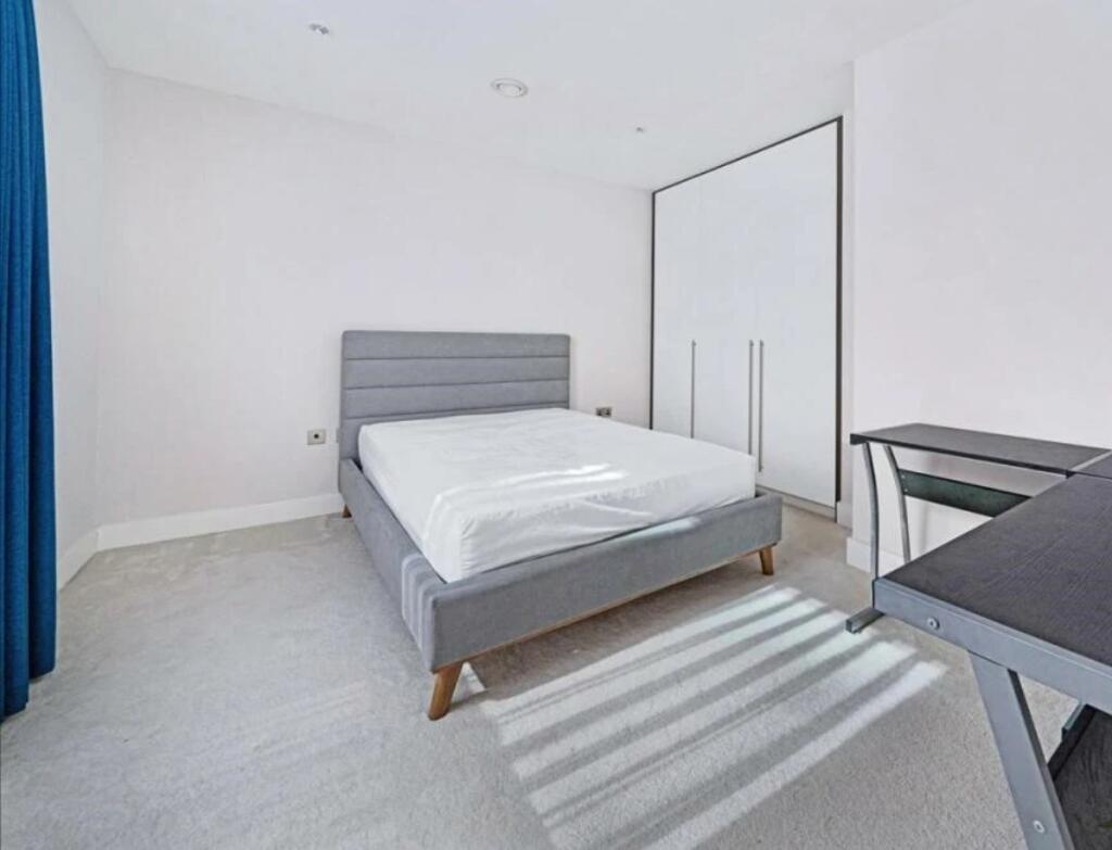
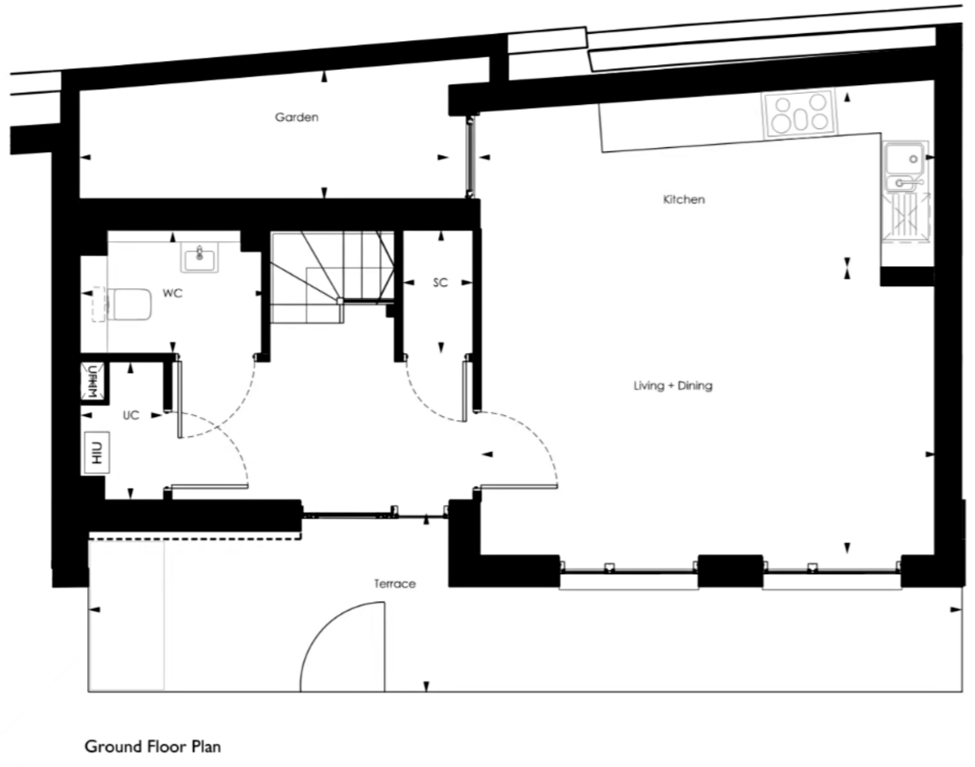
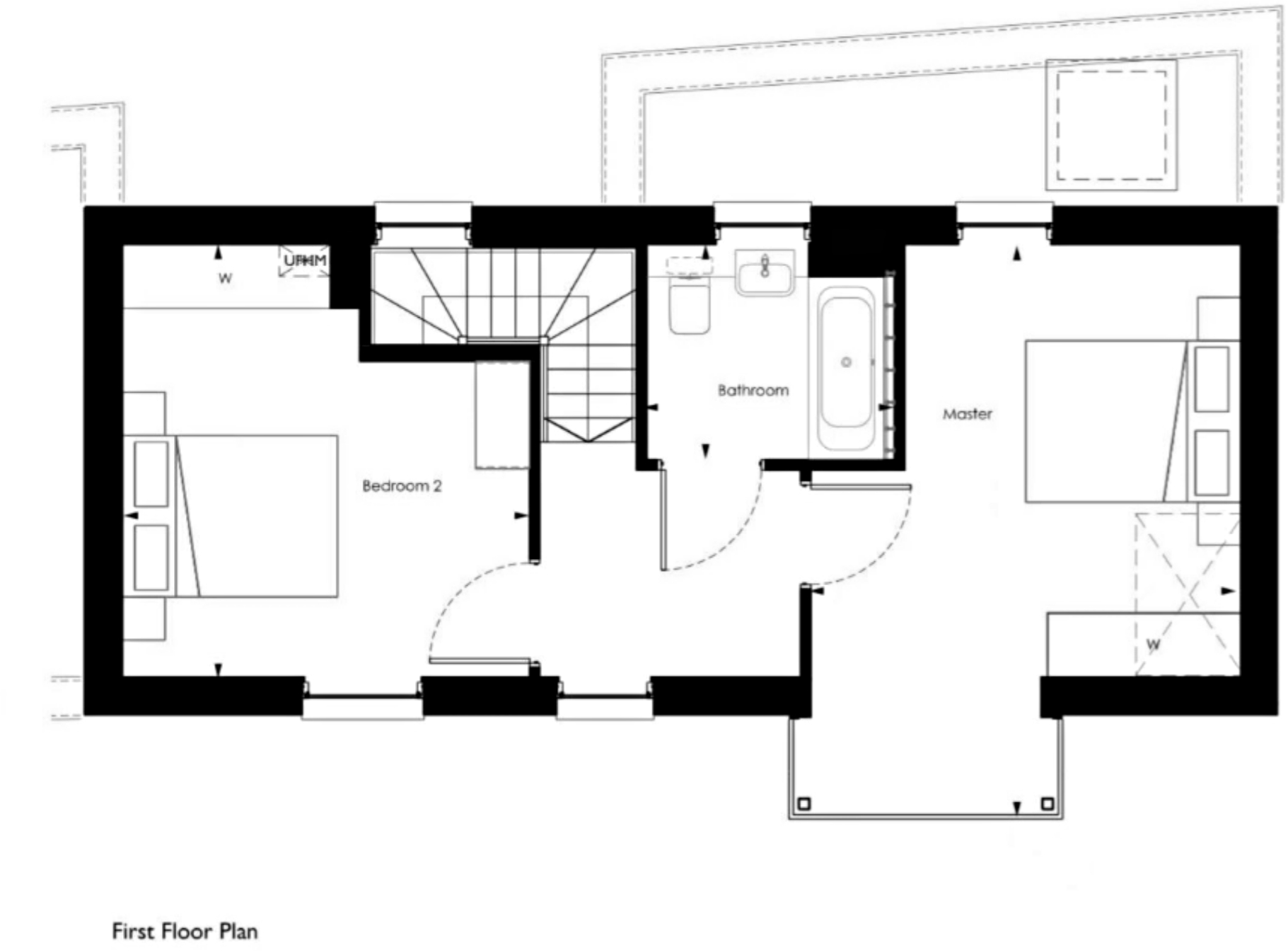
Images


Nearby Streets
| Name | Average Price | Average Sqft | Distance |
|---|---|---|---|
| Palmer Road | £ 0 | 0 | 0.00 KM |
| Corunna Terrace | £ 0 | 0 | 0.00 KM |
| Prospect Way | £ 1,565,000 | 0 | 0.00 KM |
| Circus Road South | £ 0 | 0 | 0.00 KM |
| Electric Boulevard | £ 3,183,325 | 0 | 0.00 KM |
Nearby Transport
| Name | NLC | TLC | Distance |
|---|---|---|---|
| Battersea Park | 5420 | BAK | 0.12 KM |
| Queenstown Road (Battersea) | 5596 | QRB | 0.12 KM |
| Wandsworth Road | 5372 | WWR | 1.13 KM |
| Clapham High Street | 5301 | CLP | 1.98 KM |
| Victoria | 5426 | VIC | 2.15 KM |
Nearby Listings
| Address | Price | Type | Score | Distance |
|---|---|---|---|---|
| Patcham Terrace | £ 3,553 | RENT | Unknown | 0.00 KM |
| Patcham Terrace | £ 3,423 | RENT | Unknown | 0.00 KM |
| Patcham Terrace | £ 3,466 | RENT | Unknown | 0.00 KM |
| Patcham Terrace | £ 3,700 | RENT | Unknown | 0.02 KM |
| Patcham Terrace, Battersea Exchange, London, SW8 | £ 4,000 | RENT | Unknown | 0.04 KM |
Nearby Properties
| Address | Price | Distance |
|---|---|---|
| 266 Queenstown Road | £ 438,000 | 0.05 KM |
| 250 Queenstown Road | £ 500,000 | 0.05 KM |
| 264 Queenstown Road | £ 650,000 | 0.05 KM |
| 246 Queenstown Road | £ 654,000 | 0.05 KM |
| 242 Queenstown Road | £ 760,000 | 0.05 KM |