Moorfield Court, Moorfield Road, Alcester, B49
By Sanders & Sanders
£ 245,000
Reviews
3 out of 5 stars
Sanders & Sanders says ..
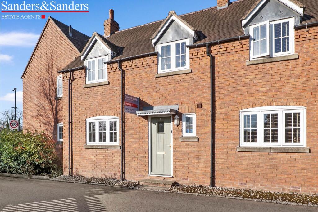
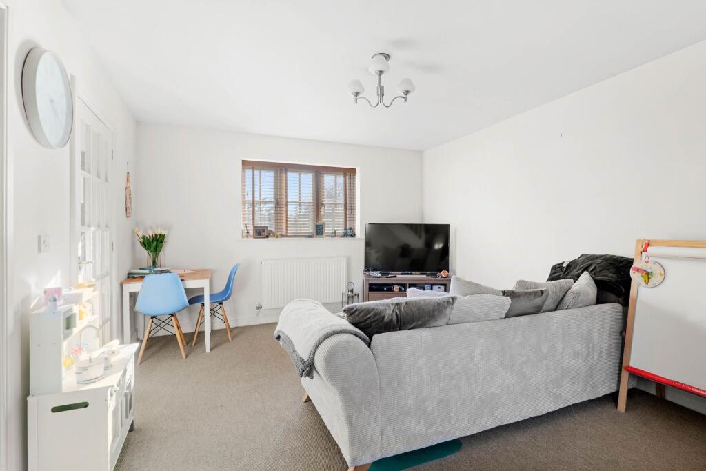
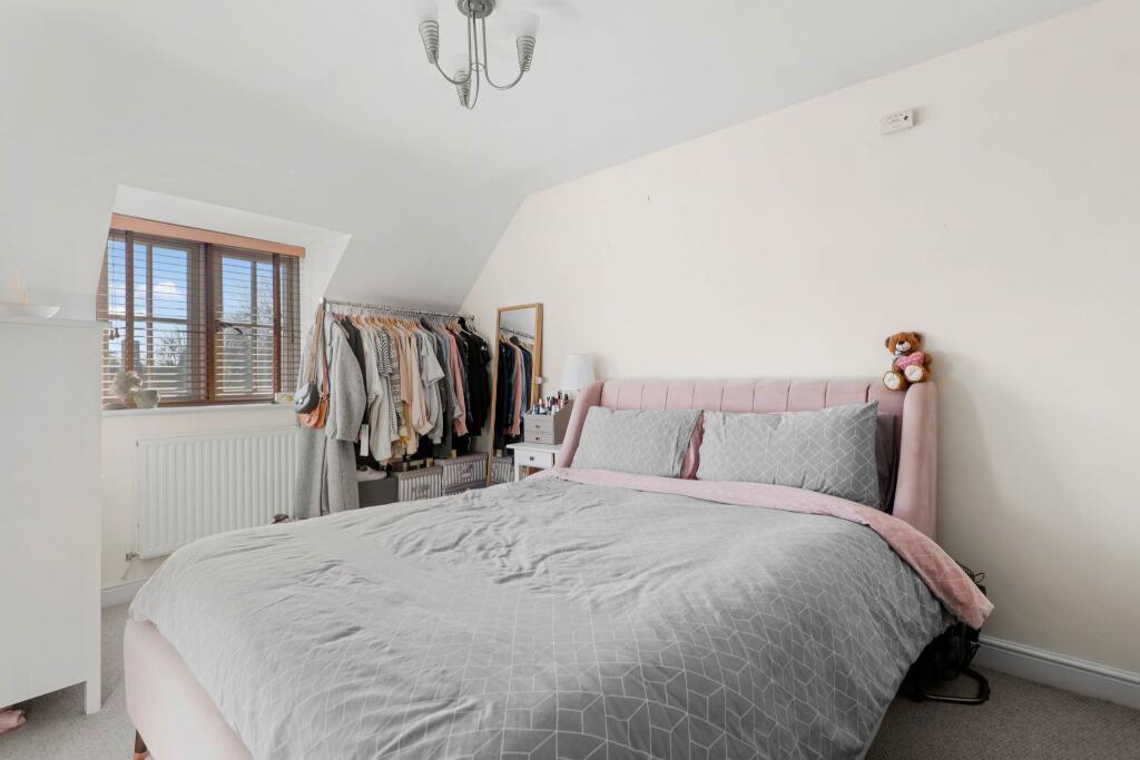
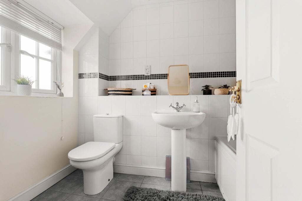
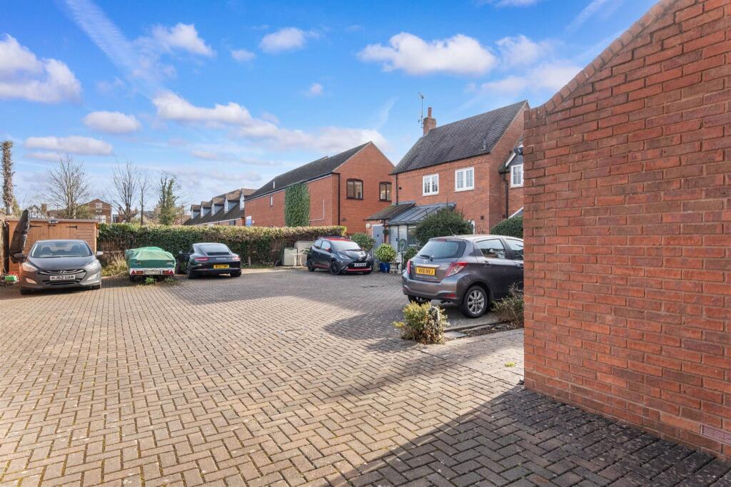
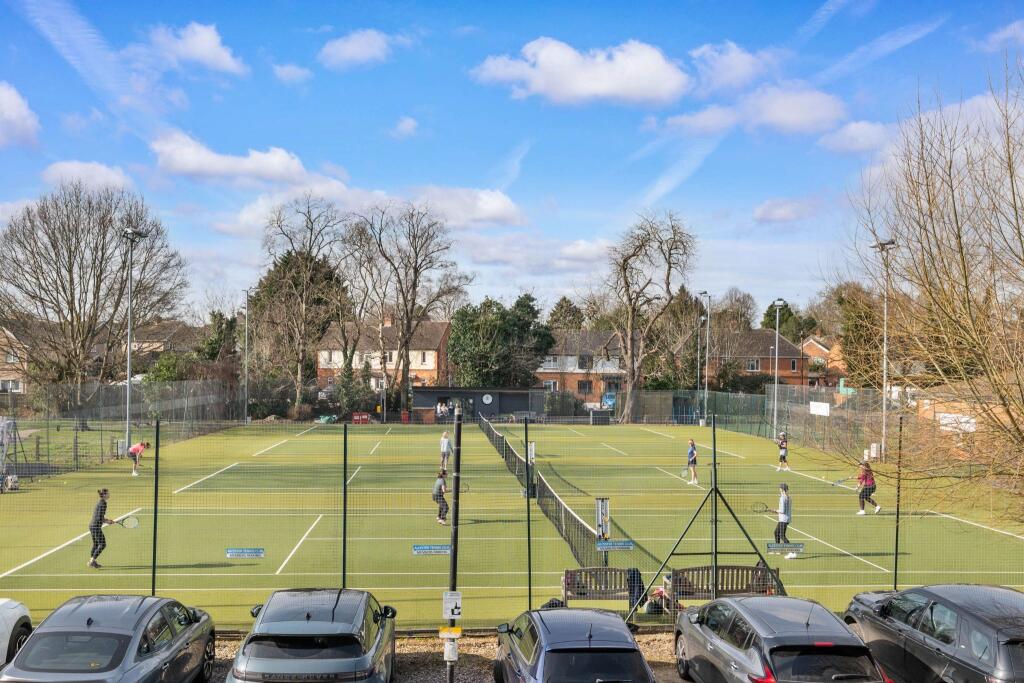
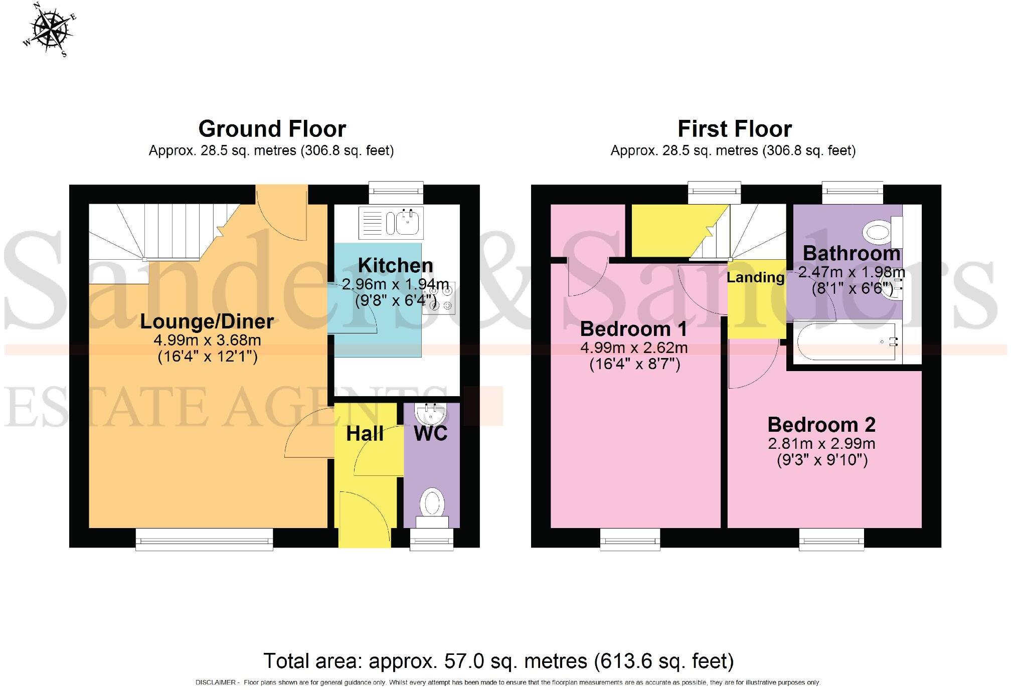
Enjoying a convenient location with Alcester tennis club and small park on the doorstep, and located a stone's throw away from the town centre high street. Having a secure gated shared vehicular access and having accommodation to include: Entrance Hall, lounge/diner, Kitchen, WC, two bedrooms, ba...
Property Oracle says ..
The property is a two-bedroom, one-bathroom terraced house with a total area of 621.40 sqft situated on a 613.54 sqft plot. The list price is £245,000. Alcester is a town in Stratford-on-Avon, Warwickshire, in the West Midlands. The average house price in the area is £244,294, with an average price per sqft of £314. Several schools are within a 1km radius, including Alcester Grammar School, Our Lady’s Catholic Primary School, and St Nicholas Cofe Primary School. The property appears to be in good condition based on the provided images, and benefits from a small patio area and allocated parking. The property’s list price of £245,000 is slightly above the average house price in the area (£244,294). However, considering the property is presented in good condition and includes allocated parking, this price seems reasonable. The average price per sqft in the area is £314, while this property is listed at approximately £394 per sqft. This is higher than the average, but given the apparent good condition and inclusion of parking, it is not unreasonable. More information on comparable properties in the immediate vicinity would be beneficial to further refine this assessment. The small size of the plot may be a factor influencing the price.
Therefore, we give this property 6 / 10. *Disclaimer: This is our option and does constitute a recommendation or financial advice. Do your own research. *
- Price
- 7
- Condition
- 8
- Location
- 7
- Land
- 4
- Bedrooms
- 2
- Bathrooms
- 1
- Sqft (est)
- 621.40
- Lot (est)
- 613.54
The heatmap indicates the level of crime in the area. The color of the heatmap indicates the crime severity and recency.
Metrics Year-on-Year
- Average area value
- 345,048.00 £Increased by 34.37 %
- Est sale value
- 315,049.80 £Increased by 11.92 %
- Average area rental value
- 803.00 £/moDecreased by 6.19 %
- Est letting value
- 621.40 £/moUnchanged by 0.00 %
- Est rental Yield
- 2.79 %Decreased by 30.25 %
- Crime Rate
- 18.00 %Unchanged by 0.00 %
Agent Activity
Sanders & Sanders created the listing.
Nearby Schools
| Name | Type | Ofsted | Distance |
|---|---|---|---|
| Alcester Grammar School | Academy Converter | 0.37 KM | |
| Our Lady'S Catholic Primary School | Academy Converter | Requires improvement | 0.61 KM |
| St Nicholas Cofe Primary | Academy Converter | 0.67 KM | |
| Alcester And District Children'S Centre | Children's Centre | 0.67 KM | |
| St Benedict'S Catholic High School | Academy Converter | Requires improvement | 0.73 KM |
Images


Nearby Streets
| Name | Average Price | Average Sqft | Distance |
|---|---|---|---|
| Priory Road | £ 130,000 | 0 | 0.00 KM |
| Old Rectory Garden | £ 0 | 0 | 0.00 KM |
| Henley Court | £ 375,000 | 0 | 0.00 KM |
| Mayors Drive | £ 0 | 0 | 0.00 KM |
| Lea Close | £ 234,975 | 0 | 0.00 KM |
Nearby Listings
| Address | Price | Type | Score | Distance |
|---|---|---|---|---|
| Moorfield Court, Moorfield Road, Alcester, B49 | £ 245,000 | BUY | 6 / 10 | 0.00 KM |
| Priory Road, Alcester | £ 100,000 | BUY | Unknown | 0.13 KM |
| Ropewalk, Alcester | £ 325,000 | BUY | 6 / 10 | 0.15 KM |
| Ropewalk, Alcester, B49 | £ 495,000 | BUY | 7 / 10 | 0.16 KM |
| School Road, Alcester | £ 79,950 | BUY | 5 / 10 | 0.19 KM |
Nearby Properties
| Address | Price | Distance |
|---|---|---|
| 4 Ropewalk | £ 205,000 | 0.10 KM |
| 19 Ropewalk | £ 445,000 | 0.10 KM |
| 22 Ropewalk | £ 270,000 | 0.10 KM |
| 2 Ropewalk | £ 200,000 | 0.10 KM |
| 18 Ropewalk | £ 305,000 | 0.10 KM |