
ST
Walford, Taunton
By Stags Farm Agency
£ 275,000
Stags Farm Agency says ..
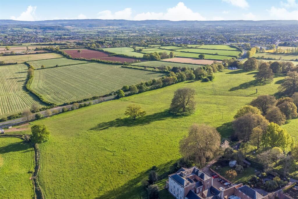
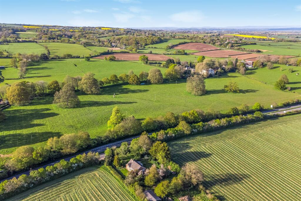
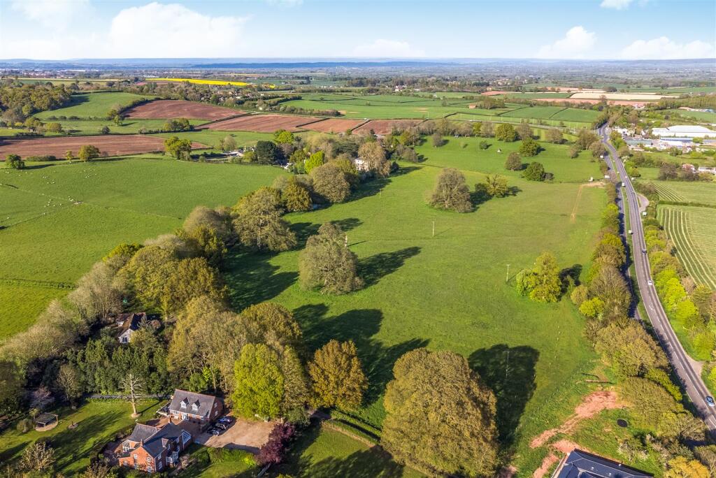
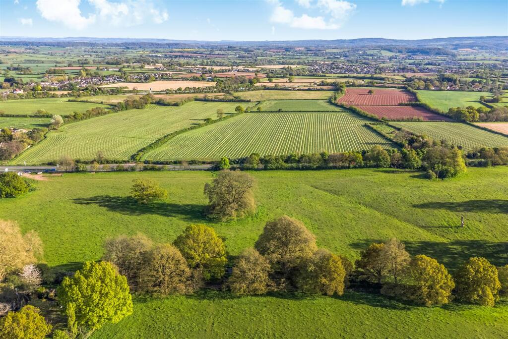
About 24.4 acres of pasture with mains water and direct access to the A38
- Bedrooms
- 0
- Bathrooms
- 0
The heatmap indicates the level of crime in the area. The color of the heatmap indicates the crime severity and recency.
Metrics Year-on-Year
- Average area value
- 356,400.00 £Decreased by 0.27 %
- Average area rental value
- 2,094.00 £/moIncreased by 68.33 %
- Est rental Yield
- 7.05 %Increased by 68.66 %
- Crime Rate
- 0.00 %
from 357,372.00 £
from 1,244.00 £/mo
from 4.18 %
from 0.00 %
Agent Activity
Stags Farm Agency created the listing.
Nearby Schools
| Name | Type | Ofsted | Distance |
|---|---|---|---|
| West Monkton Church Of England School | Academy Converter | 1.98 KM | |
| Creech St Michael Church Of England Primary School | Voluntary Controlled School | Good | 2.04 KM |
| The Villages Children'S Centre | Children's Centre Linked Site | 2.34 KM | |
| Cambian Somerset School | Other Independent Special School | Good | 2.60 KM |
| Heathfield Community School | Community School | Outstanding | 2.62 KM |
Images


Nearby Streets
| Name | Average Price | Average Sqft | Distance |
|---|---|---|---|
| Old Lipe Lane | £ 0 | 0 | 0.00 KM |
| Langaller Lane | £ 875,000 | 0 | 0.00 KM |
| Francis Close | £ 450,000 | 0 | 0.00 KM |
| Burlinch Lane | £ 0 | 0 | 0.00 KM |
Nearby Transport
| Name | NLC | TLC | Distance |
|---|---|---|---|
| Taunton | 3471 | TAU | 7.19 KM |
Nearby Listings
| Address | Price | Type | Score | Distance |
|---|---|---|---|---|
| Walford, Taunton | £ 275,000 | BUY | Unknown | 0.00 KM |
| Walford House, Walford Cross, Taunton, Somerset. | £ 250,000 | BUY | 6 / 10 | 0.26 KM |
| Walford Cross, Taunton | £ 475,000 | BUY | 7 / 10 | 0.96 KM |
| Coombe, West Monkton, Taunton, TA2 | £ 935,000 | BUY | 7 / 10 | 1.15 KM |
| West Monkton, Taunton, Somerset, TA2 | £ 950,000 | BUY | 8 / 10 | 1.33 KM |
Nearby Properties
| Address | Price | Distance |
|---|---|---|
| 2 Church Cottages | £ 285,000 | 1.22 KM |
| 3 Adsborough Hill Cottages | £ 332,000 | 1.27 KM |
| 2 The Street | £ 712,500 | 1.34 KM |
| 1 The Street | £ 705,000 | 1.34 KM |
| 4 Kendall Close | £ 310,000 | 1.43 KM |