T
Land at Lee Lane, Abram, Wigan
By T Fazakerley & Son
£ 60,000
T Fazakerley & Son says ..
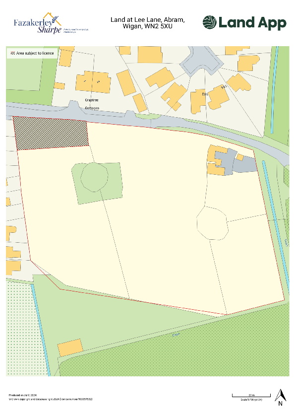
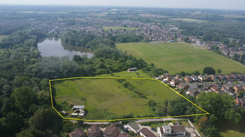
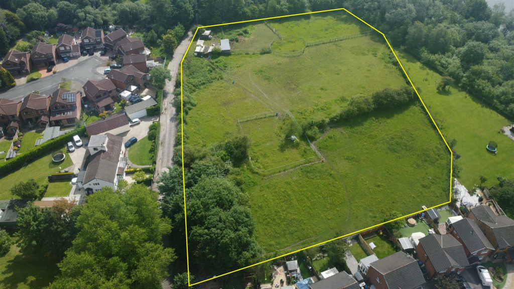
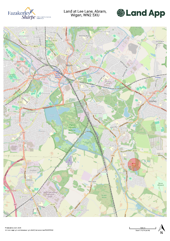
**FOR SALE BY INFORMAL TENDER - 23/8/24** Approximately 1.19 ha (2.94 ac) of land which is currently laid to pasture and used for equestrian purposes, the land is accessed via a private road and is within easy access of the town of Wigan. The land itself is classified as being G...
- Bedrooms
- 0
- Bathrooms
- 0
The heatmap indicates the level of crime in the area. The color of the heatmap indicates the crime severity and recency.
Metrics Year-on-Year
- Average area value
- 169,995.00 £Increased by 0.86 %
- Average area rental value
- 909.00 £/moIncreased by 14.34 %
- Est rental Yield
- 6.42 %Increased by 13.43 %
- Crime Rate
- 0.00 %
from 168,541.00 £
from 795.00 £/mo
from 5.66 %
from 0.00 %
Agent Activity
T Fazakerley & Son created the listing.
Nearby Schools
| Name | Type | Ofsted | Distance |
|---|---|---|---|
| St John'S Church Of England Primary School, Abram | Academy Converter | Good | 0.58 KM |
| Holy Family Catholic Primary School Platt Bridge | Voluntary Aided School | Good | 1.34 KM |
| Platt Bridge Community School | Academy Converter | Outstanding | 1.35 KM |
| Platt Bridge Sure Start Children'S Centre | Children's Centre | 1.36 KM | |
| St Mary'S Cofe Primary School | Voluntary Controlled School | Good | 1.74 KM |
Images
Nearby Streets
| Name | Average Price | Average Sqft | Distance |
|---|---|---|---|
| Coniston Drive | £ 0 | 0 | 0.00 KM |
| Thirlmere Avenue | £ 175,000 | 0 | 0.00 KM |
| Grasmere Terrace | £ 0 | 0 | 0.00 KM |
| Oak Avenue | £ 140,000 | 0 | 0.00 KM |
| Willow Street | £ 0 | 0 | 0.00 KM |
Nearby Transport
| Name | NLC | TLC | Distance |
|---|---|---|---|
| Hindley | 2398 | HIN | 3.70 KM |
| Ince (Manchester) | 2236 | INC | 3.87 KM |
| Wigan North Western | 2363 | WGN | 6.00 KM |
| Wigan Wallgate | 2406 | WGW | 6.07 KM |
| Bryn | 2222 | BYN | 6.54 KM |
Nearby Listings
| Address | Price | Type | Score | Distance |
|---|---|---|---|---|
| Land at Lee Lane, Abram, Wigan | £ 60,000 | COMMERCIAL_BUY | Unknown | 0.00 KM |
Nearby Properties
| Address | Price | Distance |
|---|---|---|
| 15 Dickens Drive | £ 141,000 | 0.12 KM |
| 23 Dickens Drive | £ 185,000 | 0.12 KM |
| 8 Ansford Avenue | £ 69,995 | 0.16 KM |
| 25 Ansford Avenue | £ 67,495 | 0.16 KM |
| 33 Ansford Avenue | £ 180,000 | 0.16 KM |