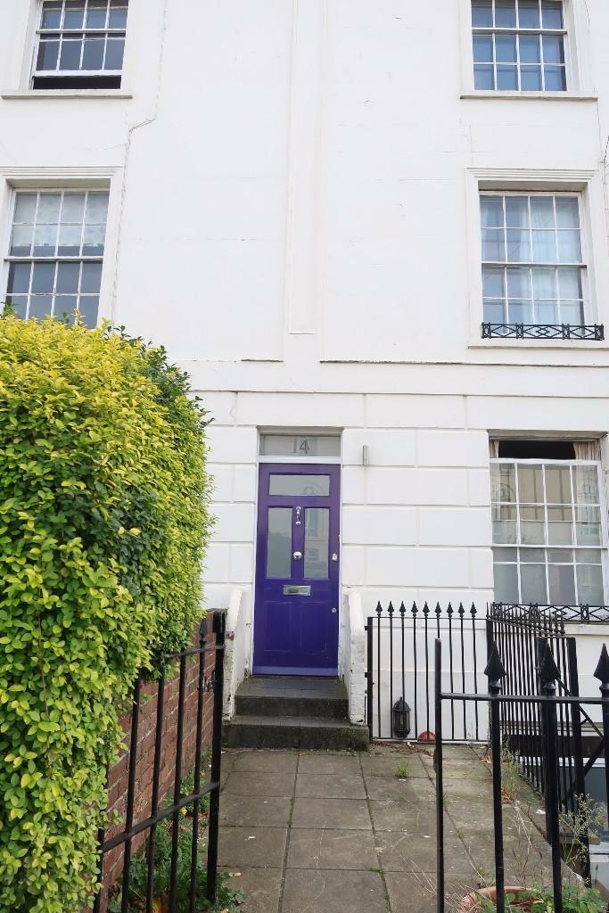
PO
14 Henstead Road
By Posh Pads
£ 952
Posh Pads says ..
STUDENT LET Posh Pads’ bills package includes a FREE professional clean and complementary waste removal service at the end of your tenancy. Tenants also have the option to add a weekly or fortnightly clean of communal areas, making it even easier to enjoy your student lifestyle stress-fr...
- Bedrooms
- 7
- Bathrooms
- 3
The heatmap indicates the level of crime in the area. The color of the heatmap indicates the crime severity and recency.
Metrics Year-on-Year
- Average area value
- 222,098.00 £Decreased by 0.46 %
- Average area rental value
- 1,204.00 £/moDecreased by 7.81 %
- Est rental Yield
- 6.51 %Decreased by 7.26 %
- Crime Rate
- 24.00 %Unchanged by 0.00 %
from 223,118.00 £
from 1,306.00 £/mo
from 7.02 %
from 24.00 %
Agent Activity
Posh Pads created the listing.
Nearby Schools
| Name | Type | Ofsted | Distance |
|---|---|---|---|
| St Anne'S Catholic School | Academy Converter | Outstanding | 0.33 KM |
| Banister Primary School | Foundation School | Good | 0.59 KM |
| The Polygon School | Foundation Special School | Good | 0.68 KM |
| Southampton Solent University | Higher Education Institutions | Good | 0.88 KM |
| Springhill Catholic Primary School | Academy Converter | 0.89 KM |
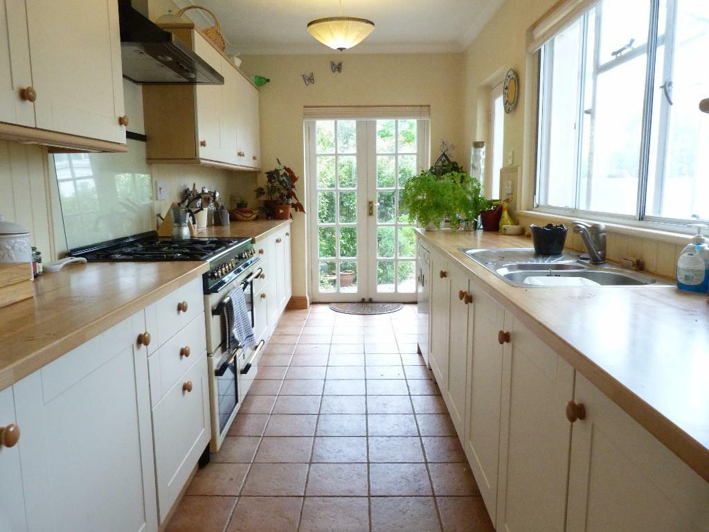
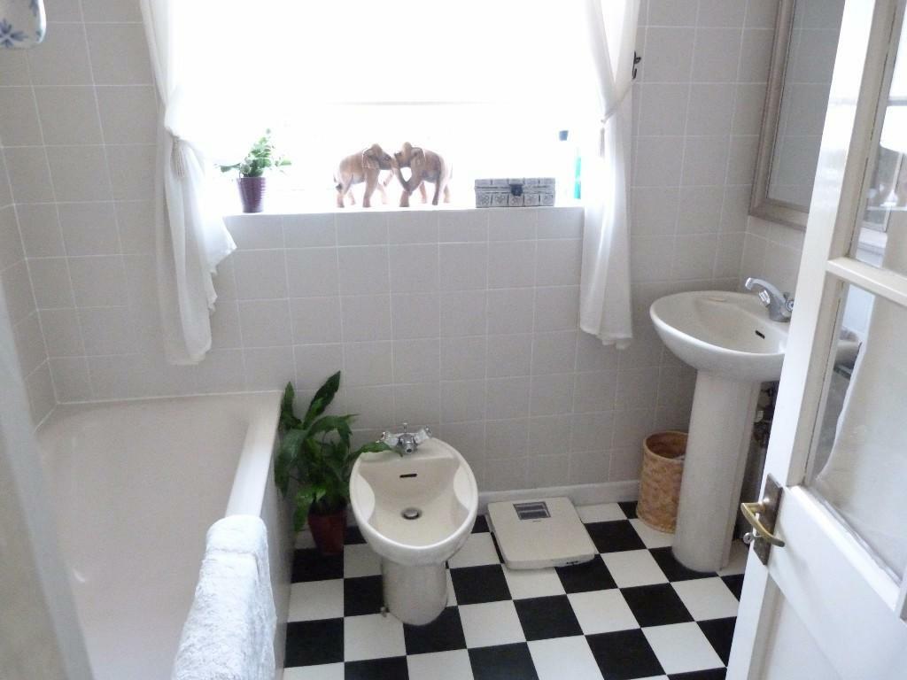
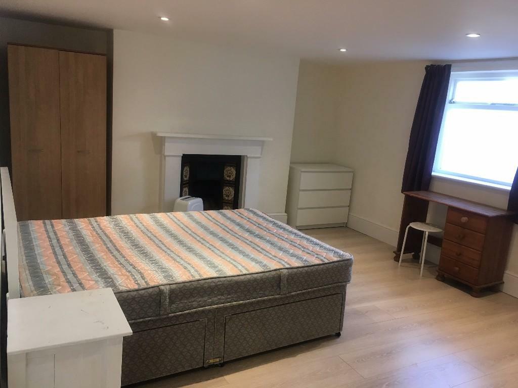
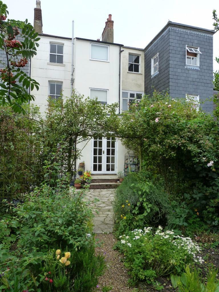
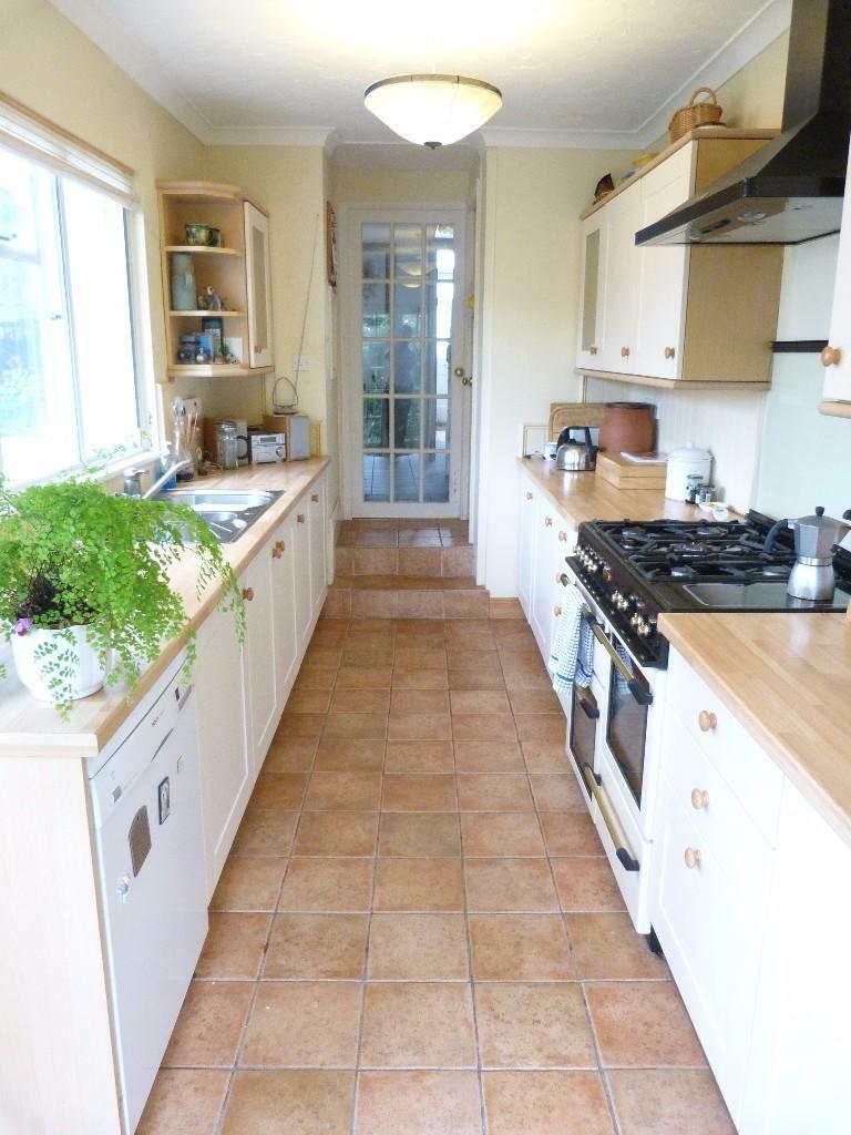
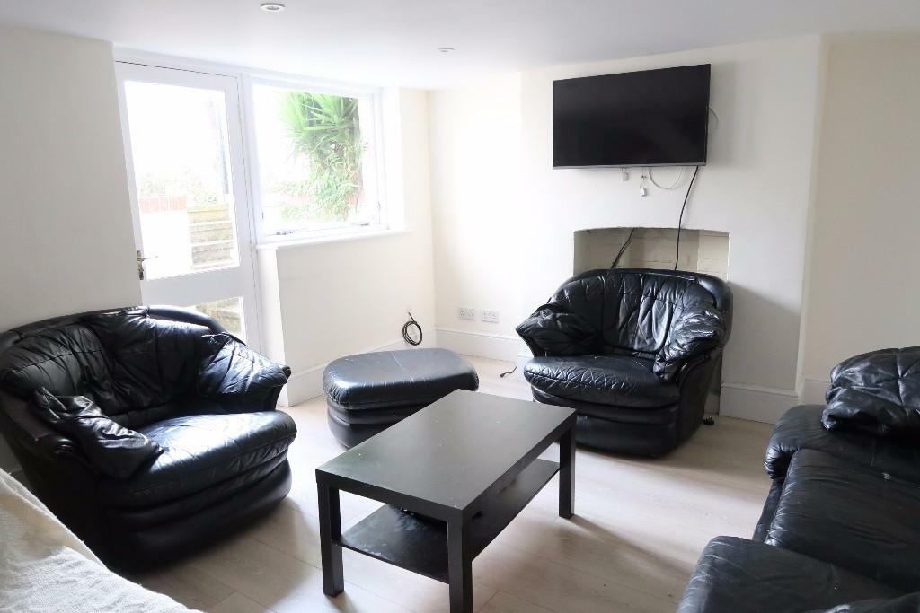
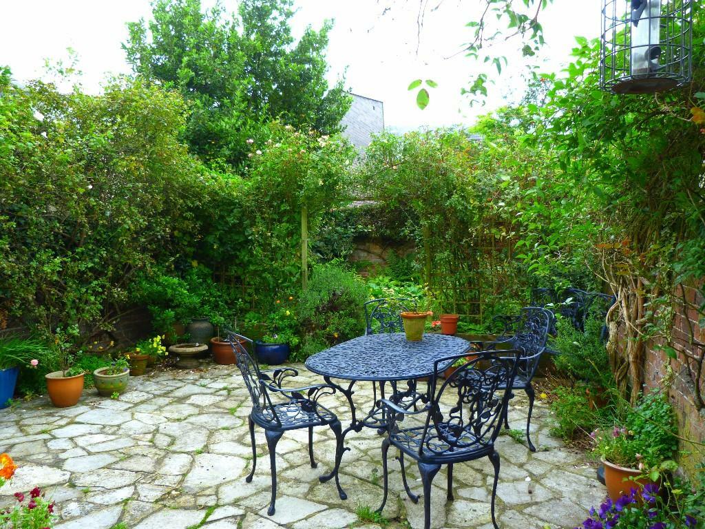
Images

Nearby Streets
| Name | Average Price | Average Sqft | Distance |
|---|---|---|---|
| Grosvenor Square | £ 0 | 0 | 0.00 KM |
| Leroux Close | £ 0 | 0 | 0.00 KM |
| Commercial Road | £ 0 | 0 | 0.00 KM |
| Windsor Terrace | £ 0 | 0 | 0.00 KM |
| Morris Road | £ 0 | 0 | 0.00 KM |
Nearby Transport
| Name | NLC | TLC | Distance |
|---|---|---|---|
| Southampton Central | 5932 | SOU | 0.91 KM |
| St Denys | 5914 | SDN | 2.39 KM |
| Millbrook (Hants) | 5909 | MBK | 2.99 KM |
| Bitterne | 5945 | BTE | 3.37 KM |
| Woolston | 5925 | WLS | 3.60 KM |
Nearby Listings
| Address | Price | Type | Score | Distance |
|---|---|---|---|---|
| 14 Henstead Road | £ 952 | RENT | Unknown | 0.00 KM |
| Henstead Road, Southampton | £ 1,300 | RENT | Unknown | 0.03 KM |
| 8 Henstead Road | £ 590 | RENT | Unknown | 0.03 KM |
| 8a Henstead Road | £ 230 | RENT | Unknown | 0.03 KM |
| Henstead Road, Polygon | £ 2,250 | RENT | Unknown | 0.04 KM |
Nearby Properties
| Address | Price | Distance |
|---|---|---|
| 3 Henstead Road | £ 332,000 | 0.04 KM |
| 9 Henstead Road | £ 350,000 | 0.04 KM |
| 1 Henstead Road | £ 264,000 | 0.04 KM |
| 7b Henstead Road | £ 76,250 | 0.04 KM |
| 7c Henstead Road | £ 110,000 | 0.04 KM |