MA
Broad Street, Sheerness. ME12
By Mann Lettings
£ 725
Mann Lettings says ..
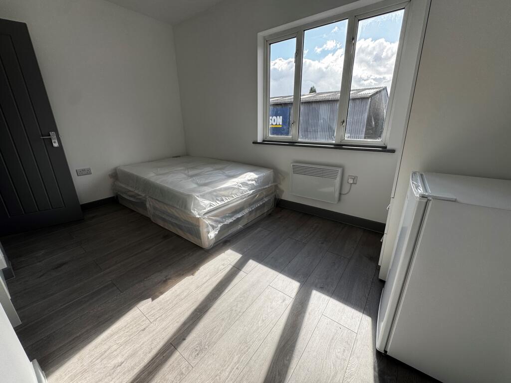
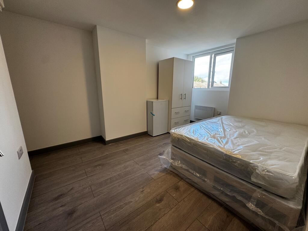
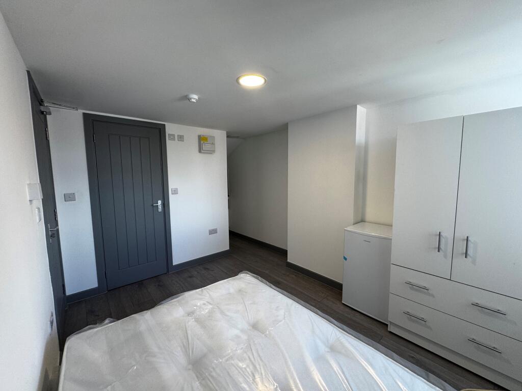
High specification Double Room with its own en-suite in a shared house (Selection of rooms available)
- Bedrooms
- 0
- Bathrooms
- 1
The heatmap indicates the level of crime in the area. The color of the heatmap indicates the crime severity and recency.
Metrics Year-on-Year
- Average area value
- 229,250.00 £Increased by 1.09 %
- Average area rental value
- 1,258.00 £/moIncreased by 13.95 %
- Est rental Yield
- 6.58 %Increased by 12.67 %
- Crime Rate
- 18.00 %Unchanged by 0.00 %
from 226,767.00 £
from 1,104.00 £/mo
from 5.84 %
from 18.00 %
Agent Activity
Mann Lettings created the listing.
Nearby Schools
| Name | Type | Ofsted | Distance |
|---|---|---|---|
| St Edward'S Catholic Primary School | Academy Sponsor Led | Good | 0.13 KM |
| Rose Street Primary School | Community School | Good | 0.27 KM |
| Seashells Children'S Centre | Children's Centre | 0.27 KM | |
| West Minster Primary School | Community School | Good | 0.92 KM |
| Richmond Academy | Academy Sponsor Led | Requires improvement | 1.91 KM |
Images

Nearby Streets
| Name | Average Price | Average Sqft | Distance |
|---|---|---|---|
| True Briton Alley | £ 0 | 0 | 0.00 KM |
| Holland Close | £ 130,000 | 0 | 0.00 KM |
| St George's Avenue | £ 280,000 | 0 | 0.00 KM |
| East Lane | £ 0 | 0 | 0.00 KM |
| Regency Close | £ 0 | 0 | 0.00 KM |
Nearby Transport
| Name | NLC | TLC | Distance |
|---|---|---|---|
| Sheerness-On-Sea | 5184 | SSS | 0.28 KM |
| Queenborough | 5176 | QBR | 2.73 KM |
| Swale | 5249 | SWL | 5.64 KM |
| Kemsley | 5205 | KML | 8.85 KM |
Nearby Listings
| Address | Price | Type | Score | Distance |
|---|---|---|---|---|
| Broad Street, Sheerness, Kent, ME12 | £ 173 | RENT | Unknown | 0.00 KM |
| Broad Street, Sheerness. ME12 | £ 725 | RENT | Unknown | 0.00 KM |
| Broad Street, Sheerness. ME12 | £ 725 | RENT | Unknown | 0.00 KM |
| Railway Road, Sheerness, Kent, ME12 | £ 1,100 | RENT | Unknown | 0.13 KM |
| Sheerness, Kent, ME12 | £ 1,195 | RENT | Unknown | 0.33 KM |
Nearby Properties
| Address | Price | Distance |
|---|---|---|
| 91 Russell Street | £ 80,000 | 0.04 KM |
| 15a Railway Road | £ 77,500 | 0.09 KM |
| 21 Railway Road | £ 155,000 | 0.10 KM |
| 25 Railway Road | £ 217,000 | 0.10 KM |
| 23 Railway Road | £ 141,000 | 0.10 KM |