TH
Westfield Walk, High Wycombe
By Thompson Wilson Estate Agents
£ 950
Thompson Wilson Estate Agents says ..
1 BEDROOM HOUSE SITUATED IN A POPULAR RESIDENTIAL AREA OF HIGH WYCOMBE.
- Bedrooms
- 1
- Bathrooms
- 1
The heatmap indicates the level of crime in the area. The color of the heatmap indicates the crime severity and recency.
Metrics Year-on-Year
- Average area value
- 327,500.00 £Increased by 3.49 %
- Average area rental value
- 1,202.00 £/moDecreased by 7.04 %
- Est rental Yield
- 4.40 %Decreased by 10.20 %
- Crime Rate
- 8.00 %Unchanged by 0.00 %
from 316,470.00 £
from 1,293.00 £/mo
from 4.90 %
from 8.00 %
Agent Activity
Thompson Wilson Estate Agents created the listing.
Nearby Schools
| Name | Type | Ofsted | Distance |
|---|---|---|---|
| Oakridge School | Community School | Requires improvement | 0.54 KM |
| Castlefield Family Centre (Wycombe) | Children's Centre | 0.82 KM | |
| Castlefield School | Foundation School | Good | 0.90 KM |
| Unity College | Other Independent Special School | Good | 1.04 KM |
| Chiltern Wood School | Community Special School | Good | 1.05 KM |
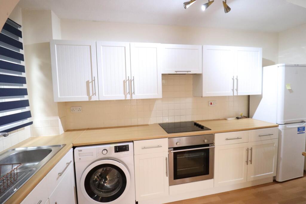
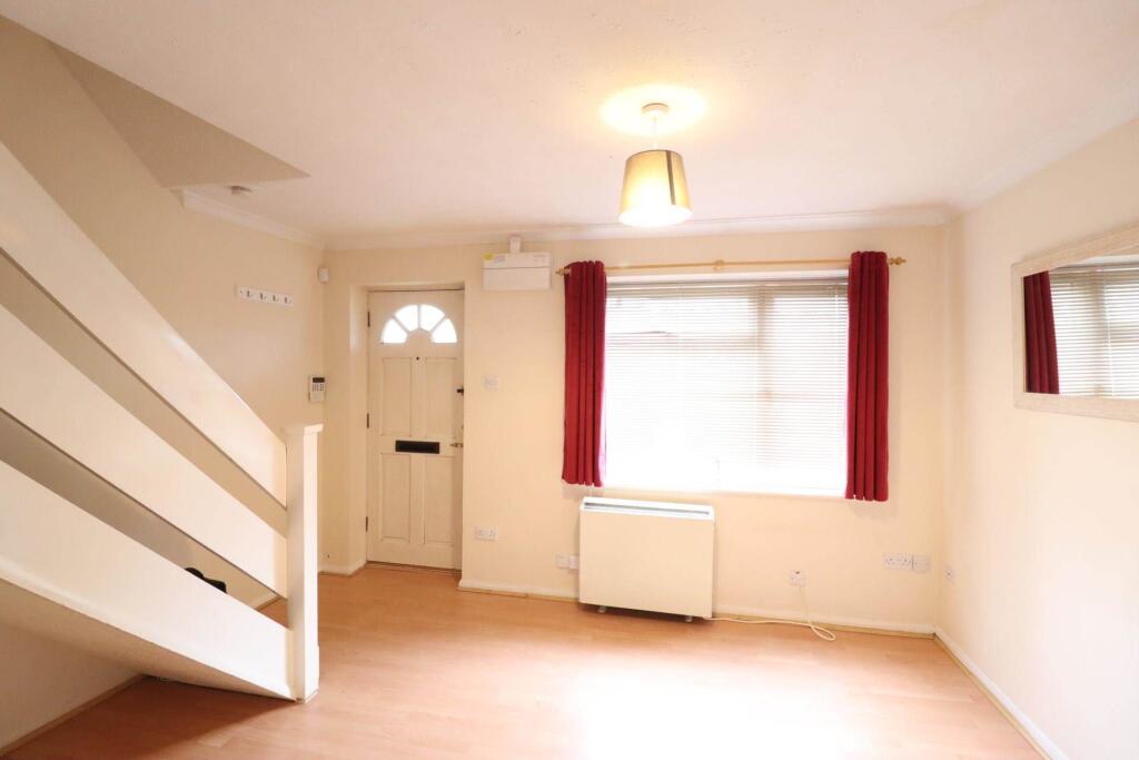
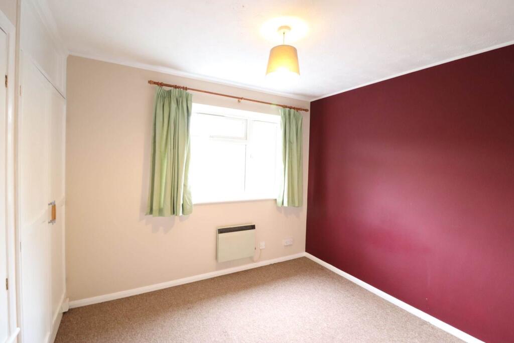
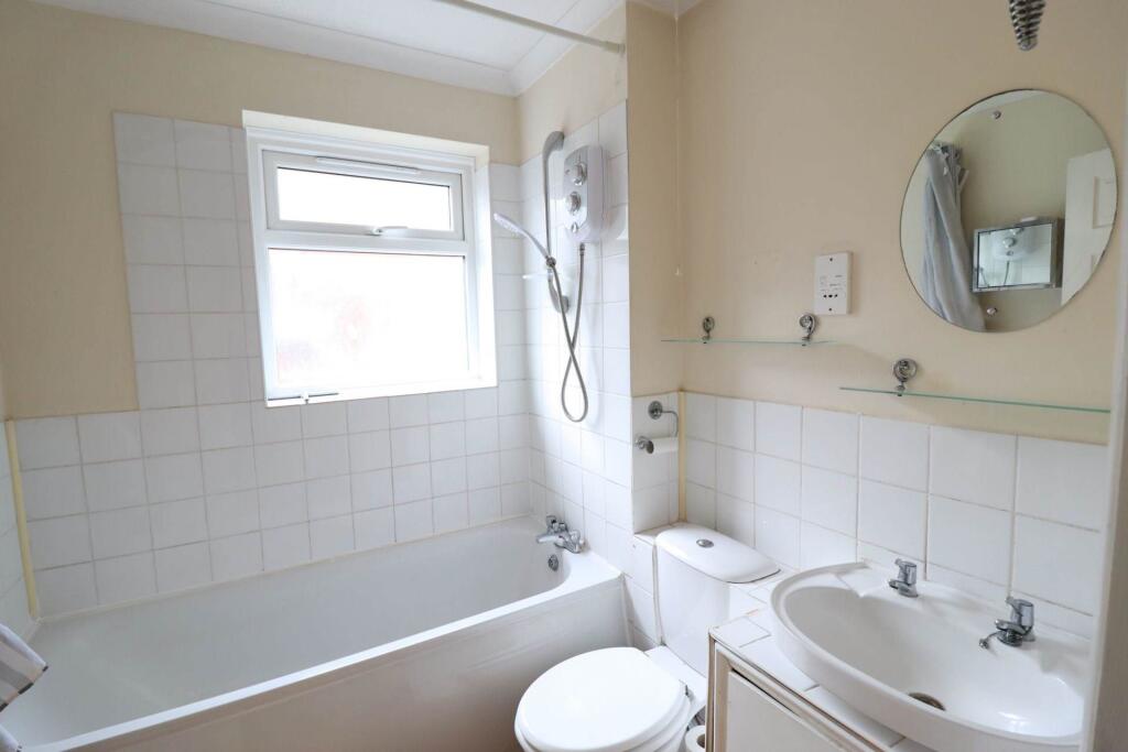
Images

Nearby Streets
| Name | Average Price | Average Sqft | Distance |
|---|---|---|---|
| Link Road | £ 0 | 0 | 0.00 KM |
| Bevelwood Gardens | £ 200,000 | 0 | 0.00 KM |
| Anglo Office Park | £ 1,500,000 | 0 | 0.00 KM |
| Bartless Crescent | £ 250,000 | 0 | 0.00 KM |
| Lancaster Road | £ 0 | 0 | 0.00 KM |
Nearby Transport
| Name | NLC | TLC | Distance |
|---|---|---|---|
| High Wycombe | 3054 | HWY | 3.17 KM |
| Marlow | 3021 | MLW | 6.44 KM |
| Saunderton | 3056 | SDR | 7.77 KM |
| Bourne End | 3018 | BNE | 9.05 KM |
| Cookham | 3019 | COO | 9.76 KM |
Nearby Listings
| Address | Price | Type | Score | Distance |
|---|---|---|---|---|
| Westfield Walk, High Wycombe | £ 950 | RENT | Unknown | 0.00 KM |
| One Bedroom Starter Home | £ 1,150 | RENT | Unknown | 0.01 KM |
| Westfield Walk, HIGH WYCOMBE | £ 1,100 | RENT | Unknown | 0.01 KM |
| Carrington Road, Hp13 | £ 1,700 | RENT | Unknown | 0.07 KM |
| Carrington Road, Hp13 | £ 1,900 | RENT | Unknown | 0.07 KM |
Nearby Properties
| Address | Price | Distance |
|---|---|---|
| 31 Westfield Walk | £ 46,500 | 0.01 KM |
| 1 Westfield Walk | £ 132,000 | 0.01 KM |
| 17 Westfield Walk | £ 186,000 | 0.01 KM |
| 39 Westfield Walk | £ 220,000 | 0.01 KM |
| 20 Westfield Walk | £ 131,000 | 0.01 KM |