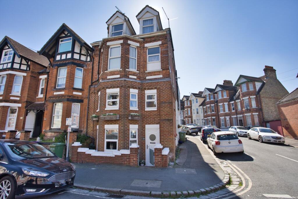
Bournemouth Road, Folkestone, CT19
By Miles & Barr
£ 200,000
Reviews
3 out of 5 stars
Miles & Barr says ..
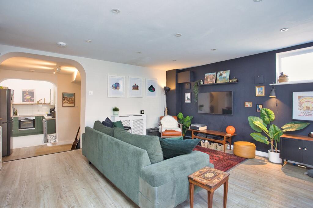
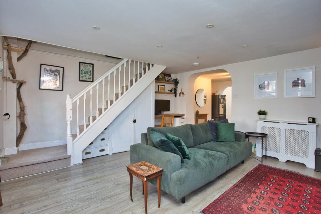
OPEN DAY SATURDAY THE 26TH OF APRIL - BY APPOINTMENT ONLY STYLISH TWO BEDROOM HOME WITH PRIVATE FRONT DOOR CLOSE TO THE STATION Beautifully presented throughout making this an ideal first home, investment or retreat by the sea. The property comes with a long lease and ideall...
Property Oracle says ..
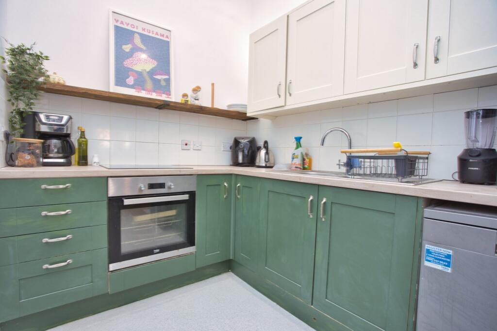
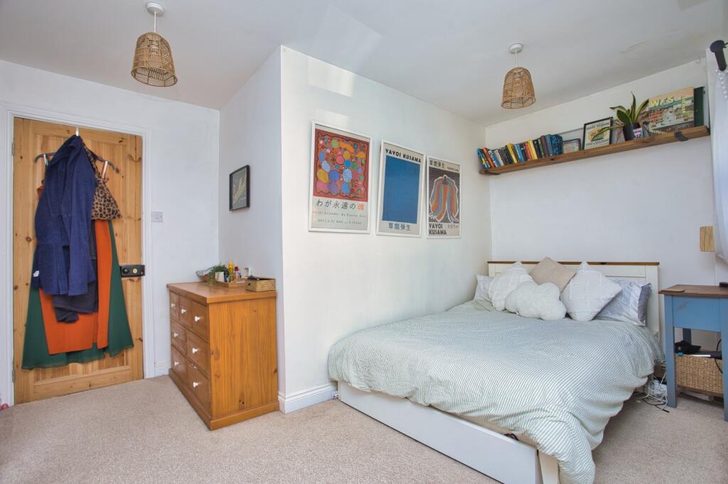
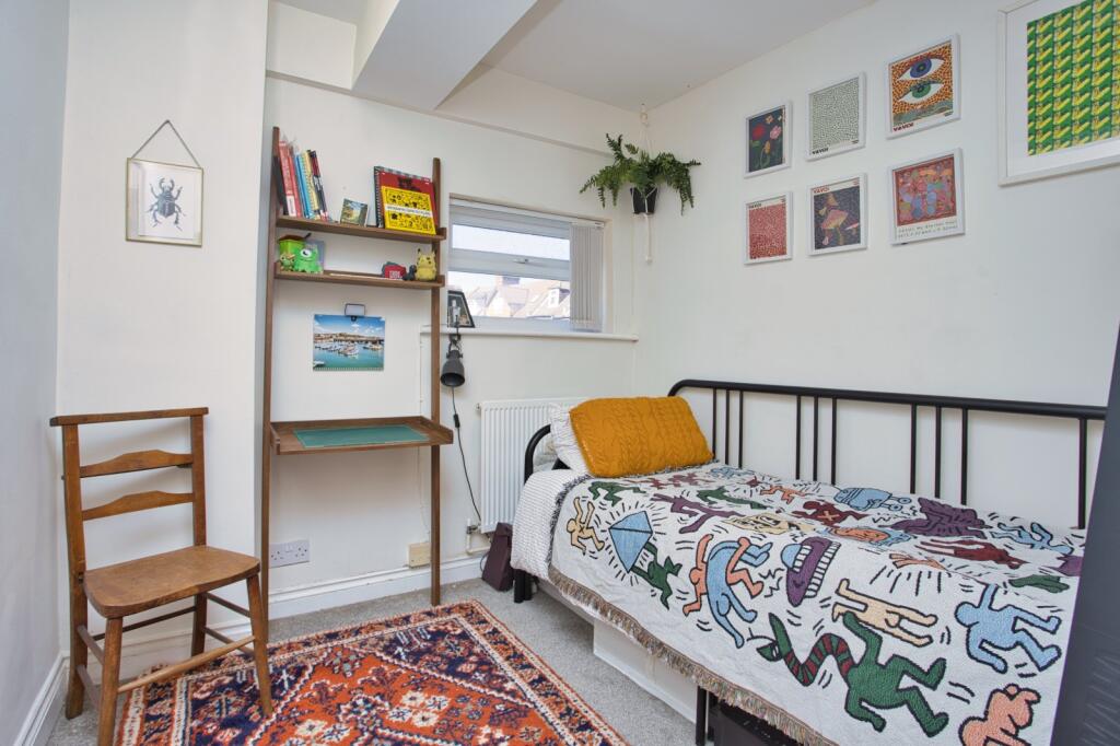
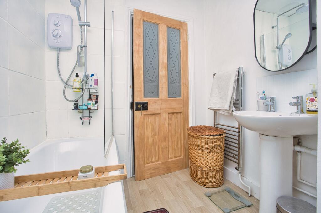
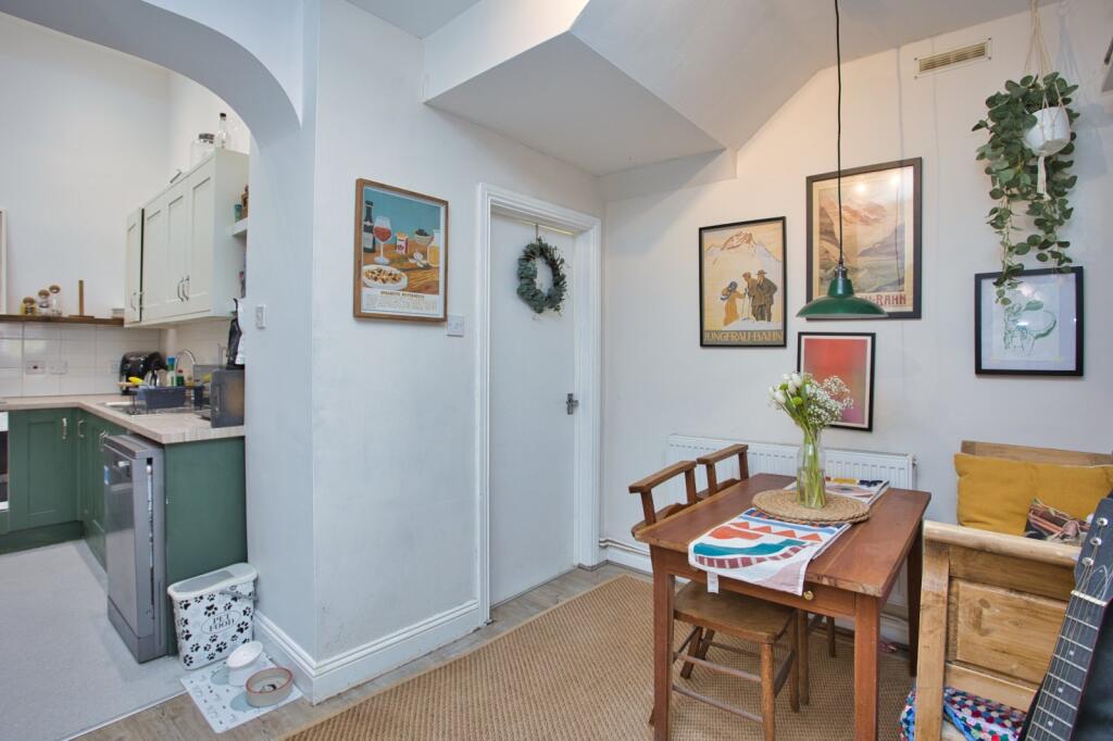
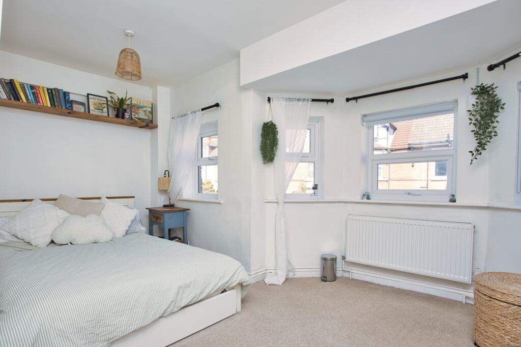
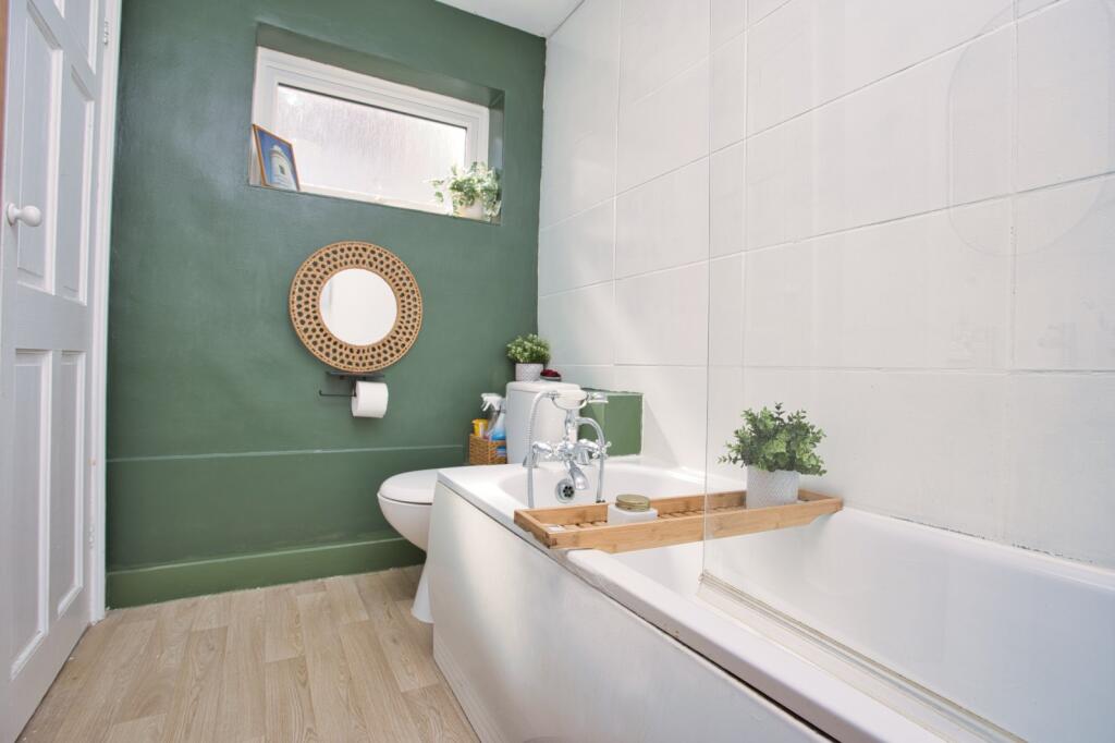
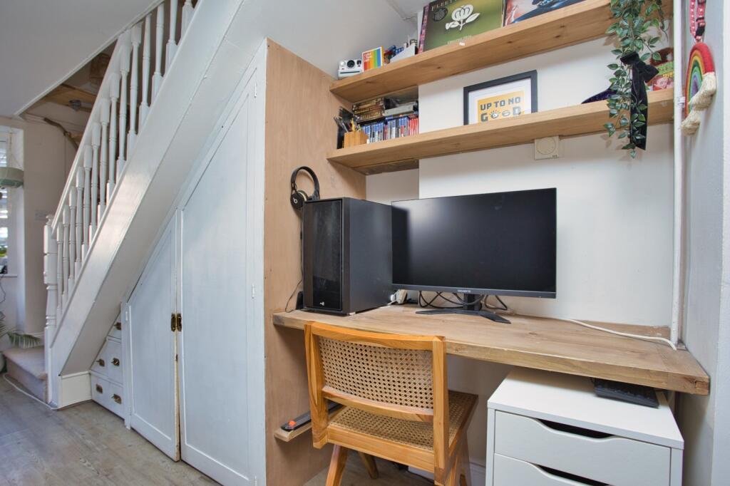
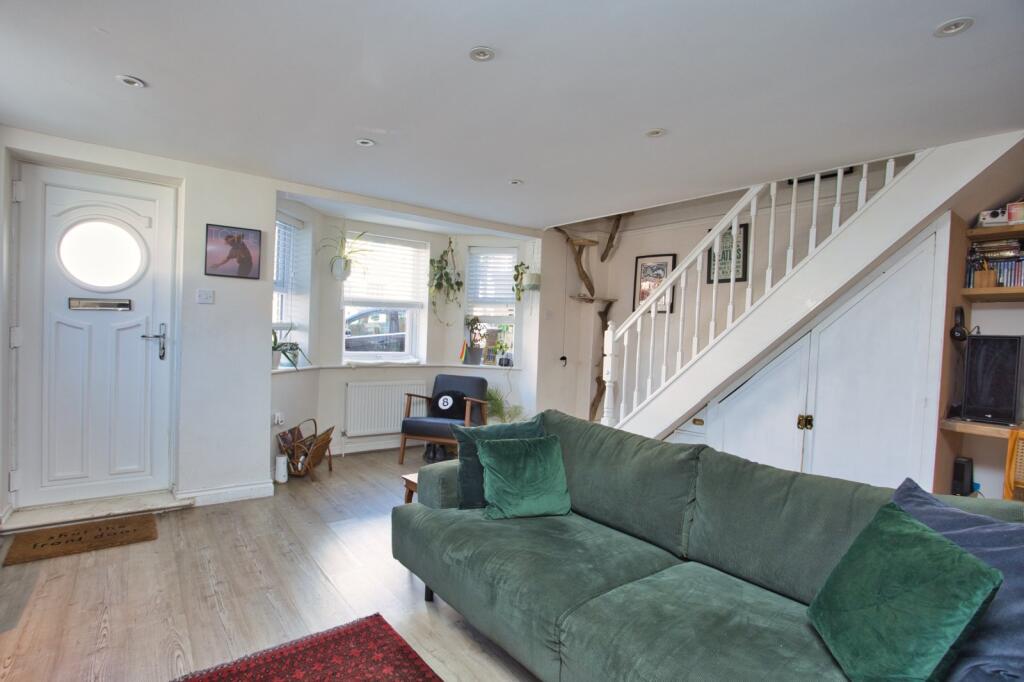
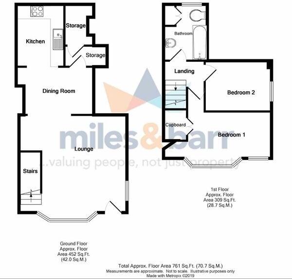
The property is a 2-bedroom flat located on Bournemouth Road in Folkestone, Kent. It’s situated in East Folkestone, within a short distance of Folkestone Central train station (0.61 KM). Several primary schools with good Ofsted ratings are also nearby, including Christ Church Cep Academy (0.21 KM) and Stella Maris Catholic Primary School (0.46 KM). The flat itself appears to be in good condition based on the provided images. The interior is modern and well-maintained, with a recently updated kitchen and bathroom. There is no evidence of significant repairs or renovations needed. While the plot size is the same as the square footage of the property itself (761 sqft), indicating a lack of a significant garden, the property’s location and condition are positive factors. Considering the list price of £200,000, the average price for properties in the area is £267,119, and the average price per square foot is £301. The subject property is smaller than average (761 sqft vs 886 sqft average) and is priced considerably lower than the average price for the area. However, nearby comparable properties (2a Bournemouth Road at £136,000) support the listing price to some degree. The price seems reasonable given its size, location, and condition, although it is at the lower end of the market value for the area.
Therefore, we give this property 6 / 10. *Disclaimer: This is our option and does constitute a recommendation or financial advice. Do your own research. *
- Price
- 7
- Condition
- 8
- Location
- 7
- Land
- 3
- Bedrooms
- 2
- Bathrooms
- 1
- Sqft (est)
- 761.00
- Lot (est)
- 761.00
The heatmap indicates the level of crime in the area. The color of the heatmap indicates the crime severity and recency.
Metrics Year-on-Year
- Average area value
- 232,813.00 £Decreased by 16.54 %
- Est sale value
- 215,363.00 £Decreased by 20.95 %
- Average area rental value
- 1,254.00 £/moIncreased by 17.86 %
- Est letting value
- 761.00 £/moUnchanged by 0.00 %
- Est rental Yield
- 6.46 %Increased by 41.05 %
- Crime Rate
- 8.00 %Unchanged by 0.00 %
Agent Activity
Miles & Barr marked this listing as sold.
Miles & Barr created the listing.
Nearby Schools
| Name | Type | Ofsted | Distance |
|---|---|---|---|
| Christ Church Cep Academy, Folkestone | Academy Converter | Good | 0.21 KM |
| Stella Maris Catholic Primary School | Academy Converter | Good | 0.46 KM |
| Mundella Primary School | Academy Converter | 0.67 KM | |
| The Beacon Folkestone | Foundation Special School | Outstanding | 0.69 KM |
| Compass Community School Coastal Park | Other Independent Special School | Requires improvement | 0.78 KM |
Images

Nearby Streets
| Name | Average Price | Average Sqft | Distance |
|---|---|---|---|
| Palmerston Street | £ 150,000 | 0 | 0.00 KM |
| Park Farm Road | £ 0 | 0 | 0.00 KM |
| Arras Close | £ 0 | 0 | 0.00 KM |
| Arras Close | £ 0 | 0 | 0.00 KM |
| Albion Mews Road | £ 100,000 | 0 | 0.00 KM |
Nearby Transport
| Name | NLC | TLC | Distance |
|---|---|---|---|
| Folkestone Central | 5035 | FKC | 0.61 KM |
| Folkestone West | 5027 | FKW | 2.31 KM |
Nearby Listings
| Address | Price | Type | Score | Distance |
|---|---|---|---|---|
| Bournemouth Road, Folkestone, CT19 | £ 200,000 | BUY | 6 / 10 | 0.00 KM |
| Victoria Road, Folkestone, CT19 | £ 415,000 | BUY | 6 / 10 | 0.03 KM |
| Bournemouth Road, Folkestone, Kent, CT19 | £ 350,000 | BUY | 6 / 10 | 0.06 KM |
| Bournemouth Road, Folkestone | £ 375,000 | BUY | 6 / 10 | 0.06 KM |
| Broadmead Road, Folkestone | £ 330,000 | BUY | 5 / 10 | 0.07 KM |
Nearby Properties
| Address | Price | Distance |
|---|---|---|
| 40 Bournemouth Road | £ 177,500 | 0.01 KM |
| 2a Bournemouth Road | £ 136,000 | 0.01 KM |
| 21 Bournemouth Road | £ 165,000 | 0.01 KM |
| 39 Bournemouth Road | £ 196,000 | 0.01 KM |
| 14 Bournemouth Road | £ 310,710 | 0.01 KM |