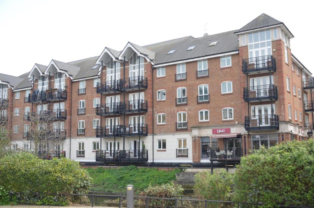

Brentford Lock, Brentford
By Quilliam
£ 110
Quilliam says ..
Brentford Lock - 1 x Secure Allocated Parking Space.
- Bedrooms
- 0
- Bathrooms
- 0
The heatmap indicates the level of crime in the area. The color of the heatmap indicates the crime severity and recency.
Metrics Year-on-Year
- Average area value
- 517,032.00 £Decreased by 3.11 %
- Average area rental value
- 1,845.00 £/moIncreased by 3.59 %
- Est rental Yield
- 4.28 %Increased by 7.00 %
- Crime Rate
- 19.00 %Unchanged by 0.00 %
from 533,636.00 £
from 1,781.00 £/mo
from 4.00 %
from 19.00 %
Agent Activity
Quilliam created the listing.
Nearby Schools
| Name | Type | Ofsted | Distance |
|---|---|---|---|
| Brentford School For Girls | Academy Converter | Good | 0.48 KM |
| St Paul'S Cofe Primary School | Voluntary Aided School | Good | 0.60 KM |
| Our Lady And St John'S Catholic Primary School | Voluntary Aided School | Good | 0.91 KM |
| Gunnersbury Catholic School | Voluntary Aided School | Outstanding | 1.21 KM |
| Ealing Fields High School | Free Schools | Good | 1.50 KM |
Images
Nearby Streets
| Name | Average Price | Average Sqft | Distance |
|---|---|---|---|
| Ronalds Road | £ 0 | 0 | 0.00 KM |
| Brentford Town Square | £ 0 | 0 | 0.00 KM |
| Kingham Avenue | £ 0 | 0 | 0.00 KM |
| Boars Head Yard | £ 0 | 0 | 0.00 KM |
| Brentside | £ 0 | 0 | 0.00 KM |
Nearby Transport
| Name | NLC | TLC | Distance |
|---|---|---|---|
| Brentford | 5552 | BFD | 0.49 KM |
| Syon Lane | 5609 | SYL | 1.63 KM |
| Richmond | 5570 | RMD | 2.43 KM |
| Kew Bridge | 5593 | KWB | 2.64 KM |
| Kew Gardens | 5594 | KWG | 2.86 KM |
Nearby Listings
| Address | Price | Type | Score | Distance |
|---|---|---|---|---|
| High Street, Brentford | £ 2,200 | RENT | Unknown | 0.00 KM |
| Brentford Lock, Brentford | £ 110 | RENT | Unknown | 0.00 KM |
| High Street, Brentford | £ 496 | RENT | Unknown | 0.00 KM |
| High Street, Brentford | £ 2,000 | RENT | Unknown | 0.03 KM |
| Brentford Lock, Brentford | £ 2,100 | RENT | Unknown | 0.03 KM |
Nearby Properties
| Address | Price | Distance |
|---|---|---|
| 19 Market Place | £ 1,000,000 | 0.13 KM |
| 11 Tallow Road | £ 1,200,000 | 0.14 KM |
| 12 Tallow Road | £ 1,180,000 | 0.14 KM |
| 16 Tallow Road | £ 800,000 | 0.14 KM |
| 8 Tallow Road | £ 1,200,000 | 0.14 KM |