
Pearson Ferrier says ..
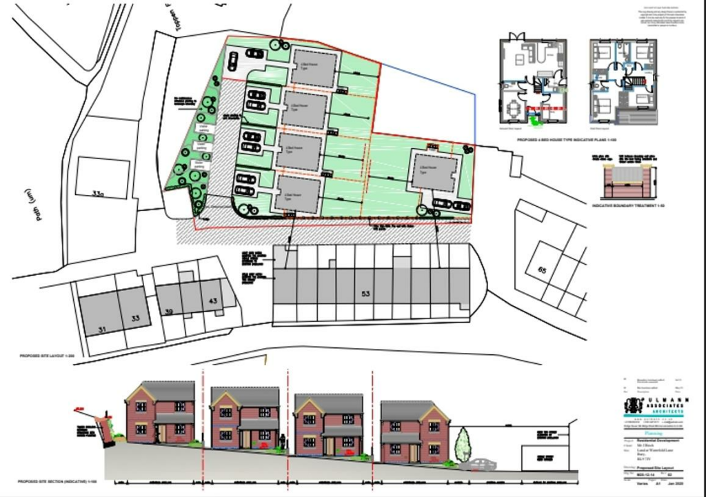
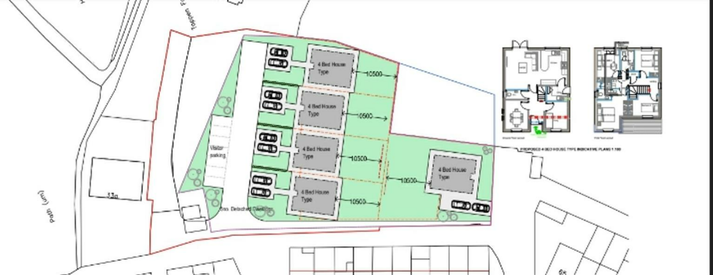
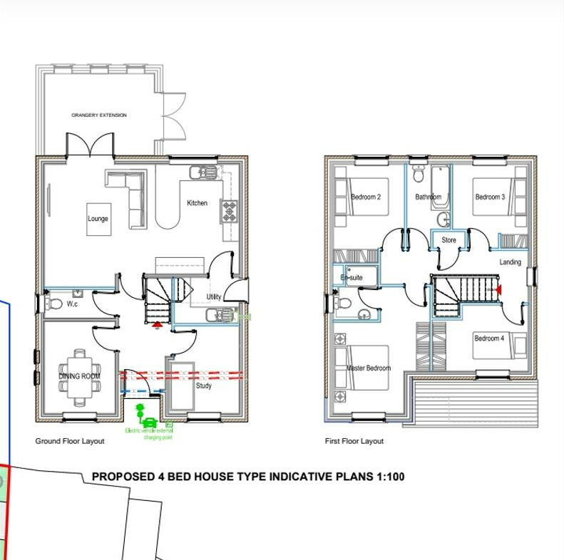
A parcel of Freehold land to the rear of 39 to 65 Waterfold Lane Bury which has been granted outline planning permission for the construction of 5 detached properties under application reference 21/01345/OUT with Rochdale Borough Council. Waterfold Lane is conveniently located for junction 2 of t...
Property Oracle says ..
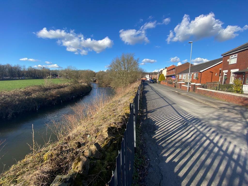
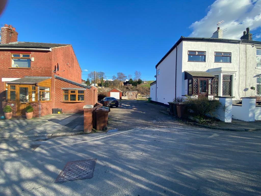
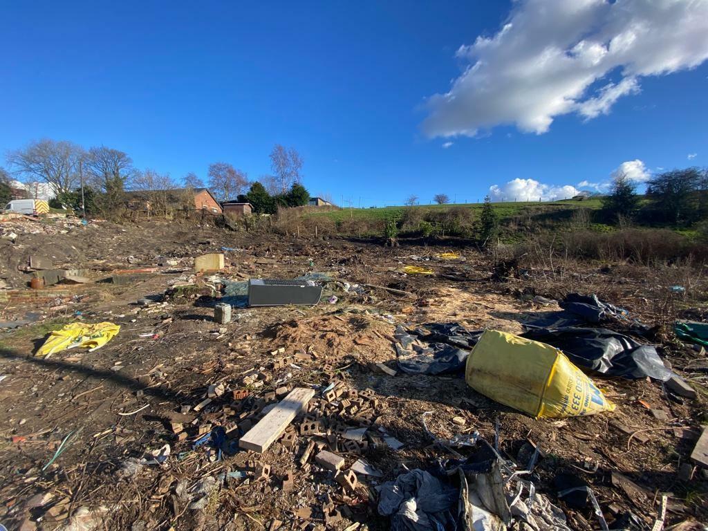
This property listing is for a plot of land at Waterfold Lane, Bury, Greater Manchester. The key feature is that it already has outline planning permission for the construction of five detached properties. This is a significant advantage, reducing the time and cost associated with obtaining planning consent. The location is reasonably convenient, being within a reasonable distance of schools and a train station. However, the immediate surroundings, based on the photographs, show a considerable amount of waste and debris on site, which is a significant negative. The price reflects the development potential, which is not immediately apparent in the current condition. Nearby property prices provide some comparative context but not a direct equivalent for a site with planning permission for multiple homes. More detailed analysis of recent sales of comparable land plots with planning permission would be necessary for a complete valuation. The absence of precise details regarding sqft and plot size (beyond the planning drawings) limits a more granular price per sqft calculation. The current condition of the land is poor. This suggests some costs to remove the debris, groundworks etc. will need to be taken into account by the developer.
Therefore, we give this property 5 / 10. *Disclaimer: This is our option and does constitute a recommendation or financial advice. Do your own research. *
- Price
- 7
- Condition
- 3
- Location
- 6
- Land
- 7
- Bedrooms
- 0
- Bathrooms
- 0
The heatmap indicates the level of crime in the area. The color of the heatmap indicates the crime severity and recency.
Metrics Year-on-Year
- Average area value
- 511,000.00 £Increased by 12.42 %
- Average area rental value
- 1,413.00 £/moDecreased by 25.47 %
- Est rental Yield
- 3.32 %Decreased by 33.73 %
- Crime Rate
- 0.00 %
Agent Activity
Pearson Ferrier marked this listing as sold.
Pearson Ferrier created the listing.
Nearby Schools
| Name | Type | Ofsted | Distance |
|---|---|---|---|
| Hazel Wood High School | Academy Sponsor Led | 0.66 KM | |
| Bury East Children'S Centre Hub | Children's Centre | 0.77 KM | |
| East Ward Community Primary School | Academy Converter | 0.88 KM | |
| Heap Bridge Village Primary School | Community School | Good | 0.94 KM |
| St Thomas Church Of England Primary School | Academy Converter | 1.25 KM |
Images
Nearby Streets
| Name | Average Price | Average Sqft | Distance |
|---|---|---|---|
| Poplar Avenue | £ 135,000 | 0 | 0.00 KM |
| School Street | £ 1,800,000 | 0 | 0.00 KM |
| Elm Street | £ 0 | 0 | 0.00 KM |
| Back Elm Street | £ 0 | 0 | 0.00 KM |
| Rowan Drive | £ 175,000 | 0 | 0.00 KM |
Nearby Transport
| Name | NLC | TLC | Distance |
|---|---|---|---|
| Clifton (Manchester) | 2795 | CLI | 8.88 KM |
Nearby Listings
| Address | Price | Type | Score | Distance |
|---|---|---|---|---|
| Waterfold Lane, Bury | £ 390,000 | BUY | 5 / 10 | 0.00 KM |
| Waterfold Lane, Bury | £ 190,000 | BUY | 6 / 10 | 0.16 KM |
| Waterfold Lane, Bury, Greater Manchester, BL9 | £ 100,000 | BUY | 6 / 10 | 0.25 KM |
| Heap Bridge, Bury, Rochdale, Lancashire | £ 190,000 | BUY | 6 / 10 | 0.30 KM |
| St. Georges Mount, Bury, BL9 – Stunning 4-Bed Detached with Views, Double Garage & No Chain | £ 500,000 | BUY | Unknown | 0.37 KM |
Nearby Properties
| Address | Price | Distance |
|---|---|---|
| 55 Waterfold Lane | £ 118,500 | 0.17 KM |
| 59 Waterfold Lane | £ 105,000 | 0.17 KM |
| 69 Waterfold Lane | £ 180,000 | 0.17 KM |
| 43 Waterfold Lane | £ 95,000 | 0.17 KM |
| 49 Waterfold Lane | £ 140,000 | 0.17 KM |