
PA
Wallis Road, KETTERING
By Pattison Lane
£ 950
Pattison Lane says ..
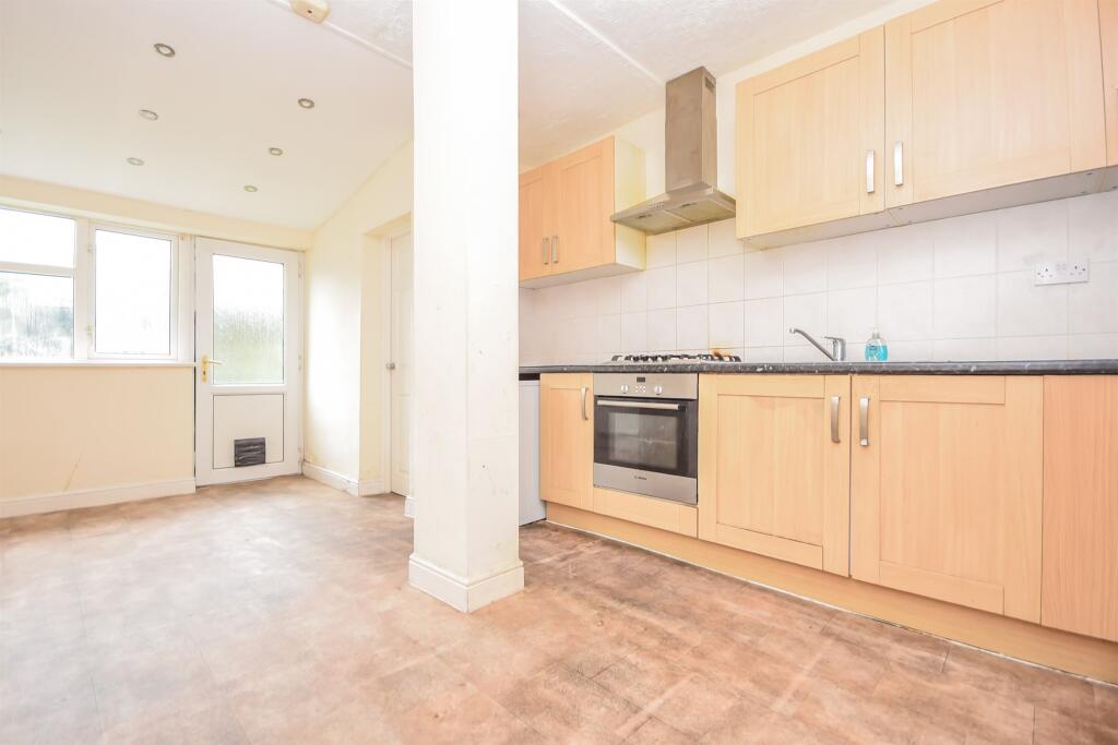
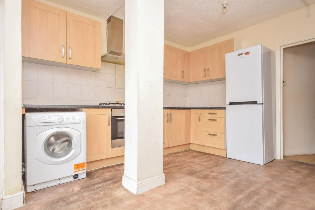
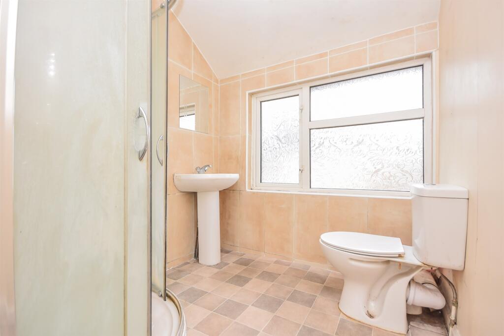
POPULAR LOCATION CLOSE TO THE TRAIN STATION AND SCHOOLS
- Bedrooms
- 2
- Bathrooms
- 0
The heatmap indicates the level of crime in the area. The color of the heatmap indicates the crime severity and recency.
Metrics Year-on-Year
- Average area value
- 487,124.00 £Increased by 94.35 %
- Average area rental value
- 1,220.00 £/moIncreased by 6.46 %
- Est rental Yield
- 3.01 %Decreased by 45.17 %
- Crime Rate
- 3.00 %Unchanged by 0.00 %
from 250,641.00 £
from 1,146.00 £/mo
from 5.49 %
from 3.00 %
Agent Activity
Pattison Lane created the listing.
Nearby Schools
| Name | Type | Ofsted | Distance |
|---|---|---|---|
| Southfield School For Girls | Academy Converter | Good | 0.51 KM |
| Hawthorn Community Primary School | Academy Converter | 0.83 KM | |
| Compass Primary Academy | Academy Sponsor Led | Requires improvement | 0.92 KM |
| St Edward'S Catholic Primary School | Academy Converter | Requires improvement | 1.04 KM |
| Greenfields Primary School And Nursery | Academy Sponsor Led | Outstanding | 1.06 KM |
Images


Nearby Streets
| Name | Average Price | Average Sqft | Distance |
|---|---|---|---|
| Boddington Road | £ 0 | 0 | 0.00 KM |
| Hillcrest Avenue | £ 0 | 0 | 0.00 KM |
| Linden Avenue | £ 185,000 | 0 | 0.00 KM |
| Spring Rise | £ 195,000 | 0 | 0.00 KM |
| Northumberland Close | £ 0 | 0 | 0.00 KM |
Nearby Transport
| Name | NLC | TLC | Distance |
|---|---|---|---|
| Kettering | 1857 | KET | 1.59 KM |
Nearby Listings
| Address | Price | Type | Score | Distance |
|---|---|---|---|---|
| Wallis Road, KETTERING | £ 950 | RENT | Unknown | 0.00 KM |
| Wallis Road, KETTERING | £ 1,300 | RENT | Unknown | 0.00 KM |
| Wallis Road, KETTERING | £ 1,295 | RENT | Unknown | 0.00 KM |
| Wallis Road, NN15 | £ 1,100 | RENT | Unknown | 0.04 KM |
| Woodcroft Way, KETTERING | £ 925 | RENT | Unknown | 0.13 KM |
Nearby Properties
| Address | Price | Distance |
|---|---|---|
| 7 Wallis Road | £ 156,000 | 0.00 KM |
| 2 Wallis Road | £ 158,000 | 0.00 KM |
| 11 Wallis Road | £ 187,000 | 0.00 KM |
| 18 Wallis Road | £ 128,500 | 0.00 KM |
| 16 Wallis Road | £ 204,000 | 0.00 KM |