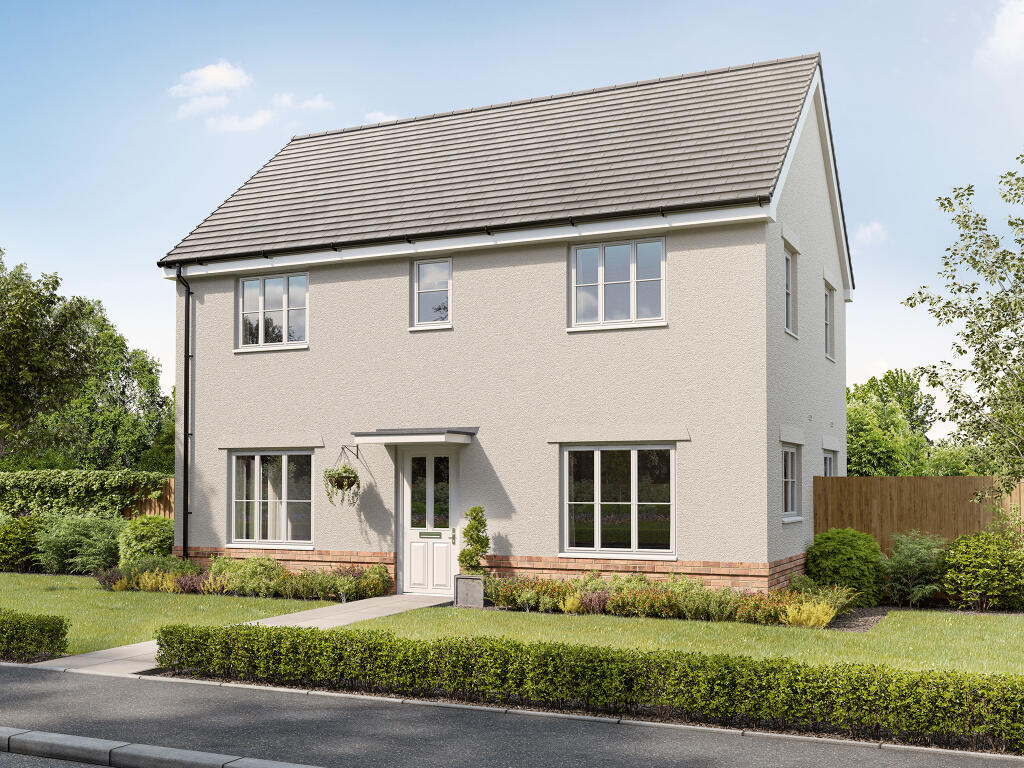
Ixworth Road, Thurston, Bury St Edmunds IP31 3UJ
By Persimmon Homes Suffolk
£ 373,000
Reviews
3 out of 5 stars
Persimmon Homes Suffolk says ..
Perfect for growing families, first-time buyers and house movers, explore our stunning Hakewill Mews development offering energy-efficient one, two, three, four and five-bedroom homes. Settled on the edge of the historic village of Thurston, the development is surrounded by the beautifu...
Property Oracle says ..
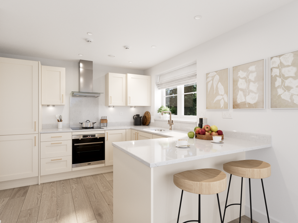
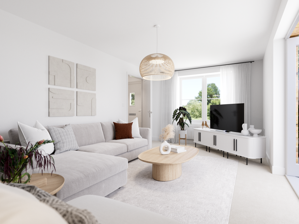
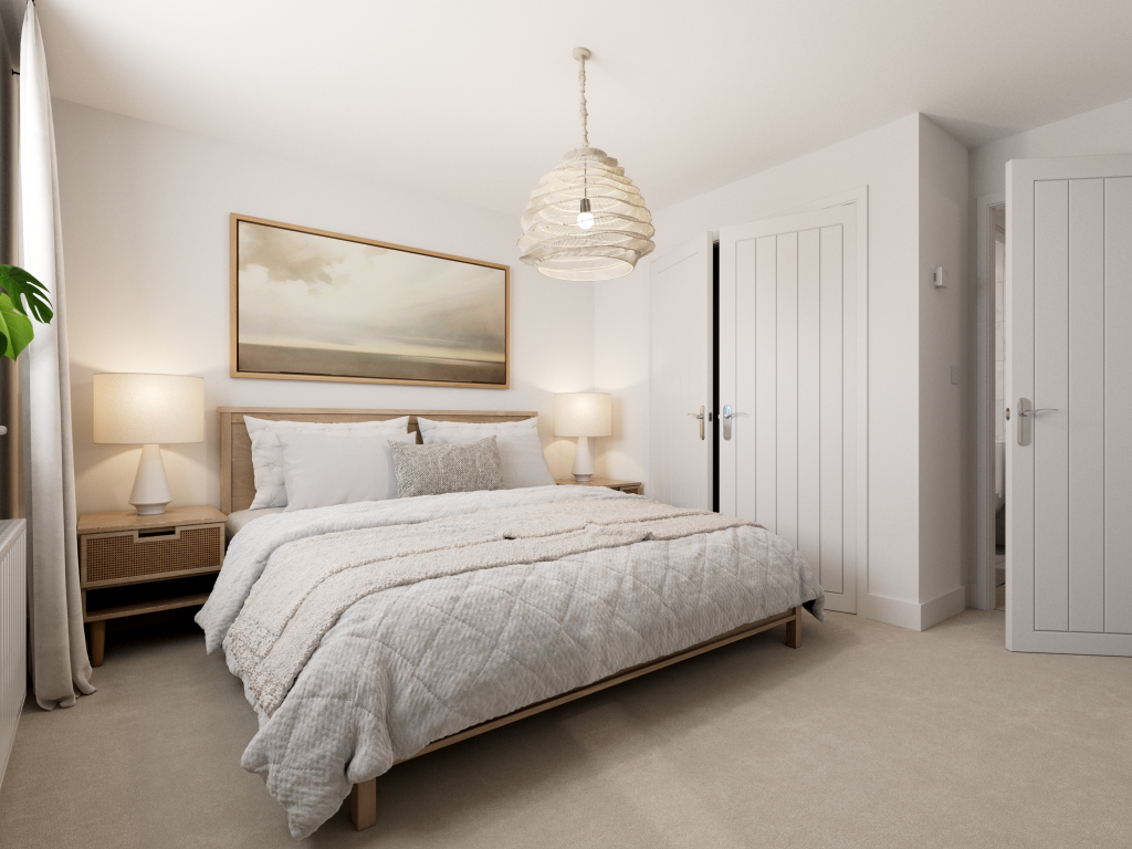
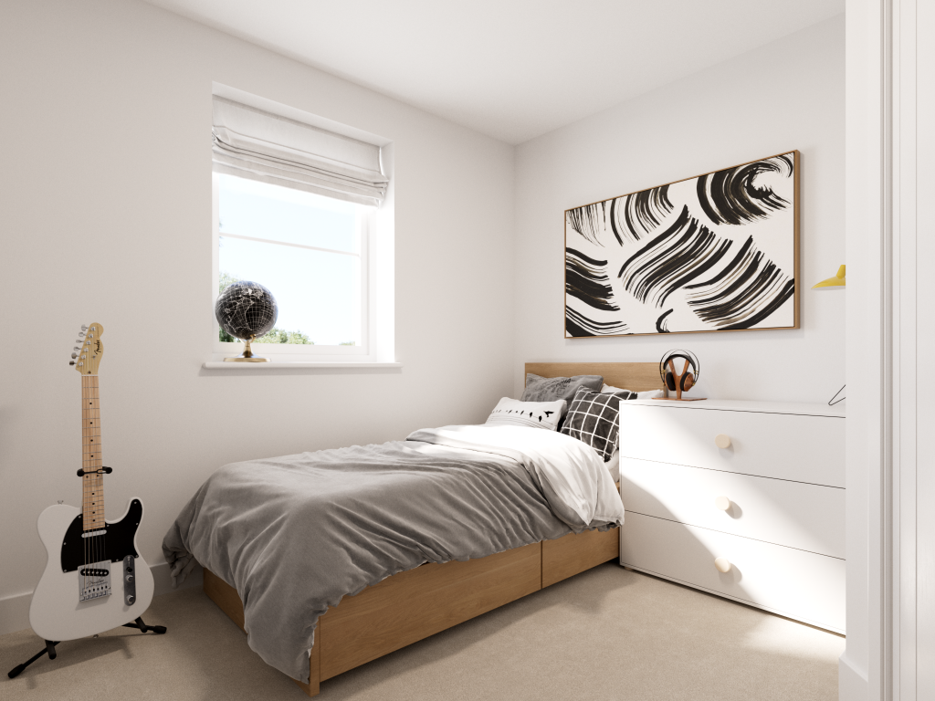
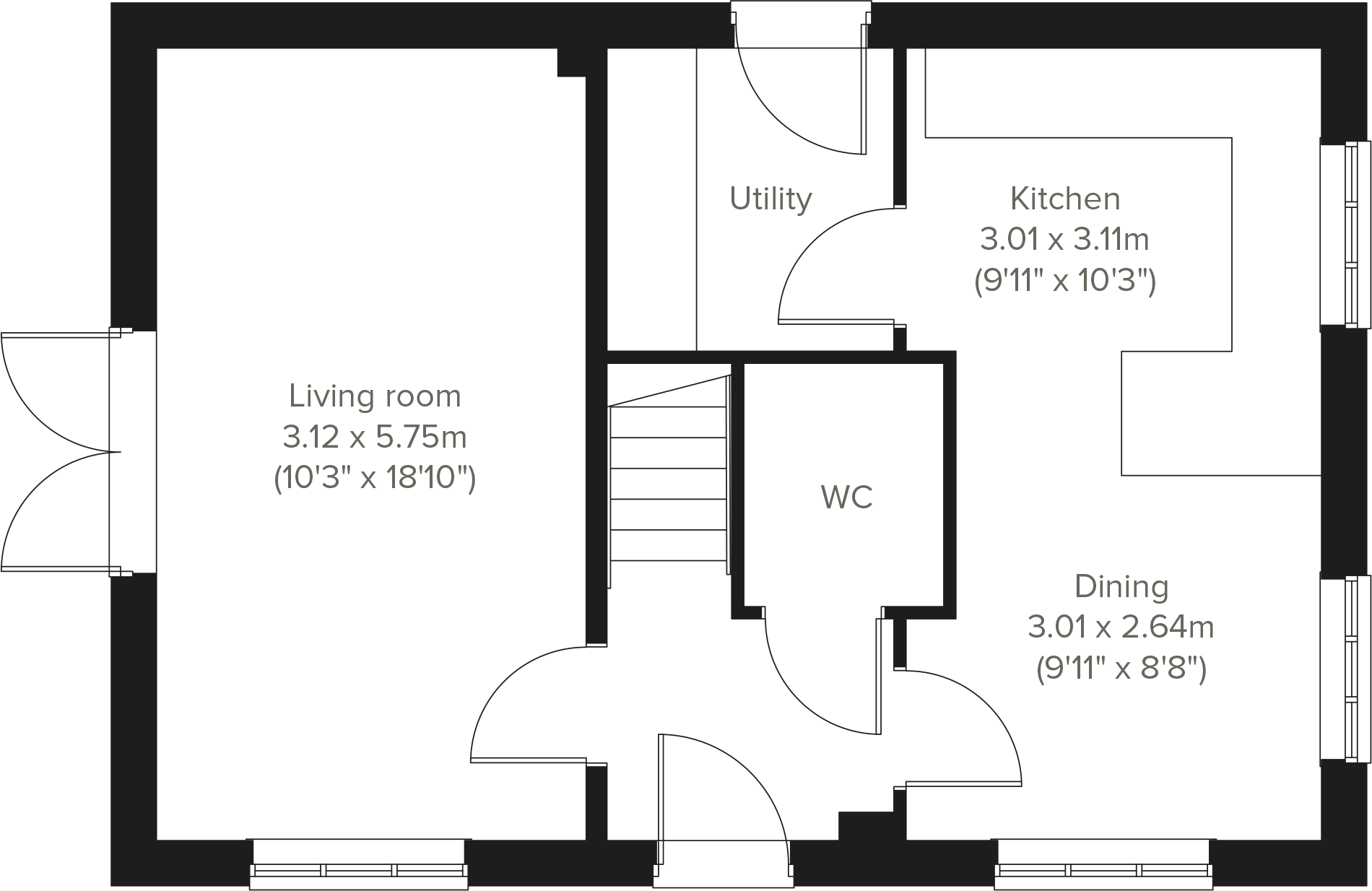
The property is a 3-bedroom house located in Thurston, Bury St Edmunds, Suffolk. It is listed at £373,000 and has a square footage of 429.80 sqft. The average price for properties in the area is £425,206, with an average price per sqft of £366. Nearby listings show prices ranging from £277,000 to £460,000. The property is situated near Thurston Community College (0.45km), a school with a “Good” Ofsted rating, suggesting a positive aspect for families. Thurston train station is also within close proximity (0.97km), providing convenient transport links. The property appears to be in good condition based on the provided images. The kitchen and living areas are modern and well-presented, suggesting that the property is well-maintained. However, the lack of information regarding plot size and the absence of bathroom details limits a full assessment. While the property is located near a well-regarded school and a train station, the limited plot size (0.00 sqft) is a notable factor. The price of £373,000 is slightly below the average price for the area (£425,206). However, the significantly smaller size of this property (429.80 sqft vs. 1161 sqft average) needs to be considered when evaluating the price per sqft. The lack of plot size data prevents a full evaluation of the land aspect.
Therefore, we give this property 7 / 10. *Disclaimer: This is our option and does constitute a recommendation or financial advice. Do your own research. *
- Price
- 6
- Condition
- 8
- Location
- 7
- Land
- 0
- Bedrooms
- 3
- Bathrooms
- 0
- Sqft (est)
- 429.80
The heatmap indicates the level of crime in the area. The color of the heatmap indicates the crime severity and recency.
Metrics Year-on-Year
- Average area value
- 418,571.00 £Decreased by 7.66 %
- Est sale value
- 146,561.80 £Decreased by 2.29 %
- Average area rental value
- 1,600.00 £/moIncreased by 55.19 %
- Est letting value
- 429.80 £/mo
- Est rental Yield
- 4.59 %Increased by 68.13 %
- Crime Rate
- 0.00 %
Agent Activity
Persimmon Homes Suffolk created the listing.
Nearby Schools
| Name | Type | Ofsted | Distance |
|---|---|---|---|
| Thurston Community College | Community School | Good | 0.45 KM |
| Rougham Church Of England Primary School | Academy Sponsor Led | 3.59 KM | |
| Great Barton Church Of England Primary Academy | Academy Converter | 4.41 KM | |
| Ixworth Church Of England Primary School | Academy Sponsor Led | 5.37 KM | |
| Sybil Andrews Academy | Academy Sponsor Led | Requires improvement | 5.85 KM |
Images


Nearby Streets
| Name | Average Price | Average Sqft | Distance |
|---|---|---|---|
| Bennett Close | £ 0 | 0 | 0.00 KM |
| Bassett Road | £ 330,000 | 0 | 0.00 KM |
| Meadow Lane | £ 0 | 0 | 0.00 KM |
| Kings Road | £ 379,950 | 0 | 0.00 KM |
| Hunter Drive | £ 0 | 0 | 0.00 KM |
Nearby Transport
| Name | NLC | TLC | Distance |
|---|---|---|---|
| Thurston | 7356 | TRS | 0.97 KM |
Nearby Listings
| Address | Price | Type | Score | Distance |
|---|---|---|---|---|
| Ixworth Road, Thurston, Bury St Edmunds, Suffolk, IP31 3UJ | £ 120,000 | BUY | Unknown | 0.00 KM |
| Ixworth Road, Thurston, Bury St Edmunds, Suffolk, IP31 3UJ | £ 156,000 | BUY | Unknown | 0.00 KM |
| Ixworth Road, Thurston, Bury St Edmunds IP31 3UJ | £ 340,000 | BUY | 7 / 10 | 0.00 KM |
| Ixworth Road, Thurston, Bury St Edmunds, Suffolk, IP31 3UJ | £ 156,000 | BUY | Unknown | 0.00 KM |
| Double Road, Thurston | £ 410,000 | BUY | 7 / 10 | 0.00 KM |
Nearby Properties
| Address | Price | Distance |
|---|---|---|
| Newhaven | £ 345,000 | 0.39 KM |
| 4 Cedars Close | £ 610,000 | 0.46 KM |
| Mill Lane Cottage | £ 575,000 | 0.47 KM |
| Sherwood | £ 700,000 | 0.52 KM |
| Woodlands | £ 440,000 | 0.52 KM |