Mark Ewin says ..
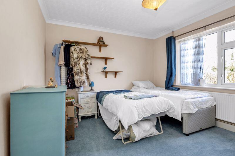
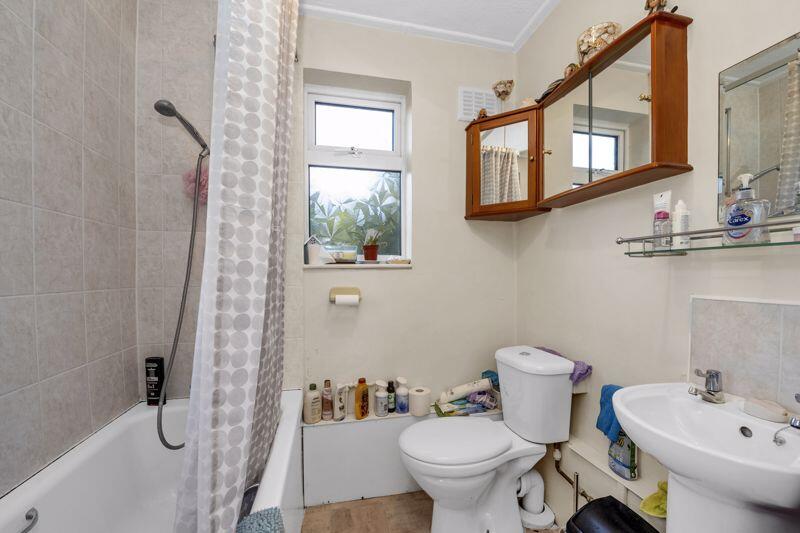
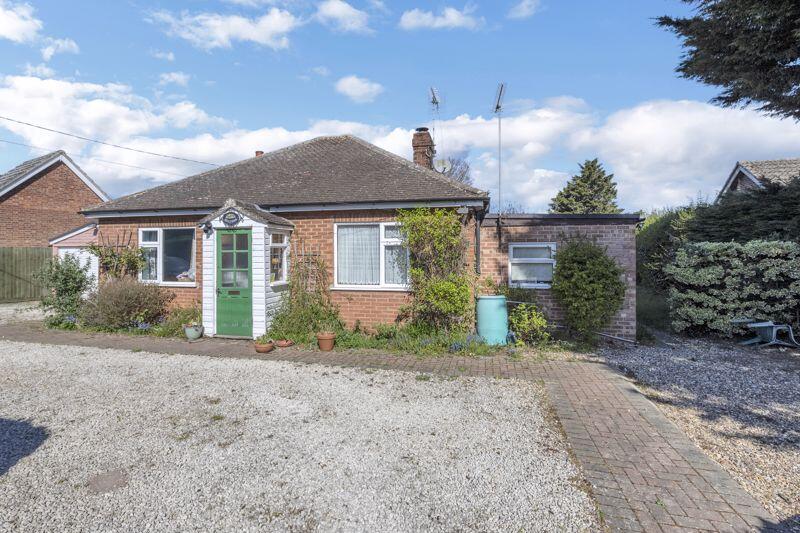
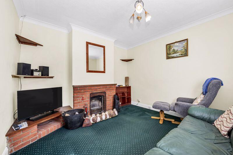
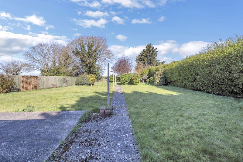
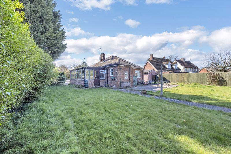
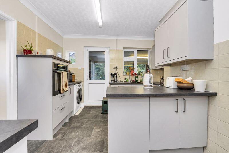
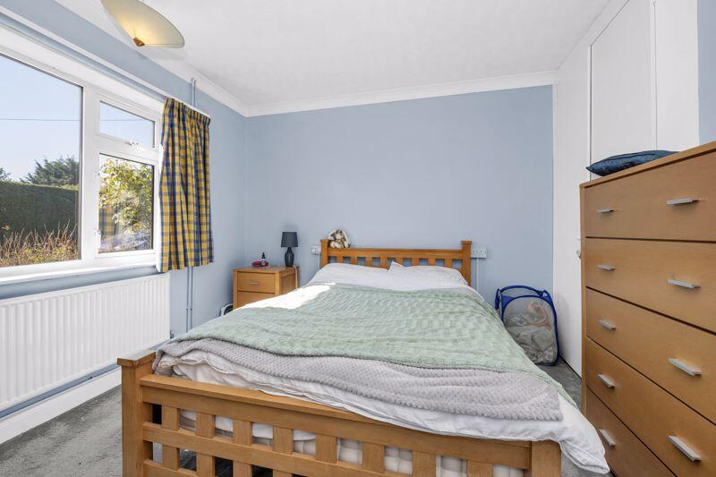
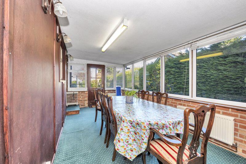
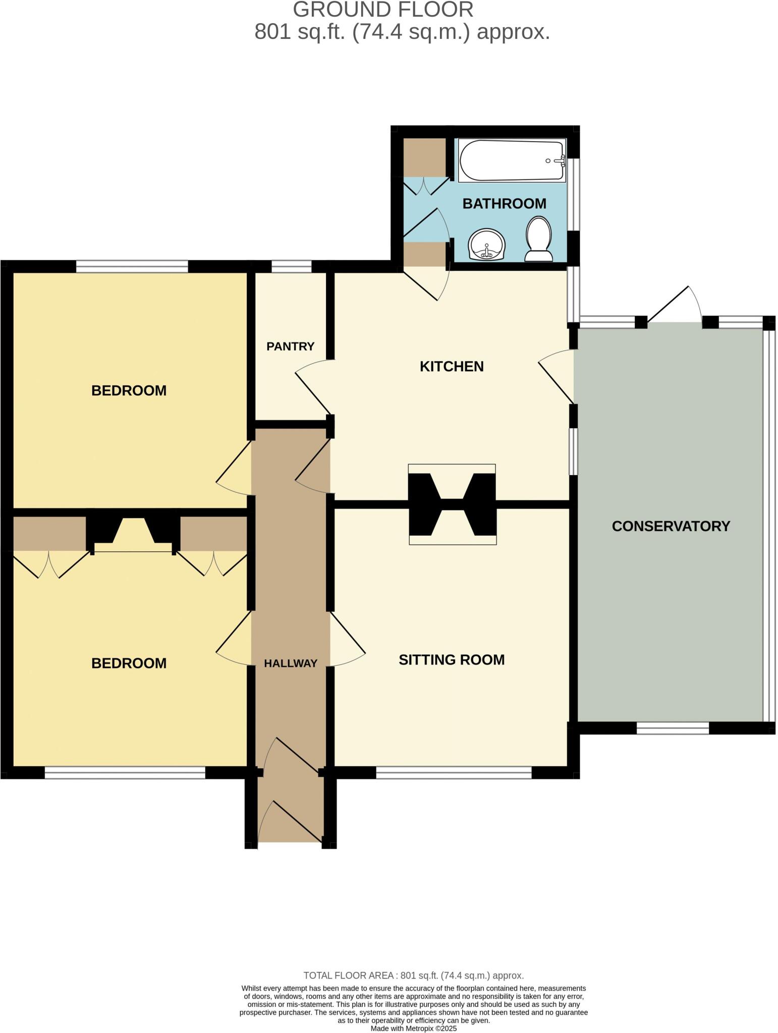
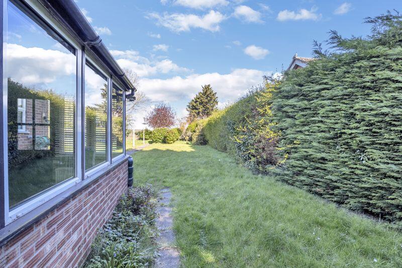
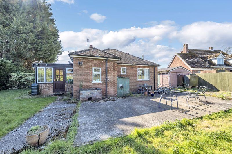
A two-bedroom, detached bungalow located in the village of Ingham and with NO ONWARD CHAIN. The property comprises of an entrance hall, sitting room with an open fire, conservatory, modern kitchen with a built-in eye level oven, bathroom and two bedrooms. Outside, parking is offered via a drivewa...
Property Oracle says ..
The property is a 2 bedroom detached bungalow situated on Culford Road, Ingham, West Suffolk. The list price is £300,000 and the property is 801 sqft, situated on a plot of the same size. The average price for a property in the area is £234,748 with an average size of 842 sqft and an average price per sqft of £278. While the property is slightly smaller than average, its list price is higher than the average. Based on the images provided, the property appears to be in reasonable condition. The interior is dated but well maintained. The kitchen and bathroom are functional but could benefit from some modernisation. The garden is of a good size and well maintained. The location is relatively rural, with the nearest train station, Bury St Edmunds, being 5.68km away. There are a number of schools within a reasonable distance, including Culford School (3.17km), Tollgate Primary School (5.12km), The Albany (5.39km), St Benedict’s Catholic School (5.39km), and Bury St Edmunds County Upper School (5.55km). The proximity to these schools could be a positive factor for families. Considering the condition, location, and land size, the list price of £300,000 appears slightly high compared to the average price per sqft in the area. However, the property benefits from a good size garden and is a detached bungalow which is often desirable. The final assessment of value will depend on a detailed survey and comparison with similar recently sold properties in the immediate vicinity.
Therefore, we give this property 6 / 10. *Disclaimer: This is our option and does constitute a recommendation or financial advice. Do your own research. *
- Price
- 6
- Condition
- 7
- Location
- 6
- Land
- 7
- Bedrooms
- 2
- Bathrooms
- 1
- Sqft (est)
- 801.00
- Lot (est)
- 801.00
The heatmap indicates the level of crime in the area. The color of the heatmap indicates the crime severity and recency.
Metrics Year-on-Year
- Average area value
- 400,000.00 £Decreased by 62.22 %
- Est sale value
- 221,076.00 £Decreased by 26.40 %
- Average area rental value
- 2,250.00 £/moIncreased by 73.08 %
- Est letting value
- 801.00 £/mo
- Est rental Yield
- 6.75 %Increased by 359.18 %
- Crime Rate
- 30.00 %Unchanged by 0.00 %
Agent Activity
Mark Ewin created the listing.
Nearby Schools
| Name | Type | Ofsted | Distance |
|---|---|---|---|
| Culford School | Other Independent School | 3.17 KM | |
| Tollgate Primary School | Academy Sponsor Led | Good | 5.12 KM |
| The Albany | Academy Alternative Provision Converter | 5.39 KM | |
| St Benedict'S Catholic School | Voluntary Aided School | Good | 5.39 KM |
| Bury St Edmunds County Upper School | Academy Converter | Serious Weaknesses | 5.55 KM |
Images
Nearby Transport
| Name | NLC | TLC | Distance |
|---|---|---|---|
| Bury St Edmunds | 7008 | BSE | 5.68 KM |
Nearby Listings
| Address | Price | Type | Score | Distance |
|---|---|---|---|---|
| Culford Road, Ingham | £ 300,000 | BUY | 6 / 10 | 0.00 KM |
| Culford Road, Ingham, Bury St. Edmunds | £ 600,000 | BUY | 3 / 10 | 0.23 KM |
| Beauford Road, Ingham | £ 285,000 | BUY | 7 / 10 | 0.27 KM |
| Beauford Road, Ingham, Bury St. Edmunds | £ 375,000 | BUY | 7 / 10 | 0.36 KM |
| The Street, Ingham, Bury St. Edmunds | £ 385,000 | BUY | 6 / 10 | 0.44 KM |
Nearby Properties
| Address | Price | Distance |
|---|---|---|
| Chippings | £ 500,000 | 0.12 KM |
| 28 Beauford Road | £ 215,000 | 0.12 KM |
| 31 Beauford Road | £ 480,000 | 0.12 KM |
| Byways | £ 210,000 | 0.12 KM |
| Brierley House | £ 265,000 | 0.12 KM |