HO
Flat 7, 41 Fortess Road, London
By Homequarters
£ 3,100
Homequarters says ..
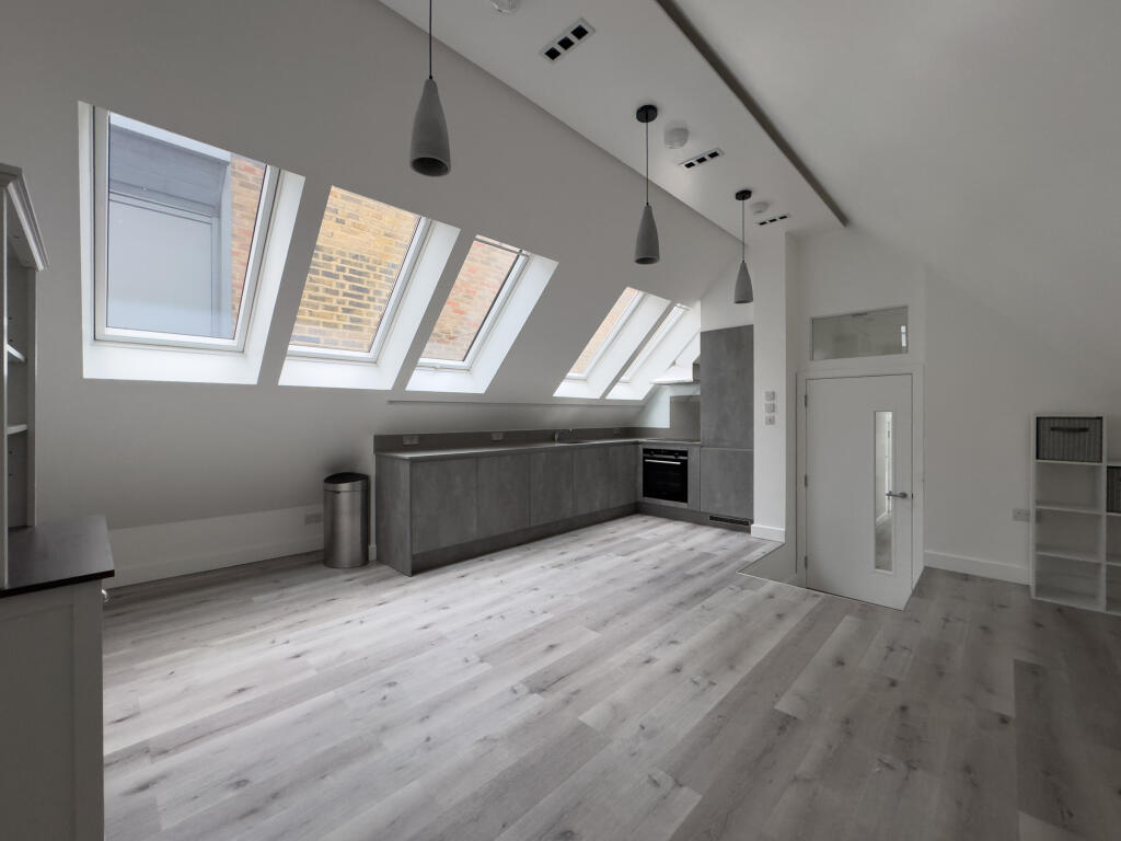
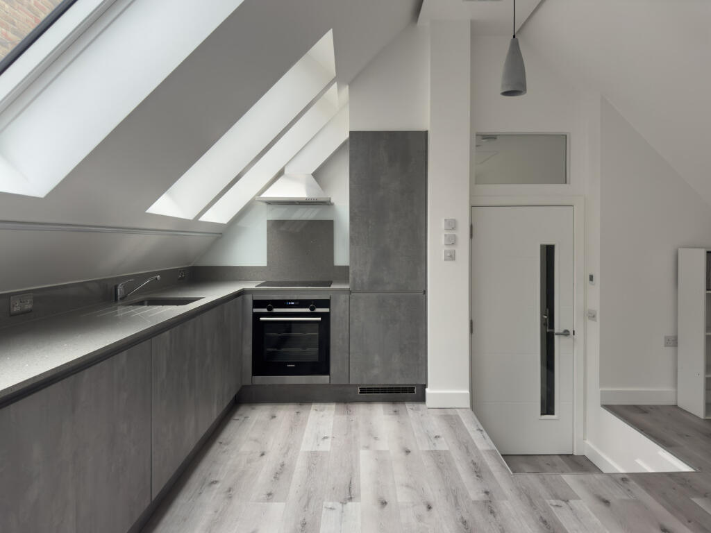
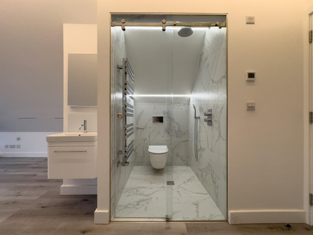
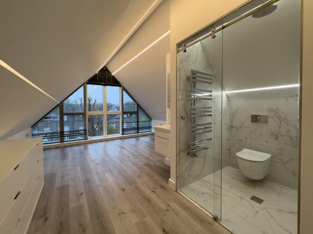
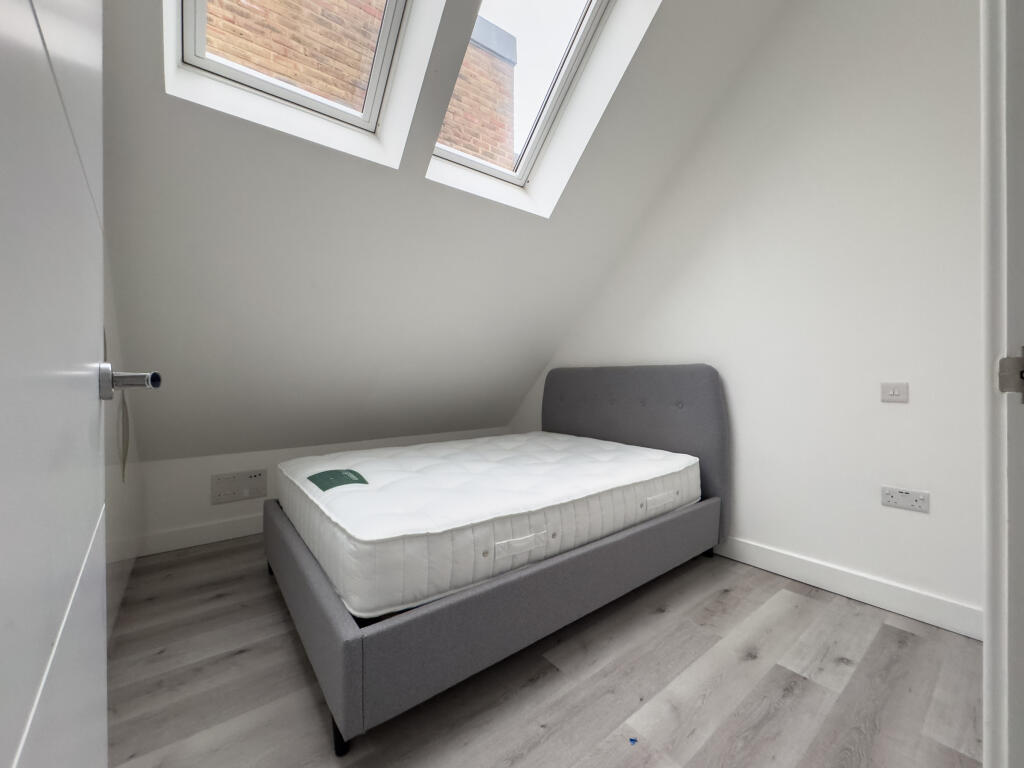
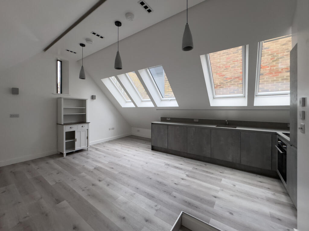
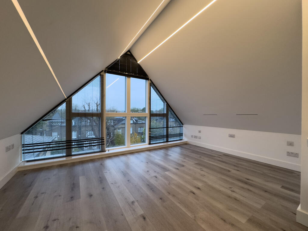
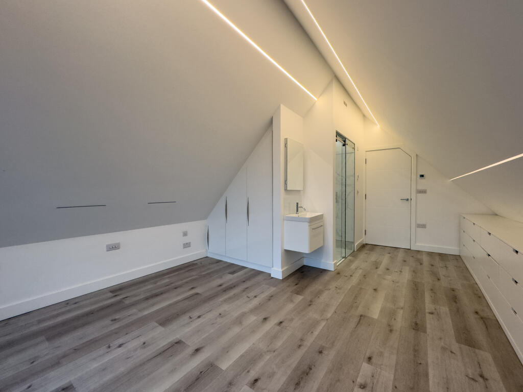
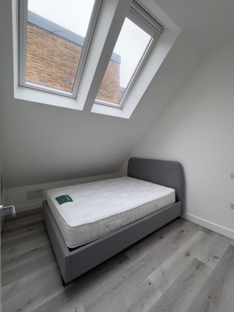
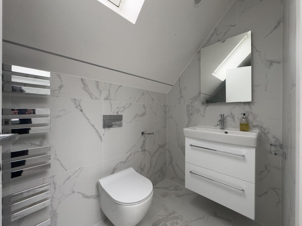
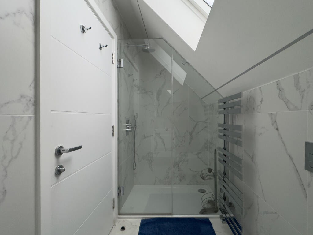
High ceilings | Two bathrooms | Wet room en suite | Full of natural light | Modern lighting | Pet friendly | Unique layout
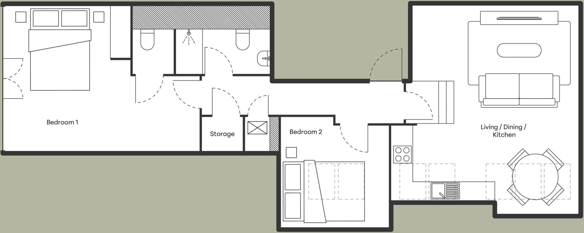
- Bedrooms
- 2
- Bathrooms
- 2
The heatmap indicates the level of crime in the area. The color of the heatmap indicates the crime severity and recency.
Metrics Year-on-Year
- Average area value
- 1,296,250.00 £Increased by 47.94 %
- Average area rental value
- 2,707.00 £/moIncreased by 9.24 %
- Est rental Yield
- 2.51 %Decreased by 25.96 %
- Crime Rate
- 6.00 %Unchanged by 0.00 %
from 876,227.00 £
from 2,478.00 £/mo
from 3.39 %
from 6.00 %
Agent Activity
Homequarters created the listing.
Nearby Schools
| Name | Type | Ofsted | Distance |
|---|---|---|---|
| Eleanor Palmer Primary School | Community School | Outstanding | 0.27 KM |
| Acland Burghley School | Community School | Good | 0.44 KM |
| Kentish Town Church Of England Primary School | Voluntary Aided School | Outstanding | 0.48 KM |
| St Patrick'S Catholic Primary School | Voluntary Aided School | Good | 0.52 KM |
| College Francais Bilingue De Londres | Other Independent School | Outstanding | 0.70 KM |
Images

Nearby Streets
| Name | Average Price | Average Sqft | Distance |
|---|---|---|---|
| Gottfried Mews | £ 0 | 0 | 0.00 KM |
| Southcote Road | £ 475,000 | 0 | 0.00 KM |
| Manorfield Close | £ 0 | 0 | 0.00 KM |
| Hammond Street | £ 975,000 | 0 | 0.00 KM |
| Spring Place | £ 0 | 0 | 0.00 KM |
Nearby Transport
| Name | NLC | TLC | Distance |
|---|---|---|---|
| Kentish Town | 1553 | KTN | 0.35 KM |
| Kentish Town West | 1449 | KTW | 0.99 KM |
| Gospel Oak | 1409 | GPO | 1.08 KM |
| Camden Road | 1440 | CMD | 1.34 KM |
| Upper Holloway | 1524 | UHL | 1.71 KM |
Nearby Listings
| Address | Price | Type | Score | Distance |
|---|---|---|---|---|
| Flat 3, 41 Fortess Road, London | £ 3,850 | RENT | Unknown | 0.00 KM |
| Flat 7, 41 Fortess Road, London | £ 3,100 | RENT | Unknown | 0.00 KM |
| Fortess Road Kentish Town NW5 | £ 2,400 | RENT | Unknown | 0.05 KM |
| Burghley road, Kentish Town | £ 495 | RENT | Unknown | 0.08 KM |
| Fortess Road, London | £ 2,000 | RENT | Unknown | 0.09 KM |
Nearby Properties
| Address | Price | Distance |
|---|---|---|
| 59 Fortess Road | £ 226,000 | 0.00 KM |
| 31b Fortess Road | £ 460,000 | 0.01 KM |
| 21b Fortess Road | £ 60,000 | 0.01 KM |
| 23a - 23c Fortess Road | £ 277,500 | 0.01 KM |
| 26 Burghley Road | £ 2,275,000 | 0.08 KM |