YO
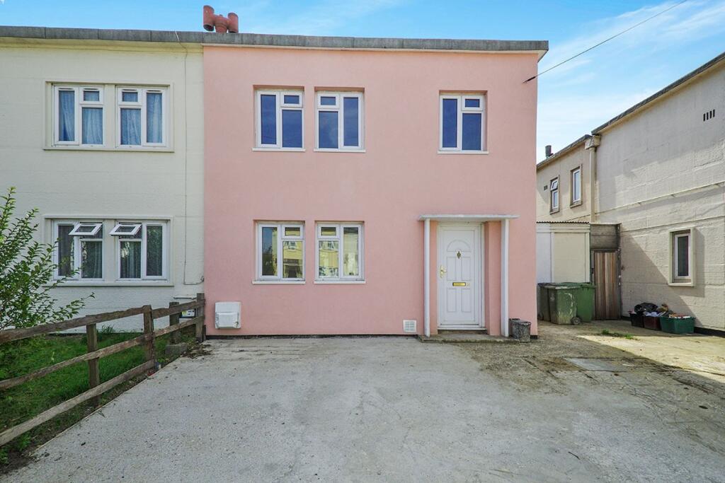
Birling Road, Erith, Kent, DA8
By Your Move
£ 1,750
Your Move says ..
TBC
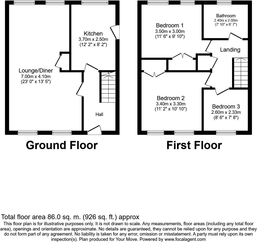
- Bedrooms
- 3
- Bathrooms
- 2
The heatmap indicates the level of crime in the area. The color of the heatmap indicates the crime severity and recency.
Metrics Year-on-Year
- Average area value
- 401,667.00 £Increased by 1.07 %
- Average area rental value
- 1,700.00 £/moDecreased by 4.28 %
- Est rental Yield
- 5.08 %Decreased by 5.22 %
- Crime Rate
- 8.00 %Unchanged by 0.00 %
from 397,418.00 £
from 1,776.00 £/mo
from 5.36 %
from 8.00 %
Agent Activity
Your Move created the listing.
Nearby Schools
| Name | Type | Ofsted | Distance |
|---|---|---|---|
| Woodside Academy | Academy Special Converter | 0.31 KM | |
| Normandy Children'S Centre | Children's Centre Linked Site | 0.36 KM | |
| Normandy Primary School | Academy Sponsor Led | Good | 0.43 KM |
| King Henry School | Academy Sponsor Led | 0.46 KM | |
| Christ Church (Erith) Cofe Primary School | Academy Sponsor Led | Outstanding | 0.77 KM |
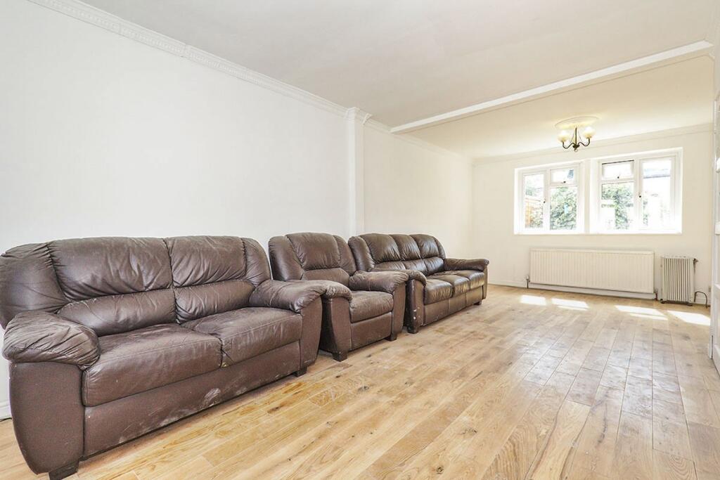
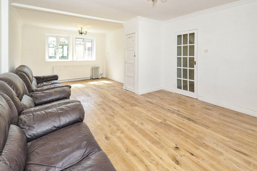
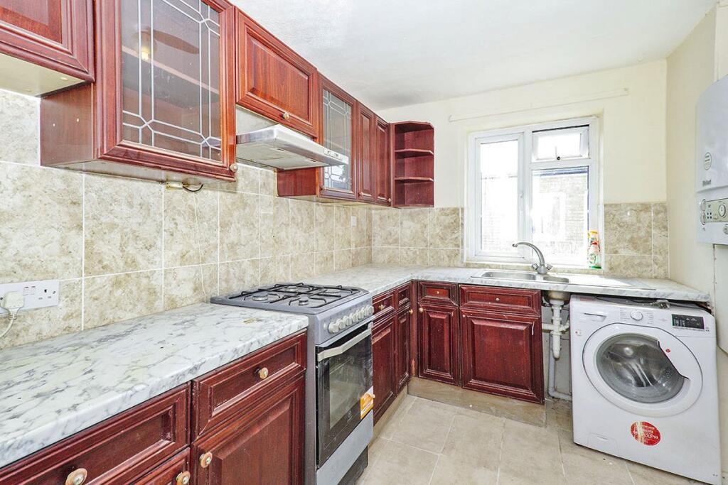
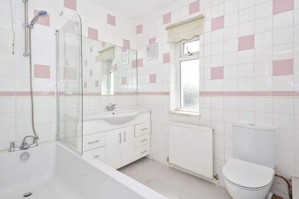
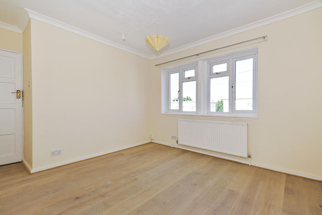
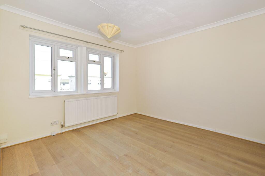
Images

Nearby Streets
| Name | Average Price | Average Sqft | Distance |
|---|---|---|---|
| Elm Grove | £ 0 | 0 | 0.00 KM |
| Hardwick Court | £ 0 | 0 | 0.00 KM |
| Halstead Road | £ 275,000 | 0 | 0.00 KM |
| Randall Close | £ 365,000 | 0 | 0.00 KM |
| Lambert Court | £ 0 | 0 | 0.00 KM |
Nearby Transport
| Name | NLC | TLC | Distance |
|---|---|---|---|
| Erith | 5104 | ERH | 1.24 KM |
| Barnehurst | 5089 | BNH | 1.35 KM |
| Slade Green | 5154 | SGR | 2.35 KM |
| Crayford | 5100 | CRY | 2.83 KM |
| Belvedere | 5092 | BVD | 2.95 KM |
Nearby Listings
| Address | Price | Type | Score | Distance |
|---|---|---|---|---|
| Birling Road, Erith, Kent, DA8 | £ 1,750 | RENT | Unknown | 0.00 KM |
| Birling Road, Erith, DA8 | £ 1,600 | RENT | Unknown | 0.00 KM |
| Stelling Road, Erith, DA8 | £ 1,600 | RENT | Unknown | 0.21 KM |
| Frinsted Road, Erith, DA8 | £ 1,850 | RENT | Unknown | 0.25 KM |
| Frinsted Road, Erith, DA8 | £ 1,850 | RENT | Unknown | 0.26 KM |
Nearby Properties
| Address | Price | Distance |
|---|---|---|
| 54 Birling Road | £ 88,000 | 0.01 KM |
| 80 Birling Road | £ 245,000 | 0.03 KM |
| 64 Birling Road | £ 173,995 | 0.03 KM |
| 52 Birling Road | £ 90,000 | 0.03 KM |
| 27 Birling Road | £ 264,000 | 0.03 KM |