
School Lane, Ashby-de-la-zouch, LE65
By Purplebricks
£ 340,000
Reviews
4 out of 5 stars
Purplebricks says ..
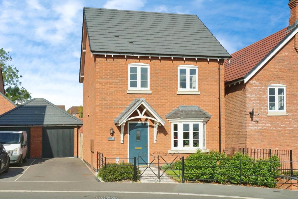
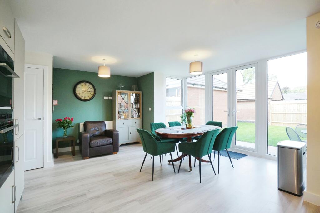
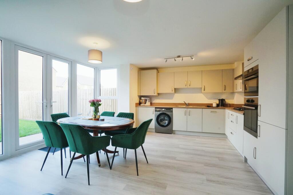
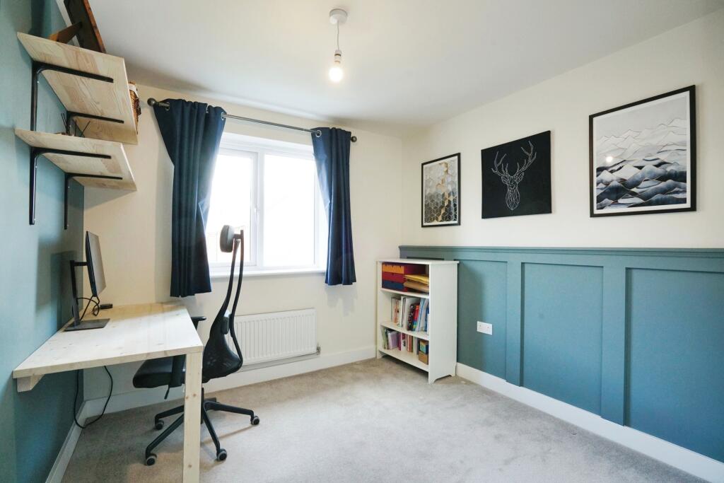
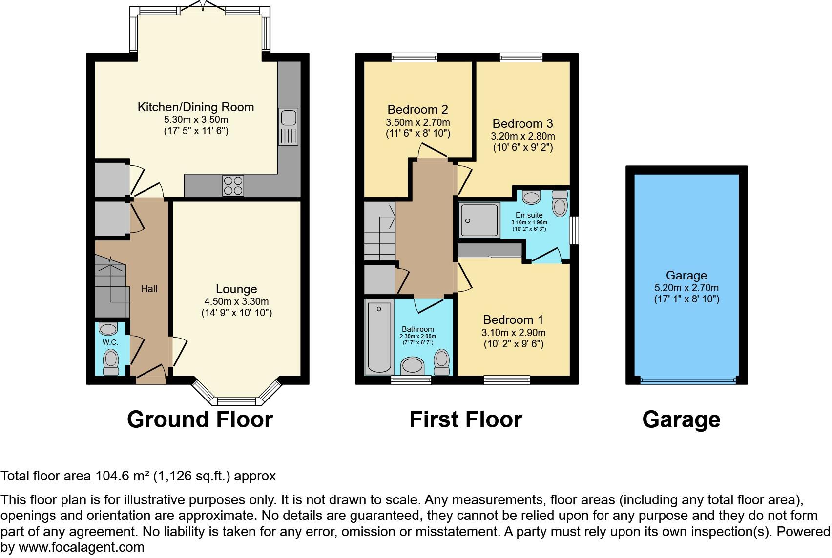
Modern 3-Bedroom Detached Home in a Beautiful New Development in Ashby-de-la-Zouch Located in the charming and highly desirable town of Ashby-de-la-Zouch, this modern 3-bedroom detached house offers a perfect blend of contemporary design and comfortable family living. Set within a new developme...
Property Oracle says ..
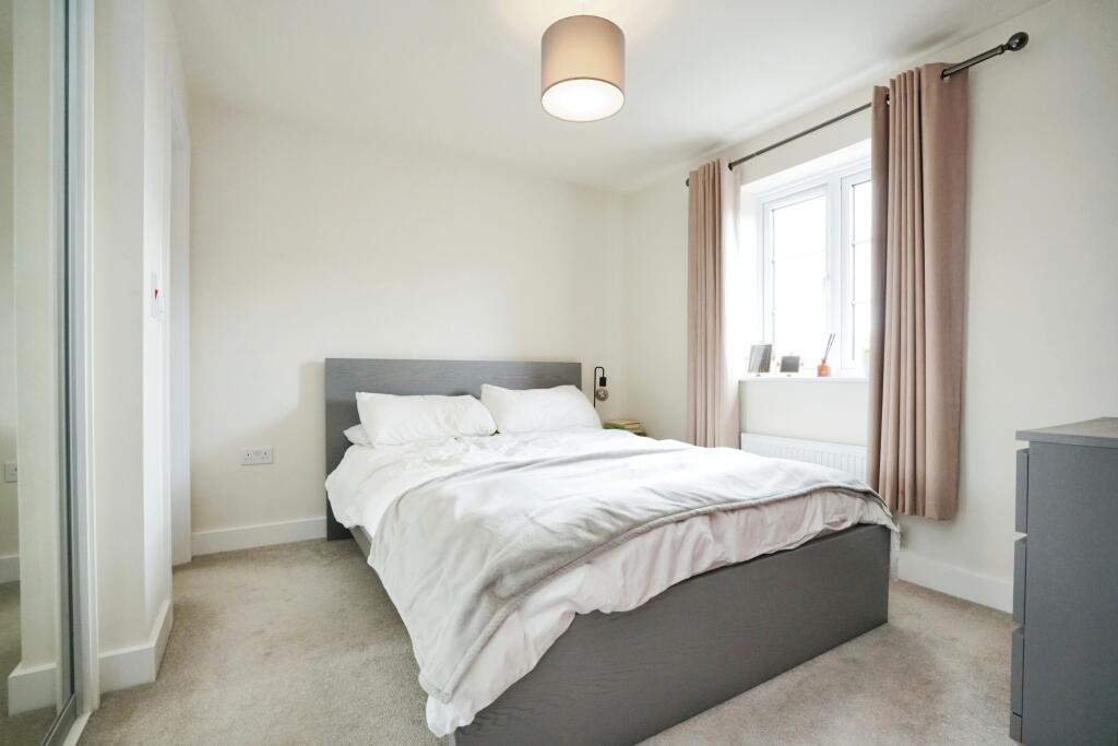
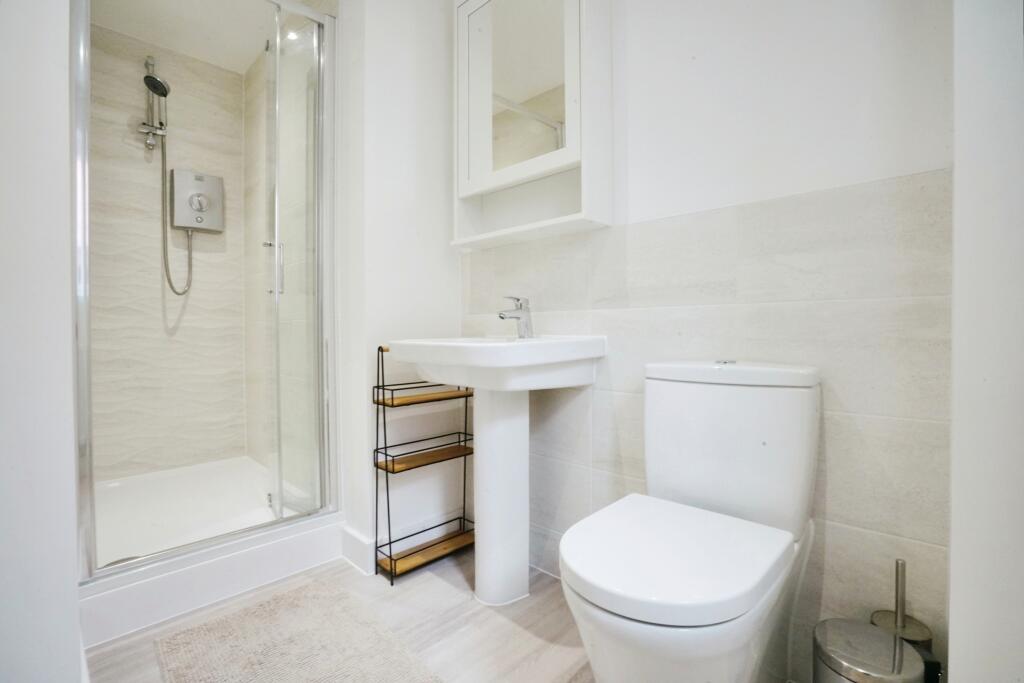
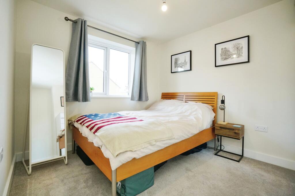
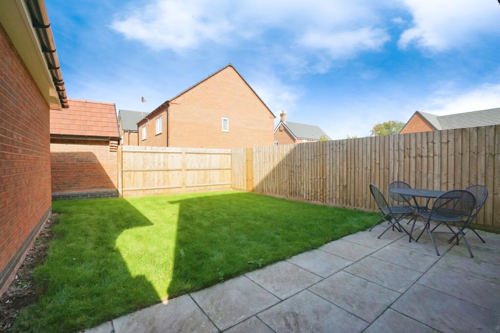
The property is a 3-bedroom, 2-bathroom detached house located in Ashby-de-la-Zouch, Leicestershire. The list price is £340,000, and the property has 1,048.30 sqft of living space and a 1,125.91 sqft plot. Based on the provided images, the property appears to be in excellent condition. It is modern and well-maintained, with contemporary fixtures and fittings throughout. The kitchen and bathrooms are modern and stylish. There is also a well-maintained garden. The property is located close to several primary schools, including Ashby Hastings Primary School (0.19km), Ashby Hill Top Primary School (0.66km), and Ashby-De-La-Zouch Church Of England Primary School (0.93km). The proximity to these schools makes it an attractive option for families. The average house price in the area is £357,723, with an average price per sqft of £277. This property is slightly below the average price, but considering its modern condition and proximity to schools, the list price of £340,000 appears reasonable. The plot size is also a considerable asset, offering a good-sized garden. Considering the condition, location, and land size, this property presents a good value proposition. The modern design and finishes are appealing, and the location is convenient for families due to the nearby schools.
Therefore, we give this property 8 / 10. *Disclaimer: This is our option and does constitute a recommendation or financial advice. Do your own research. *
- Price
- 8
- Condition
- 10
- Location
- 8
- Land
- 8
- Bedrooms
- 3
- Bathrooms
- 2
- Sqft (est)
- 1,048.30
- Lot (est)
- 1,125.91
The heatmap indicates the level of crime in the area. The color of the heatmap indicates the crime severity and recency.
Metrics Year-on-Year
- Average area value
- 364,824.00 £Decreased by 8.81 %
- Est sale value
- 330,214.50 £Increased by 41.26 %
- Average area rental value
- 926.00 £/moIncreased by 8.94 %
- Est letting value
- 0.00 £/mo
- Est rental Yield
- 3.05 %Increased by 19.61 %
- Crime Rate
- 8.00 %Unchanged by 0.00 %
Agent Activity
Purplebricks created the listing.
Nearby Schools
| Name | Type | Ofsted | Distance |
|---|---|---|---|
| Ashby Hastings Primary School | Free Schools | 0.19 KM | |
| Ashby Hill Top Primary School | Academy Converter | Outstanding | 0.66 KM |
| Ashby-De-La-Zouch Church Of England Primary School | Voluntary Controlled School | Good | 0.93 KM |
| Ashby Sure Start Children'S Centre | Children's Centre | 1.51 KM | |
| Woodcote Primary School | Community School | Good | 1.53 KM |
Images


Nearby Streets
| Name | Average Price | Average Sqft | Distance |
|---|---|---|---|
| Spring Avenue | £ 429,661 | 0 | 0.00 KM |
| Orchard Close | £ 399,950 | 0 | 0.00 KM |
| Powton Lane | £ 453,750 | 0 | 0.00 KM |
| Marlborough Way | £ 333,125 | 0 | 0.00 KM |
| King George Avenue | £ 0 | 0 | 0.00 KM |
Nearby Listings
| Address | Price | Type | Score | Distance |
|---|---|---|---|---|
| School Lane, Ashby-de-la-zouch, LE65 | £ 340,000 | BUY | 8 / 10 | 0.00 KM |
| School Lane, Ashby-De-La-Zouch, LE65 | £ 125,000 | BUY | 7 / 10 | 0.03 KM |
| School Lane, Ashby-De-La-Zouch, LE65 | £ 160,000 | BUY | 6 / 10 | 0.03 KM |
| Burton Road, Ashby-De-La-Zouch, LE65 | £ 219,950 | BUY | Unknown | 0.09 KM |
| School Lane, Ashby-De-La-Zouch, LE65 | £ 130,000 | BUY | 6 / 10 | 0.17 KM |
Nearby Properties
| Address | Price | Distance |
|---|---|---|
| 1 Westfields Terrace | £ 137,500 | 0.10 KM |
| 11 Westfields Terrace | £ 150,000 | 0.10 KM |
| 8 Knights Close | £ 81,950 | 0.22 KM |
| 6 Knights Close | £ 65,500 | 0.22 KM |
| 3 Knights Close | £ 160,000 | 0.22 KM |