BE
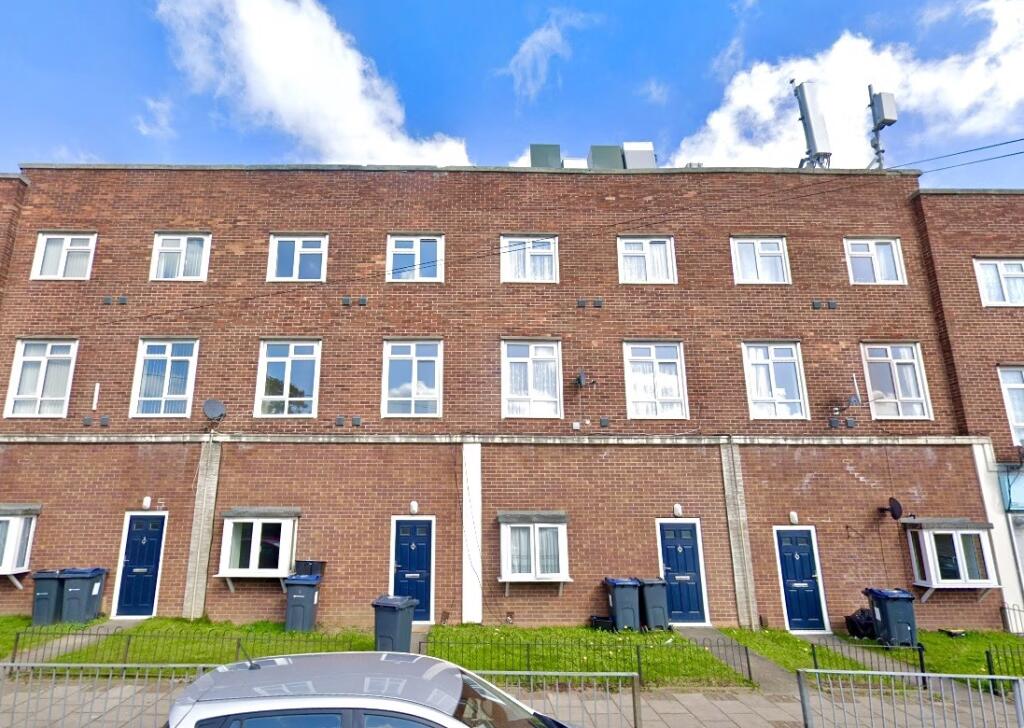
Hurstcroft Road, Birmingham, B33
By Belvoir
£ 625
Belvoir says ..
** GROUND FLOOR ONE BED FLAT ** PLEASE ENQUIRE BY CLICKING EMAIL AGENT ON THE WEBSITE
- Bedrooms
- 1
- Bathrooms
- 1
The heatmap indicates the level of crime in the area. The color of the heatmap indicates the crime severity and recency.
Metrics Year-on-Year
- Average area value
- 211,000.00 £Increased by 2.49 %
- Average area rental value
- 961.00 £/moDecreased by 14.43 %
- Est rental Yield
- 5.47 %Decreased by 16.49 %
- Crime Rate
- 0.00 %
from 205,865.00 £
from 1,123.00 £/mo
from 6.55 %
from 0.00 %
Agent Activity
Belvoir created the listing.
Nearby Schools
| Name | Type | Ofsted | Distance |
|---|---|---|---|
| Kitts Green Children'S Centre | Children's Centre | 0.30 KM | |
| Lea Forest Primary Academy | Academy Sponsor Led | Good | 0.45 KM |
| Gossey Lane Academy | Academy Converter | Requires improvement | 0.56 KM |
| Oasis Academy Blakenhale Infants | Academy Sponsor Led | Good | 0.93 KM |
| Oasis Academy Blakenhale Junior | Academy Sponsor Led | Good | 1.02 KM |
Images

Nearby Streets
| Name | Average Price | Average Sqft | Distance |
|---|---|---|---|
| Mill View | £ 0 | 0 | 0.00 KM |
| Castle Way | £ 260,000 | 0 | 0.00 KM |
| Bridgnorth Road | £ 233,333 | 0 | 0.00 KM |
| Lea Mews | £ 185,000 | 0 | 0.00 KM |
| Compton Way | £ 0 | 0 | 0.00 KM |
Nearby Transport
| Name | NLC | TLC | Distance |
|---|---|---|---|
| Lea Hall | 1133 | LEH | 0.47 KM |
| Stechford | 1043 | SCF | 3.20 KM |
| Marston Green | 1034 | MGN | 3.40 KM |
| Olton | 4533 | OLT | 5.47 KM |
| Acocks Green | 4529 | ACG | 5.50 KM |
Nearby Listings
| Address | Price | Type | Score | Distance |
|---|---|---|---|---|
| Hurstcroft Road, Birmingham, B33 | £ 625 | RENT | Unknown | 0.00 KM |
| Hurstcroft Road, Stechford | £ 60 | RENT | Unknown | 0.09 KM |
| Meadway, B33 | £ 1,300 | RENT | Unknown | 0.39 KM |
| Kelynmead Road, Kitts Green, Birmingham | £ 1,300 | RENT | Unknown | 0.53 KM |
| Moodyscroft Road, BIRMINGHAM | £ 1,100 | RENT | Unknown | 0.54 KM |
Nearby Properties
| Address | Price | Distance |
|---|---|---|
| 118 Hurstcroft Road | £ 105,000 | 0.00 KM |
| 82 Hurstcroft Road | £ 88,500 | 0.00 KM |
| 72 Hurstcroft Road | £ 87,000 | 0.00 KM |
| 76 Hurstcroft Road | £ 65,000 | 0.00 KM |
| 3 Hallmoor Road | £ 145,000 | 0.07 KM |