
MO
Sanderstead Avenue, London, NW2
By Moreland
£ 1,000,000
Moreland says ..
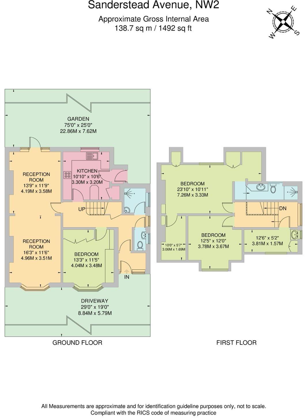
Three bed semi detached bungalow spread over 2 floors spanning 1492sqft/138.7sqm located in Sanderstead Avenue NW2
- Bedrooms
- 4
- Bathrooms
- 2
The heatmap indicates the level of crime in the area. The color of the heatmap indicates the crime severity and recency.
Metrics Year-on-Year
- Average area value
- 631,500.00 £Decreased by 49.35 %
- Average area rental value
- 2,142.00 £/moDecreased by 10.94 %
- Est rental Yield
- 4.07 %Increased by 76.19 %
- Crime Rate
- 2.00 %Unchanged by 0.00 %
from 1,246,724.00 £
from 2,405.00 £/mo
from 2.31 %
from 2.00 %
Agent Activity
Moreland created the listing.
Nearby Schools
| Name | Type | Ofsted | Distance |
|---|---|---|---|
| Childs Hill Primary School | Academy Converter | 0.39 KM | |
| St Agnes' Catholic Primary School | Voluntary Aided School | Outstanding | 0.49 KM |
| Wessex Gardens Primary School | Community School | Good | 0.80 KM |
| Rimon Jewish Primary School | Free Schools | Good | 0.91 KM |
| Claremont Primary School | Academy Converter | Good | 0.92 KM |
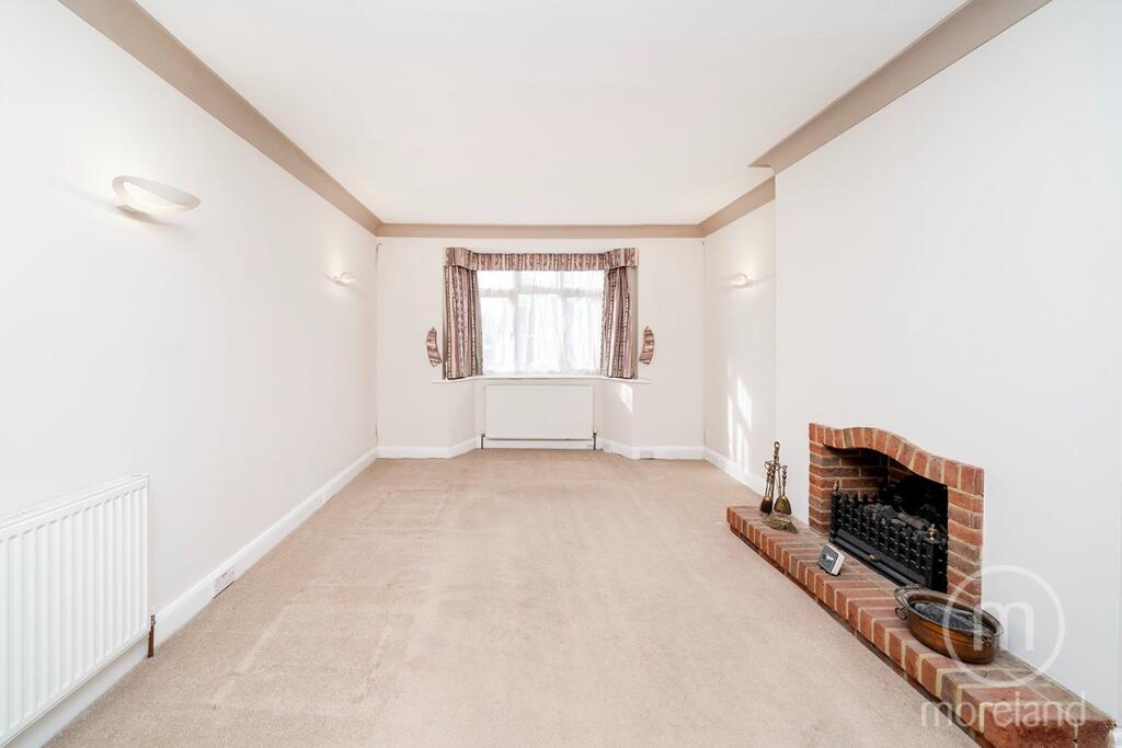
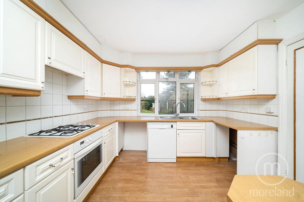
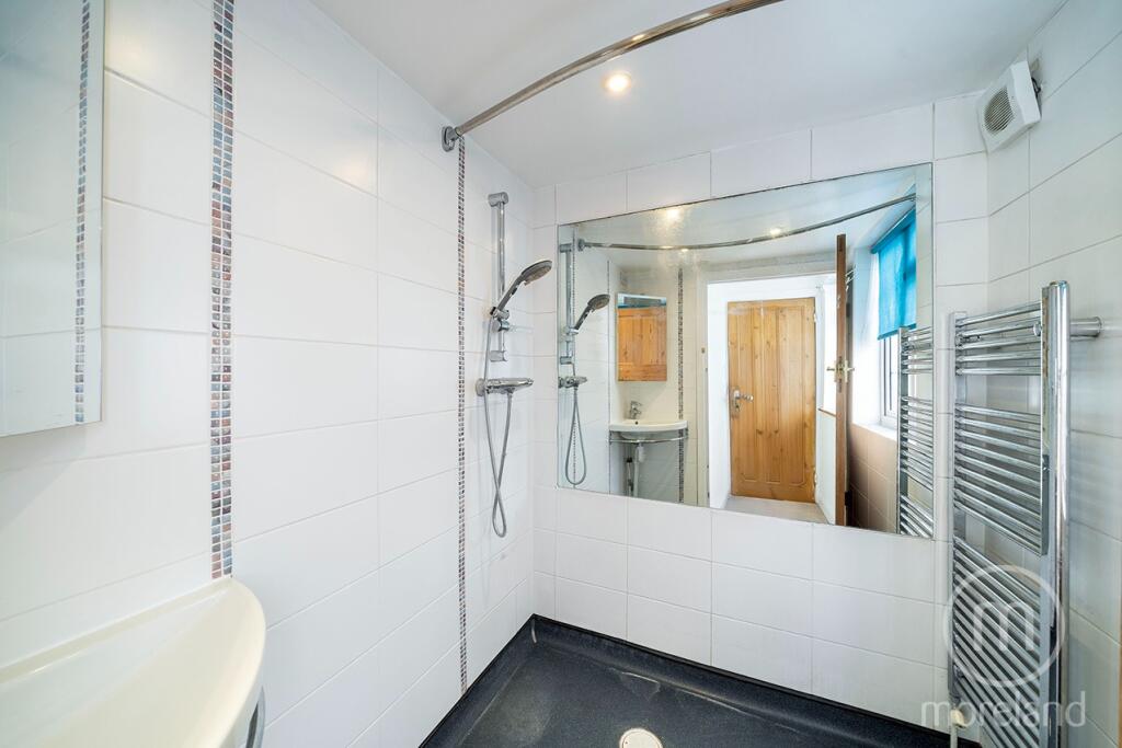
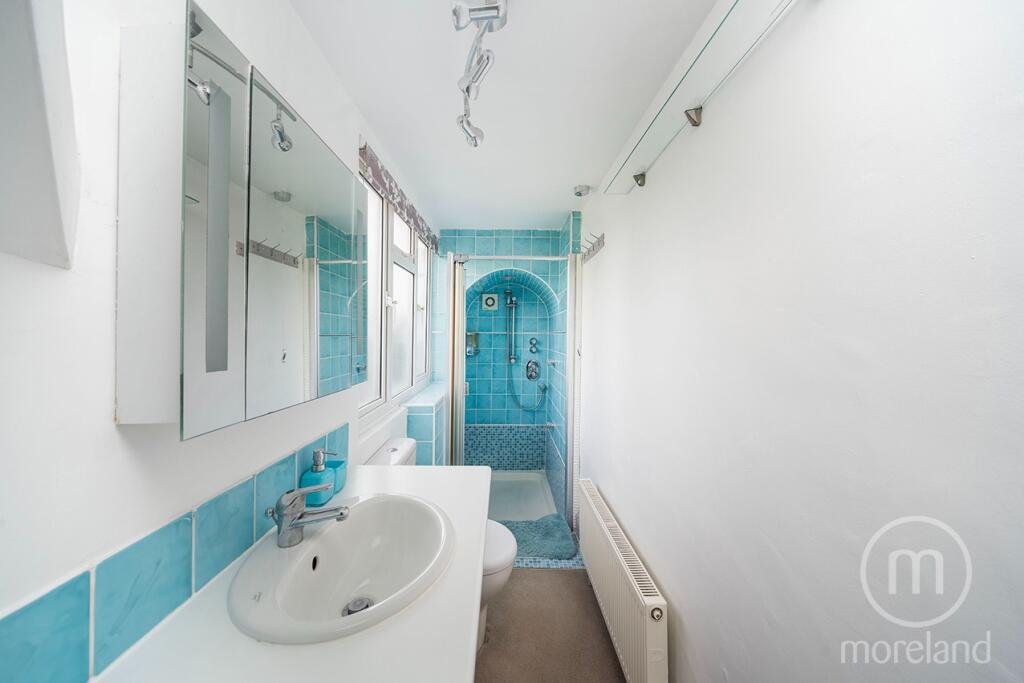
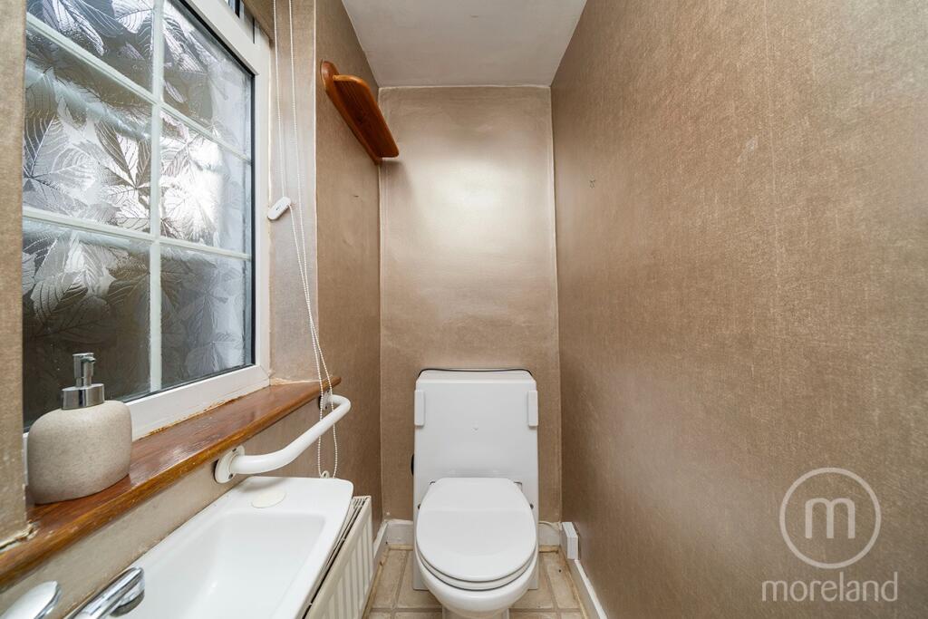
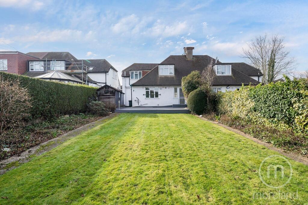
Images


Nearby Streets
| Name | Average Price | Average Sqft | Distance |
|---|---|---|---|
| Cumbrian Gardens | £ 999,500 | 0 | 0.00 KM |
| Malvern Gardens | £ 0 | 0 | 0.00 KM |
| Harman Close | £ 382,500 | 0 | 0.00 KM |
| Grampian Gardens | £ 0 | 0 | 0.00 KM |
| Hudson Way | £ 625,000 | 0 | 0.00 KM |
Nearby Transport
| Name | NLC | TLC | Distance |
|---|---|---|---|
| Cricklewood | 1519 | CRI | 0.77 KM |
| Brondesbury | 1437 | BSY | 2.30 KM |
| West Hampstead Thameslink | 1525 | WHP | 2.65 KM |
| Brondesbury Park | 1438 | BSP | 2.66 KM |
| West Hampstead | 1421 | WHD | 2.77 KM |
Nearby Listings
| Address | Price | Type | Score | Distance |
|---|---|---|---|---|
| Sanderstead Avenue, London, NW2 | £ 1,000,000 | BUY | Unknown | 0.00 KM |
| Sanderstead Ave, London, Childs Hill NW2 | £ 1,100,000 | BUY | 6 / 10 | 0.01 KM |
| Sanderstead Avenue, London, NW2 | £ 1,250,000 | BUY | 7 / 10 | 0.06 KM |
| Sanderstead Avenue, London, NW2 | £ 1,425,000 | BUY | 7 / 10 | 0.07 KM |
| The Vale, Childs Hill, NW11 | £ 975,000 | BUY | 7 / 10 | 0.11 KM |
Nearby Properties
| Address | Price | Distance |
|---|---|---|
| 6 Sanderstead Avenue | £ 295,000 | 0.07 KM |
| 12 Sanderstead Avenue | £ 259,950 | 0.07 KM |
| 10 Sanderstead Avenue | £ 1,015,000 | 0.07 KM |
| 8 Sanderstead Avenue | £ 670,000 | 0.07 KM |
| 162 The Vale | £ 115,000 | 0.07 KM |