College Avenue, Formby, Liverpool, L37
By Stephanie Macnab Estate Agents
£ 800,000
Reviews
4 out of 5 stars
Stephanie Macnab Estate Agents says ..
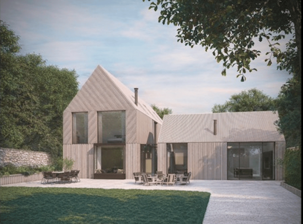
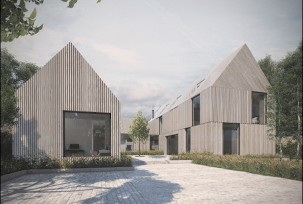
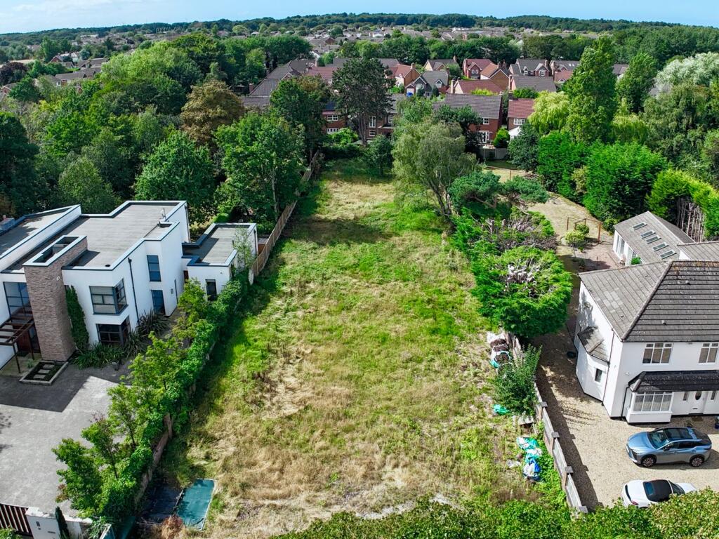
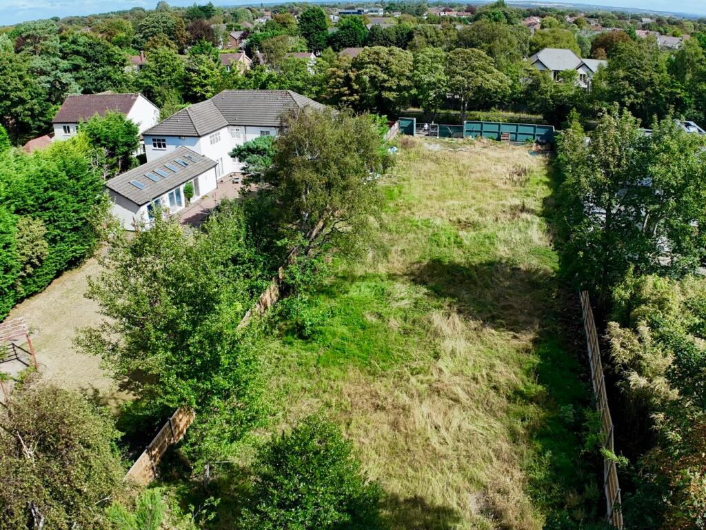
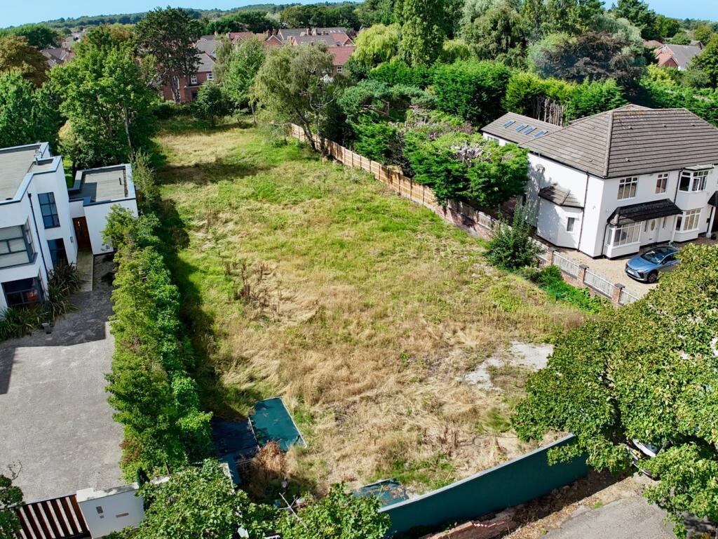
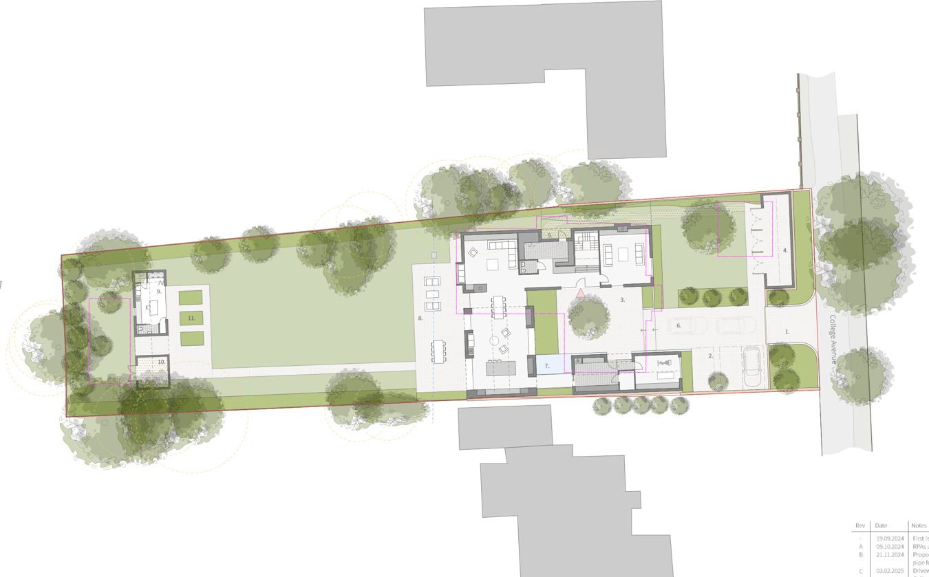
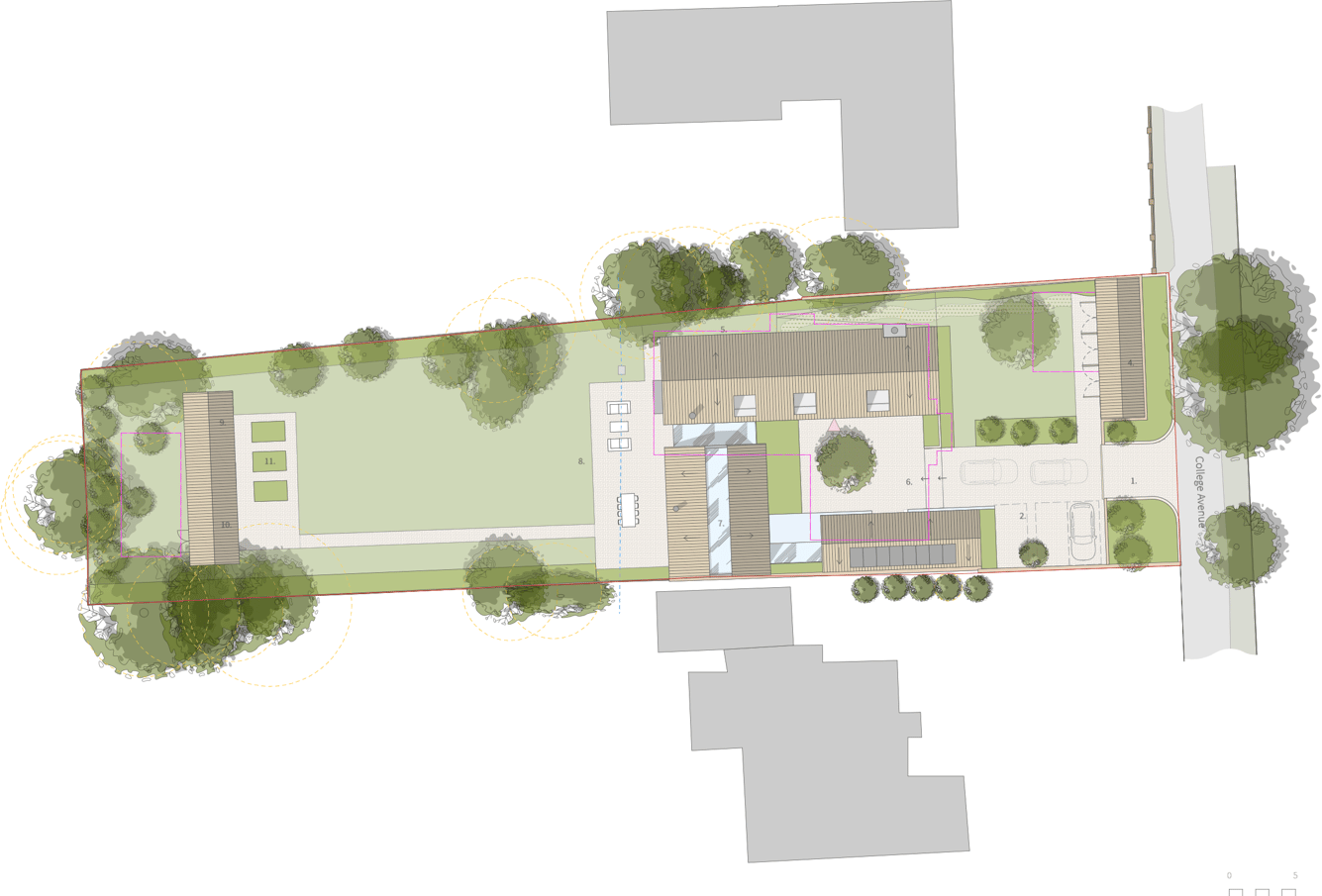
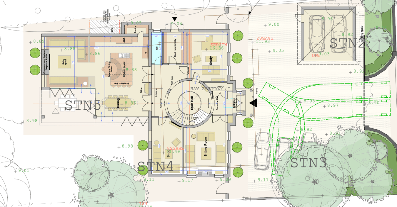
What a proposition! Rarely do BUILDING PLOTS of this calibre come to the market in Formby – quite literally “hen’s teeth.” This superb opportunity is set in one of the town’s most desirable locations and boasts a generous WEST-FACING REAR GARDEN.The FREEHOL...
Property Oracle says ..
The listing is for a plot of land with planning permission for a substantial detached house. The average price per square foot in the area is £653. The average property price in the area is £971,667 with an average size of 1,488 sqft. The property is located close to Formby High School and Woodlands Primary School, both within a mile. Formby and Freshfield train stations are also less than a mile away, providing convenient access to transportation.
Therefore, we give this property 8 / 10. *Disclaimer: This is our option and does constitute a recommendation or financial advice. Do your own research. *
- Price
- 7
- Condition
- 10
- Location
- 8
- Land
- 7
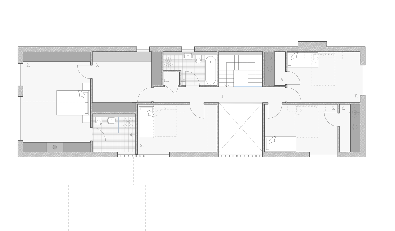
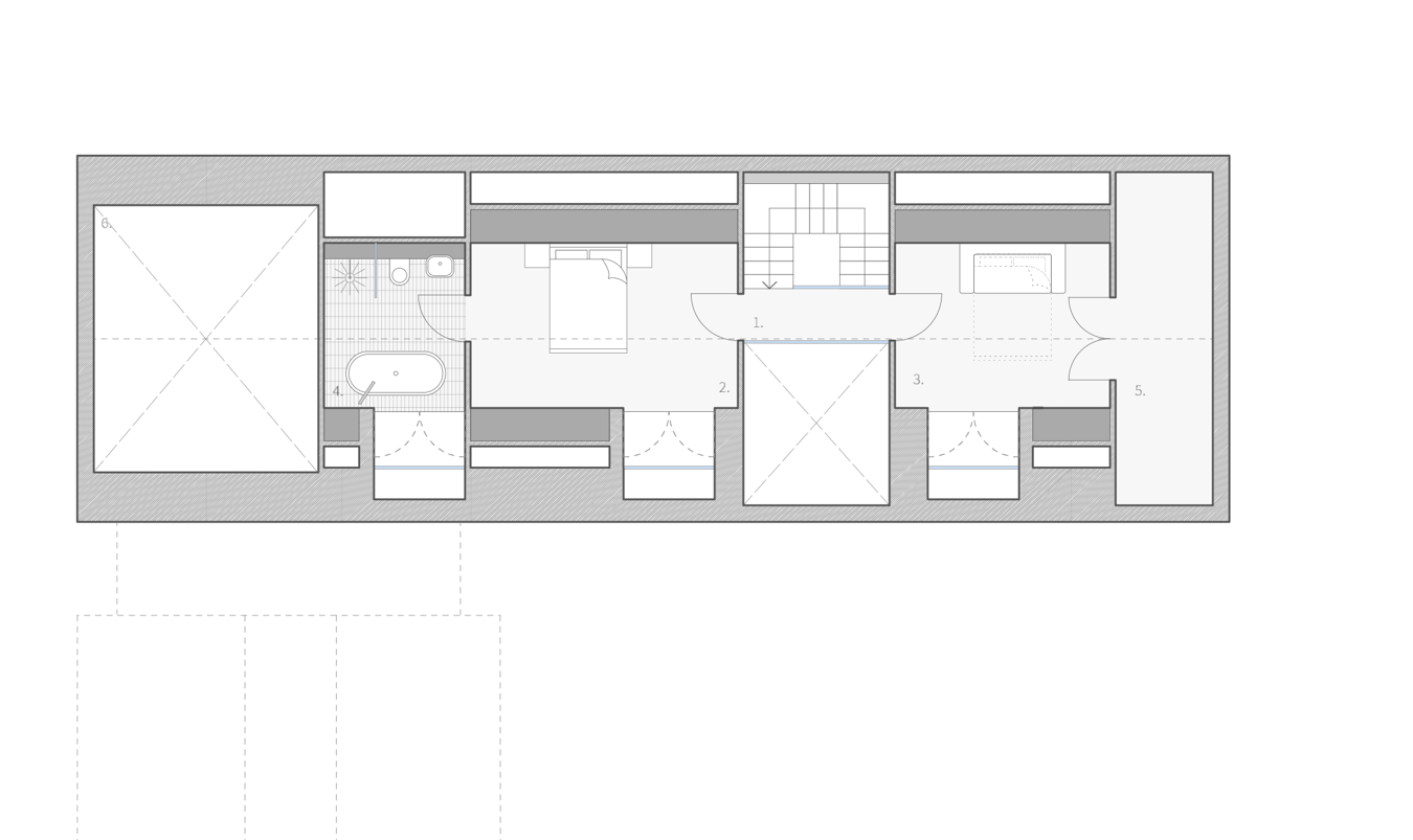
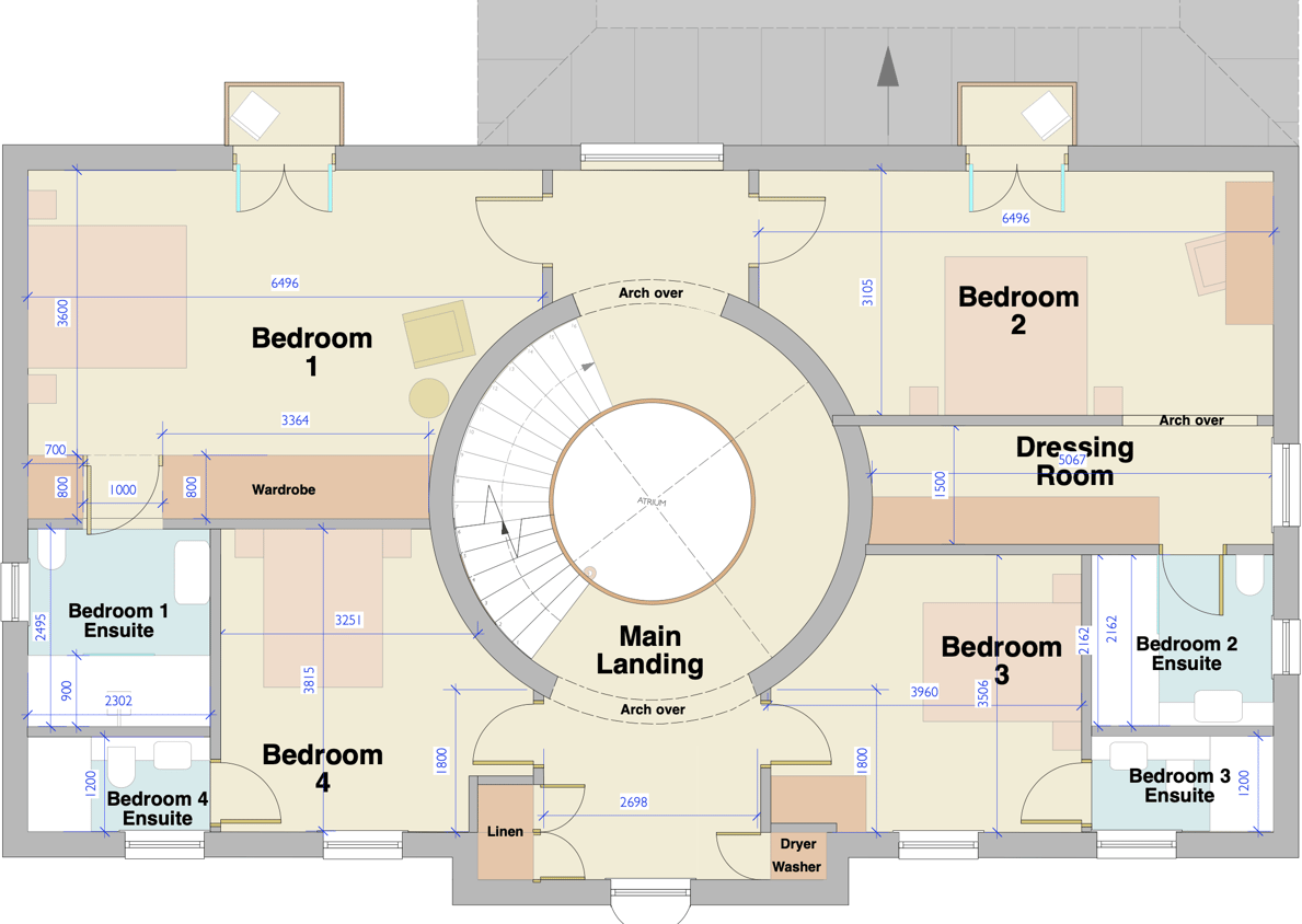
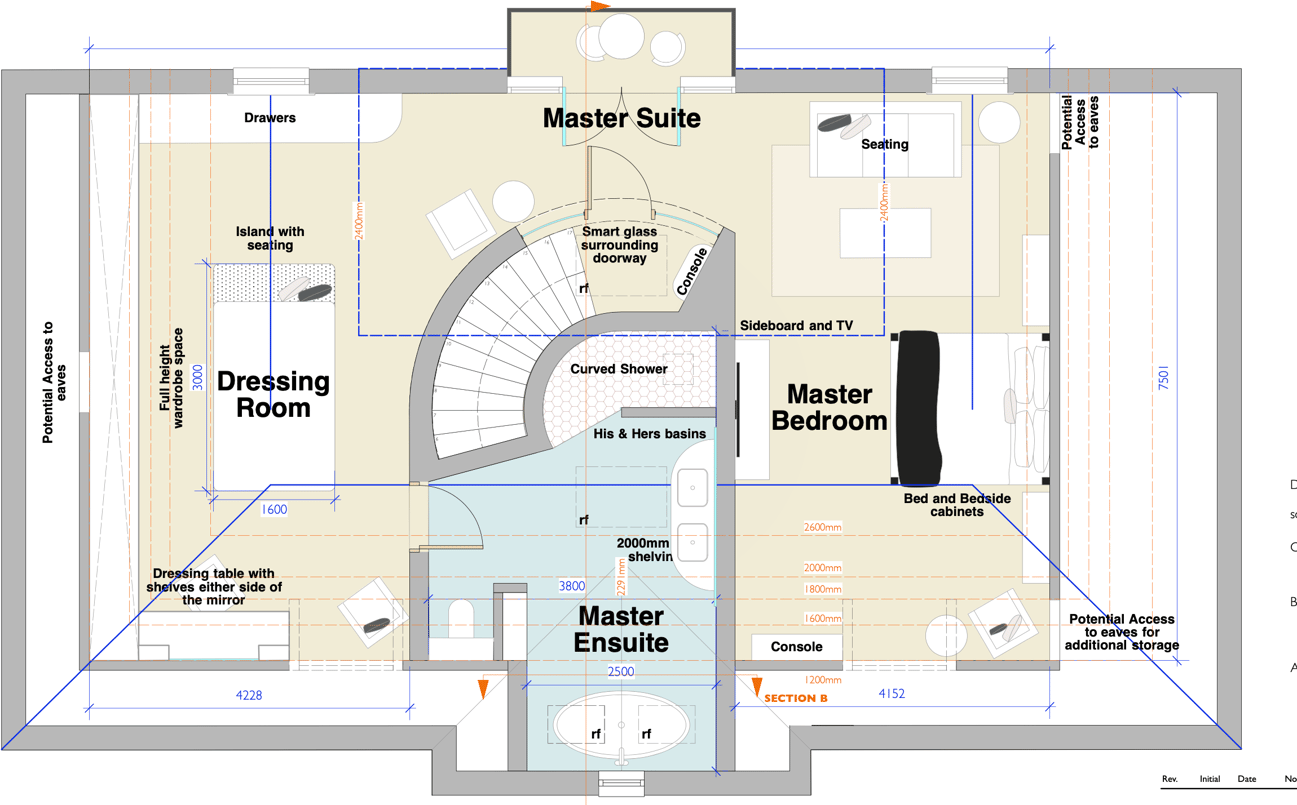
- Bedrooms
- 5
- Bathrooms
- 5
- Sqft (est)
- 668.00
The heatmap indicates the level of crime in the area. The color of the heatmap indicates the crime severity and recency.
Metrics Year-on-Year
- Average area value
- 971,667.00 £Increased by 80.27 %
- Est sale value
- 436,204.00 £Increased by 79.89 %
- Average area rental value
- 4,667.00 £/moIncreased by 20.81 %
- Est letting value
- 2,004.00 £/moIncreased by 50.00 %
- Est rental Yield
- 5.76 %Decreased by 33.02 %
- Crime Rate
- 0.00 %
Agent Activity
Stephanie Macnab Estate Agents created the listing.
Nearby Schools
| Name | Type | Ofsted | Distance |
|---|---|---|---|
| Formby High School | Academy Converter | 0.43 KM | |
| Woodlands Primary School | Community School | Good | 0.77 KM |
| St Luke'S Church Of England Primary School | Voluntary Controlled School | Good | 1.22 KM |
| St Jerome'S Catholic Primary School | Voluntary Aided School | Good | 1.59 KM |
| Range High School | Academy Converter | Requires improvement | 1.94 KM |
Images

Nearby Streets
| Name | Average Price | Average Sqft | Distance |
|---|---|---|---|
| The Copse | £ 0 | 0 | 0.00 KM |
| Acorn Gardens | £ 0 | 0 | 0.00 KM |
| Sunningdale Gardens | £ 0 | 0 | 0.00 KM |
| Saint Peter's Close | £ 0 | 0 | 0.00 KM |
| Mere Road | £ 0 | 0 | 0.00 KM |
Nearby Transport
| Name | NLC | TLC | Distance |
|---|---|---|---|
| Formby | 2354 | FBY | 0.67 KM |
| Freshfield | 2355 | FRE | 0.73 KM |
| Hightown | 2356 | HTO | 4.15 KM |
| Ainsdale | 2350 | ANS | 5.71 KM |
| Hall Road | 2229 | HLR | 7.31 KM |
Nearby Listings
| Address | Price | Type | Score | Distance |
|---|---|---|---|---|
| College Avenue, Formby, Liverpool, L37 | £ 800,000 | BUY | 8 / 10 | 0.00 KM |
| Barkfield Avenue, Formby, Liverpool | £ 875,000 | BUY | 7 / 10 | 0.08 KM |
| Barkfield Avenue, Formby, Liverpool, L37 | £ 1,800,000 | BUY | 8 / 10 | 0.09 KM |
| The Evergreens, Formby, Liverpool, L37 | £ 530,000 | BUY | Unknown | 0.20 KM |
| Wicks Lane, Formby, Liverpool | £ 650,000 | BUY | 6 / 10 | 0.21 KM |
Nearby Properties
| Address | Price | Distance |
|---|---|---|
| 20 College Avenue | £ 221,000 | 0.08 KM |
| 19 College Avenue | £ 1,500,000 | 0.08 KM |
| 18 College Avenue | £ 480,000 | 0.08 KM |
| 12 College Avenue | £ 590,000 | 0.08 KM |
| 9 College Avenue | £ 750,000 | 0.08 KM |