
Majors Road, Watchfield, Swindon, SN6
By Waymark Property
£ 400,000
Reviews
2 out of 5 stars
Waymark Property says ..
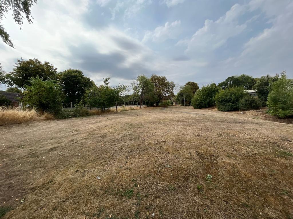
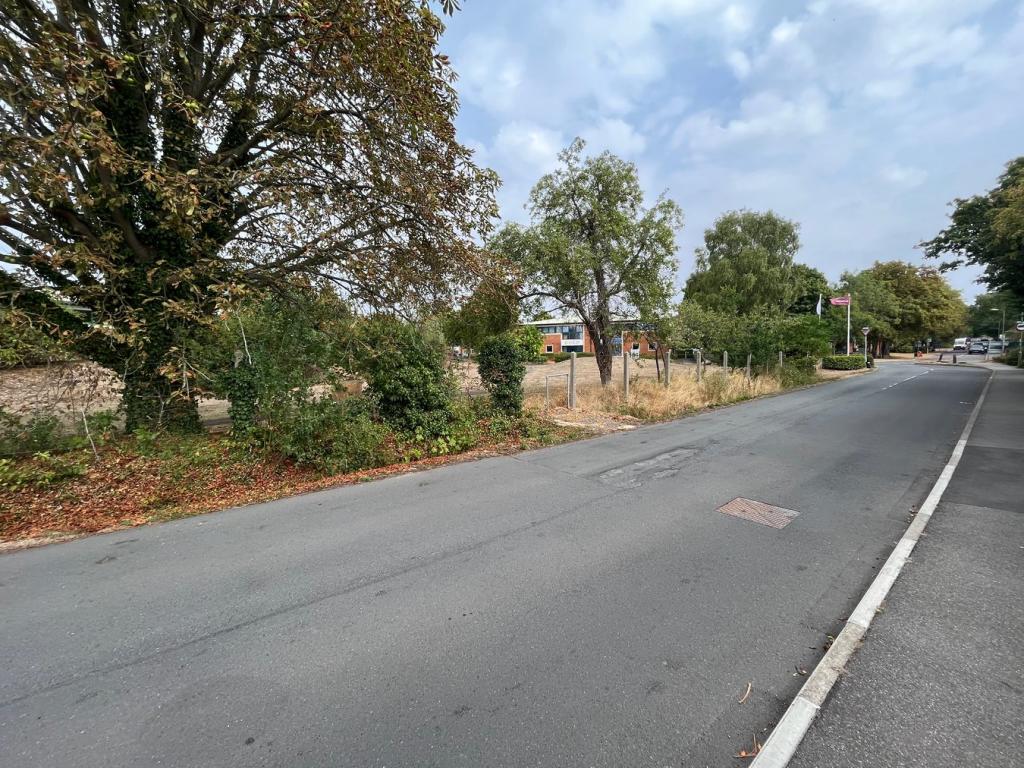
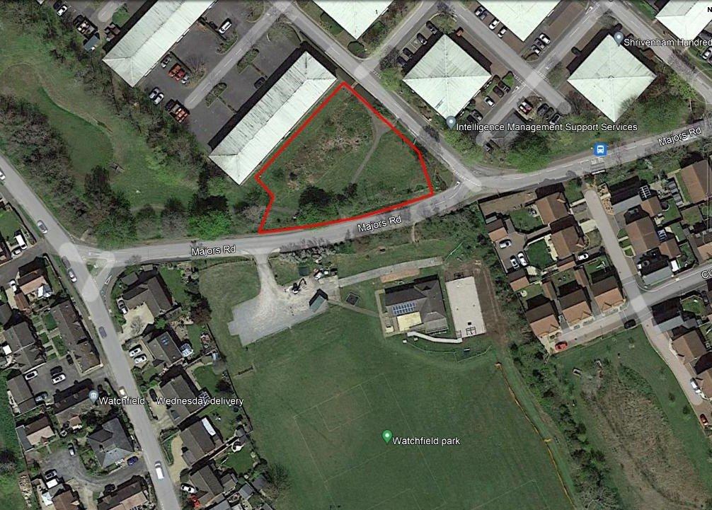
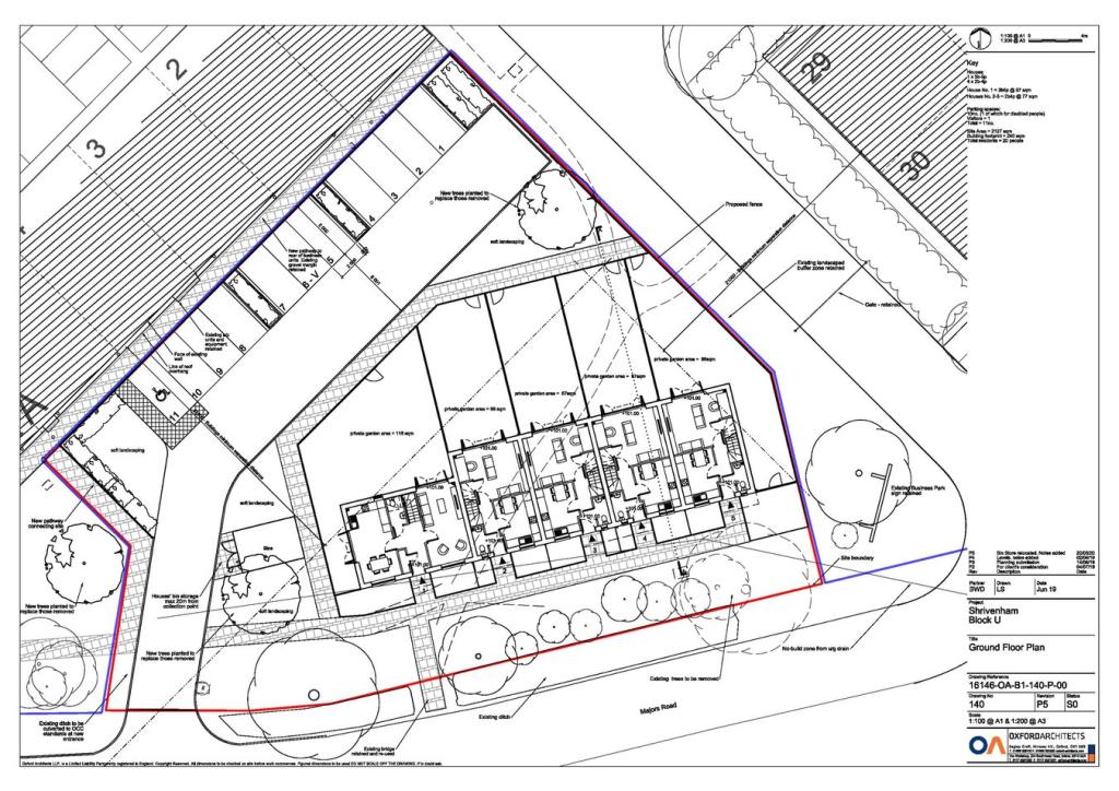
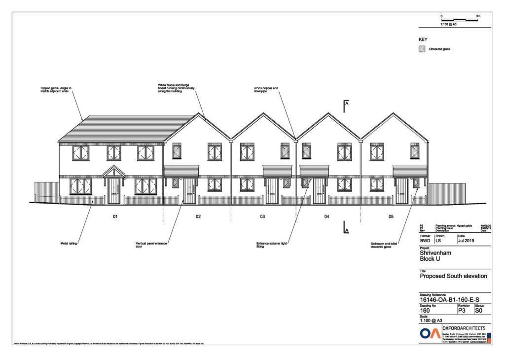
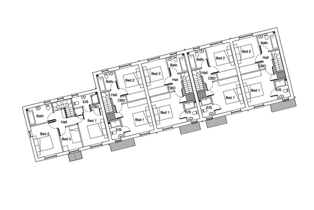
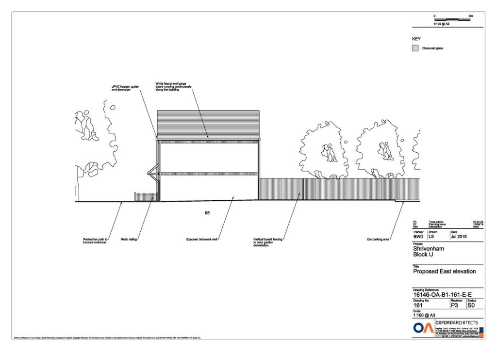
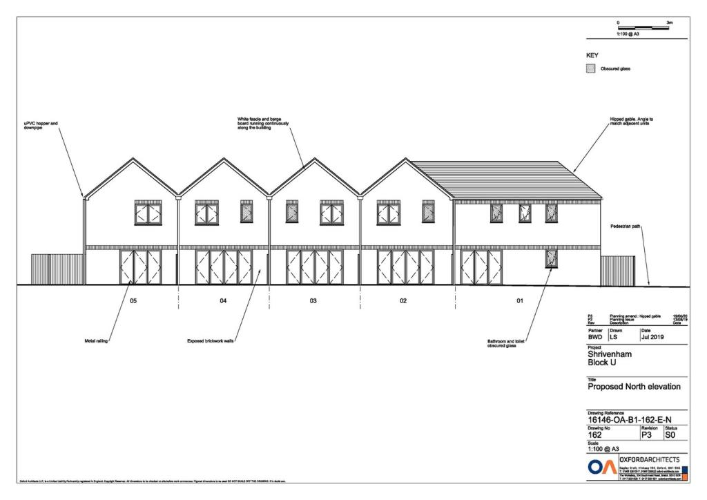
A level and attractive development site with detailed planning consent for 5 dwellings.
Property Oracle says ..
This property listing is for a development site located on Majors Road in Watchfield, Oxfordshire. The site already possesses detailed planning permission for the construction of five dwellings. This is a significant advantage, reducing the time and cost associated with acquiring planning consent. The land itself, as shown in the photographs, is currently undeveloped and appears somewhat overgrown, requiring significant preparation before construction can start. The location is positive, situated in a sought-after village with good schools nearby. However, the absence of key details such as the total square footage of the land makes a comprehensive valuation challenging. The asking price of £400,000, while seemingly reasonable based on comparable land transactions in the area, ultimately remains somewhat speculative until the projected costs of construction and marketing of the resulting properties are considered. Interested parties should carefully consider all the associated costs of development before committing to a purchase. Buyers should also review the planning permissions meticulously to fully understand any conditions or limitations attached. The proximity to several nearby schools is a strong positive aspect for the future value. The lack of detailed information, particularly the absence of the property’s square footage and the current state of the land, limits the ability to accurately assess the full value proposition. Therefore, further detailed financial planning and due diligence are strongly recommended.
Therefore, we give this property 5 / 10. *Disclaimer: This is our option and does constitute a recommendation or financial advice. Do your own research. *
- Price
- 6
- Condition
- 3
- Location
- 7
- Land
- 6
- Bedrooms
- 0
- Bathrooms
- 0
The heatmap indicates the level of crime in the area. The color of the heatmap indicates the crime severity and recency.
Metrics Year-on-Year
- Average area value
- 260,500.00 £Increased by 6.21 %
- Average area rental value
- 1,100.00 £/moIncreased by 0.92 %
- Est rental Yield
- 5.07 %Decreased by 4.88 %
- Crime Rate
- 16.00 %Unchanged by 0.00 %
Agent Activity
Waymark Property marked this listing as sold.
Waymark Property created the listing.
Nearby Schools
| Name | Type | Ofsted | Distance |
|---|---|---|---|
| Watchfield Primary School | Academy Converter | Good | 0.48 KM |
| Shrivenham Church Of England Controlled School | Academy Converter | Good | 1.94 KM |
| Pinewood School | Other Independent School | 4.32 KM | |
| Longcot And Fernham Church Of England Primary School | Academy Converter | 4.35 KM | |
| Ashbury With Compton Beauchamp Church Of England (A) Primary School | Voluntary Aided School | Good | 6.24 KM |
Images

Nearby Streets
| Name | Average Price | Average Sqft | Distance |
|---|---|---|---|
| Oak Road | £ 35,000 | 0 | 0.00 KM |
| Queens Close | £ 500,000 | 0 | 0.00 KM |
| Anson Drive | £ 350,000 | 0 | 0.00 KM |
| Pennyhooks Lane | £ 0 | 0 | 0.00 KM |
| Benfield Place | £ 0 | 0 | 0.00 KM |
Nearby Listings
| Address | Price | Type | Score | Distance |
|---|---|---|---|---|
| Majors Road, Watchfield, Swindon, SN6 | £ 400,000 | BUY | 5 / 10 | 0.00 KM |
| High Street, Watchfield, SN6 | £ 600,000 | BUY | 7 / 10 | 0.10 KM |
| High Street, Watchfield, Oxfordshire, SN6 | £ 525,000 | BUY | Unknown | 0.12 KM |
| Curtis Close, Watchfield, Swindon | £ 335,000 | BUY | 7 / 10 | 0.23 KM |
| Star Lane, Watchfield, Swindon, SN6 | £ 550,000 | BUY | 6 / 10 | 0.23 KM |
Nearby Properties
| Address | Price | Distance |
|---|---|---|
| 67 High Street | £ 170,000 | 0.18 KM |
| 87 High Street | £ 220,000 | 0.18 KM |
| 77 - 79 High Street | £ 43,250 | 0.18 KM |
| 71 High Street | £ 185,000 | 0.18 KM |
| 91 High Street | £ 140,000 | 0.18 KM |