PL
Cowpe Road, Rossendale (district Of), Lancashire, BB4
By Places for People
£ 849
Places for People says ..
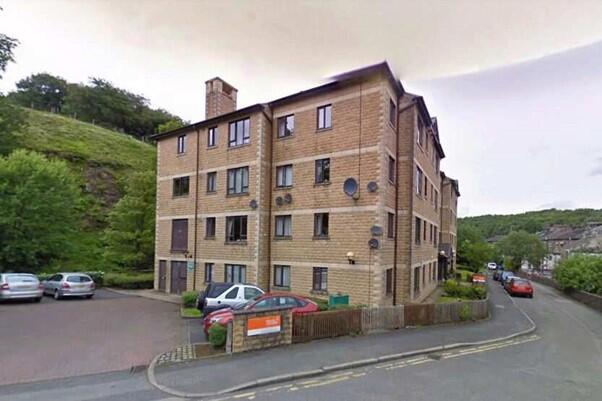
One Bedroom Third Floor Over 55s Flat Irwell House, Cowper Road, Rossendale BB4 7AL
- Bedrooms
- 1
- Bathrooms
- 1
The heatmap indicates the level of crime in the area. The color of the heatmap indicates the crime severity and recency.
Metrics Year-on-Year
- Average area value
- 221,238.00 £Decreased by 17.55 %
- Average area rental value
- 875.00 £/moIncreased by 9.79 %
- Est rental Yield
- 4.75 %Increased by 33.43 %
- Crime Rate
- 24.00 %Unchanged by 0.00 %
from 268,336.00 £
from 797.00 £/mo
from 3.56 %
from 24.00 %
Agent Activity
Places for People created the listing.
Nearby Schools
| Name | Type | Ofsted | Distance |
|---|---|---|---|
| Bacup And Rawtenstall Grammar School | Academy Converter | Outstanding | 0.62 KM |
| Rawtenstall Newchurch Church Of England Primary School | Voluntary Controlled School | Good | 0.71 KM |
| Staghills Children'S Centre | Children's Centre | 0.84 KM | |
| Waterfoot Primary School | Community School | Good | 0.88 KM |
| Staghills Nursery School | Local Authority Nursery School | Outstanding | 0.90 KM |
Images
Nearby Streets
| Name | Average Price | Average Sqft | Distance |
|---|---|---|---|
| Bacup Road | £ 0 | 0 | 0.00 KM |
| Willow Street | £ 95,000 | 0 | 0.00 KM |
| The Cloisters | £ 240,000 | 0 | 0.00 KM |
| Brandwood | £ 0 | 0 | 0.00 KM |
| Thistlemount Mews | £ 0 | 0 | 0.00 KM |
Nearby Listings
| Address | Price | Type | Score | Distance |
|---|---|---|---|---|
| Cowpe Road, Rossendale (district Of), Lancashire, BB4 | £ 894 | RENT | Unknown | 0.00 KM |
| Cowpe Road, Rossendale (district Of), Lancashire, BB4 | £ 849 | RENT | Unknown | 0.00 KM |
| Victoria Parade, Rossendale, Lancashire, BB4 | £ 775 | RENT | Unknown | 0.15 KM |
| Burnley Road East, Rossendale (District of), Lancashire, BB4 | £ 500 | RENT | Unknown | 0.17 KM |
| Baltic Road, Waterfoot, Rossendale | £ 575 | RENT | Unknown | 0.22 KM |
Nearby Properties
| Address | Price | Distance |
|---|---|---|
| 713 Bacup Road | £ 65,000 | 0.06 KM |
| 5 Victoria Parade | £ 127,500 | 0.15 KM |
| 8 Rock View | £ 86,000 | 0.18 KM |
| 10 Rock View | £ 73,500 | 0.18 KM |
| 14 Rock View | £ 82,500 | 0.18 KM |