Stonebridge Lane, Warsop, Nottinghamshire, NG200DS
By Legal and General Affordable Homes
£ 87,000
Reviews
3 out of 5 stars
Legal and General Affordable Homes says ..
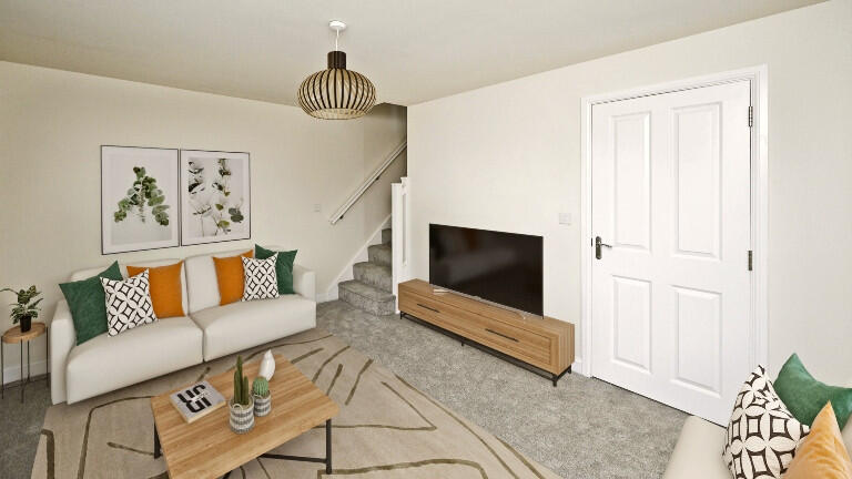
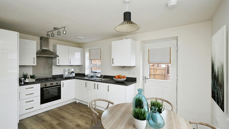
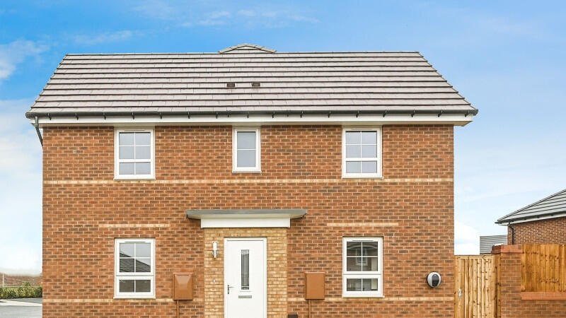
A new 3 bedroom end of terrace house with 2 parking spaces and integrated kitchen appliances, available with Shared Ownership. Located in Warsop, Nottinghamshire. Available to move in Summer 2025.
Property Oracle says ..
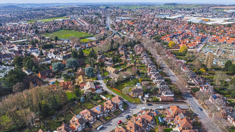
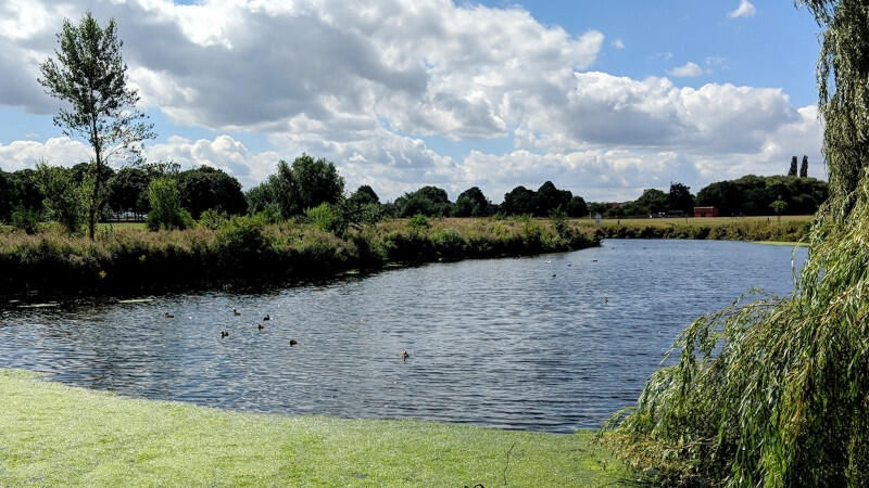
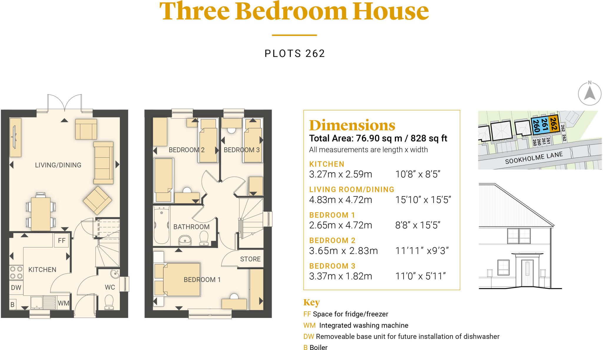
The property is a three-bedroom terraced house located in Warsop, Nottinghamshire. Based on the provided images, the property appears to be newly built or in excellent condition, with a modern kitchen and bathroom. The exterior is a brick-built terrace house with a small, enclosed rear garden. There is a nearby railway station and several primary schools within a reasonable distance. The list price of £87,000 is significantly lower than the average house price in the area (£334,459). However, the average house size in the area is 1,193 sqft, while this property is only 827.74 sqft. The average price per sqft in the area is £280.00. This suggests that the property may be priced competitively, although more information on the specific condition and features would be needed to confirm this. The smaller plot size and terraced nature of the property compared to the predominantly detached properties in the area also contribute to the lower list price. Nearby properties on Stonebridge Lane have sold for between £115,000 and £140,000, which supports the lower list price of this property. The presence of a small garden is a positive feature. The proximity to schools and transport links is also advantageous, making this property potentially attractive to families and commuters.
Therefore, we give this property 7 / 10. *Disclaimer: This is our option and does constitute a recommendation or financial advice. Do your own research. *
- Price
- 8
- Condition
- 10
- Location
- 7
- Land
- 6
- Bedrooms
- 3
- Bathrooms
- 0
- Sqft (est)
- 827.74
- Lot (est)
- 827.74
The heatmap indicates the level of crime in the area. The color of the heatmap indicates the crime severity and recency.
Metrics Year-on-Year
- Average area value
- 275,000.00 £Decreased by 19.09 %
- Est sale value
- 216,867.88 £Decreased by 16.29 %
- Average area rental value
- 750.00 £/moDecreased by 19.53 %
- Est letting value
- 0.00 £/mo
- Est rental Yield
- 3.27 %Decreased by 0.61 %
- Crime Rate
- 14.00 %Unchanged by 0.00 %
Agent Activity
Legal and General Affordable Homes created the listing.
Nearby Schools
| Name | Type | Ofsted | Distance |
|---|---|---|---|
| Warsop Children'S Centre | Children's Centre | 1.05 KM | |
| Birklands Primary School | Academy Sponsor Led | Good | 1.26 KM |
| Church Vale Primary School And Foundation Unit | Community School | Good | 1.31 KM |
| Hetts Lane Infant And Nursery School | Community School | Good | 1.38 KM |
| Sherwood Junior School | Community School | Requires improvement | 1.47 KM |
Images


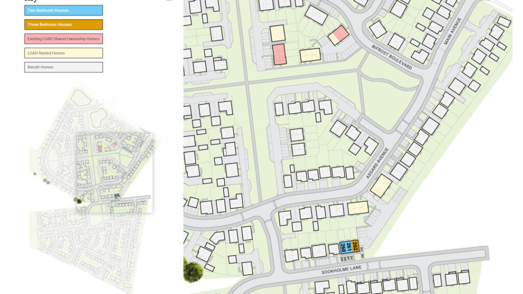


Nearby Streets
| Name | Average Price | Average Sqft | Distance |
|---|---|---|---|
| Asgard Avenue | £ 325,000 | 0 | 0.00 KM |
| Bifrost Boulevard | £ 0 | 0 | 0.00 KM |
| Blackberry Way | £ 0 | 0 | 0.00 KM |
| Portland Street | £ 0 | 0 | 0.00 KM |
| Lilac Grove | £ 165,000 | 0 | 0.00 KM |
Nearby Transport
| Name | NLC | TLC | Distance |
|---|---|---|---|
| Shirebrook | 1595 | SHB | 4.42 KM |
| Langwith-Whaley Thorns | 1871 | LAG | 6.00 KM |
| Mansfield Woodhouse | 1728 | MSW | 6.33 KM |
| Mansfield | 1727 | MFT | 8.03 KM |
| Creswell | 1874 | CWD | 8.90 KM |
Nearby Listings
| Address | Price | Type | Score | Distance |
|---|---|---|---|---|
| Stonebridge Lane, Market Warsop, Mansfield, Nottinghamshire, NG20 0DS | £ 231,995 | BUY | 7 / 10 | 0.00 KM |
| Stonebridge Lane, Market Warsop, Mansfield, Nottinghamshire, NG20 0DS | £ 314,995 | BUY | 7 / 10 | 0.00 KM |
| Stonebridge Lane, Market Warsop, Mansfield, Nottinghamshire, NG20 0DS | £ 412,995 | BUY | 7 / 10 | 0.00 KM |
| Stonebridge Lane, Market Warsop, Mansfield, Nottinghamshire, NG20 0DS | £ 274,995 | BUY | 7 / 10 | 0.00 KM |
| Stonebridge Lane, Market Warsop, Mansfield, Nottinghamshire, NG20 0DS | £ 364,995 | BUY | 7 / 10 | 0.00 KM |
Nearby Properties
| Address | Price | Distance |
|---|---|---|
| 8 Stonebridge Lane | £ 118,500 | 0.00 KM |
| 30 Stonebridge Lane | £ 120,000 | 0.00 KM |
| 22 Stonebridge Lane | £ 140,000 | 0.00 KM |
| The Gables | £ 138,000 | 0.00 KM |
| 68 Stonebridge Lane | £ 115,500 | 0.00 KM |