Goadsby says ..
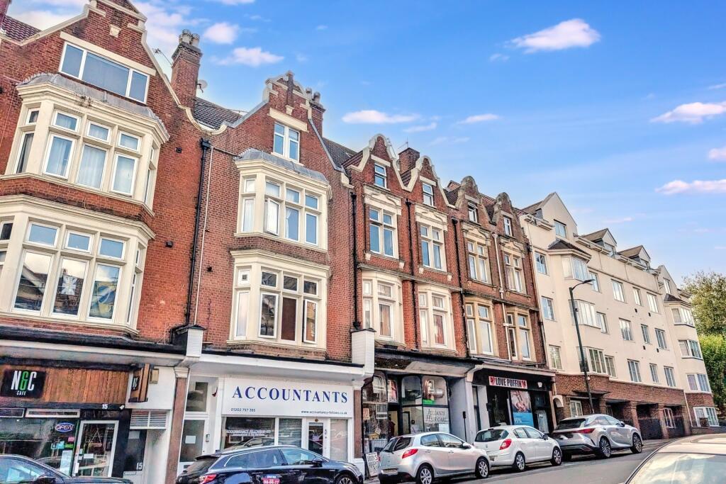
STUNNING TWO BEDROOM FIRST FLOOR APARTMENT WITH CHARACTER FEATURES- Walking distance to Bournemouth and Westbourne high-street.
Property Oracle says ..
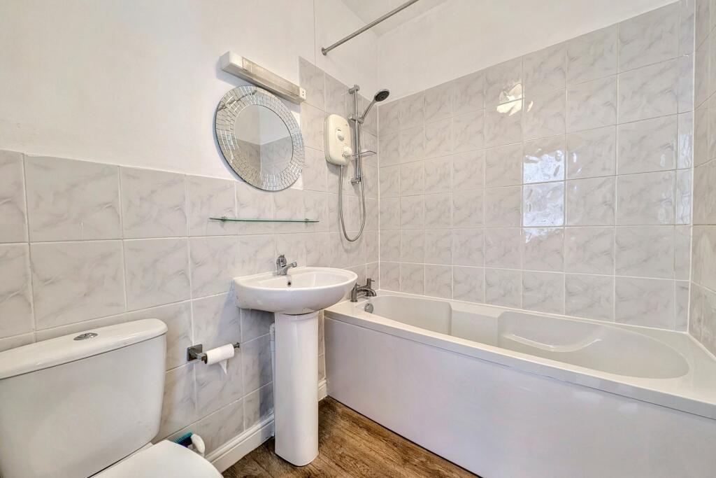
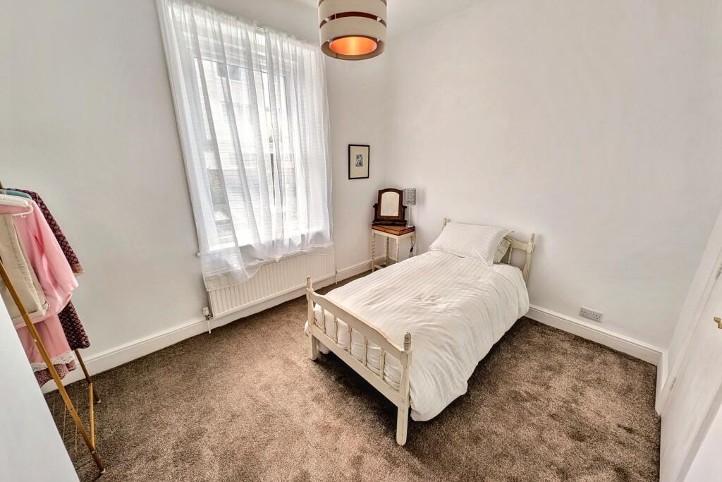
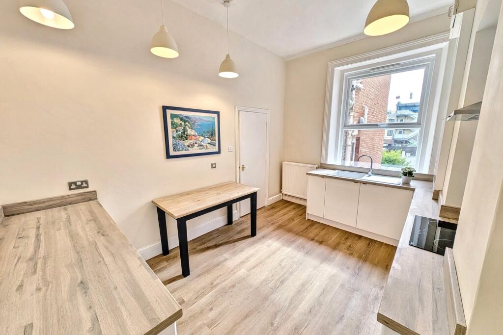
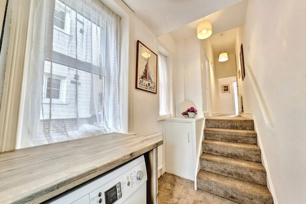
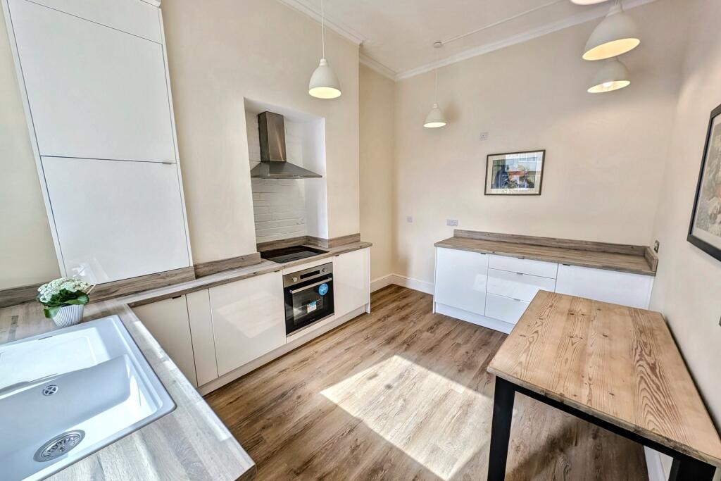
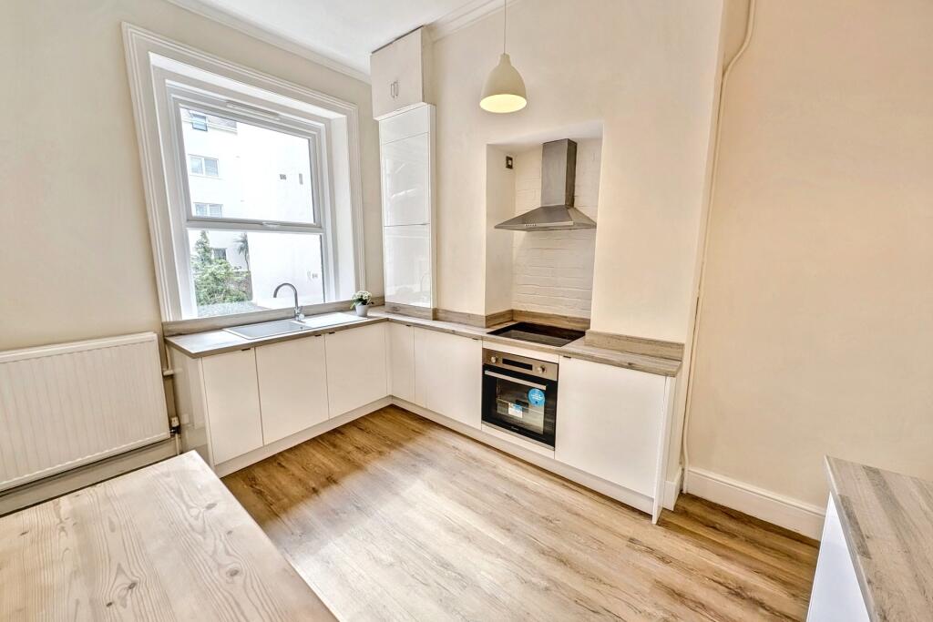
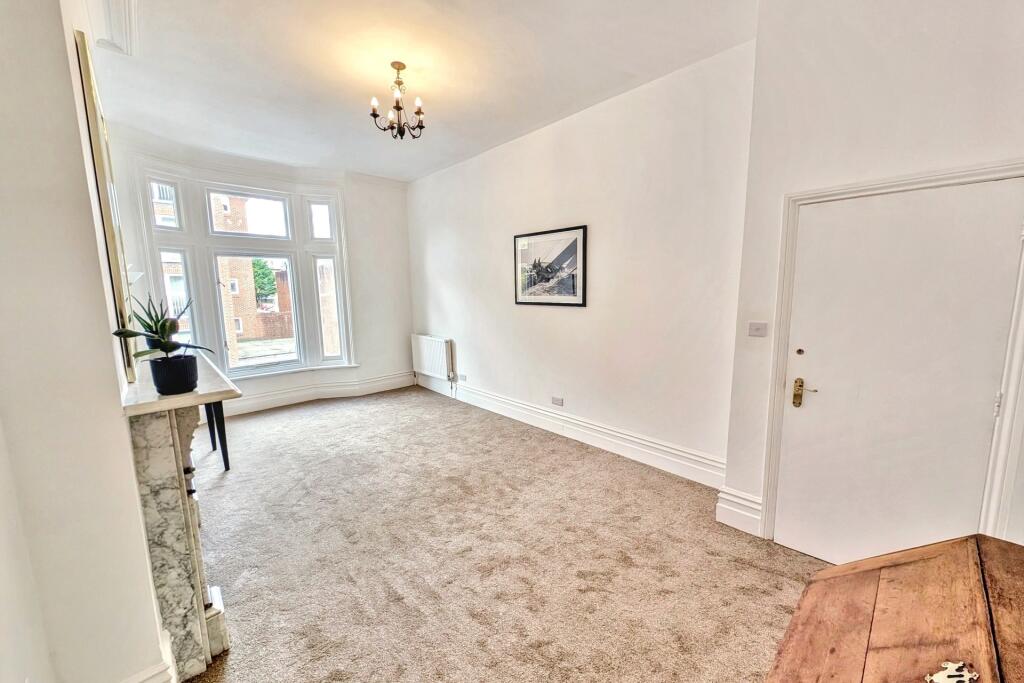
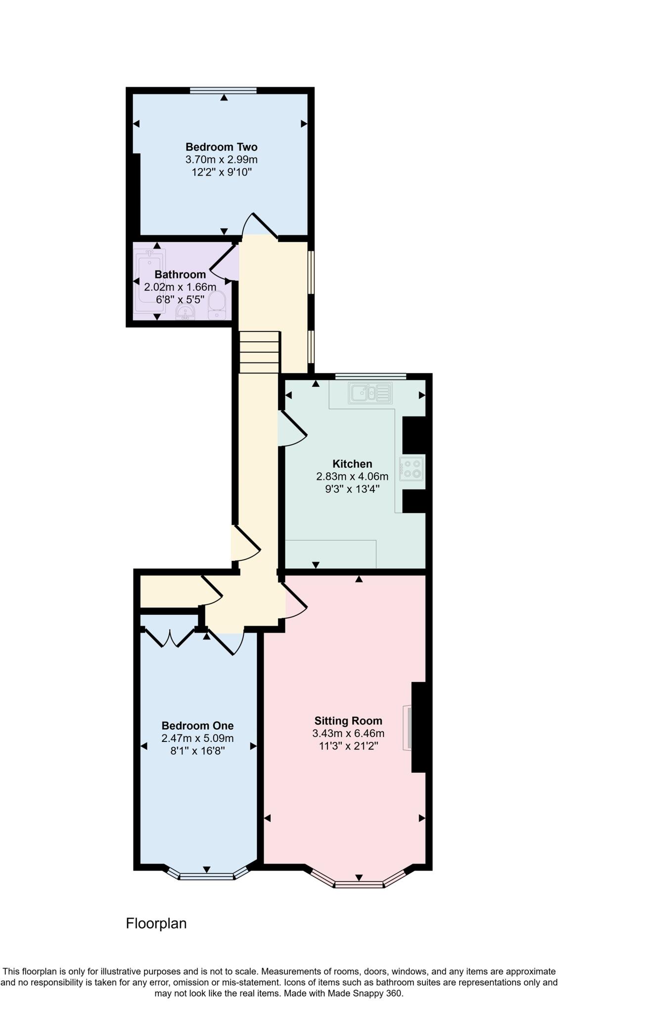
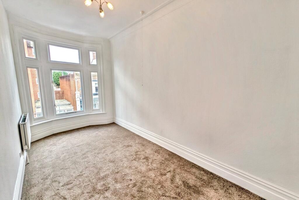
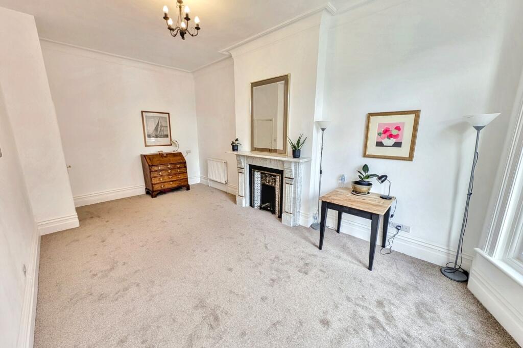
This property is a 2-bedroom flat located in Bournemouth’s Westbourne & West Cliff area. The flat is situated on Queens Road, a street with a mix of properties, suggesting a diverse neighborhood. The area benefits from proximity to several schools, including St Michael’s Church of England Primary School (0.55km) and Kings Bournemouth (1.77km), both rated as ‘Good’ by Ofsted. Transportation links are also relatively close, with Bournemouth railway station approximately 3.19km away. The property itself appears to be in good condition, having undergone some modernisation while retaining period features. The kitchen and bathroom are modern and well-maintained. The living area features original fireplaces, adding character. The lack of outdoor space is a notable drawback. Considering the average price per sqft in the area (\£399) and the property’s size (652.18 sqft), the list price of \£210,000 seems reasonable, particularly when compared to similar properties on Queens Road. However, the absence of plot size data prevents a more precise assessment of value.
Therefore, we give this property 5 / 10. *Disclaimer: This is our option and does constitute a recommendation or financial advice. Do your own research. *
- Price
- 7
- Condition
- 8
- Location
- 7
- Land
- 1
- Bedrooms
- 2
- Bathrooms
- 1
- Sqft (est)
- 652.18
The heatmap indicates the level of crime in the area. The color of the heatmap indicates the crime severity and recency.
Metrics Year-on-Year
- Average area value
- 376,737.00 £Increased by 7.60 %
- Est sale value
- 304,568.06 £Increased by 24.20 %
- Average area rental value
- 1,284.00 £/moDecreased by 2.65 %
- Est letting value
- 652.18 £/moUnchanged by 0.00 %
- Est rental Yield
- 4.09 %Decreased by 9.51 %
- Crime Rate
- 14.00 %Unchanged by 0.00 %
Agent Activity
Goadsby created the listing.
Nearby Schools
| Name | Type | Ofsted | Distance |
|---|---|---|---|
| St Michael'S Church Of England Primary School | Academy Converter | Good | 0.55 KM |
| Talbot Heath School | Other Independent School | 1.45 KM | |
| Kings Bournemouth | Other Independent School | Good | 1.77 KM |
| Bournemouth Christian School | Other Independent School | Good | 2.29 KM |
| Arts University Bournemouth | Higher Education Institutions | Outstanding | 2.34 KM |
Images


Nearby Streets
| Name | Average Price | Average Sqft | Distance |
|---|---|---|---|
| The Cedars | £ 0 | 0 | 0.00 KM |
| Durley Roundabout | £ 332,980 | 0 | 0.00 KM |
| Middle Chine | £ 0 | 0 | 0.00 KM |
| Milburn Close | £ 0 | 0 | 0.00 KM |
| Avenue Road | £ 200,000 | 0 | 0.00 KM |
Nearby Transport
| Name | NLC | TLC | Distance |
|---|---|---|---|
| Branksome | 5875 | BSM | 3.05 KM |
| Bournemouth | 5876 | BMH | 3.19 KM |
| Parkstone (Dorset) | 5882 | PKS | 6.11 KM |
| Pokesdown | 5885 | POK | 7.56 KM |
Nearby Listings
| Address | Price | Type | Score | Distance |
|---|---|---|---|---|
| Bournemouth | £ 210,000 | BUY | 5 / 10 | 0.00 KM |
| Queens Road, Bournemouth | £ 180,000 | BUY | 6 / 10 | 0.02 KM |
| Queens Road, Bournemouth, Dorset | £ 425,000 | BUY | 4 / 10 | 0.02 KM |
| Queens Road, Bournemouth, Dorset, BH2 | £ 210,000 | BUY | 7 / 10 | 0.02 KM |
| Poole Road, Bournemouth, Dorset, BH2 | £ 90,000 | BUY | 6 / 10 | 0.03 KM |
Nearby Properties
| Address | Price | Distance |
|---|---|---|
| 9a Queens Road | £ 108,000 | 0.01 KM |
| 23 Queens Road | £ 110,000 | 0.01 KM |
| 9c Queens Road | £ 165,000 | 0.01 KM |
| 17a Queens Road | £ 205,000 | 0.01 KM |
| 10a Queens Road | £ 190,000 | 0.06 KM |