SI
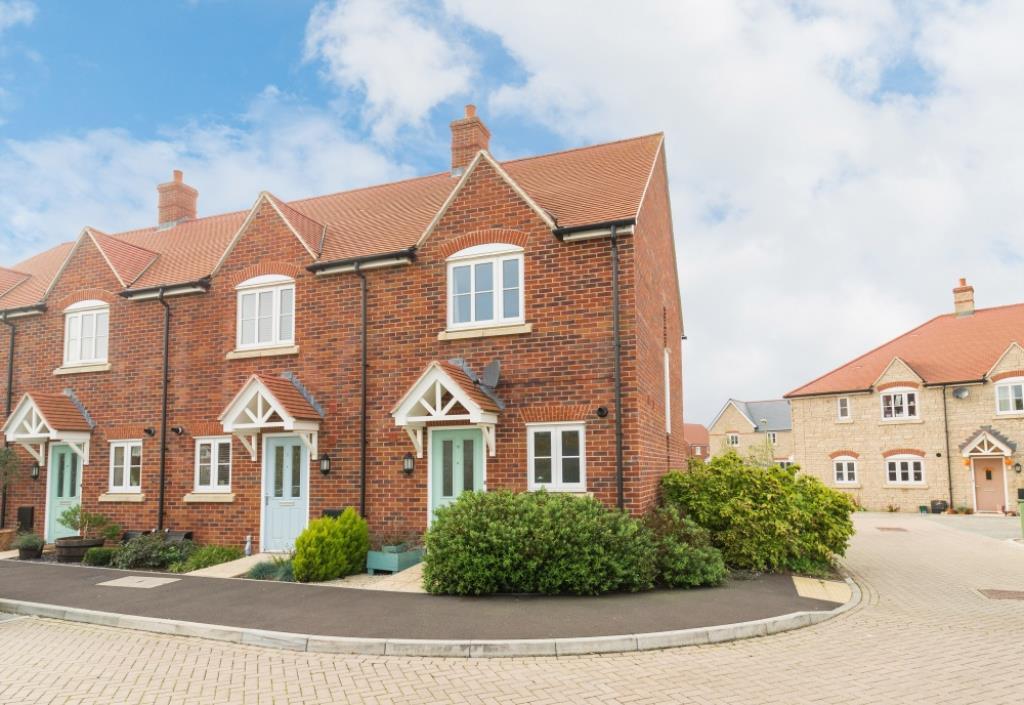
Milbank Way, Steventon
By Simpsons
£ 1,500
Simpsons says ..
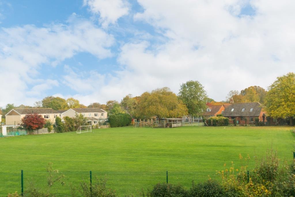
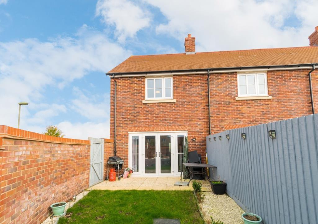
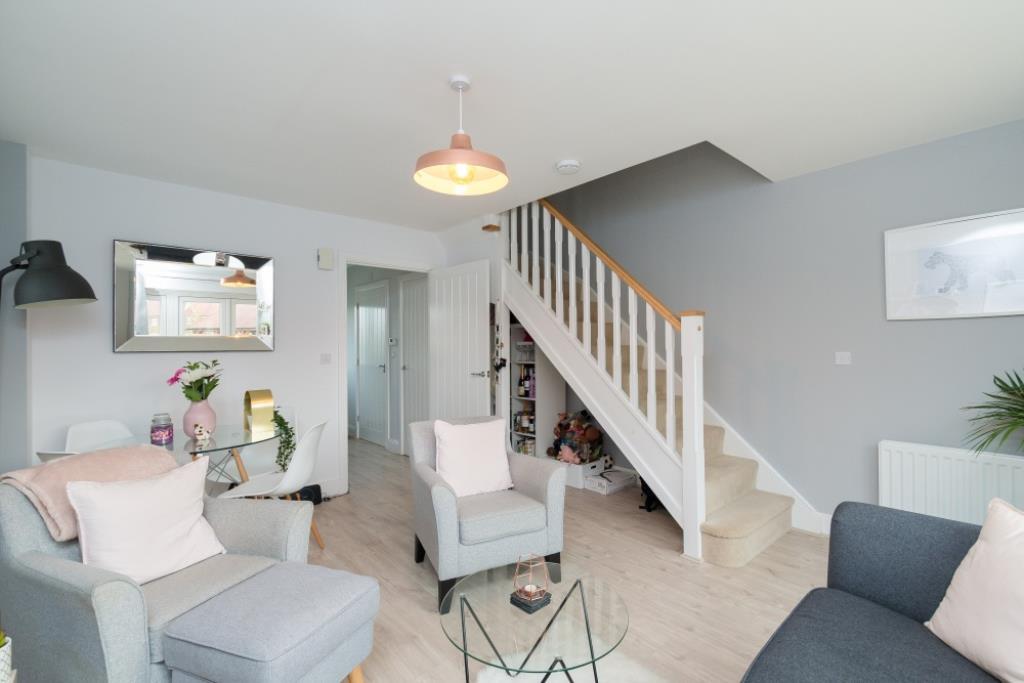
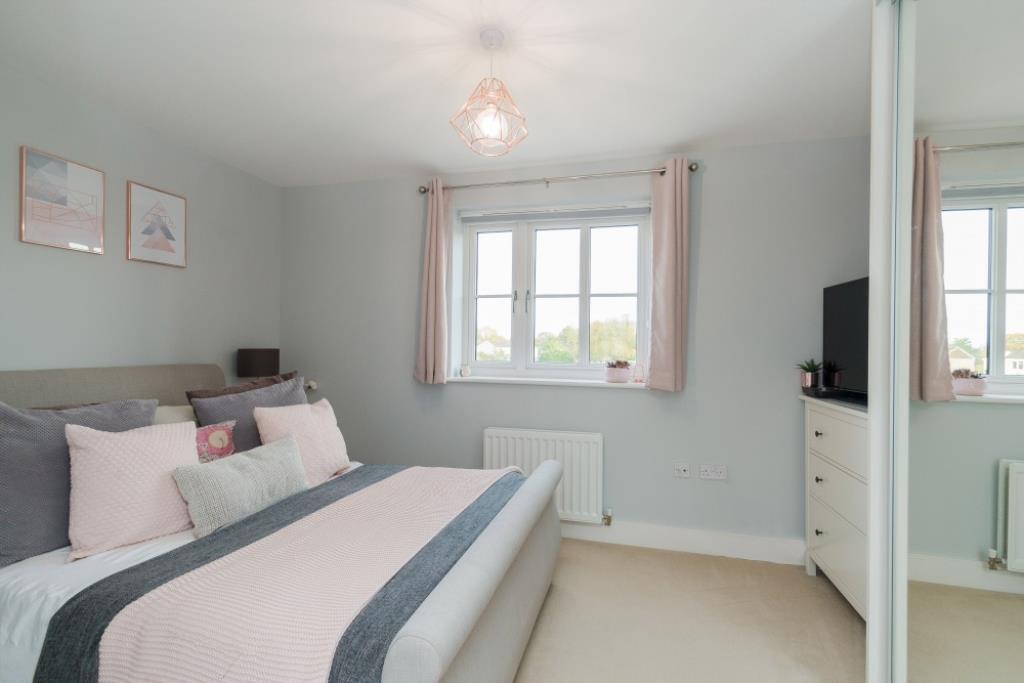
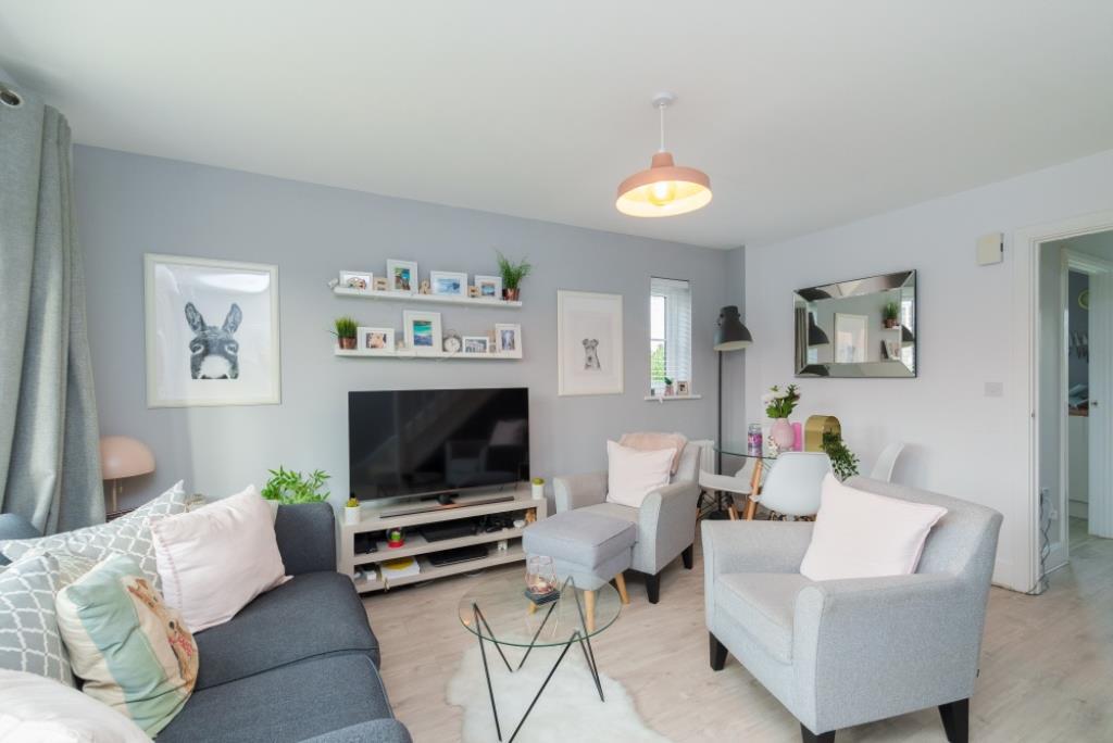
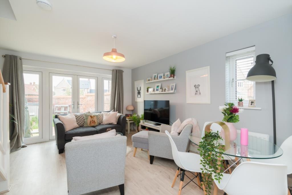
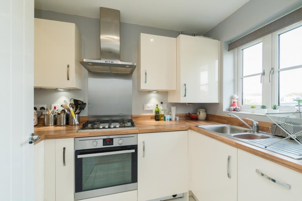
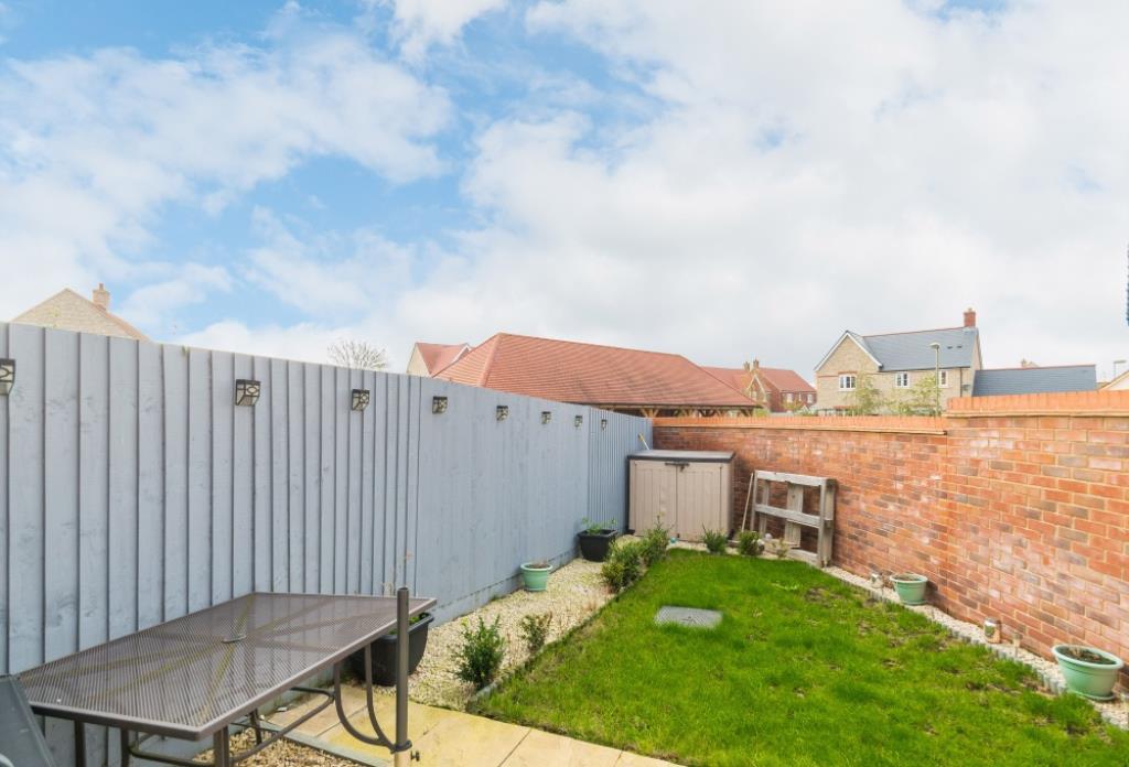
A modern 2015 built house, set in a desirable village location. UNFURNISHED. Available from late September. EPC Rating C.
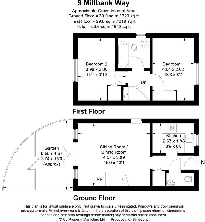
- Bedrooms
- 2
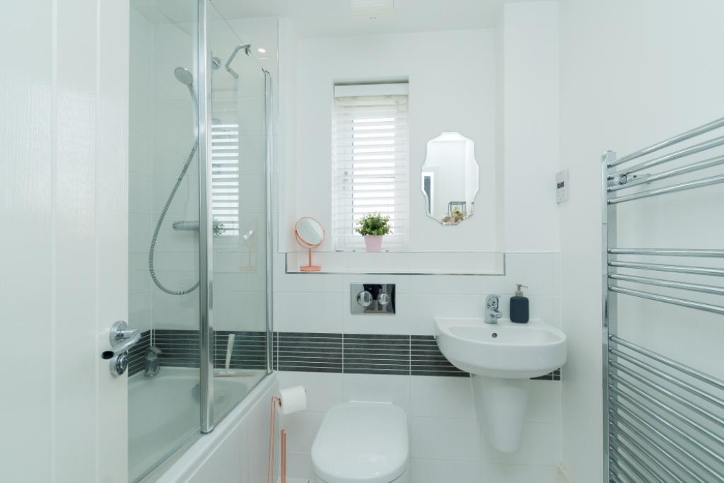
- Bathrooms
- 1
The heatmap indicates the level of crime in the area. The color of the heatmap indicates the crime severity and recency.
Metrics Year-on-Year
- Average area value
- 481,000.00 £Decreased by 19.11 %
- Average area rental value
- 2,598.00 £/moIncreased by 35.45 %
- Est rental Yield
- 6.48 %Increased by 67.44 %
- Crime Rate
- 37.00 %Unchanged by 0.00 %
from 594,629.00 £
from 1,918.00 £/mo
from 3.87 %
from 37.00 %
Agent Activity
Simpsons created the listing.
Nearby Schools
| Name | Type | Ofsted | Distance |
|---|---|---|---|
| St Michaels Cofe Primary School | Voluntary Controlled School | Good | 0.25 KM |
| St Blaise Cofe Primary School | Voluntary Controlled School | Good | 2.74 KM |
| Drayton Community Primary School | Community School | Good | 3.14 KM |
| The Hendreds Church Of England School | Academy Converter | Outstanding | 3.57 KM |
| St Amand'S Catholic Primary School | Voluntary Aided School | Good | 3.59 KM |
Images
Nearby Streets
| Name | Average Price | Average Sqft | Distance |
|---|---|---|---|
| Church Lane | £ 0 | 0 | 0.00 KM |
| Frank's Lane | £ 475,000 | 0 | 0.00 KM |
| Mill Street | £ 300,000 | 0 | 0.00 KM |
| Brewer Close | £ 0 | 0 | 0.00 KM |
Nearby Transport
| Name | NLC | TLC | Distance |
|---|---|---|---|
| Didcot Parkway | 3030 | DID | 9.58 KM |
| Appleford | 3109 | APF | 9.72 KM |
Nearby Listings
| Address | Price | Type | Score | Distance |
|---|---|---|---|---|
| Milbank Way, Steventon | £ 1,500 | RENT | Unknown | 0.00 KM |
| Vicarage Road, Steventon | £ 3,250 | RENT | Unknown | 0.45 KM |
| Steventon | £ 1,175 | RENT | Unknown | 0.85 KM |
| Drayton, ABingdon, OX13 | £ 2,250 | RENT | Unknown | 1.65 KM |
Nearby Properties
| Address | Price | Distance |
|---|---|---|
| 16 Milbank Way | £ 525,000 | 0.01 KM |
| 8 Milbank Way | £ 289,995 | 0.01 KM |
| 19 Milbank Way | £ 275,000 | 0.01 KM |
| 9 Milbank Way | £ 272,500 | 0.01 KM |
| 10 Brind Close | £ 600,000 | 0.09 KM |