CB
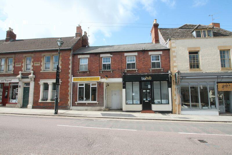
High Street, Cricklade, Wiltshire
By CBSlade
£ 453
CBSlade says ..
Commercial unit on Cricklade High Street
- Bedrooms
- 0
- Bathrooms
- 1
The heatmap indicates the level of crime in the area. The color of the heatmap indicates the crime severity and recency.
Metrics Year-on-Year
- Average area value
- 196,667.00 £Decreased by 59.28 %
- Average area rental value
- 1,188.00 £/moDecreased by 6.31 %
- Est rental Yield
- 7.25 %Increased by 130.16 %
- Crime Rate
- 47.00 %Unchanged by 0.00 %
from 482,957.00 £
from 1,268.00 £/mo
from 3.15 %
from 47.00 %
Agent Activity
CBSlade created the listing.
Nearby Schools
| Name | Type | Ofsted | Distance |
|---|---|---|---|
| Cricklade Children'S Centre | Children's Centre | 0.19 KM | |
| St Sampson'S Church Of England Primary School | Voluntary Controlled School | Good | 0.20 KM |
| Cricklade Manor Prep | Other Independent School | 0.35 KM | |
| Meadowpark School | Other Independent School | Inadequate | 0.44 KM |
| Down Ampney Church Of England Primary School | Voluntary Controlled School | Good | 3.64 KM |
Images
Nearby Streets
| Name | Average Price | Average Sqft | Distance |
|---|---|---|---|
| Church Lane | £ 535,000 | 0 | 0.00 KM |
| Parsonage Farm | £ 458,333 | 0 | 0.00 KM |
| Rectory Lane | £ 0 | 0 | 0.00 KM |
| Red Lion Lane | £ 210,000 | 0 | 0.00 KM |
| Willow Grove | £ 92,000 | 0 | 0.00 KM |
Nearby Listings
| Address | Price | Type | Score | Distance |
|---|---|---|---|---|
| High Street, Cricklade, Wiltshire | £ 900 | RENT | Unknown | 0.05 KM |
| High Street, Cricklade, SN6 | £ 775 | RENT | Unknown | 0.09 KM |
| High Street, Cricklade, SN6 | £ 1,600 | RENT | Unknown | 0.28 KM |
| Rectory Lane, Cricklade, Wiltshire | £ 750 | RENT | Unknown | 0.35 KM |
| Bath Road, Swindon, Wiltshire | £ 1,530 | RENT | Unknown | 0.39 KM |
Nearby Properties
| Address | Price | Distance |
|---|---|---|
| 36a High Street | £ 150,000 | 0.05 KM |
| 46 High Street | £ 590,000 | 0.11 KM |
| 37 Calcutt Street | £ 131,000 | 0.13 KM |
| 25 Calcutt Street | £ 470,000 | 0.13 KM |
| 35 Calcutt Street | £ 195,000 | 0.13 KM |