Connells says ..
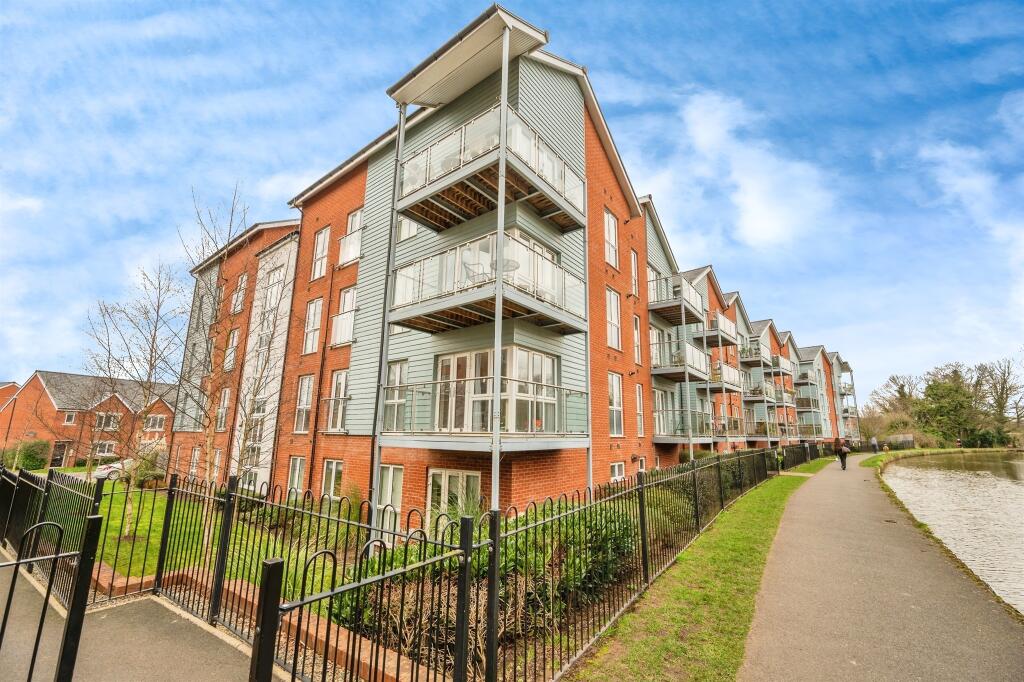
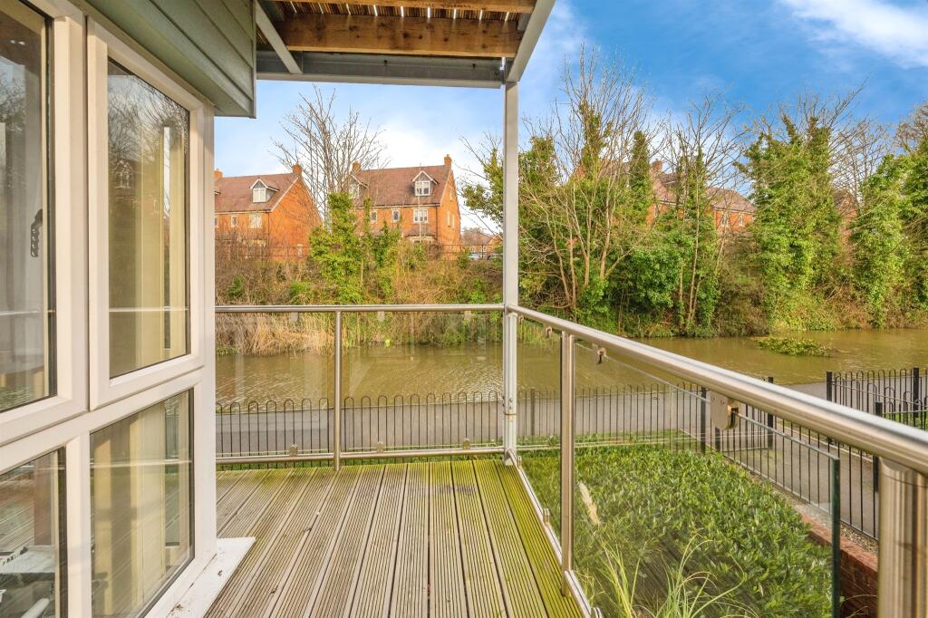
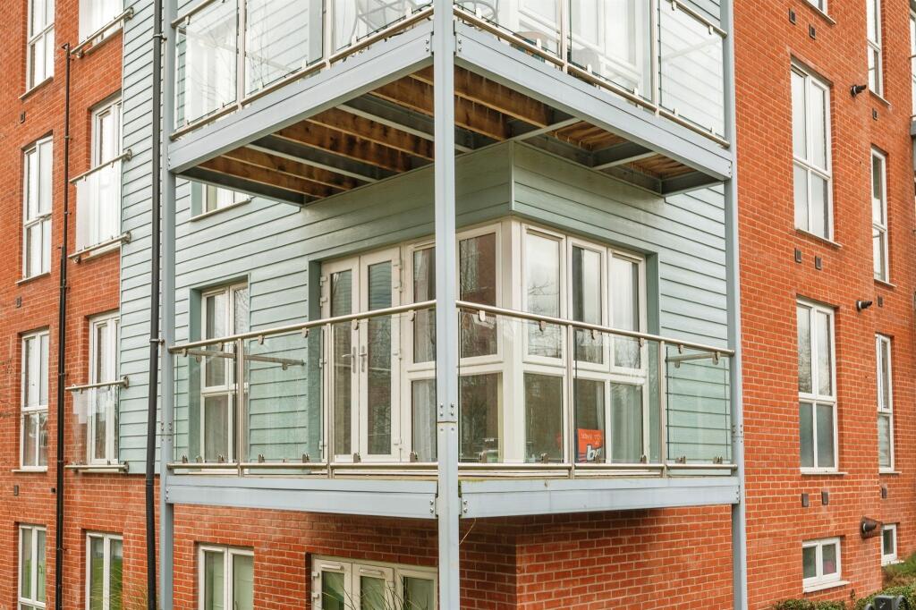
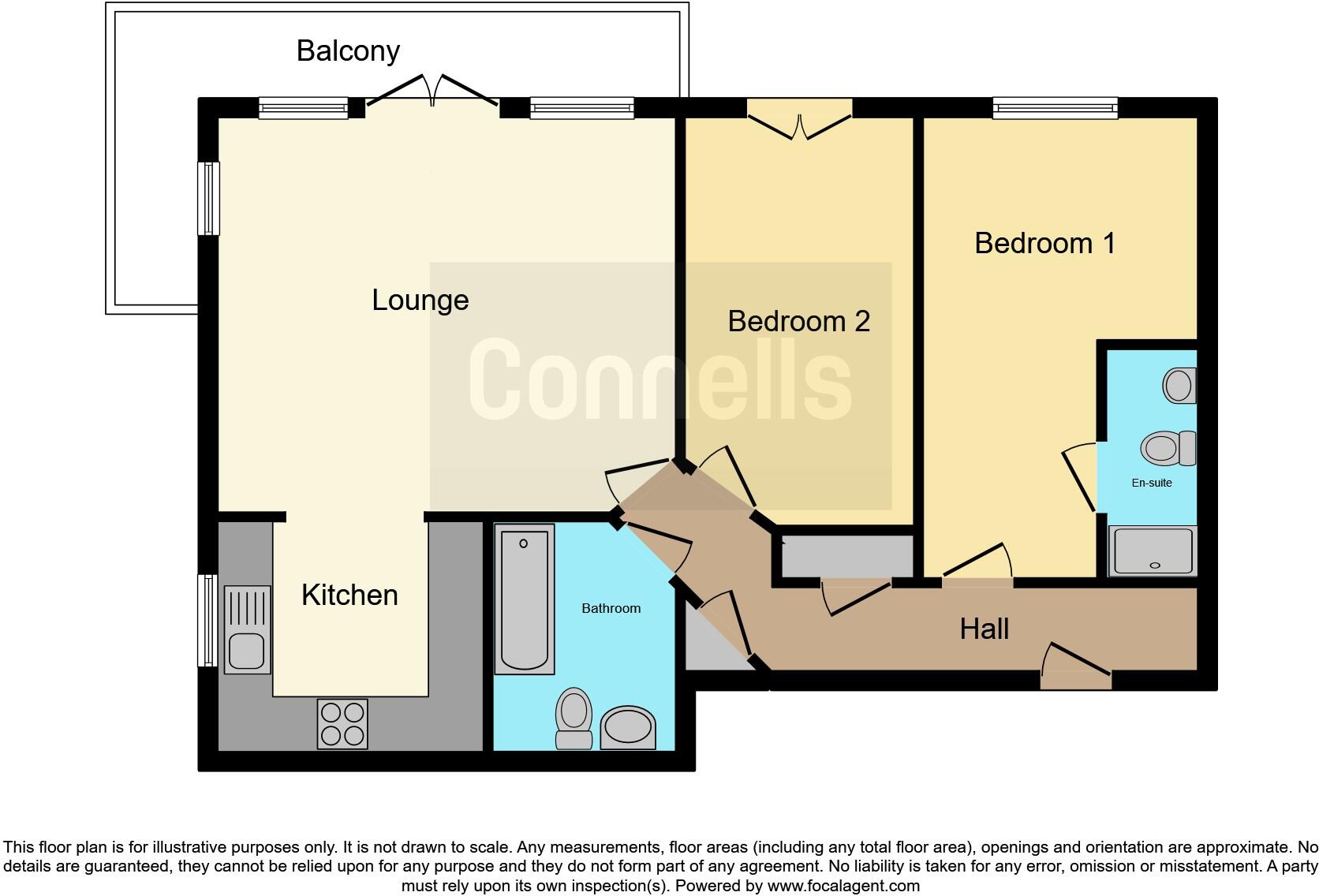
A well presented first floor apartment with large balcony overlooking the canal with high specification fixtures and fittings, en-suite to the master bedroom and allocated parking.
Property Oracle says ..
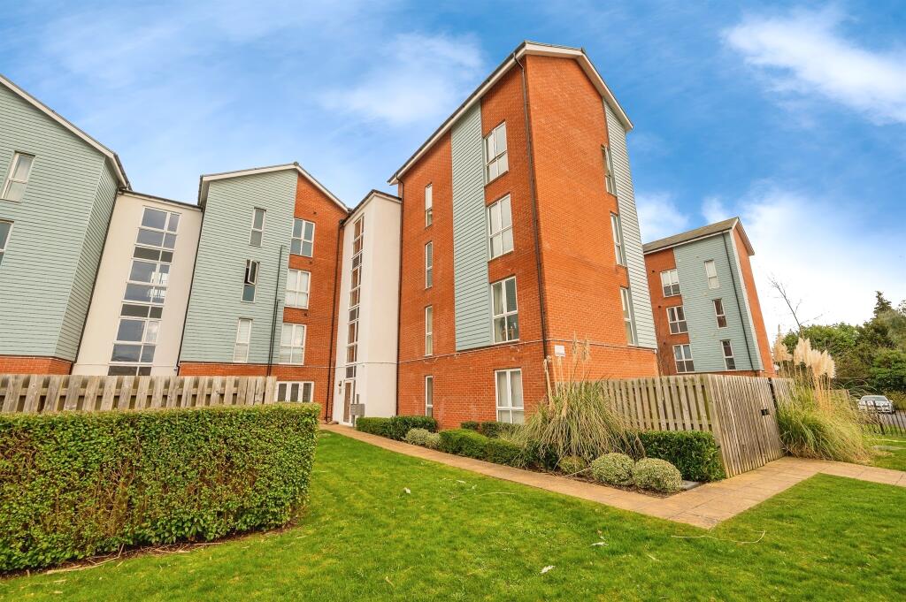
The property is a 2 bedroom flat located on The Lane in Worcester, Worcestershire. It’s a modern flat in a development that appears well-maintained from the provided images. The location is convenient, with several schools and train stations within a reasonable distance. Worcester Foregate Street train station is only 1.15km away. The closest school, St George’s Cofe Primary School, is 0.33km away and has an Ofsted rating of ‘Requires Improvement’. Bishop Perowne Cofe College, rated ‘Good’ by Ofsted, is slightly further at 0.51km.
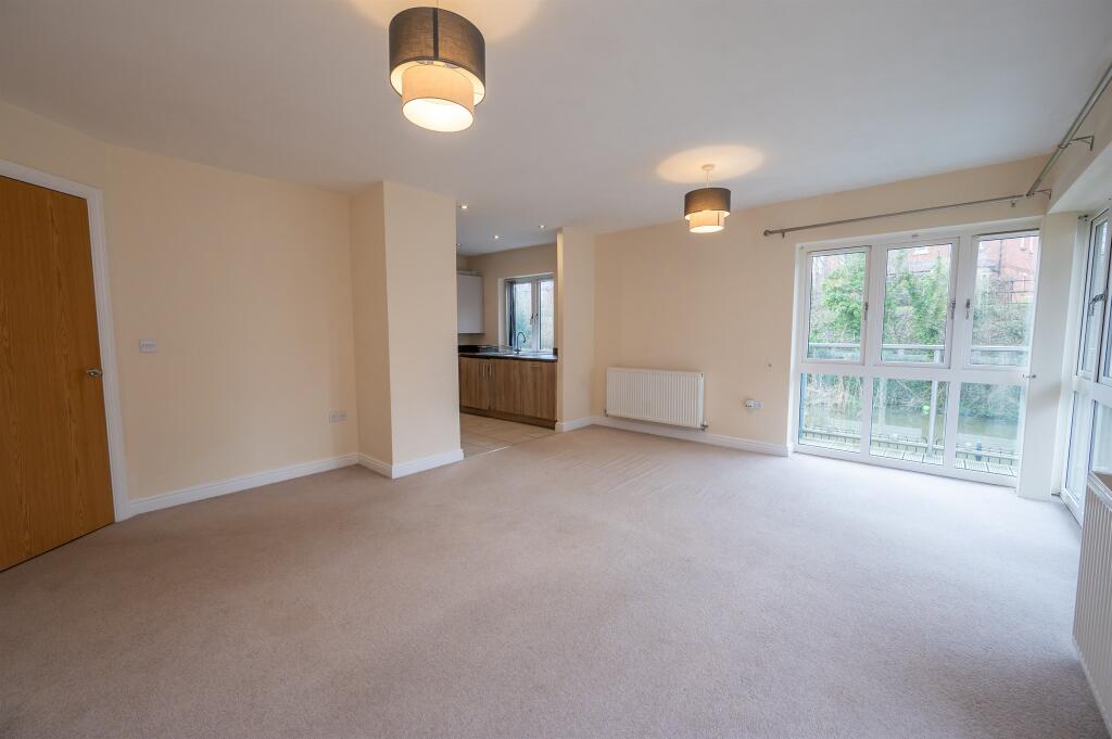
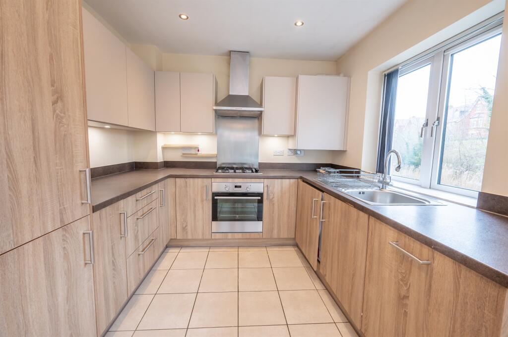
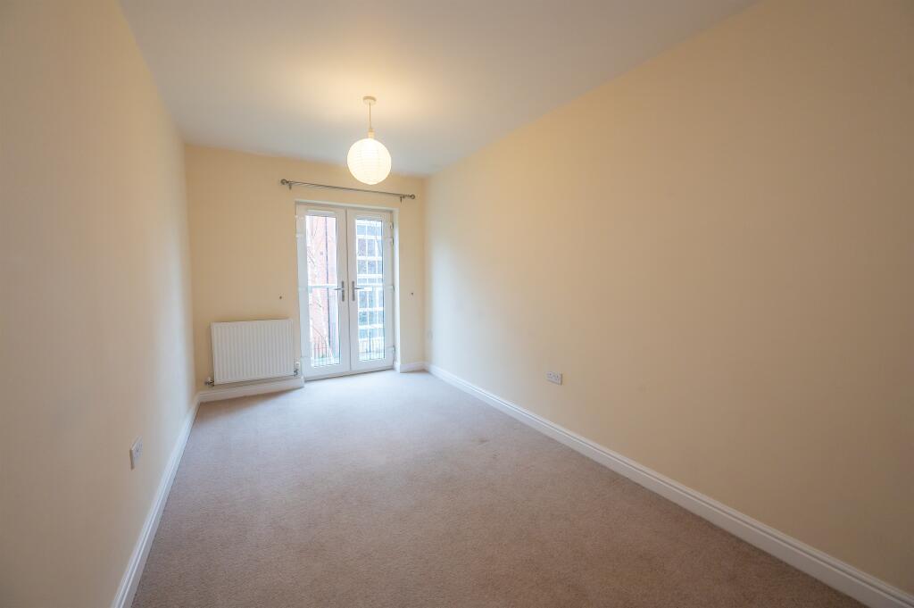
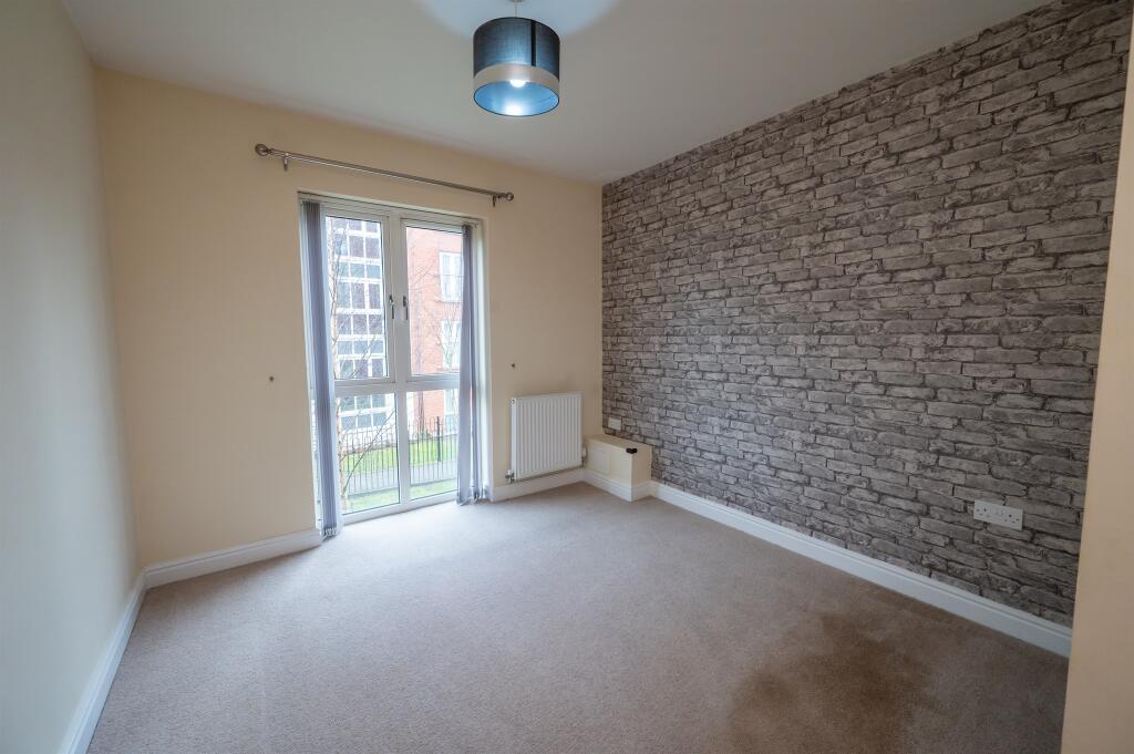
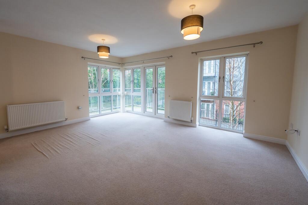
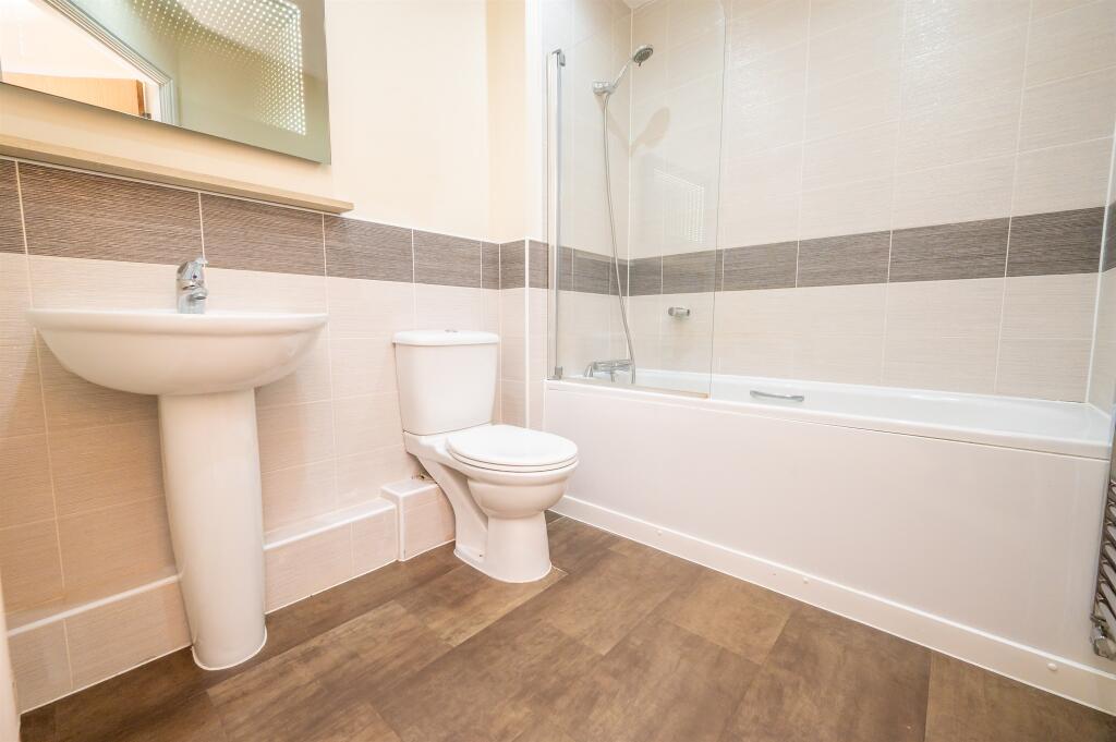
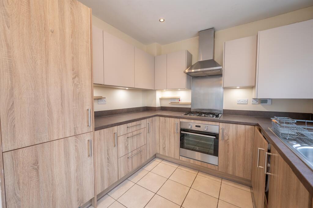
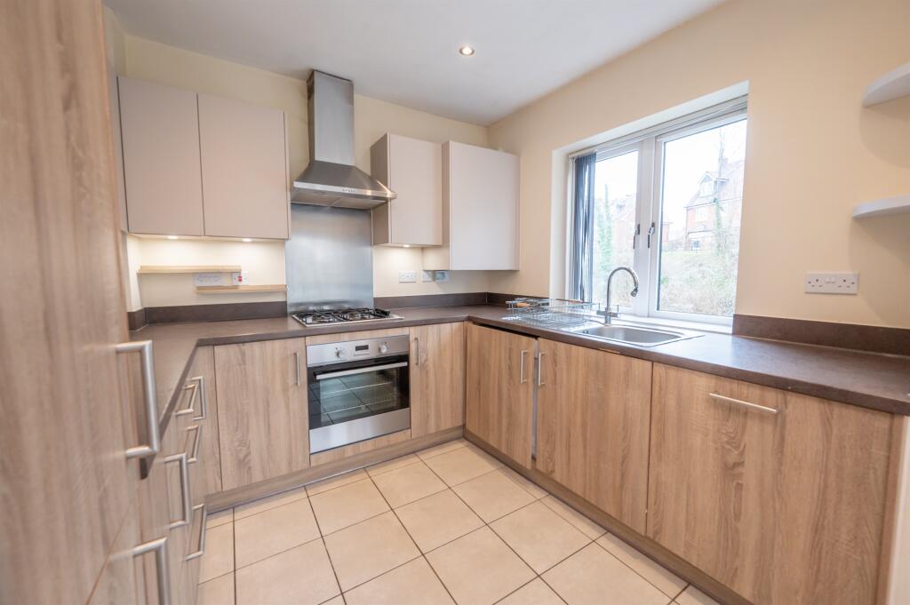
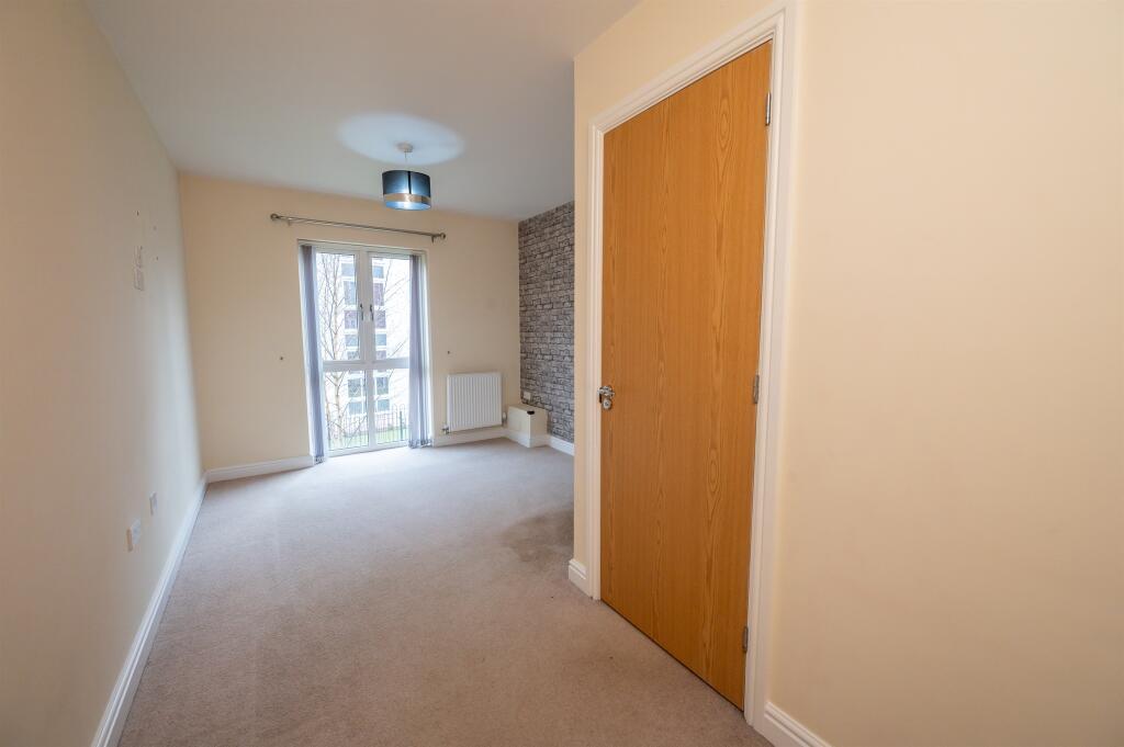
The flat itself appears to be in excellent condition. The images show a modern, clean, and well-presented interior. There is no evidence of damage or the need for repairs or renovations. The kitchen and bathroom are modern and fitted to a good standard.
The property has a small balcony overlooking a canal. While not a large garden, it does offer some outdoor space.
Considering the average price per square foot in the area is £457, and this property is listed at £220,000 with 725 sqft, the price per sqft is approximately £303. This is significantly lower than the area average, suggesting it may represent good value for money, especially considering its modern condition and convenient location. However, the lack of plot size may affect the overall value perception for some buyers. The nearby comparable properties also support this assessment, with similar properties in the area selling for similar or slightly higher prices.
Therefore, we give this property 7 / 10. *Disclaimer: This is our option and does constitute a recommendation or financial advice. Do your own research. *
- Price
- 9
- Condition
- 10
- Location
- 8
- Land
- 3
- Bedrooms
- 2
- Bathrooms
- 1
- Sqft (est)
- 725.00
The heatmap indicates the level of crime in the area. The color of the heatmap indicates the crime severity and recency.
Metrics Year-on-Year
- Average area value
- 890,625.00 £Increased by 35.96 %
- Est sale value
- 413,250.00 £Increased by 58.77 %
- Average area rental value
- 1,412.00 £/moDecreased by 13.11 %
- Est letting value
- 0.00 £/mo
- Est rental Yield
- 1.90 %Decreased by 36.24 %
- Crime Rate
- 1.00 %Unchanged by 0.00 %
Agent Activity
Connells created the listing.
Nearby Schools
| Name | Type | Ofsted | Distance |
|---|---|---|---|
| St George'S Cofe Primary School | Voluntary Aided School | Requires improvement | 0.33 KM |
| Bishop Perowne Cofe College | Academy Converter | Good | 0.51 KM |
| Royal Grammar School Worcester | Other Independent School | 0.63 KM | |
| St George'S Catholic Primary School | Voluntary Aided School | Good | 0.81 KM |
| Riversides School | Academy Special Sponsor Led | Good | 0.82 KM |
Images


Nearby Streets
| Name | Average Price | Average Sqft | Distance |
|---|---|---|---|
| Henry Street | £ 0 | 0 | 0.00 KM |
| Milton Close | £ 300,000 | 0 | 0.00 KM |
| Hebb Street | £ 225,000 | 0 | 0.00 KM |
| Coleridge Close | £ 0 | 0 | 0.00 KM |
| St Stephen's Terrace | £ 0 | 0 | 0.00 KM |
Nearby Transport
| Name | NLC | TLC | Distance |
|---|---|---|---|
| Worcester Foregate Street | 4893 | WOF | 1.15 KM |
| Worcester Shrub Hill | 4891 | WOS | 1.80 KM |
| Worcestershire Parkway | 6580 | WOP | 8.75 KM |
| Droitwich Spa | 4878 | DTW | 9.88 KM |
Nearby Listings
| Address | Price | Type | Score | Distance |
|---|---|---|---|---|
| The Lane, Worcester | £ 220,000 | BUY | 7 / 10 | 0.00 KM |
| The Lane, Worcester, Worcestershire | £ 160,000 | BUY | 6 / 10 | 0.04 KM |
| The Lane, Worcester, WR1 | £ 330,000 | BUY | Unknown | 0.07 KM |
| Gregorys Bank, Worcester, Worcestershire. | £ 380,000 | BUY | 7 / 10 | 0.08 KM |
| Shrubbery Road, Worcester, Worcestershire, WR1 | £ 270,000 | BUY | 6 / 10 | 0.10 KM |
Nearby Properties
| Address | Price | Distance |
|---|---|---|
| 105 St Georges Lane North | £ 187,000 | 0.09 KM |
| 4 The Lane | £ 220,000 | 0.11 KM |
| 39 The Lane | £ 235,000 | 0.12 KM |
| 31 The Lane | £ 295,000 | 0.12 KM |
| 3 The Lane | £ 235,000 | 0.12 KM |