
CO
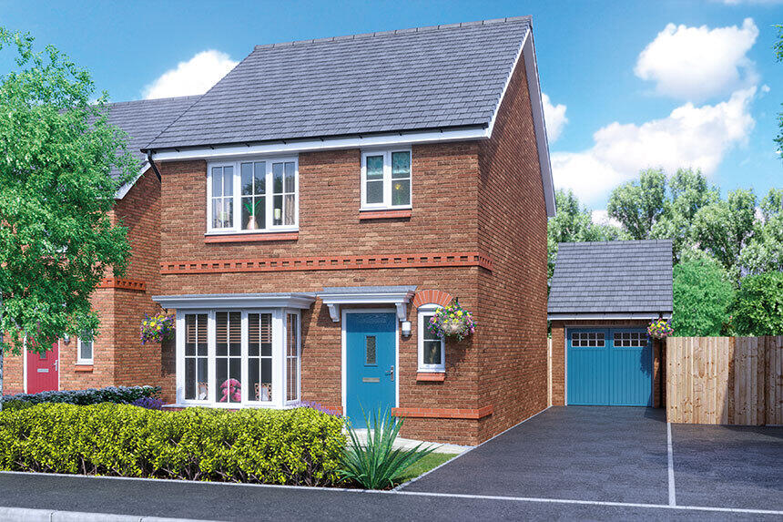
Poverty Lane, Maghull, L31 1GP
By Countryside Partnerships North
£ 355,000
Reviews
3 out of 5 stars
Countryside Partnerships North says ..
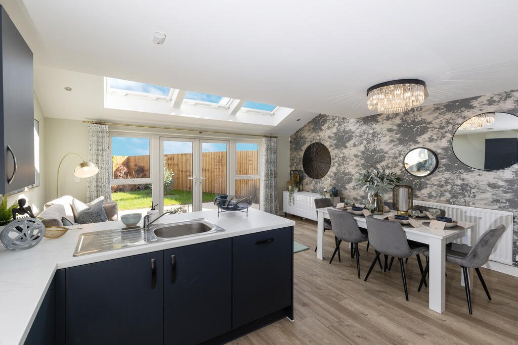
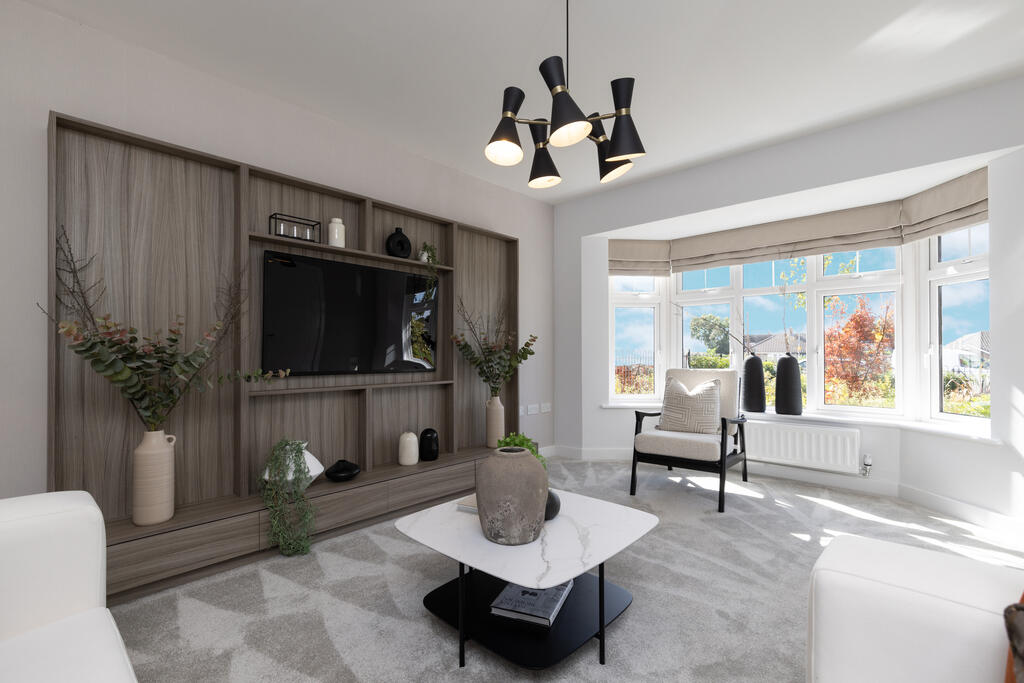
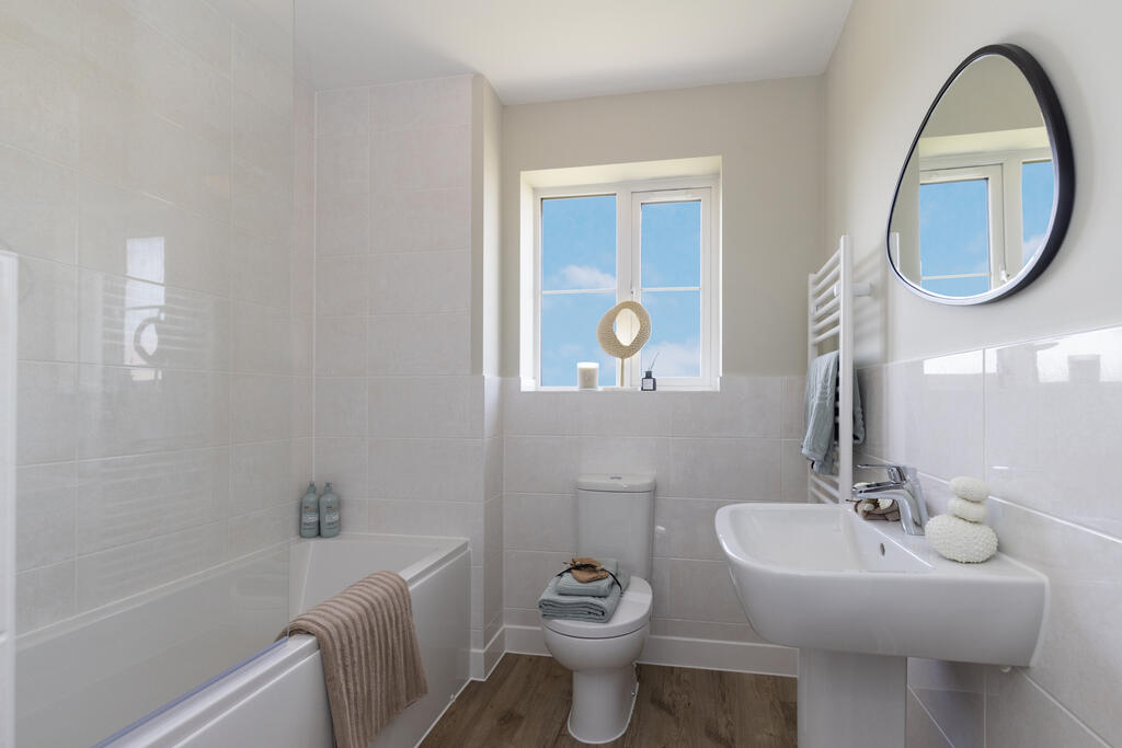
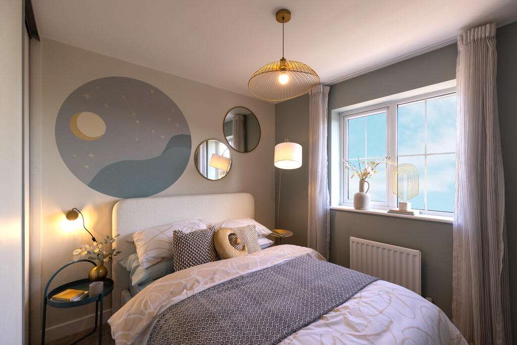
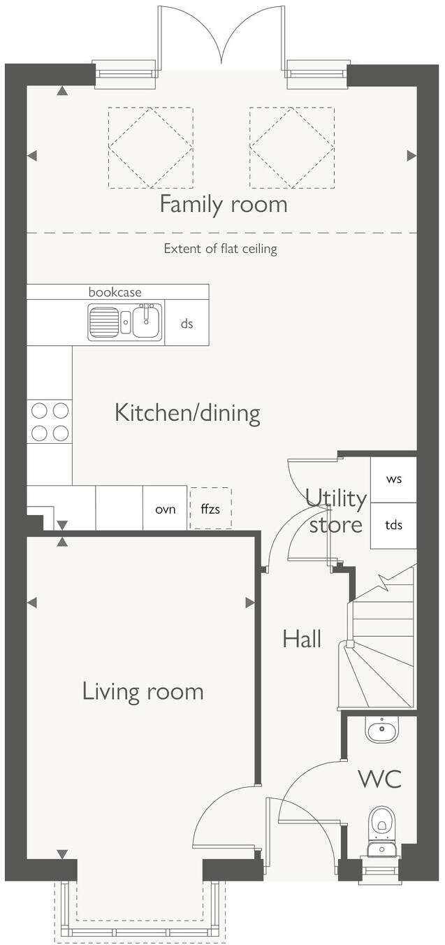
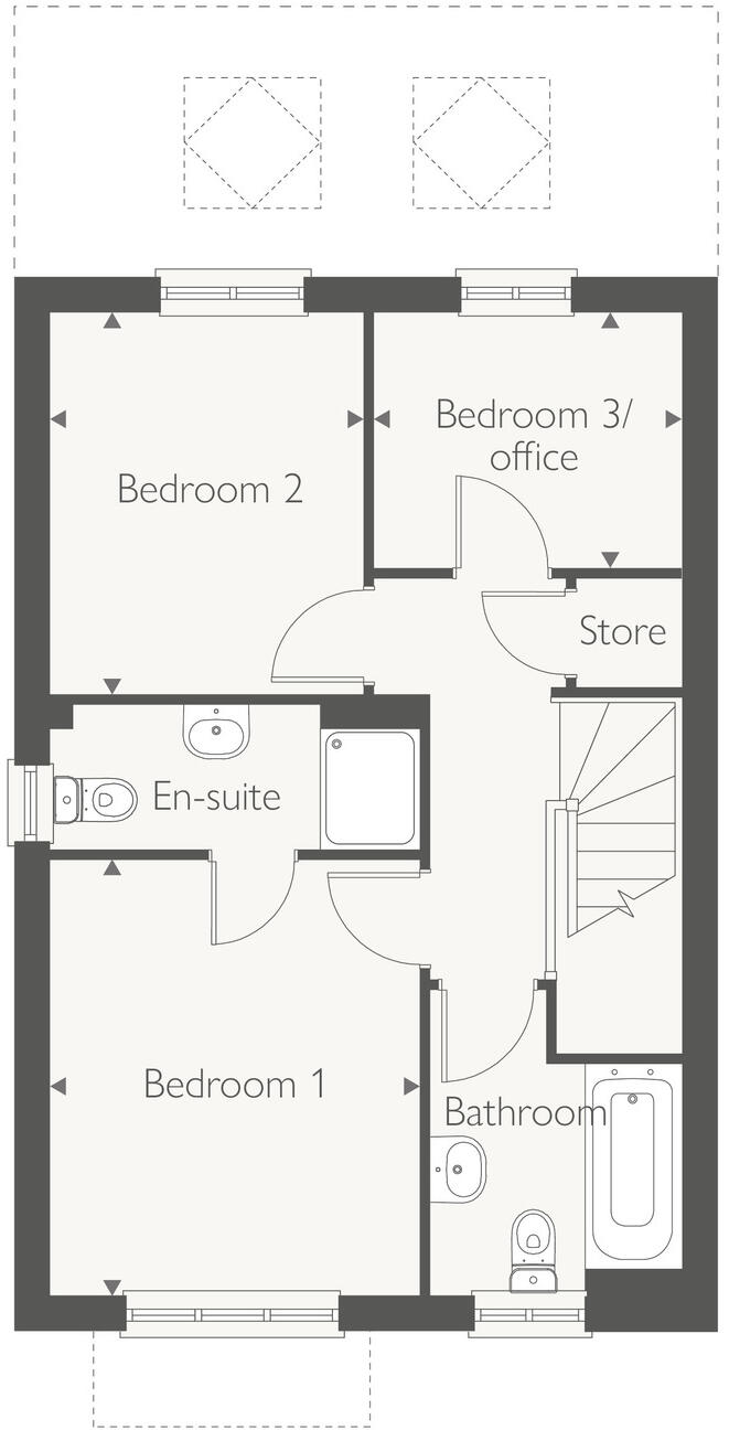
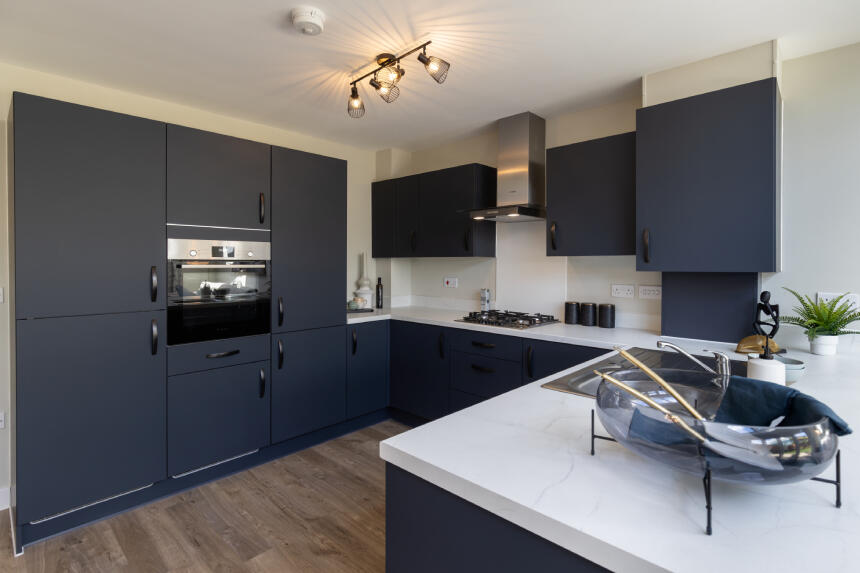
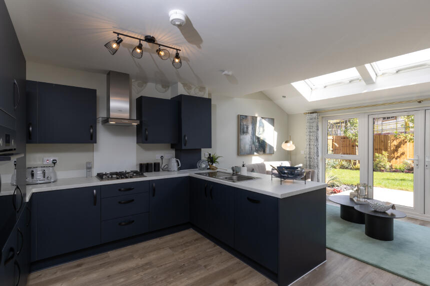
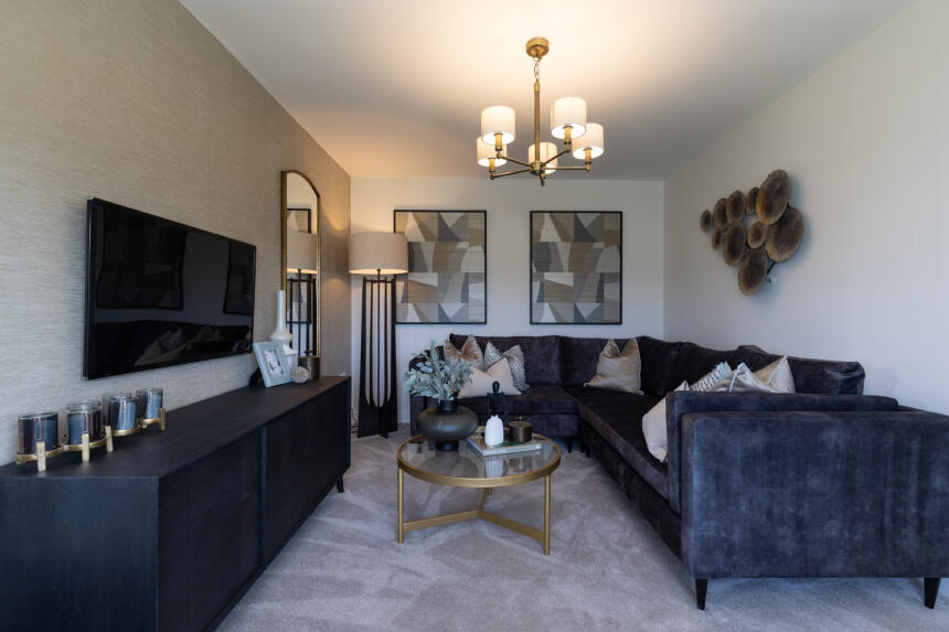
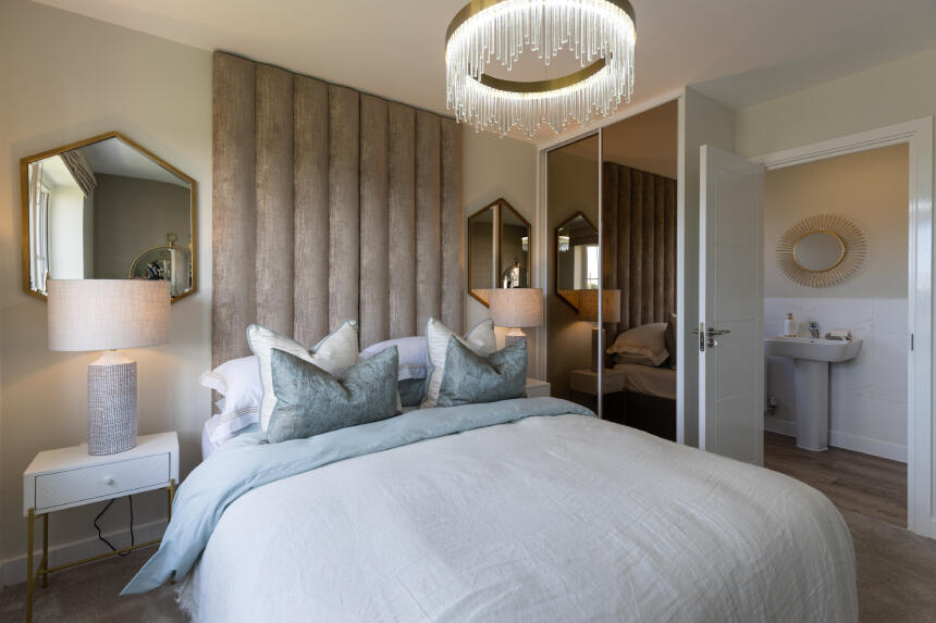
Take a look at our superb light and airy home, The Ashop, featuring an open plan kitchen/dining/family room with French doors leading out to the private garden. Over this well proportioned room you will find three skylight windows which fill the space with natural light. The ground fl...
Property Oracle says ..
Therefore, we give this property 6 / 10. *Disclaimer: This is our option and does constitute a recommendation or financial advice. Do your own research. *
- Price
- 4
- Condition
- 9
- Location
- 7
- Land
- 7
- Bedrooms
- 3
- Bathrooms
- 0
- Sqft (est)
- 582.00
The heatmap indicates the level of crime in the area. The color of the heatmap indicates the crime severity and recency.
Metrics Year-on-Year
- Average area value
- 257,222.00 £Decreased by 8.17 %
- Est sale value
- 144,336.00 £Increased by 16.43 %
- Average area rental value
- 1,100.00 £/moIncreased by 7.32 %
- Est letting value
- 582.00 £/mo
- Est rental Yield
- 5.13 %Increased by 16.86 %
- Crime Rate
- 6.00 %Unchanged by 0.00 %
from 280,098.00 £
from 123,966.00 £
from 1,025.00 £/mo
from 0.00 £/mo
from 4.39 %
from 6.00 %
Agent Activity
Countryside Partnerships North created the listing.
Nearby Schools
| Name | Type | Ofsted | Distance |
|---|---|---|---|
| Summerhill Primary School | Community School | Good | 0.41 KM |
| Maricourt Catholic High School | Voluntary Aided School | Requires improvement | 1.73 KM |
| Hudson Children'S Centre | Children's Centre | 1.99 KM | |
| Hudson Primary School | Community School | Good | 1.99 KM |
| St Andrews Church Of England Primary School, Maghull | Academy Converter | 2.02 KM |
Images


Nearby Streets
| Name | Average Price | Average Sqft | Distance |
|---|---|---|---|
| Goshawk Drive | £ 0 | 0 | 0.00 KM |
| Kingfisher Gardens | £ 0 | 0 | 0.00 KM |
| Harrier Close | £ 0 | 0 | 0.00 KM |
| Gadwall Close | £ 0 | 0 | 0.00 KM |
| Lancaster Close | £ 210,000 | 0 | 0.00 KM |
Nearby Transport
| Name | NLC | TLC | Distance |
|---|---|---|---|
| Maghull | 2155 | MAG | 0.91 KM |
| Maghull North | 6576 | MNS | 1.10 KM |
| Kirkby (Merseyside) | 2124 | KIR | 3.17 KM |
| Old Roan | 2258 | ORN | 3.85 KM |
| Town Green | 2283 | TWN | 4.47 KM |
Nearby Listings
| Address | Price | Type | Score | Distance |
|---|---|---|---|---|
| Poverty Lane, Maghull, L31 1GP | £ 427,000 | BUY | 6 / 10 | 0.00 KM |
| Poverty Lane, Maghull, L31 1GP | £ 355,000 | BUY | 7 / 10 | 0.00 KM |
| Poverty Lane, Maghull, L31 1GP | £ 355,000 | BUY | 6 / 10 | 0.00 KM |
| Poverty Lane, Maghull, L31 1GP | £ 435,000 | BUY | 6 / 10 | 0.00 KM |
| Poverty Lane, Maghull, L31 1GP | £ 380,000 | BUY | 7 / 10 | 0.00 KM |
Nearby Properties
| Address | Price | Distance |
|---|---|---|
| 114 Poverty Lane | £ 175,000 | 0.23 KM |
| 98 Poverty Lane | £ 149,500 | 0.23 KM |
| 110 Poverty Lane | £ 219,950 | 0.23 KM |
| 106 Poverty Lane | £ 176,500 | 0.23 KM |
| 108 Poverty Lane | £ 135,000 | 0.23 KM |