HA
Kensal Rise, Derby
By haart
£ 550
haart says ..
1 WEEKS RENT FREE TO MOVE IN BY 31/12/25
- Bedrooms
- 1
- Bathrooms
- 1
The heatmap indicates the level of crime in the area. The color of the heatmap indicates the crime severity and recency.
Metrics Year-on-Year
- Average area value
- 200,000.00 £Increased by 1.02 %
- Average area rental value
- 674.00 £/moDecreased by 6.91 %
- Est rental Yield
- 4.04 %Decreased by 7.97 %
- Crime Rate
- 4.00 %Unchanged by 0.00 %
from 197,971.00 £
from 724.00 £/mo
from 4.39 %
from 4.00 %
Agent Activity
haart created the listing.
Nearby Schools
| Name | Type | Ofsted | Distance |
|---|---|---|---|
| Brackensdale Spencer Academy | Academy Sponsor Led | 0.35 KM | |
| Royal School For The Deaf Derby | Non-maintained Special School | Good | 1.32 KM |
| Reigate Park Primary Academy | Academy Sponsor Led | 1.49 KM | |
| Mackworth Morley Children'S Centre | Children's Centre | 1.53 KM | |
| The Bemrose School | Foundation School | Good | 1.74 KM |
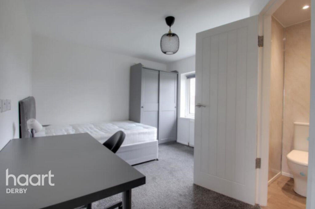
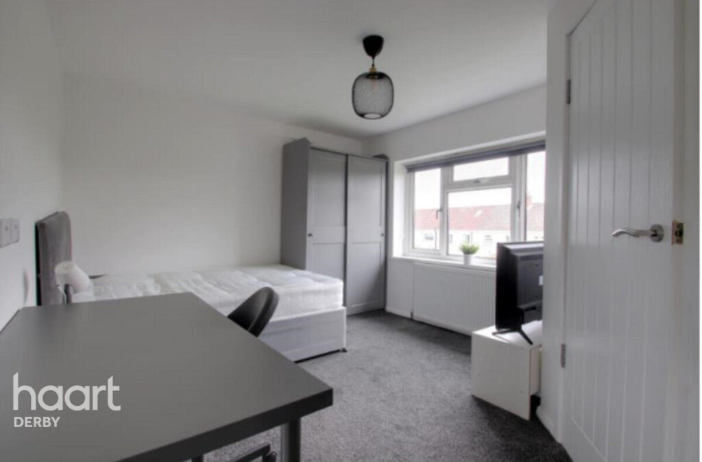
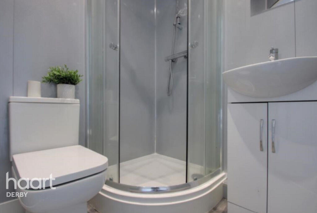
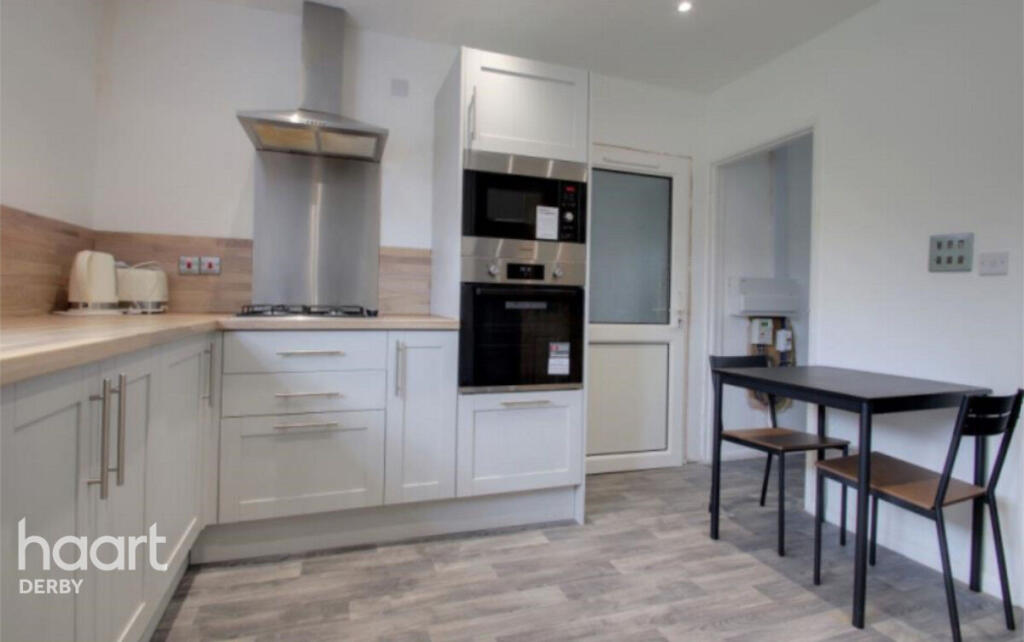
Images


Nearby Streets
| Name | Average Price | Average Sqft | Distance |
|---|---|---|---|
| Finsbury Avenue | £ 195,000 | 0 | 0.00 KM |
| Thurcroft Close | £ 0 | 0 | 0.00 KM |
| Raleigh Street | £ 0 | 0 | 0.00 KM |
| Bright Street | £ 190,000 | 0 | 0.00 KM |
| Bramble Drive | £ 284,950 | 0 | 0.00 KM |
Nearby Transport
| Name | NLC | TLC | Distance |
|---|---|---|---|
| Peartree | 1687 | PEA | 5.53 KM |
| Derby | 1823 | DBY | 5.59 KM |
| Duffield | 1691 | DFI | 7.38 KM |
| Willington | 1905 | WIL | 9.96 KM |
Nearby Listings
| Address | Price | Type | Score | Distance |
|---|---|---|---|---|
| Kensal Rise, Derby | £ 550 | RENT | Unknown | 0.00 KM |
| Kensal Rise, DERBY | £ 2,000 | RENT | Unknown | 0.09 KM |
| Enfield Road, Mackworth, Derby, DE22 | £ 900 | RENT | Unknown | 0.31 KM |
| Raleigh Street, Derby, DE22 | £ 1,090 | RENT | Unknown | 0.46 KM |
| Enfield Road, Mackworth, Derby | £ 750 | RENT | Unknown | 0.50 KM |
Nearby Properties
| Address | Price | Distance |
|---|---|---|
| 73 Kensal Rise | £ 102,000 | 0.09 KM |
| 54 Kensal Rise | £ 116,000 | 0.09 KM |
| 49 Kensal Rise | £ 155,000 | 0.09 KM |
| 34 Kensal Rise | £ 172,250 | 0.09 KM |
| 42 Kensal Rise | £ 145,000 | 0.09 KM |