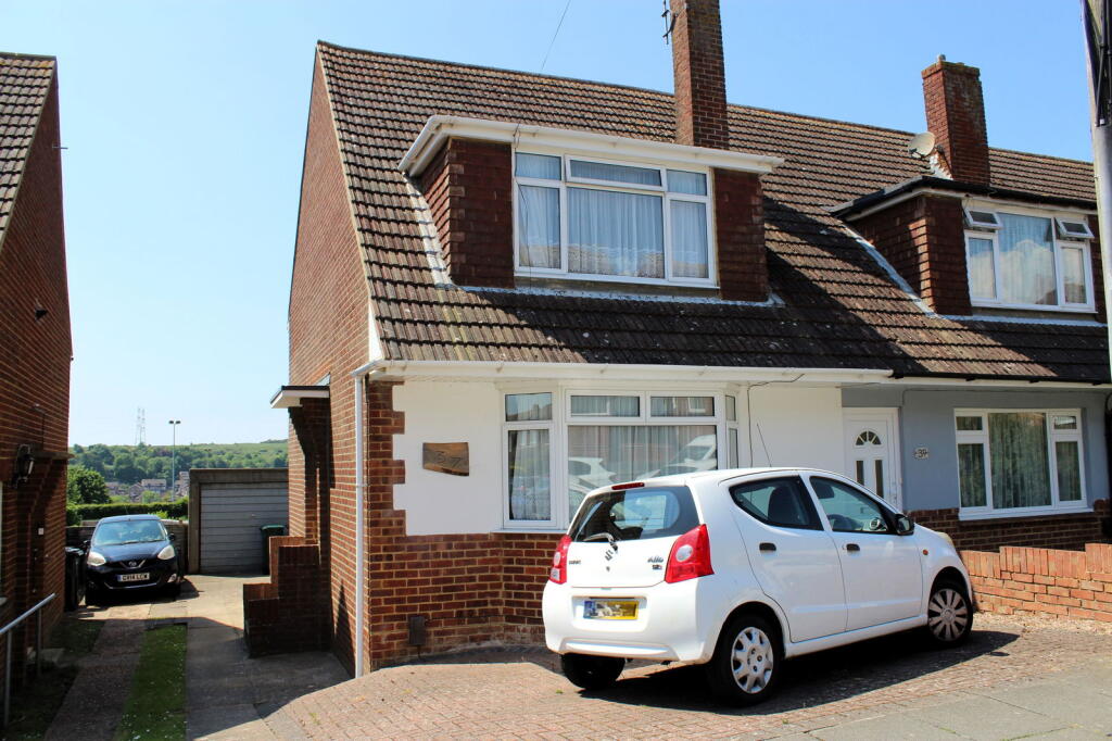
Broomfield Drive, Portslade, Brighton, BN41 2YU
By Royall Best
£ 340,000
Reviews
3 out of 5 stars
Royall Best says ..
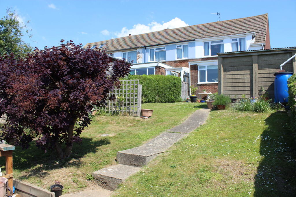
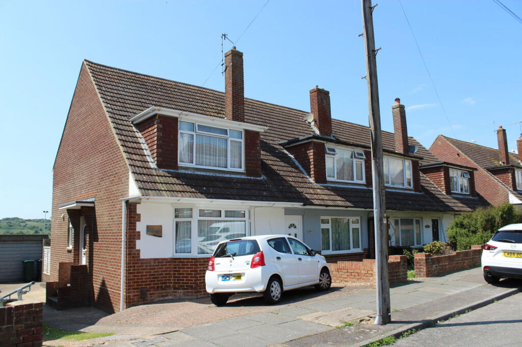
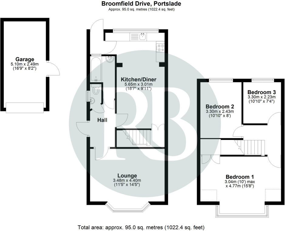
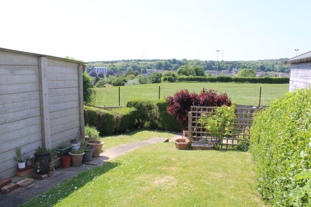
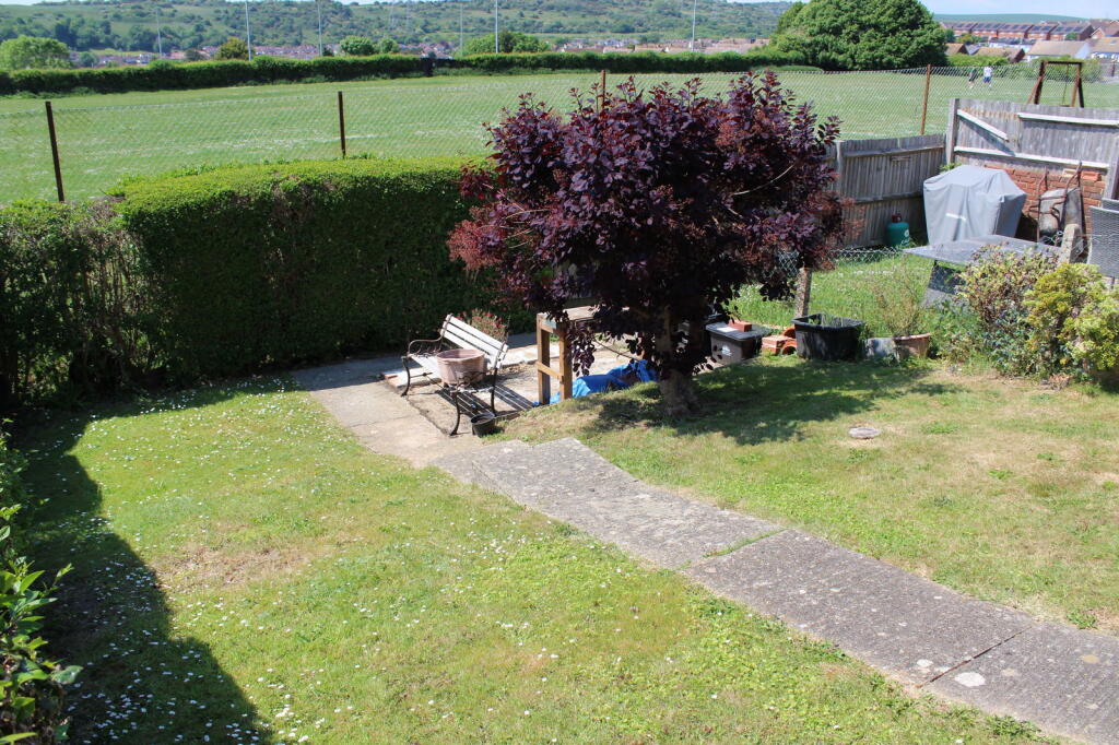
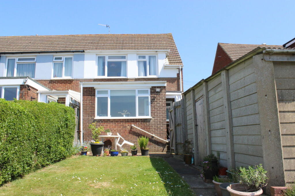
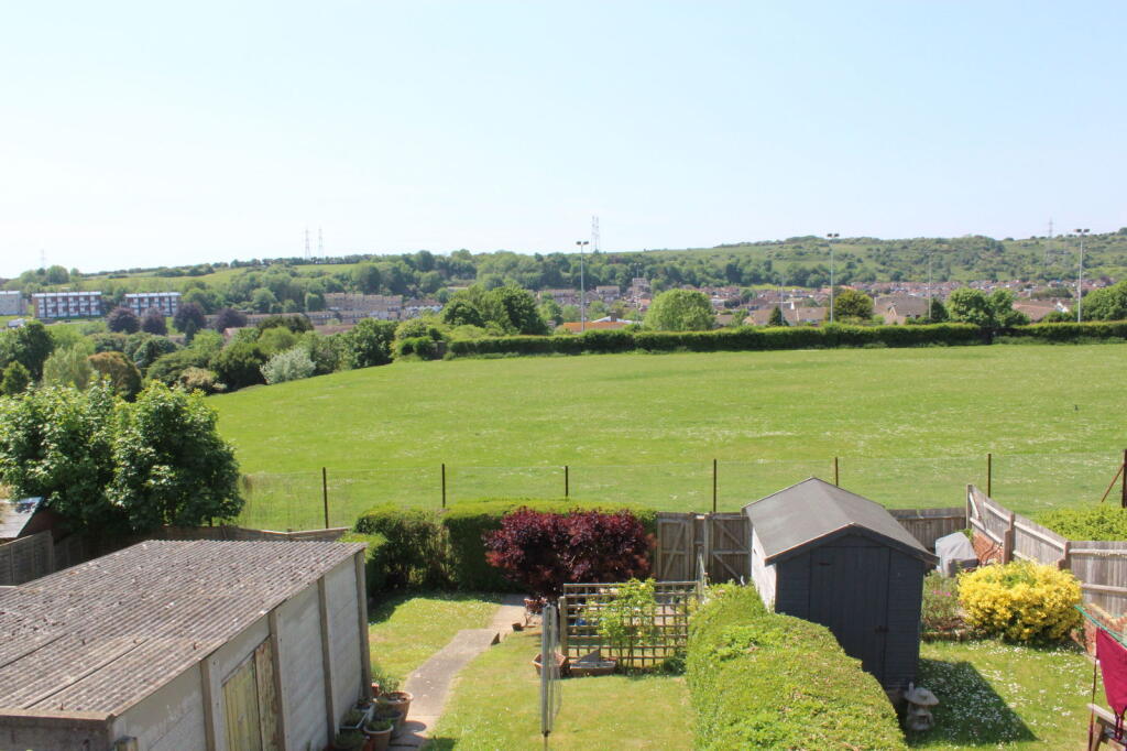
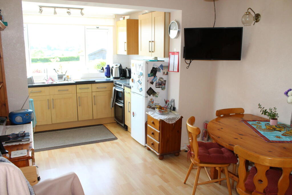
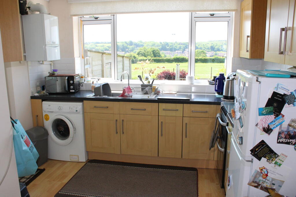
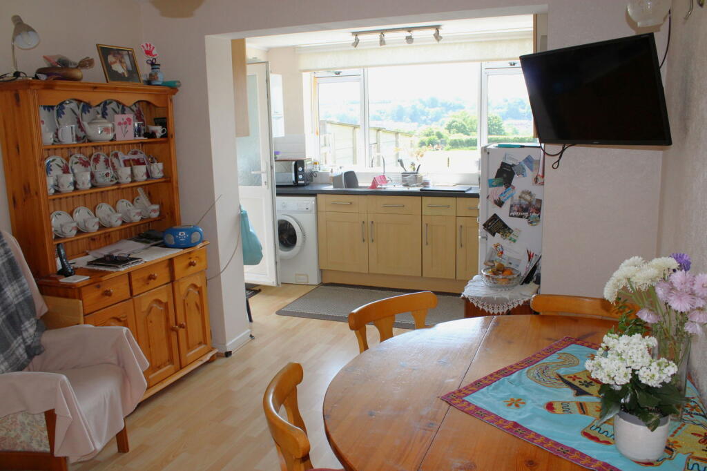
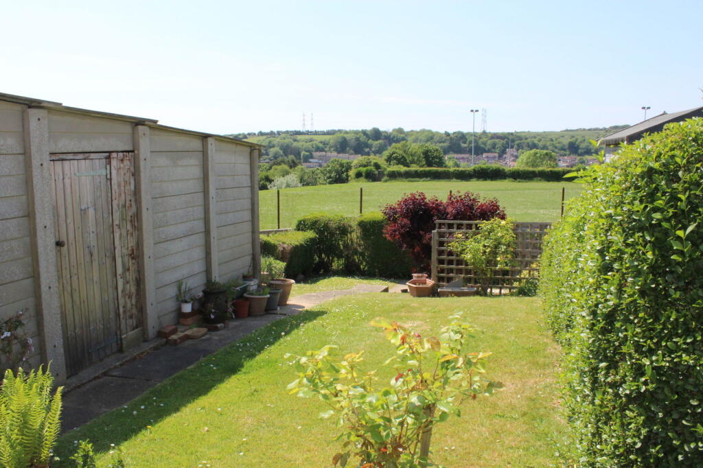
3 Bed house with a West facing garden and an open outlook over an open green. Separate lounge and good sized kitchen/diner, private parking and a garage
Property Oracle says ..
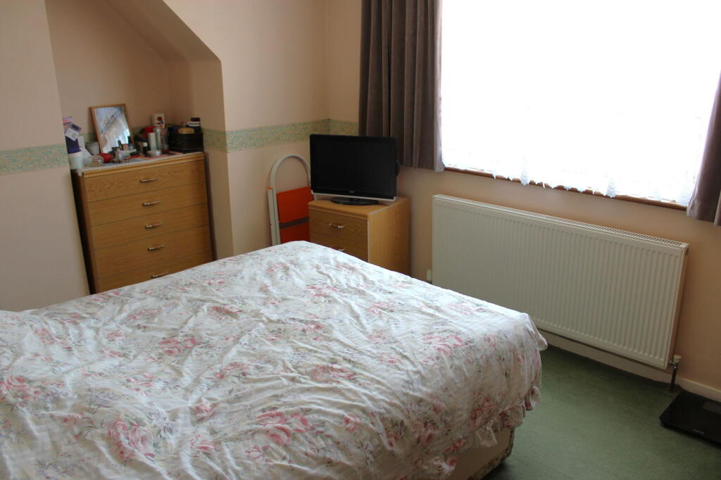
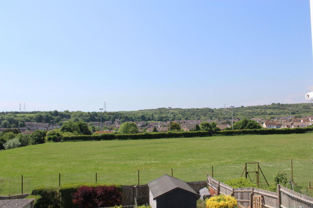
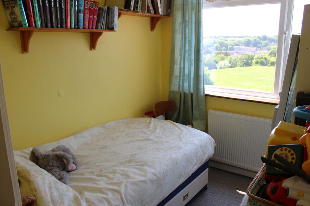
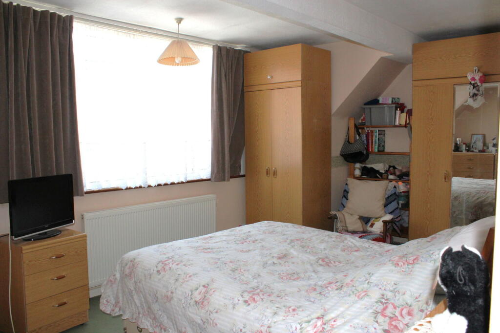
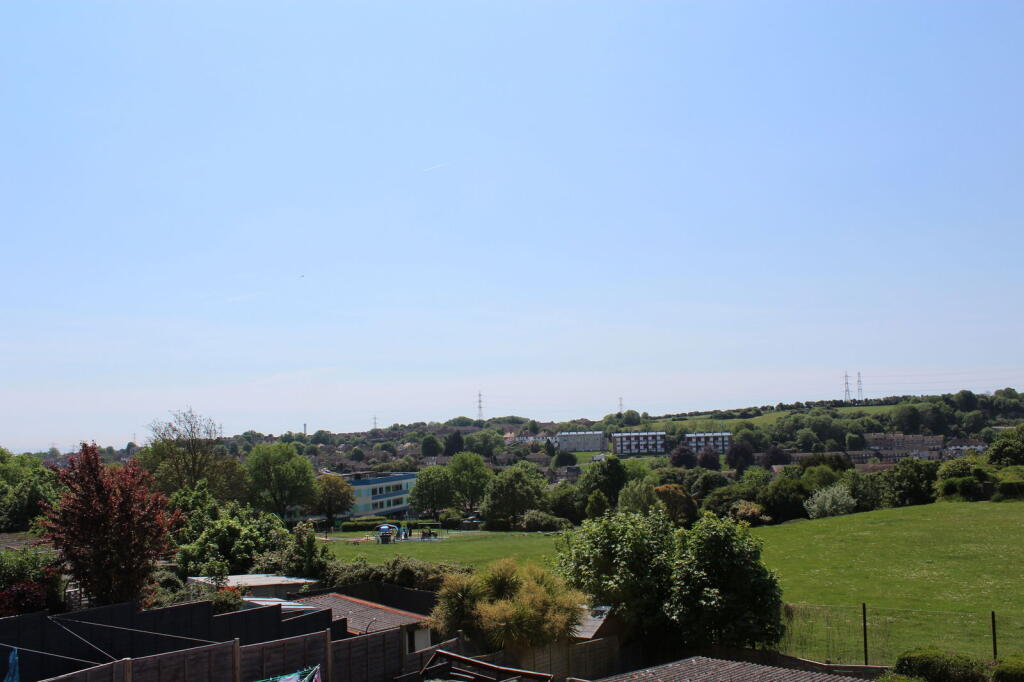
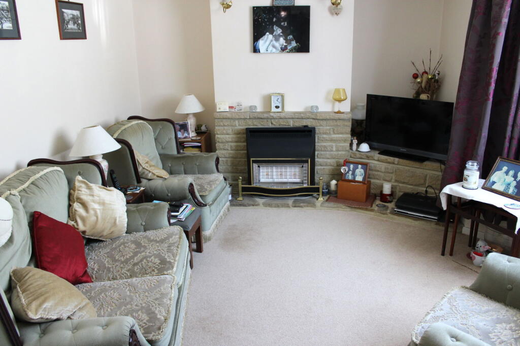
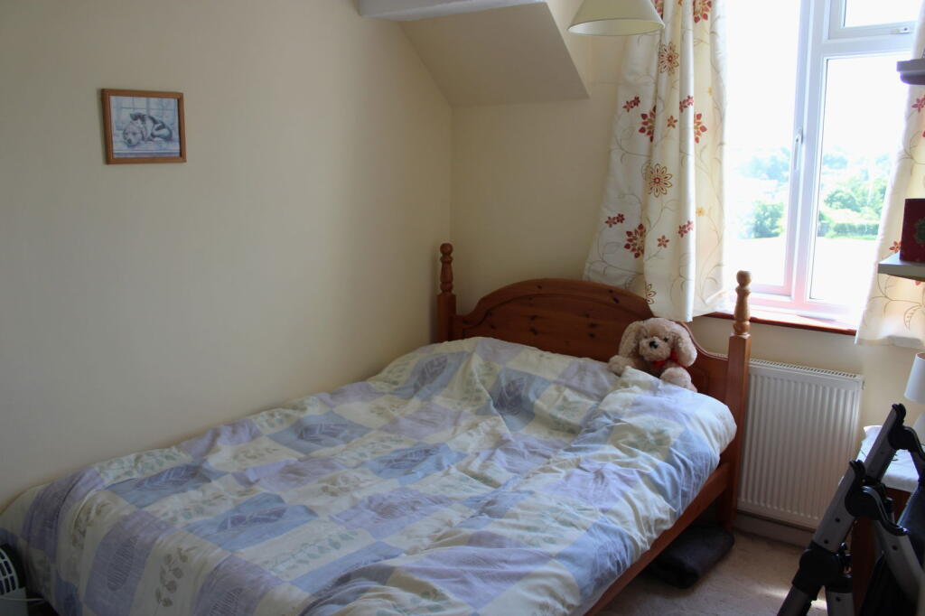
The property is located in Portslade, Brighton, a suburb with a mix of housing types. The area benefits from relatively close proximity to several primary and secondary schools, with varying Ofsted ratings. The nearby railway station offers convenient access to Brighton and other locations. The area appears to be residential with a mix of housing stock and some green spaces visible in the photos. The average house price in the area is significantly higher than the list price of this property, suggesting it may be underpriced. However, the average house size is also considerably larger. The property itself appears to be a three-bedroom end-of-terrace house. Based on the provided images, the property seems to be in reasonable condition, though some minor cosmetic updates might enhance its appeal. The interior shows a traditional style, with some dated fixtures and fittings. The garden is a notable feature, offering a good-sized outdoor space, though it could benefit from some landscaping. Considering the property’s location, condition, and the size of its plot, the list price of £340,000 appears to be relatively low compared to the area average. However, the lack of sqft data for nearby properties makes a precise comparison difficult. The smaller size of the property compared to the area average needs to be considered when assessing value. The lower price may reflect the need for some modernisation.
Therefore, we give this property 7 / 10. *Disclaimer: This is our option and does constitute a recommendation or financial advice. Do your own research. *
- Price
- 8
- Condition
- 7
- Location
- 7
- Land
- 7
- Bedrooms
- 3
- Bathrooms
- 1
- Sqft (est)
- 808.59
- Lot (est)
- 1,022.57
The heatmap indicates the level of crime in the area. The color of the heatmap indicates the crime severity and recency.
Metrics Year-on-Year
- Average area value
- 653,333.00 £Increased by 3.57 %
- Est sale value
- 485,962.59 £Increased by 8.29 %
- Average area rental value
- 1,250.00 £/moDecreased by 27.20 %
- Est letting value
- 808.59 £/moUnchanged by 0.00 %
- Est rental Yield
- 2.30 %Decreased by 29.66 %
- Crime Rate
- 5.00 %Unchanged by 0.00 %
Agent Activity
Royall Best created the listing.
Nearby Schools
| Name | Type | Ofsted | Distance |
|---|---|---|---|
| Portslade Aldridge Community Academy | Academy Sponsor Led | Good | 0.33 KM |
| Mile Oak Primary School | Community School | Requires improvement | 0.52 KM |
| North Portslade Children'S Centre | Children's Centre | 0.78 KM | |
| Hill Park School | Community Special School | Outstanding | 1.10 KM |
| Peter Gladwin Primary School | Community School | Good | 1.11 KM |
Images
Nearby Streets
| Name | Average Price | Average Sqft | Distance |
|---|---|---|---|
| Croft Drive | £ 0 | 0 | 0.00 KM |
| Harebell Drive | £ 400,000 | 0 | 0.00 KM |
| Beech Close | £ 500,000 | 0 | 0.00 KM |
| Swallows Rise | £ 400,000 | 0 | 0.00 KM |
| Nursery Close | £ 0 | 0 | 0.00 KM |
Nearby Transport
| Name | NLC | TLC | Distance |
|---|---|---|---|
| Fishersgate | 5284 | FSG | 2.13 KM |
| Southwick | 5286 | SWK | 2.63 KM |
| Portslade | 5276 | PLD | 2.80 KM |
| Aldrington | 5280 | AGT | 4.79 KM |
| Shoreham-By-Sea | 5277 | SSE | 5.68 KM |
Nearby Listings
| Address | Price | Type | Score | Distance |
|---|---|---|---|---|
| Broomfield Drive, Portslade, Brighton, BN41 2YU | £ 340,000 | BUY | 7 / 10 | 0.00 KM |
| Broomfield Drive, Portslade | £ 400,000 | BUY | 6 / 10 | 0.02 KM |
| Broomfield Drive, Portslade | £ 375,000 | BUY | 7 / 10 | 0.05 KM |
| Broomfield Drive, Portslade, Brighton | £ 400,000 | BUY | 6 / 10 | 0.05 KM |
| Broomfield Drive, Portslade, BN41 | £ 325,000 | BUY | 5 / 10 | 0.07 KM |
Nearby Properties
| Address | Price | Distance |
|---|---|---|
| 3 Broomfield Drive | £ 173,000 | 0.04 KM |
| 26 Broomfield Drive | £ 185,000 | 0.04 KM |
| 38 Broomfield Drive | £ 172,600 | 0.04 KM |
| 36 Broomfield Drive | £ 184,950 | 0.04 KM |
| 14 Broomfield Drive | £ 172,500 | 0.04 KM |