
|Ref: R207331|, Southbrook Rise, Millbrook Road East, Southampton, SO15 1BX
By Century21 Southampton
£ 975
Century21 Southampton says ..
| *** AVAILABLE FROM 25/08/2024 *** | *** VIDEO TOUR LINK ATTACHED *** | *** MINUTES WALK FROM SOUTHAMPTON CENTRAL STATION *** | *** ONE ALLOCATED PARKING SPACE FOR ONE CAR *** | *** CLOSE PROXIMITY TO CITY CENTRE *** | *** LIFT ACCESS TO ALL FLOORS *** | *** COUNCIL TAX BAND: A *** | *** WATER B...
- Bedrooms
- 1
- Bathrooms
- 1
The heatmap indicates the level of crime in the area. The color of the heatmap indicates the crime severity and recency.
Metrics Year-on-Year
- Average area value
- 345,413.00 £Increased by 43.37 %
- Average area rental value
- 1,031.00 £/moDecreased by 7.37 %
- Est rental Yield
- 3.58 %Decreased by 35.38 %
- Crime Rate
- 41.00 %Unchanged by 0.00 %
from 240,922.00 £
from 1,113.00 £/mo
from 5.54 %
from 41.00 %
Agent Activity
Century21 Southampton created the listing.
Nearby Schools
| Name | Type | Ofsted | Distance |
|---|---|---|---|
| The Polygon School | Foundation Special School | Good | 0.54 KM |
| Springhill Catholic Primary School | Academy Converter | 0.65 KM | |
| Freemantle Sure Start Children Centre | Children's Centre | 1.08 KM | |
| St Mark'S Church Of England Voluntary Controlled Primary School | Voluntary Controlled School | Good | 1.09 KM |
| Freemantle Church Of England Community Academy | Academy Converter | Good | 1.12 KM |
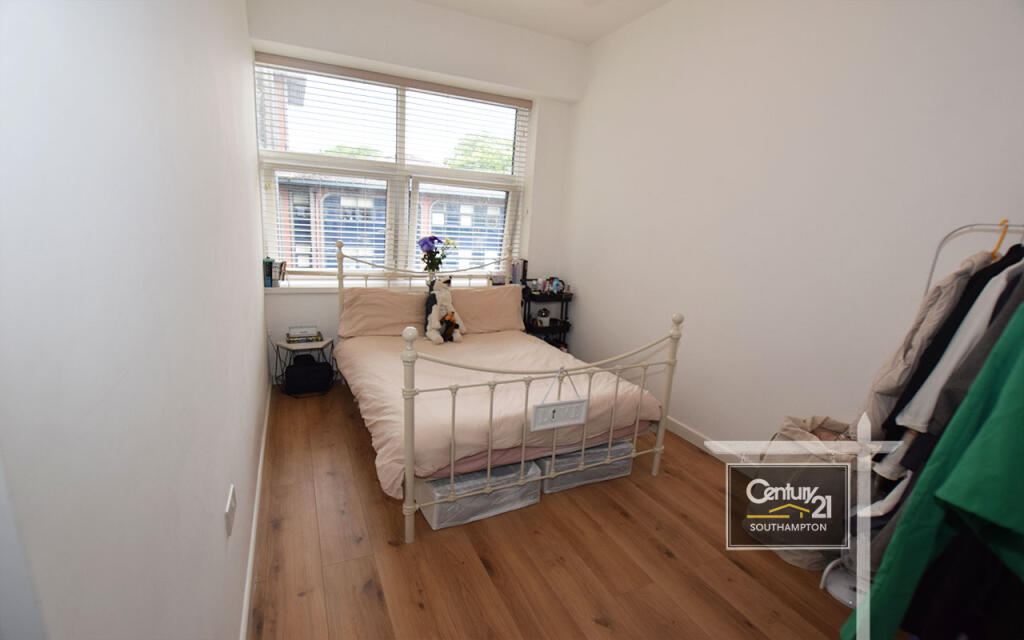
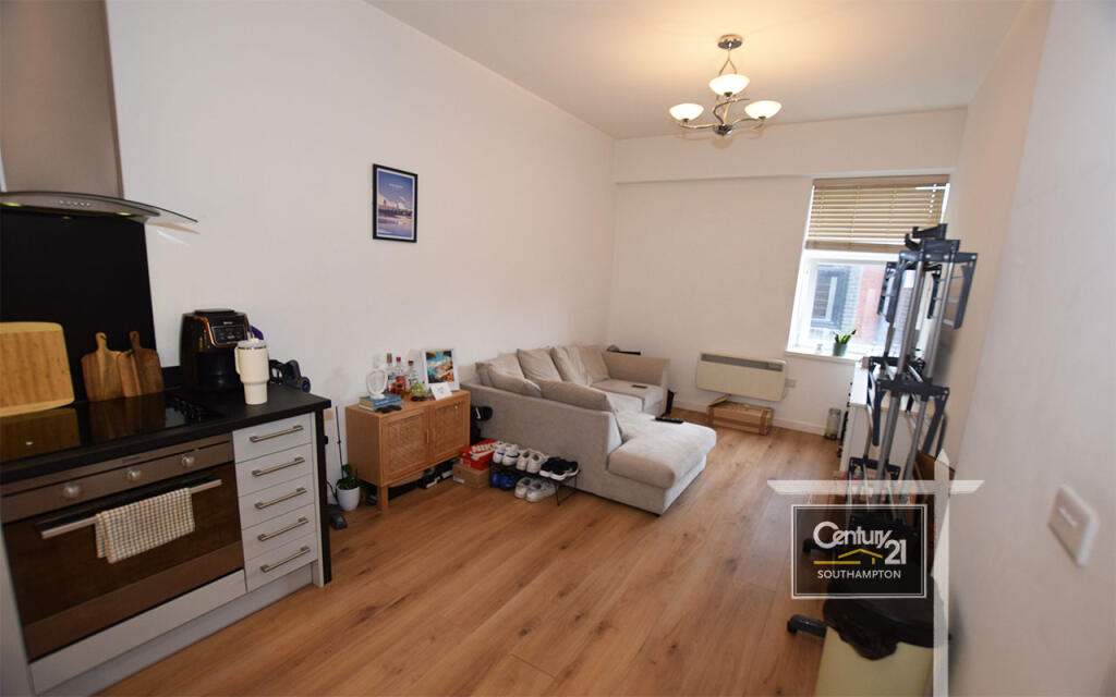
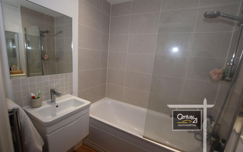
Images


Nearby Streets
| Name | Average Price | Average Sqft | Distance |
|---|---|---|---|
| Morris Road | £ 0 | 0 | 0.00 KM |
| Saxon Road | £ 0 | 0 | 0.00 KM |
| Commercial Road | £ 0 | 0 | 0.00 KM |
| Leroux Close | £ 0 | 0 | 0.00 KM |
| Western District Cut | £ 0 | 0 | 0.00 KM |
Nearby Transport
| Name | NLC | TLC | Distance |
|---|---|---|---|
| Southampton Central | 5932 | SOU | 0.39 KM |
| Millbrook (Hants) | 5909 | MBK | 1.90 KM |
| St Denys | 5914 | SDN | 3.59 KM |
| Woolston | 5925 | WLS | 4.54 KM |
| Bitterne | 5945 | BTE | 4.57 KM |
Nearby Listings
| Address | Price | Type | Score | Distance |
|---|---|---|---|---|
| Southbook Rise, Millbrook Road East, Southampton SO15 1BX | £ 850 | RENT | Unknown | 0.00 KM |
| |Ref: R207331|, Southbrook Rise, Millbrook Road East, Southampton, SO15 1BX | £ 975 | RENT | Unknown | 0.00 KM |
| Millbrook Road East, Southampton, SO15 | £ 1,300 | RENT | Unknown | 0.00 KM |
| Millbrook Road East, Southampton, Hampshire, SO15 | £ 925 | RENT | Unknown | 0.02 KM |
| Millbrook Road East, Southampton, Hampshire, SO15 | £ 925 | RENT | Unknown | 0.02 KM |
Nearby Properties
| Address | Price | Distance |
|---|---|---|
| 46a Shirley Road | £ 124,500 | 0.14 KM |
| 38 Mandela Way | £ 164,000 | 0.15 KM |
| 45 Mandela Way | £ 155,000 | 0.15 KM |
| 10 Mandela Way | £ 131,000 | 0.15 KM |
| 27 Mandela Way | £ 218,500 | 0.15 KM |