LE
The Parade, Hove, BN3 7LU
By Leaders Lettings
£ 1,200
Leaders Lettings says ..
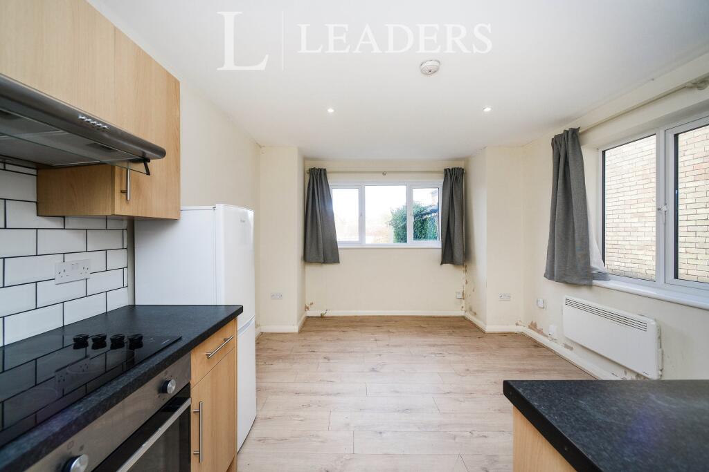
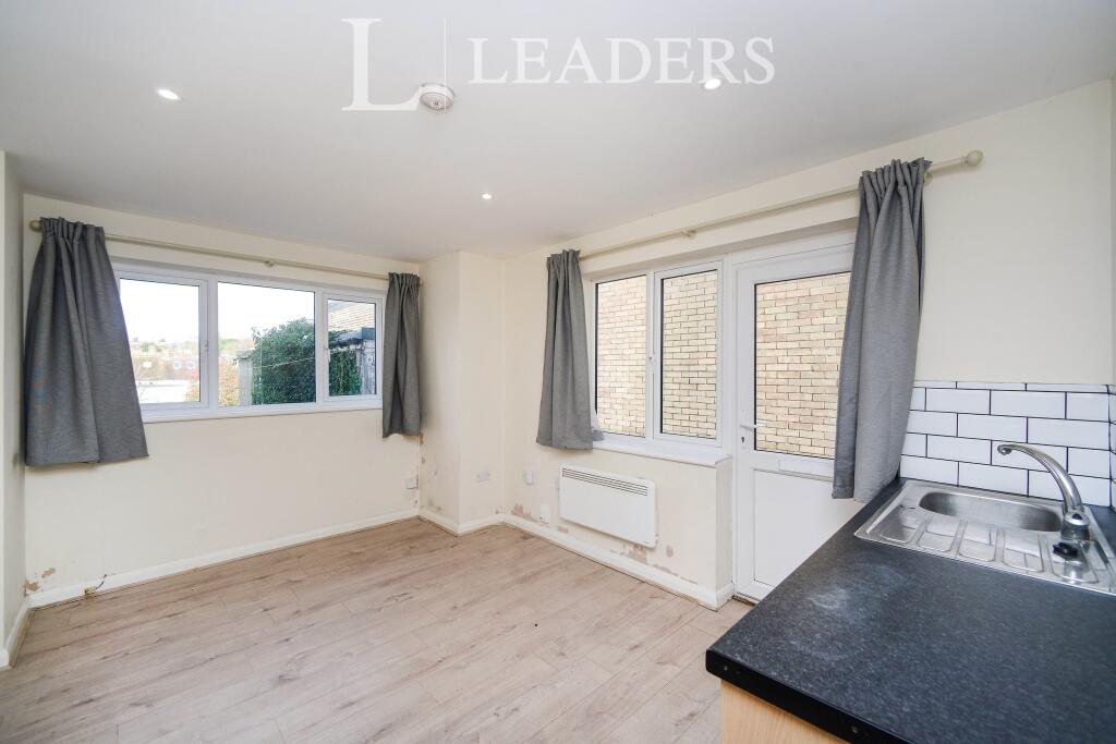
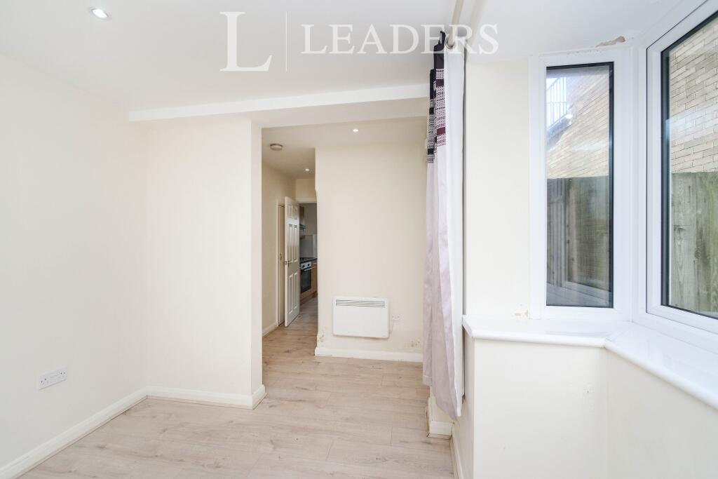
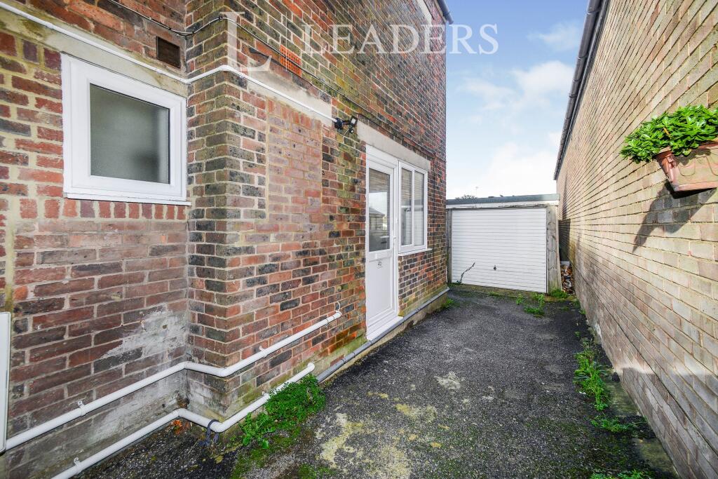
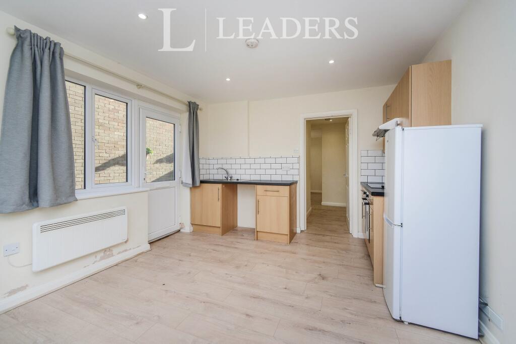
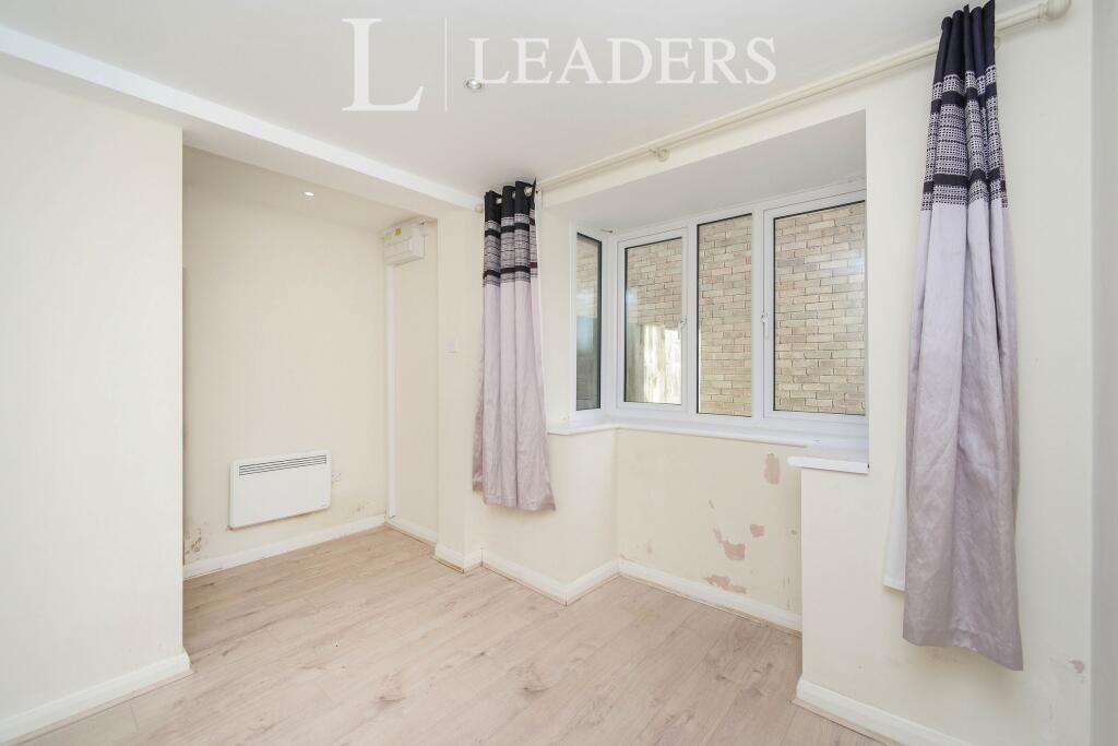
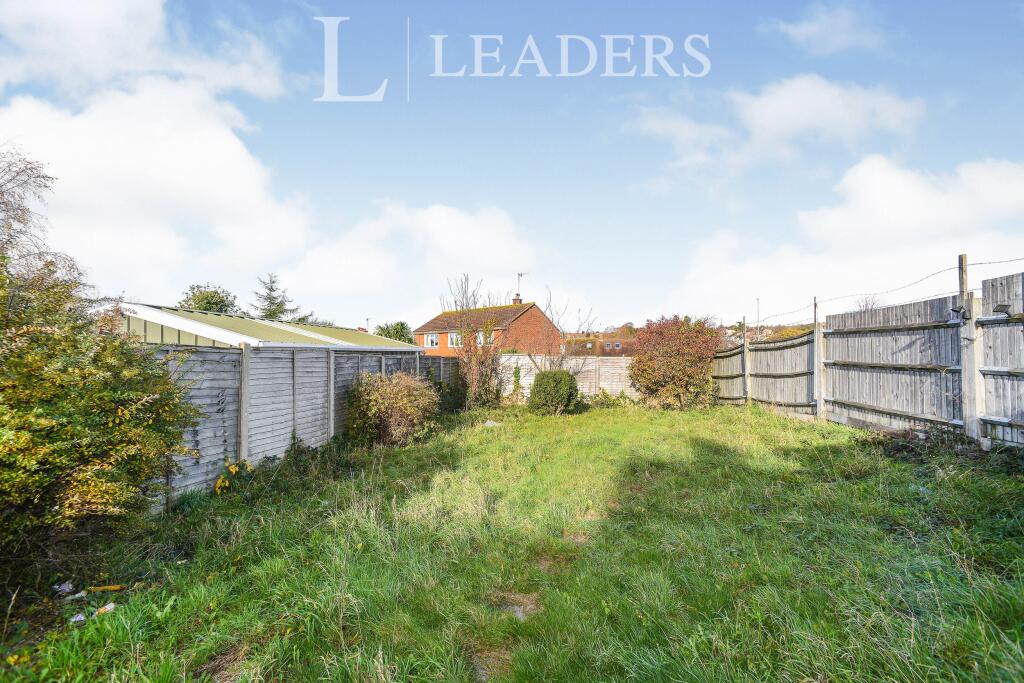
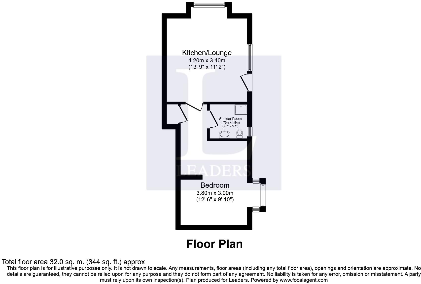
A one bedroom ground floor flat with own entrance and private garden.
- Bedrooms
- 1
- Bathrooms
- 1
The heatmap indicates the level of crime in the area. The color of the heatmap indicates the crime severity and recency.
Metrics Year-on-Year
- Average area value
- 510,000.00 £Increased by 6.25 %
- Average area rental value
- 2,722.00 £/moIncreased by 34.02 %
- Est rental Yield
- 6.40 %Increased by 25.98 %
- Crime Rate
- 17.00 %Unchanged by 0.00 %
from 479,985.00 £
from 2,031.00 £/mo
from 5.08 %
from 17.00 %
Agent Activity
Leaders Lettings created the listing.
Nearby Schools
| Name | Type | Ofsted | Distance |
|---|---|---|---|
| Goldstone Primary School | Community School | Good | 0.40 KM |
| Hangleton Primary School | Community School | Good | 0.42 KM |
| Hangleton Park Children'S Centre | Children's Centre | 0.85 KM | |
| West Blatchington Primary And Nursery School | Community School | Good | 1.07 KM |
| King'S School | Free Schools | Good | 1.13 KM |
Images


Nearby Streets
| Name | Average Price | Average Sqft | Distance |
|---|---|---|---|
| Laburnum Avenue | £ 0 | 0 | 0.00 KM |
| Poplar Close | £ 250,000 | 0 | 0.00 KM |
| Findon Close | £ 0 | 0 | 0.00 KM |
| The Meadows | £ 625,000 | 0 | 0.00 KM |
| Aldrington Place | £ 0 | 0 | 0.00 KM |
Nearby Transport
| Name | NLC | TLC | Distance |
|---|---|---|---|
| Portslade | 5276 | PLD | 1.50 KM |
| Aldrington | 5280 | AGT | 1.56 KM |
| Hove | 5273 | HOV | 2.91 KM |
| Fishersgate | 5284 | FSG | 2.92 KM |
| Preston Park | 5285 | PRP | 4.43 KM |
Nearby Listings
| Address | Price | Type | Score | Distance |
|---|---|---|---|---|
| The Parade, Hove, BN3 7LU | £ 1,200 | RENT | Unknown | 0.00 KM |
| West Way, Hove, BN3 | £ 2,500 | RENT | Unknown | 0.05 KM |
| West Way, Hove, BN3 | £ 2,500 | RENT | Unknown | 0.12 KM |
| West Way, Hove, BN3 | £ 2,995 | RENT | Unknown | 0.12 KM |
| Old School Place, Hove, East Sussex, BN3 | £ 1,800 | RENT | Unknown | 0.28 KM |
Nearby Properties
| Address | Price | Distance |
|---|---|---|
| 6 West Way | £ 320,000 | 0.05 KM |
| 14 West Way | £ 190,000 | 0.05 KM |
| 10 West Way | £ 650,000 | 0.05 KM |
| 5a West Way | £ 305,000 | 0.05 KM |
| 3a West Way | £ 170,000 | 0.05 KM |