LO
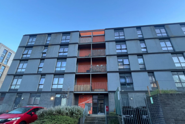
25 , WESTFIELD AVENUE , EH11 2TN
By Lowther Homes
£ 870
Lowther Homes says ..
2
- Bedrooms
- 2
- Bathrooms
- 0
The heatmap indicates the level of crime in the area. The color of the heatmap indicates the crime severity and recency.
Metrics Year-on-Year
- Average area value
- 201,550.00 £Increased by 9.41 %
- Average area rental value
- 1,253.00 £/moDecreased by 6.35 %
- Est rental Yield
- 7.46 %Decreased by 14.45 %
- Crime Rate
- 0.00 %
from 184,212.00 £
from 1,338.00 £/mo
from 8.72 %
from 0.00 %
Agent Activity
Lowther Homes created the listing.
Nearby Schools
| Name | Type | Ofsted | Distance |
|---|---|---|---|
| Merchiston Castle School | Offshore Schools | 3.10 KM | |
| Cargilfield School | Offshore Schools | 7.11 KM |
Images
Nearby Streets
| Name | Average Price | Average Sqft | Distance |
|---|---|---|---|
| Saughton Avenue | £ 0 | 0 | 0.00 KM |
| Baird Grove | £ 0 | 0 | 0.00 KM |
| Baird Terrace | £ 550,000 | 0 | 0.00 KM |
| Riversdale Road | £ 0 | 0 | 0.00 KM |
| Baird Gardens | £ 530,000 | 0 | 0.00 KM |
Nearby Transport
| Name | NLC | TLC | Distance |
|---|---|---|---|
| Slateford | 9236 | SLA | 1.29 KM |
| Haymarket | 9419 | HYM | 2.96 KM |
| Kingsknowe | 9217 | KGE | 3.16 KM |
| Wester Hailes | 9231 | WTA | 5.18 KM |
| South Gyle | 9318 | SGL | 6.12 KM |
Nearby Listings
| Address | Price | Type | Score | Distance |
|---|---|---|---|---|
| 25 , WESTFIELD AVENUE , EH11 2TN | £ 870 | RENT | Unknown | 0.00 KM |
| 26 , WESTFIELD AVENUE , EH11 2TY | £ 550 | RENT | Unknown | 0.09 KM |
| Westfield court, Gorgie, Edinburgh, EH11 | £ 1,500 | RENT | Unknown | 0.24 KM |
| Westfield court, Gorgie, Edinburgh, EH11 | £ 1,500 | RENT | Unknown | 0.24 KM |
| Westfield Court, Gorgie, Edinburgh, EH11 | £ 1,600 | RENT | Unknown | 0.24 KM |