DA
Hermon Hill, WANSTEAD, E11
By DABORACONWAY
£ 1,700
DABORACONWAY says ..
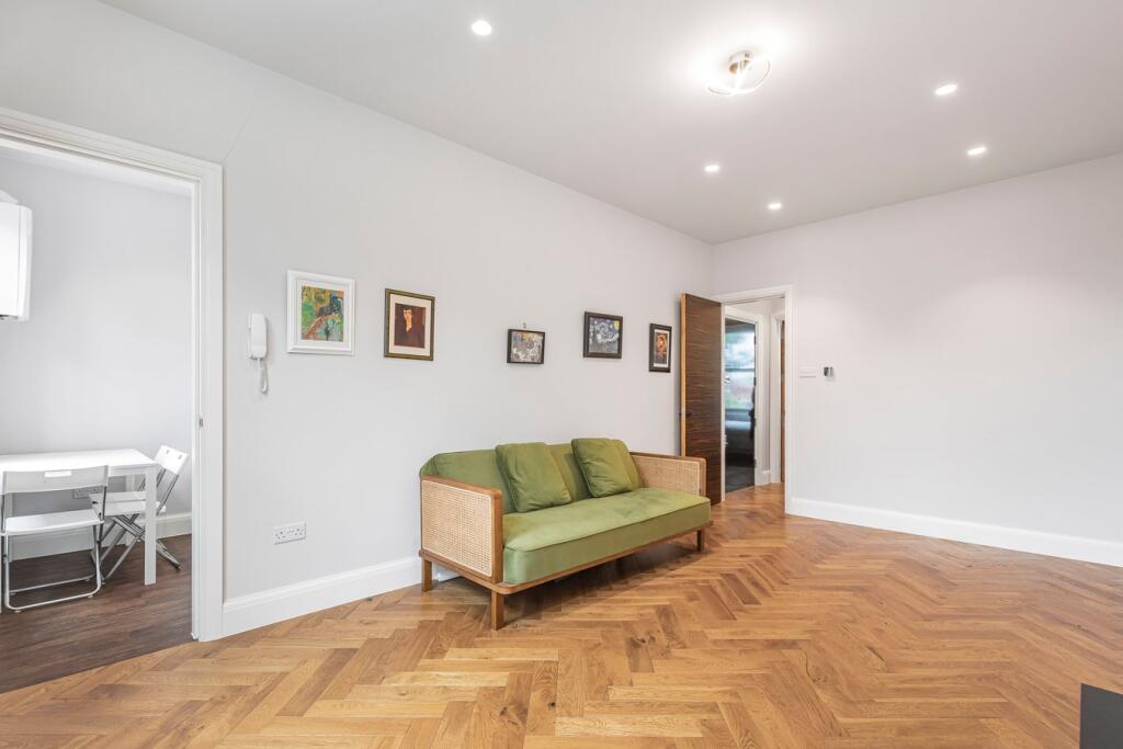
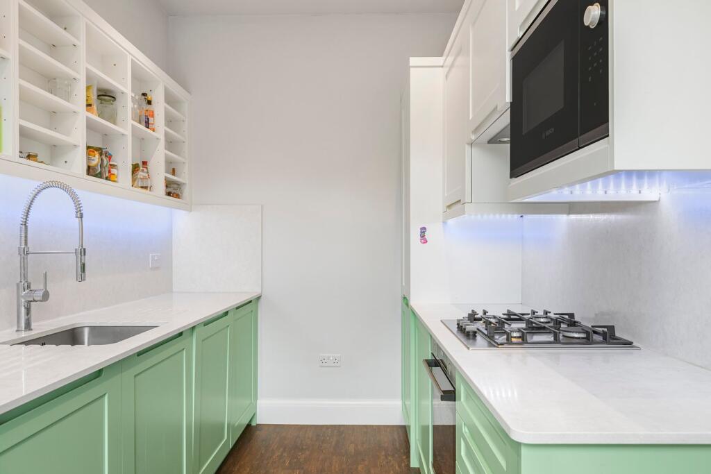
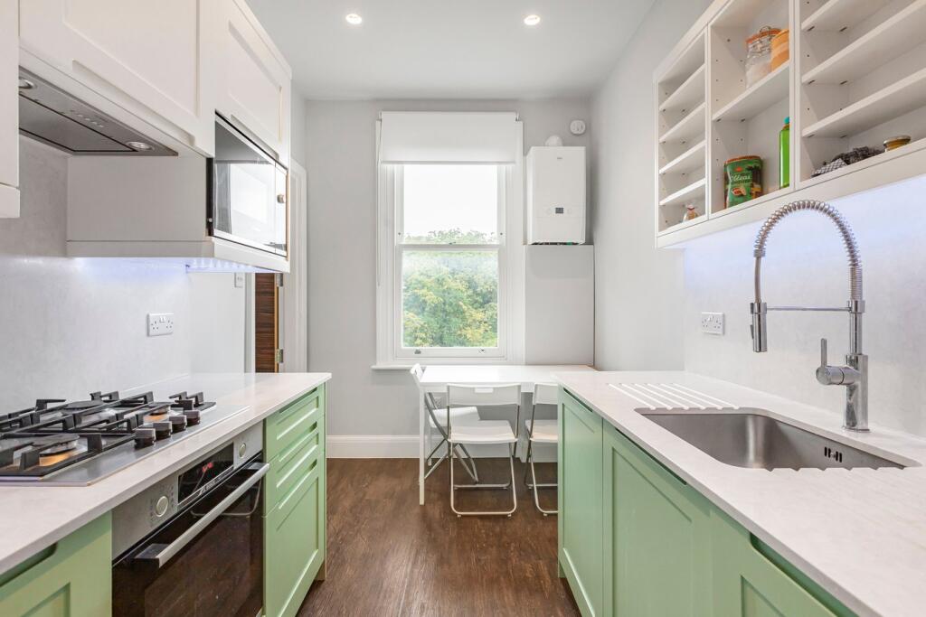
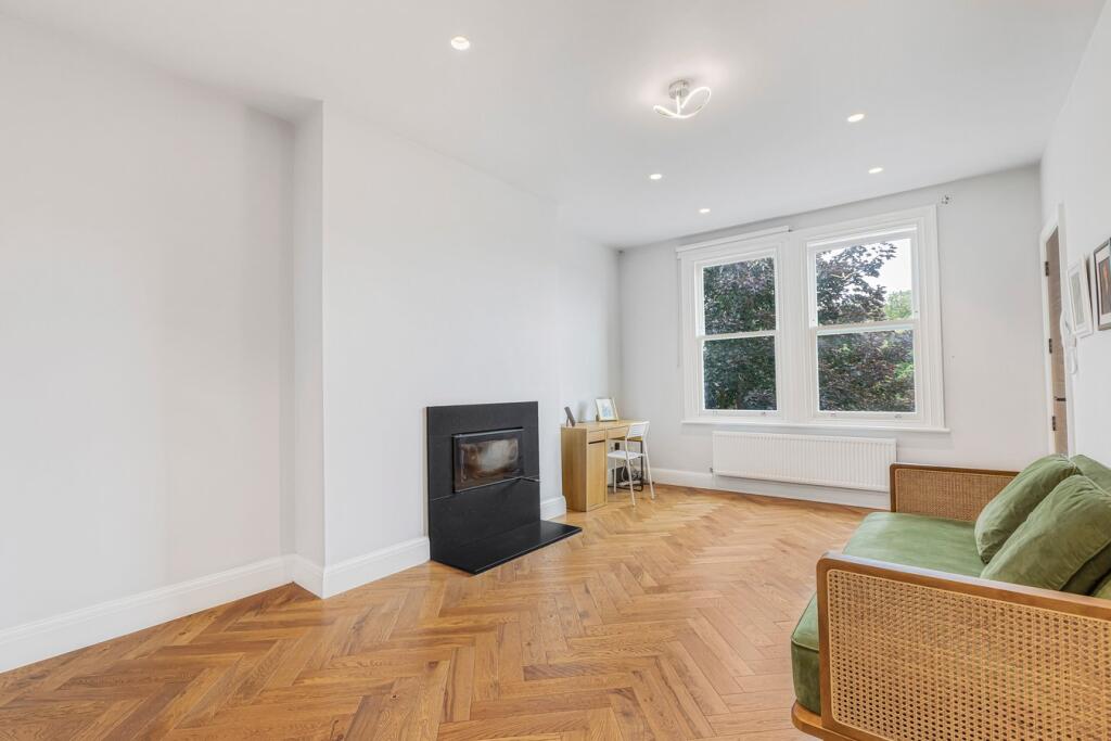
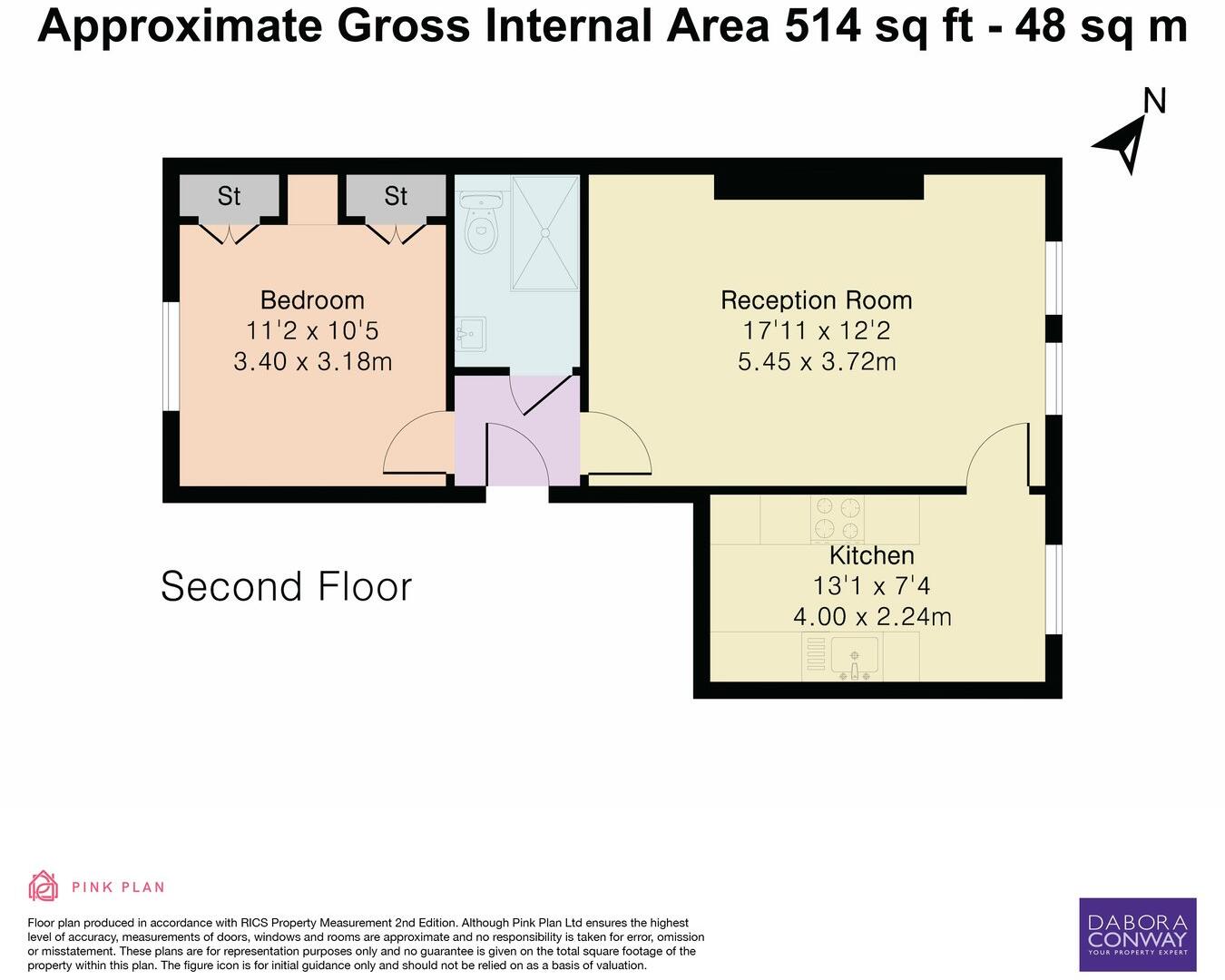
Top/second floor, one bedroom flat, within a period conversion located approx. 1/4 mile from Snaresbrook Central Line station.
- Bedrooms
- 1
- Bathrooms
- 1
The heatmap indicates the level of crime in the area. The color of the heatmap indicates the crime severity and recency.
Metrics Year-on-Year
- Average area value
- 420,625.00 £Decreased by 41.98 %
- Average area rental value
- 1,859.00 £/moDecreased by 4.42 %
- Est rental Yield
- 5.30 %Increased by 64.60 %
- Crime Rate
- 5.00 %Unchanged by 0.00 %
from 724,949.00 £
from 1,945.00 £/mo
from 3.22 %
from 5.00 %
Agent Activity
DABORACONWAY created the listing.
Nearby Schools
| Name | Type | Ofsted | Distance |
|---|---|---|---|
| Snaresbrook Primary School | Community School | Good | 0.25 KM |
| Wanstead Church School | Voluntary Aided School | Outstanding | 0.54 KM |
| Wanstead Children'S Centre | Children's Centre | 0.64 KM | |
| Snaresbrook Prep School | Other Independent School | 0.92 KM | |
| Nightingale Primary School | Community School | Outstanding | 1.08 KM |
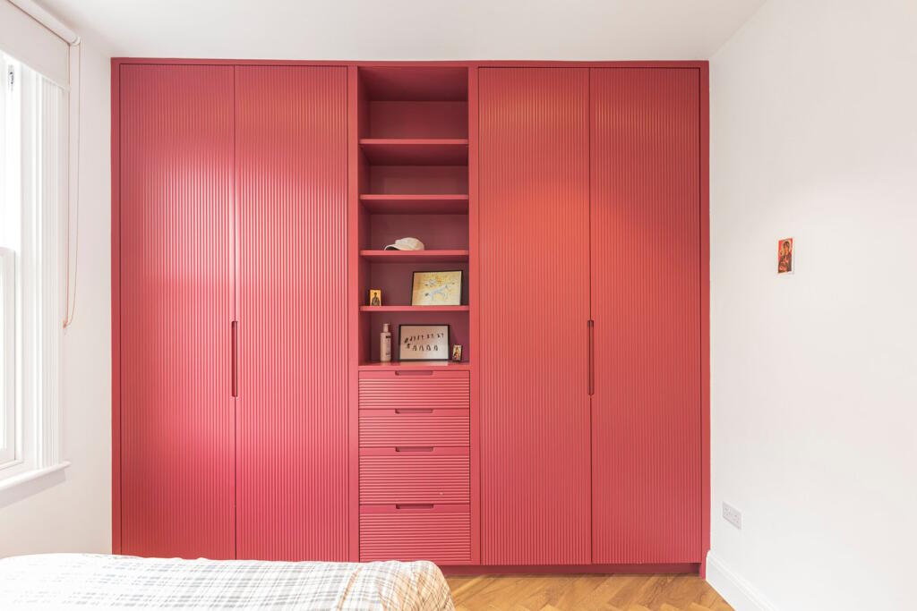
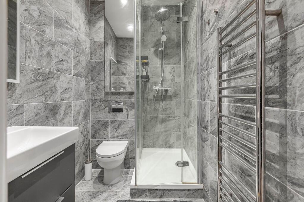
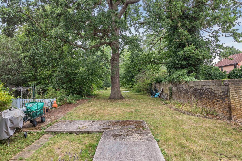
Images


Nearby Streets
| Name | Average Price | Average Sqft | Distance |
|---|---|---|---|
| Nelson Road | £ 550,000 | 0 | 0.00 KM |
| Eagle Court | £ 0 | 0 | 0.00 KM |
| Sultan Road | £ 0 | 0 | 0.00 KM |
| Esmat Close | £ 0 | 0 | 0.00 KM |
| Mountier Court | £ 0 | 0 | 0.00 KM |
Nearby Transport
| Name | NLC | TLC | Distance |
|---|---|---|---|
| Leytonstone High Road | 7403 | LER | 2.88 KM |
| Wood Street | 6954 | WST | 3.03 KM |
| Wanstead Park | 7408 | WNP | 3.56 KM |
| Forest Gate | 6876 | FOG | 3.81 KM |
| Highams Park | 6919 | HIP | 3.91 KM |
Nearby Listings
| Address | Price | Type | Score | Distance |
|---|---|---|---|---|
| Hermon Hill, WANSTEAD, E11 | £ 1,700 | RENT | Unknown | 0.00 KM |
| Hermon Hill, London, E11 | £ 1,400 | RENT | Unknown | 0.01 KM |
| Hermon Hill E11 | £ 1,850 | RENT | Unknown | 0.03 KM |
| Hermon Hill, Wanstead | £ 1,550 | RENT | Unknown | 0.08 KM |
| Hermon Hill, Wanstead | £ 1,900 | RENT | Unknown | 0.09 KM |
Nearby Properties
| Address | Price | Distance |
|---|---|---|
| 68d Hermon Hill | £ 255,000 | 0.01 KM |
| 68a Hermon Hill | £ 520,000 | 0.01 KM |
| 60 Hermon Hill | £ 648,500 | 0.01 KM |
| 68b - 68d Hermon Hill | £ 246,000 | 0.01 KM |
| 31a Hermon Hill | £ 174,999 | 0.17 KM |