TO
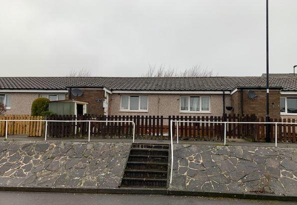
Garland Drive, Sheffield, S6
By Together Housing
£ 444
Together Housing says ..
We are delighted to offer this two bedroom bungalow in a convenient location for the over 55s. The property benefits from UPVC double glazing, gas central heating, garden and on street parking.
- Bedrooms
- 2
- Bathrooms
- 0
The heatmap indicates the level of crime in the area. The color of the heatmap indicates the crime severity and recency.
Metrics Year-on-Year
- Average area value
- 580,625.00 £Increased by 10.68 %
- Average area rental value
- 1,600.00 £/moDecreased by 9.50 %
- Est rental Yield
- 3.31 %Decreased by 18.07 %
- Crime Rate
- 13.00 %Unchanged by 0.00 %
from 524,621.00 £
from 1,768.00 £/mo
from 4.04 %
from 13.00 %
Agent Activity
Together Housing created the listing.
Nearby Schools
| Name | Type | Ofsted | Distance |
|---|---|---|---|
| Loxley Primary School | Academy Converter | 0.22 KM | |
| Shooter'S Grove Primary School | Community School | Good | 1.62 KM |
| Shooters Grove Children'S Centre | Children's Centre Linked Site | 1.75 KM | |
| Wisewood Community Primary School | Academy Sponsor Led | Requires improvement | 1.77 KM |
| Nook Lane Junior School | Academy Converter | 1.78 KM |
Images
Nearby Streets
| Name | Average Price | Average Sqft | Distance |
|---|---|---|---|
| The Grove | £ 375,000 | 0 | 0.00 KM |
| Auckland Avenue | £ 0 | 0 | 0.00 KM |
| Austin Close | £ 0 | 0 | 0.00 KM |
| Keswick Close | £ 0 | 0 | 0.00 KM |
| Cassini Drive | £ 400,000 | 0 | 0.00 KM |
Nearby Transport
| Name | NLC | TLC | Distance |
|---|---|---|---|
| Sheffield | 6691 | SHF | 8.72 KM |
| Dore And Totley | 6690 | DOR | 9.20 KM |
| Chapeltown (South Yorkshire) | 6664 | CLN | 9.73 KM |
Nearby Listings
| Address | Price | Type | Score | Distance |
|---|---|---|---|---|
| Rodney Hill, Loxley, Sheffield, S6 6SG | £ 1,300 | RENT | Unknown | 0.26 KM |
| Marchwood Road, Stannington, Sheffield, S6 | £ 1,200 | RENT | Unknown | 1.29 KM |
| High Matlock Road, Stannington, Sheffield, S6 6AS | £ 1,400 | RENT | Unknown | 1.34 KM |
| 32 Luke Lane, Sheffield, S6 4BP | £ 1,350 | RENT | Unknown | 1.49 KM |
| Rural Lane, S6 4BL | £ 1,000 | RENT | Unknown | 1.65 KM |
Nearby Properties
| Address | Price | Distance |
|---|---|---|
| 30 Phillips Road | £ 125,000 | 0.10 KM |
| 60 Phillips Road | £ 95,000 | 0.10 KM |
| 42 Phillips Road | £ 133,000 | 0.10 KM |
| 54 Phillips Road | £ 100,000 | 0.10 KM |
| 59 Phillips Road | £ 90,000 | 0.10 KM |