Karen Potter says ..
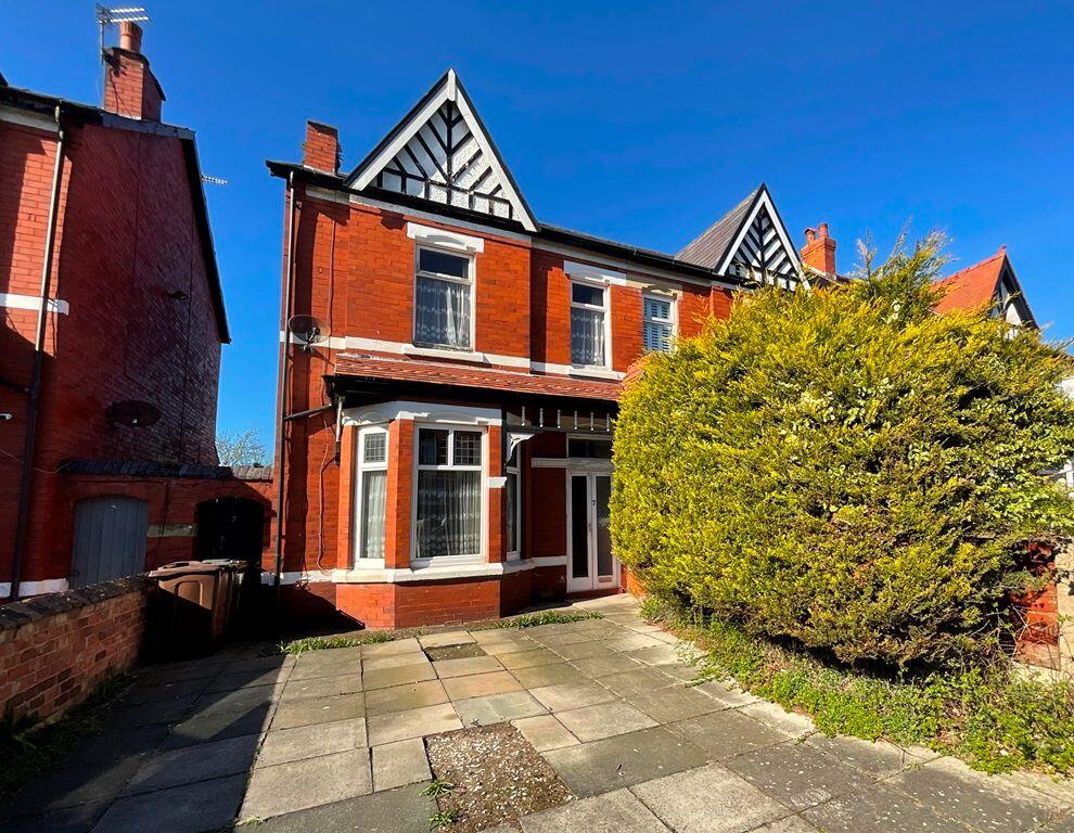
Occupying a much sought after residential area of Southport and well placed for accessing a number of highly regarded schools, this well planned, semi detached house of the 'front doors together' style requires a comprehensive programme of modernisation, though offers excellent potential.
Property Oracle says ..
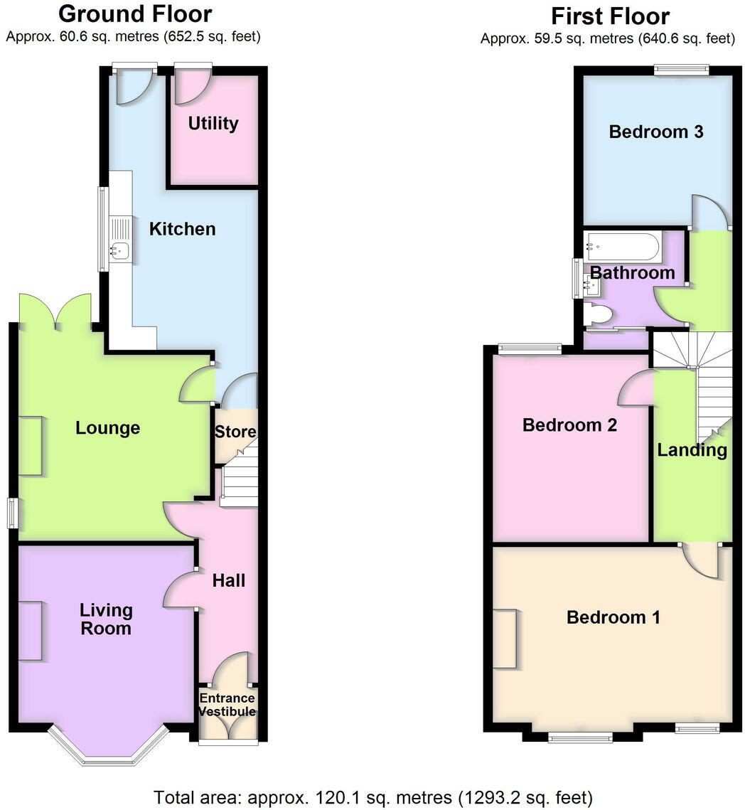
Hereford Road is located in the Norwood area of Southport, Merseyside. The property is a semi-detached house with three bedrooms and one bathroom. It has a plot size of 1,292.75 sqft and is 1,131.29 sqft in size. The list price is £210,000.
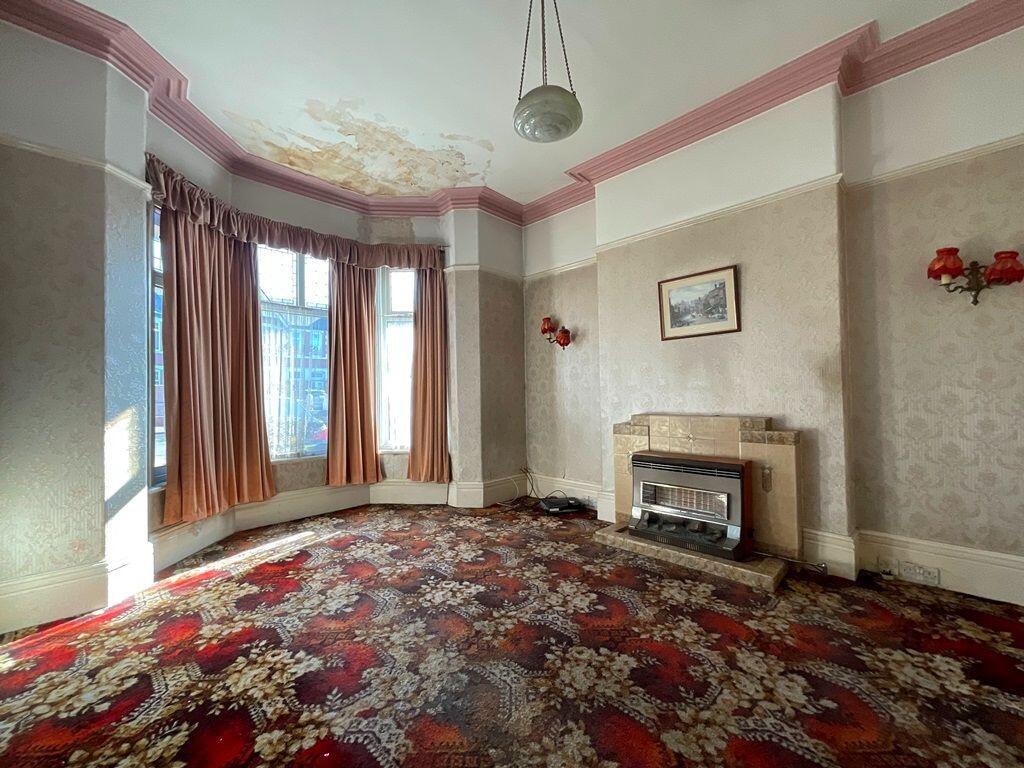
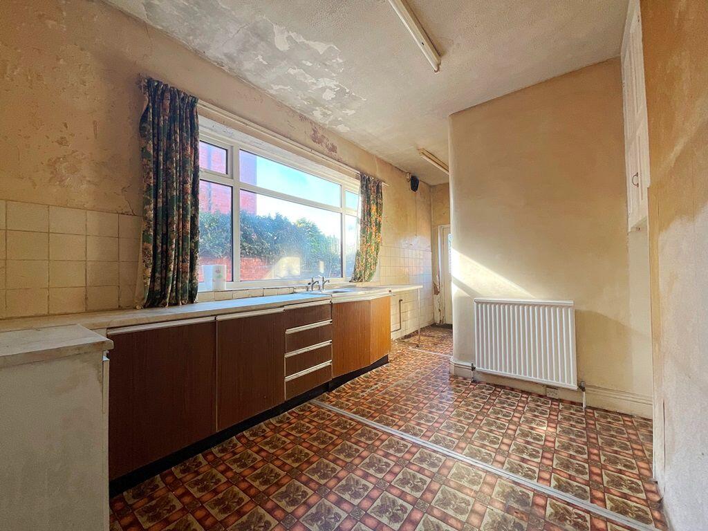
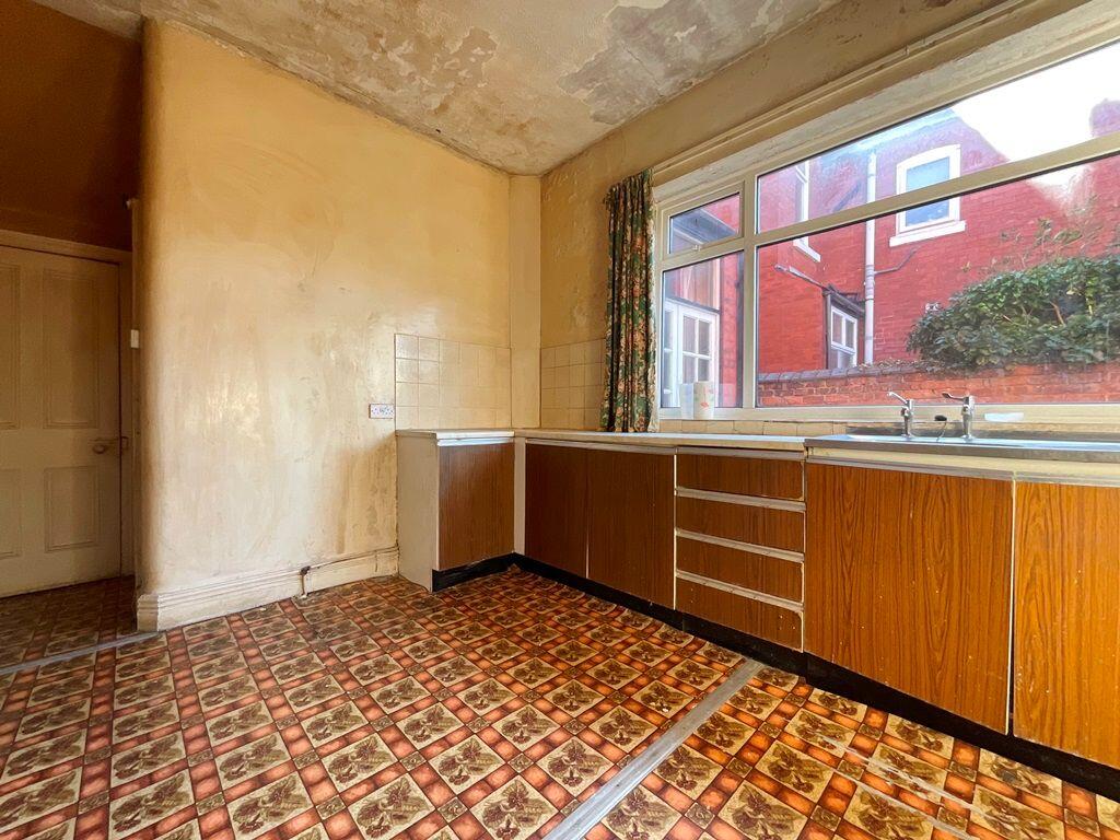
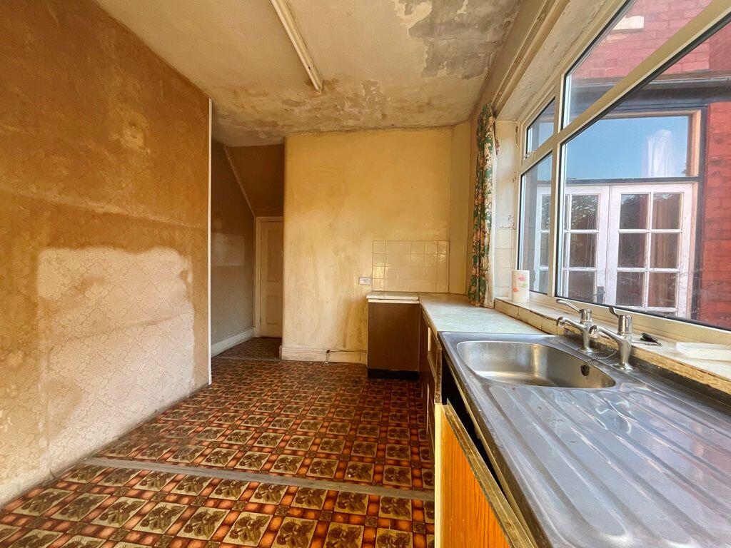
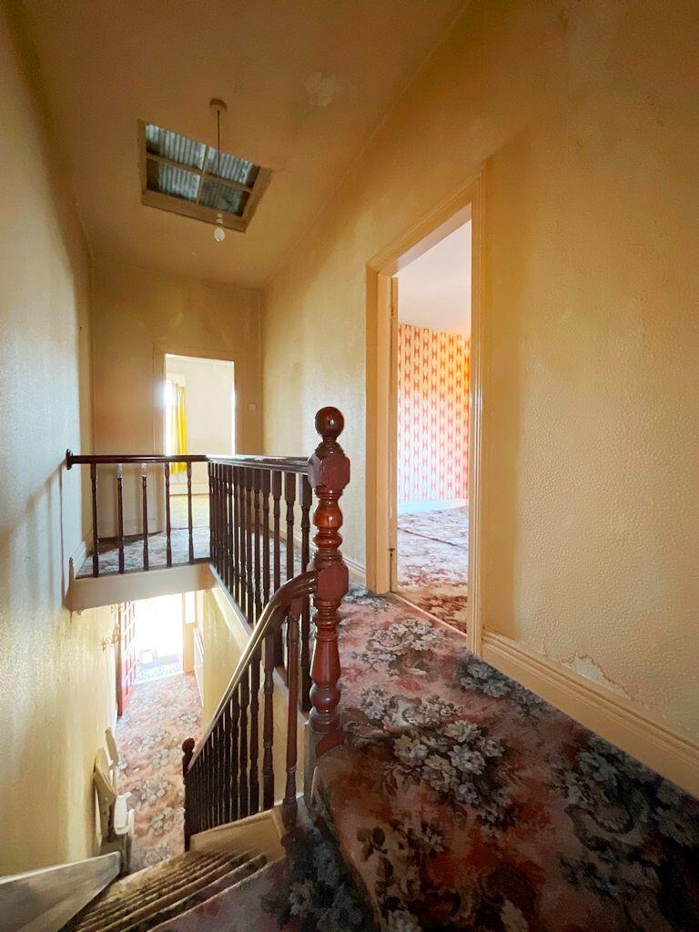
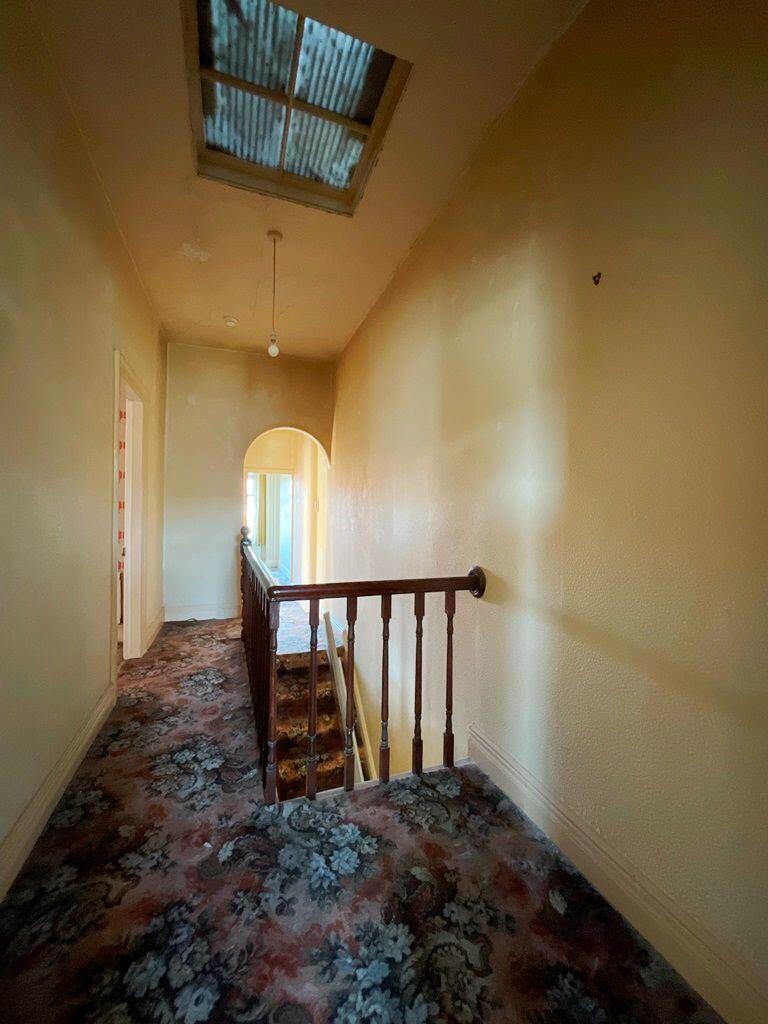
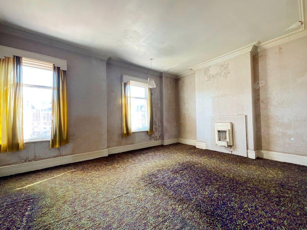
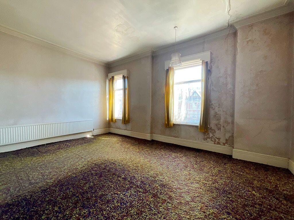
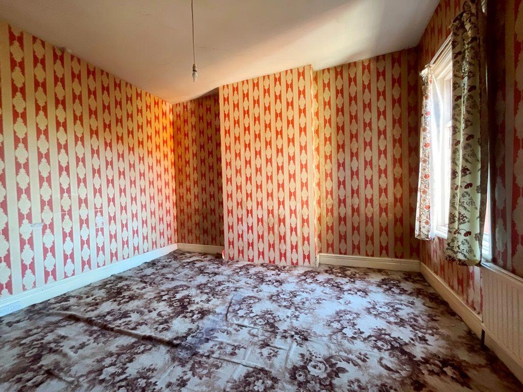
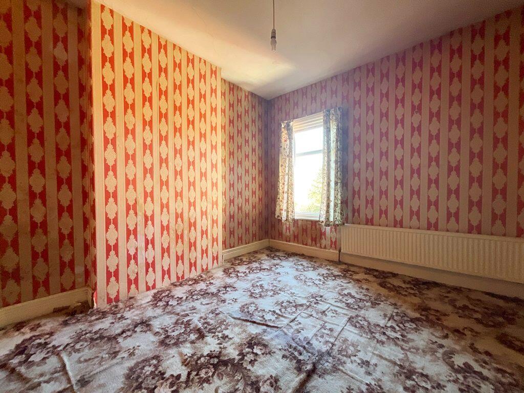
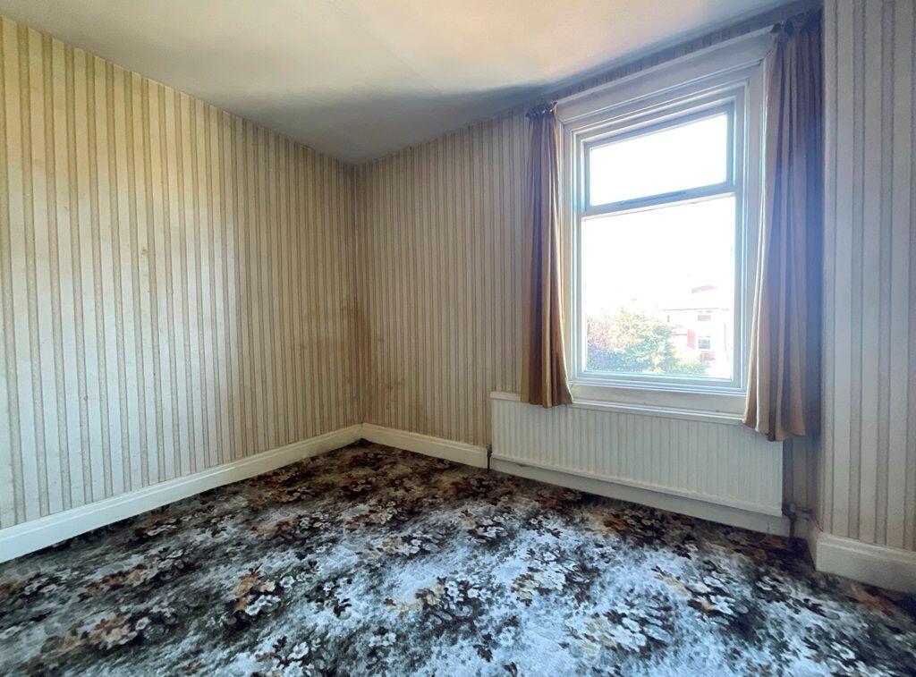
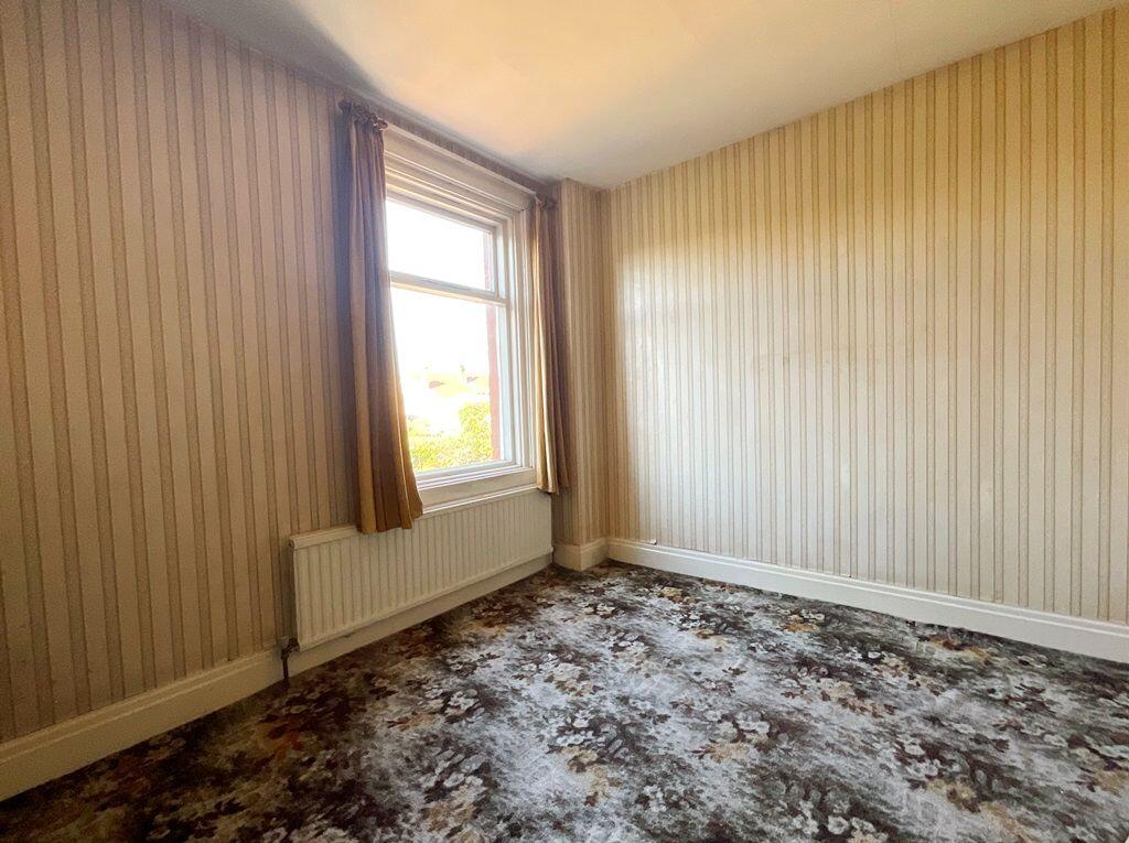
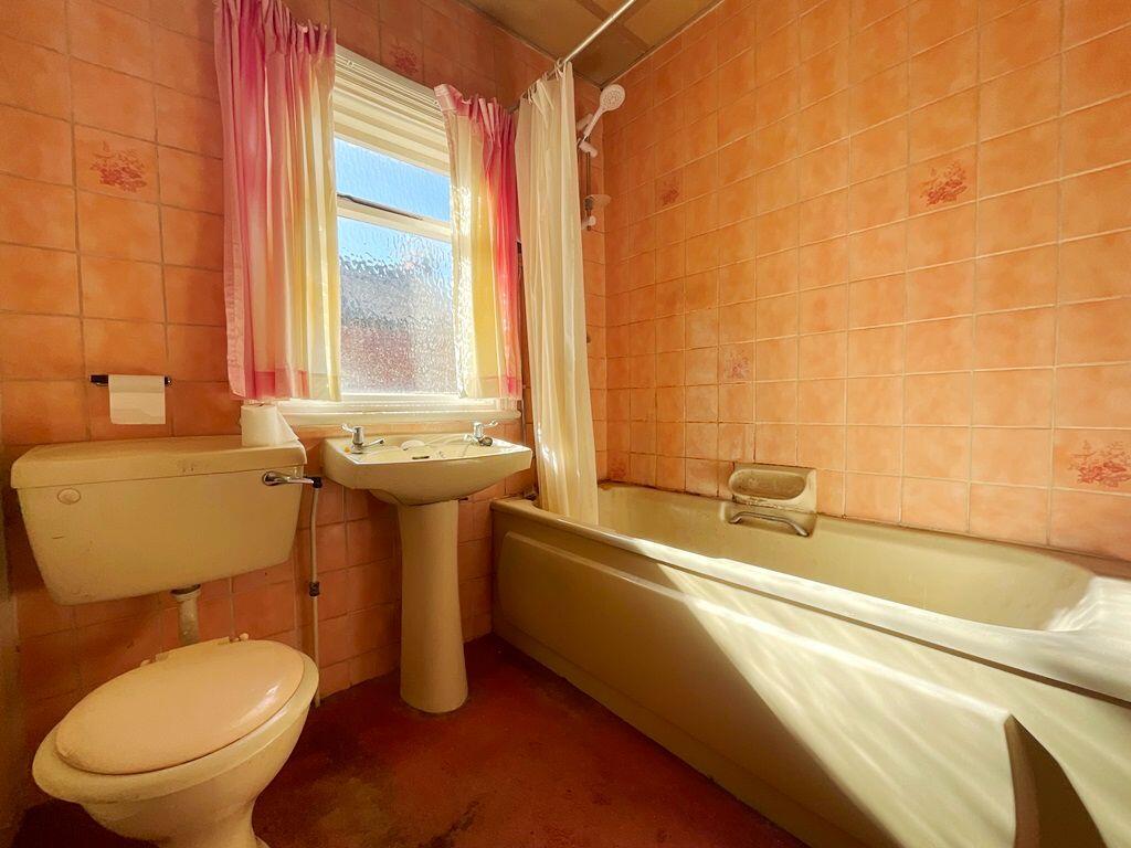
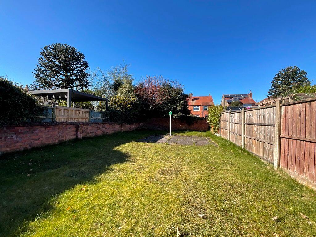
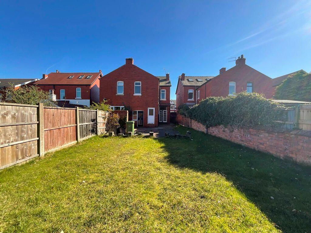
The property is in need of modernisation. The interior shows dated decor, worn carpets, and some signs of water damage to the ceilings. The kitchen and bathroom are particularly tired and require updating. The garden is of a reasonable size.
The average house price in the area is £241,449, with an average price per sqft of £229. Considering the property’s condition, the list price of £210,000 appears to be relatively reasonable, potentially even slightly below average for the area, given the need for significant renovation work. However, comparable properties on Hereford Road have sold for significantly higher prices, suggesting that the list price might undervalue the property’s potential once renovated. The lack of sqft data for nearby listings makes a precise comparison difficult.
The location benefits from being close to Norwood Primary School and Holy Family Catholic Primary School, both rated ‘Good’ by Ofsted. Meols Cop High School, rated ‘Outstanding’, is also within a reasonable distance. The proximity to Meols Cop train station provides convenient access to public transport.
Therefore, we give this property 5 / 10. *Disclaimer: This is our option and does constitute a recommendation or financial advice. Do your own research. *
- Price
- 6
- Condition
- 3
- Location
- 7
- Land
- 6
- Bedrooms
- 3
- Bathrooms
- 1
- Sqft (est)
- 1,131.29
- Lot (est)
- 1,292.75
The heatmap indicates the level of crime in the area. The color of the heatmap indicates the crime severity and recency.
Metrics Year-on-Year
- Average area value
- 273,000.00 £Increased by 27.13 %
- Est sale value
- 253,408.96 £Increased by 16.06 %
- Average area rental value
- 938.00 £/moDecreased by 8.75 %
- Est letting value
- 0.00 £/mo
- Est rental Yield
- 4.12 %Decreased by 28.22 %
- Crime Rate
- 5.00 %Unchanged by 0.00 %
Agent Activity
Karen Potter created the listing.
Nearby Schools
| Name | Type | Ofsted | Distance |
|---|---|---|---|
| Norwood Primary School | Community School | Good | 0.43 KM |
| Holy Family Catholic Primary School | Voluntary Aided School | Good | 0.48 KM |
| Meols Cop High School | Community School | Outstanding | 1.12 KM |
| Bishop David Sheppard Children'S Centre | Children's Centre Linked Site | 1.32 KM | |
| Bishop David Sheppard Church Of England Primary School | Voluntary Aided School | Good | 1.48 KM |
Images


Nearby Streets
| Name | Average Price | Average Sqft | Distance |
|---|---|---|---|
| Brompton Road | £ 0 | 0 | 0.00 KM |
| Grove Park | £ 0 | 0 | 0.00 KM |
| Keats Terrace | £ 190,000 | 0 | 0.00 KM |
| Willow Grove | £ 0 | 0 | 0.00 KM |
| Gladstone Road | £ 0 | 0 | 0.00 KM |
Nearby Transport
| Name | NLC | TLC | Distance |
|---|---|---|---|
| Meols Cop | 2357 | MEC | 0.27 KM |
| Southport | 2262 | SOP | 2.98 KM |
| Birkdale | 2352 | BDL | 4.59 KM |
| Hillside | 2231 | HIL | 6.18 KM |
| Bescar Lane | 2351 | BES | 7.29 KM |
Nearby Listings
| Address | Price | Type | Score | Distance |
|---|---|---|---|---|
| Hereford Road, Southport | £ 210,000 | BUY | 5 / 10 | 0.00 KM |
| Hereford Road, Southport, PR9 7DX | £ 335,000 | BUY | 7 / 10 | 0.04 KM |
| Norwood Avenue, Southport, PR9 | £ 575,000 | BUY | Unknown | 0.08 KM |
| Norwood Avenue, Southport, Merseyside, PR9 7EQ | £ 500,000 | BUY | 7 / 10 | 0.10 KM |
| Hereford Road, Southport, PR9 | £ 325,000 | BUY | 7 / 10 | 0.11 KM |
Nearby Properties
| Address | Price | Distance |
|---|---|---|
| 24 Hereford Road | £ 310,000 | 0.10 KM |
| 16 Hereford Road | £ 325,000 | 0.10 KM |
| 41 Hereford Road | £ 210,000 | 0.10 KM |
| 26 Hereford Road | £ 172,500 | 0.10 KM |
| 52 Hereford Road | £ 158,000 | 0.10 KM |