
Forresters Lane, Coal Aston, Dronfield
By Saxton Mee
£ 165,000
Reviews
2 out of 5 stars
Saxton Mee says ..
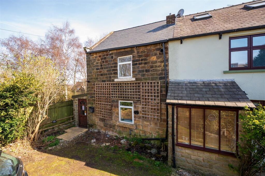
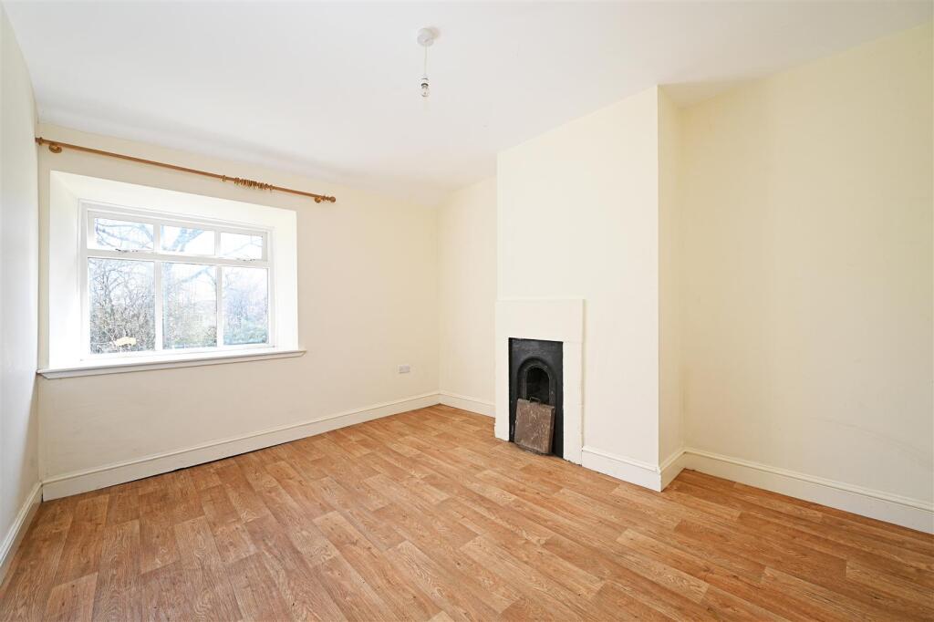
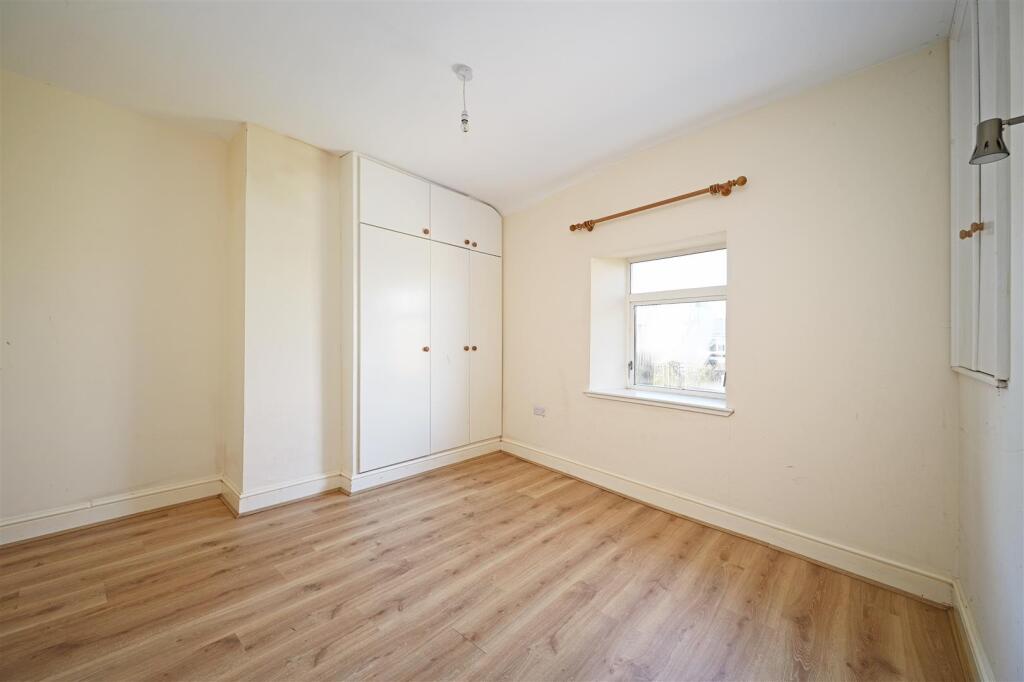
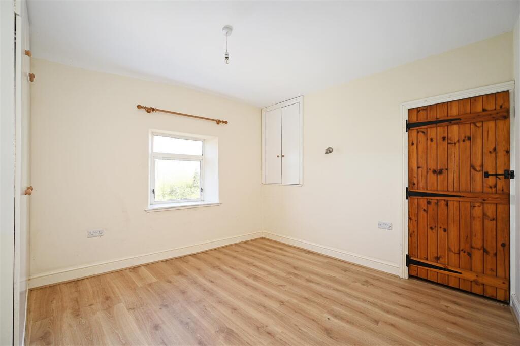
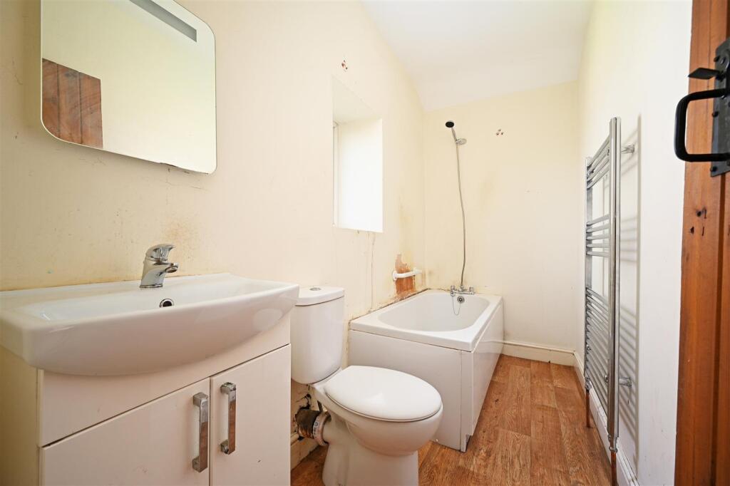
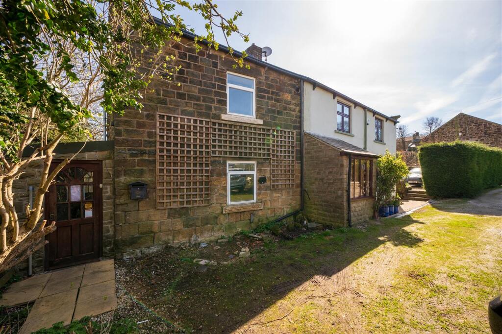
Set well away from the main thoroughfare approached by a private lane is this immediately appealing two bedroomed stone built semi detached period cottage which is conveniently placed close to the centre of Coal Aston and within easy reach of a comprehensive range of amenities in Dronfield inclu...
Property Oracle says ..
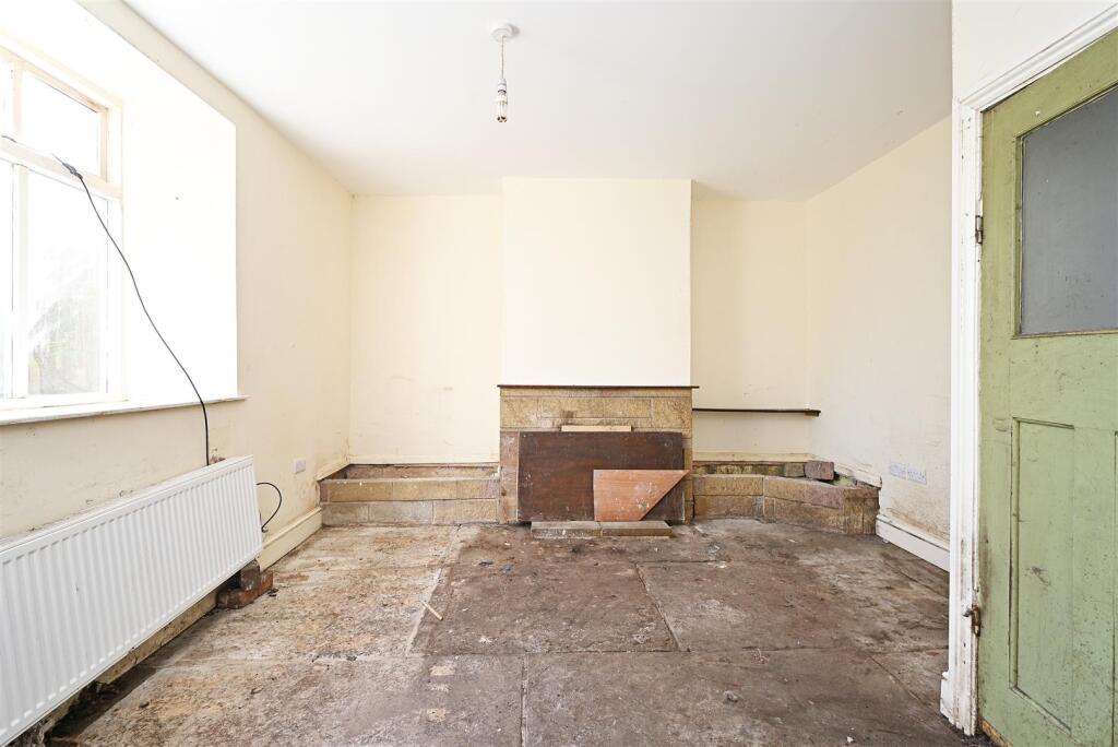
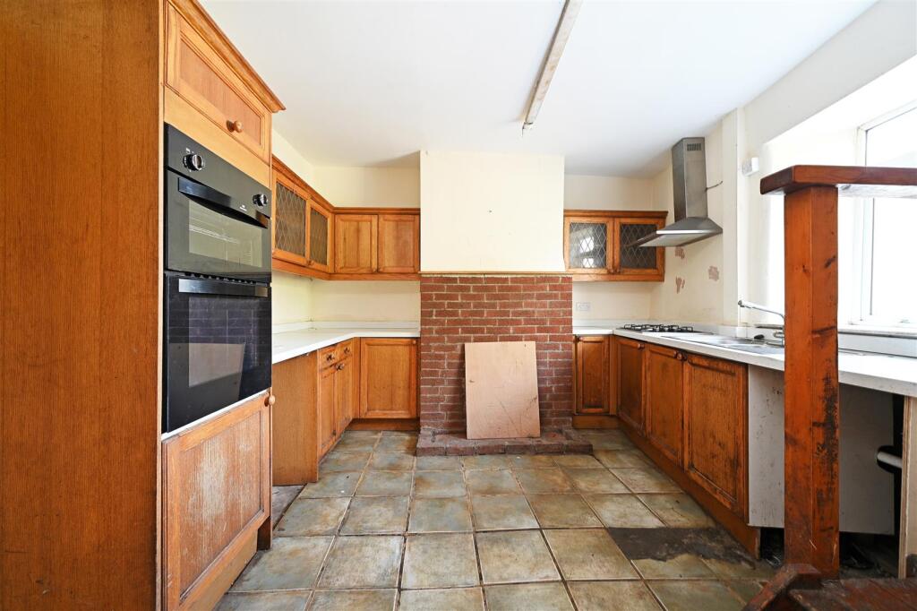
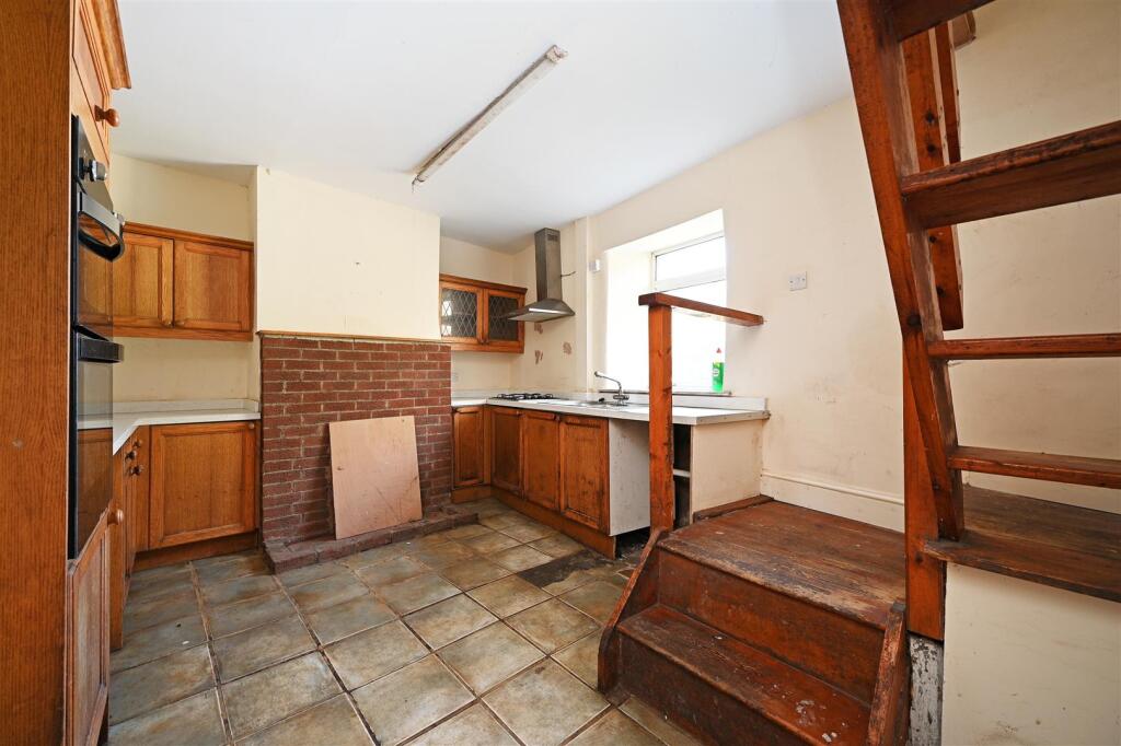
This property is a 2 bedroom cottage located in Coal Aston, Dronfield. It is listed for £165,000 and has 833.13 sqft of living space. The property is in need of renovation, as seen in the photos. The location is good, with nearby schools and transportation. However, the plot size is small. Considering the condition, location, and land, the price seems reasonable.
Therefore, we give this property 4 / 10. *Disclaimer: This is our option and does constitute a recommendation or financial advice. Do your own research. *
- Price
- 6
- Condition
- 3
- Location
- 7
- Land
- 3
- Bedrooms
- 2
- Bathrooms
- 1
- Sqft (est)
- 833.13
The heatmap indicates the level of crime in the area. The color of the heatmap indicates the crime severity and recency.
Metrics Year-on-Year
- Average area value
- 448,325.00 £Decreased by 13.51 %
- Est sale value
- 429,895.08 £Increased by 0.98 %
- Average area rental value
- 1,480.00 £/moDecreased by 11.32 %
- Est letting value
- 833.13 £/moUnchanged by 0.00 %
- Est rental Yield
- 3.96 %Increased by 2.59 %
- Crime Rate
- 3.00 %Unchanged by 0.00 %
Agent Activity
Saxton Mee created the listing.
Nearby Schools
| Name | Type | Ofsted | Distance |
|---|---|---|---|
| Northfield Junior School | Community School | Good | 0.58 KM |
| Holmesdale Infant School | Community School | Outstanding | 0.65 KM |
| Dronfield Stonelow Junior School | Community School | Good | 0.80 KM |
| Lenthall Infant And Nursery School | Community School | Good | 0.88 KM |
| Dronfield Henry Fanshawe School | Voluntary Controlled School | Outstanding | 1.31 KM |
Images


Nearby Streets
| Name | Average Price | Average Sqft | Distance |
|---|---|---|---|
| Meadow Close | £ 300,000 | 0 | 0.00 KM |
| Paddock Way | £ 0 | 0 | 0.00 KM |
| The Avenue | £ 365,000 | 0 | 0.00 KM |
| Park Avenue | £ 0 | 0 | 0.00 KM |
| Sycamore Avenue | £ 0 | 0 | 0.00 KM |
Nearby Transport
| Name | NLC | TLC | Distance |
|---|---|---|---|
| Dronfield | 6616 | DRO | 1.49 KM |
| Dore And Totley | 6690 | DOR | 6.41 KM |
| Sheffield | 6691 | SHF | 7.46 KM |
| Chesterfield | 6615 | CHD | 9.23 KM |
| Darnall | 6729 | DAN | 9.69 KM |
Nearby Listings
| Address | Price | Type | Score | Distance |
|---|---|---|---|---|
| Forresters Lane, Coal Aston, Dronfield | £ 165,000 | BUY | 4 / 10 | 0.00 KM |
| Eckington Road, Coal Aston, S18 | £ 180,000 | BUY | 7 / 10 | 0.03 KM |
| Green Lane, Dronfield | £ 675,000 | BUY | Unknown | 0.14 KM |
| Holmley Lane, Coal Aston, Dronfield | £ 325,000 | BUY | 8 / 10 | 0.16 KM |
| Farm Close, Dronfield | £ 270,000 | BUY | 6 / 10 | 0.17 KM |
Nearby Properties
| Address | Price | Distance |
|---|---|---|
| 24 Eckington Road | £ 100,000 | 0.03 KM |
| 34 Eckington Road | £ 382,500 | 0.03 KM |
| 1 Eckington Road | £ 345,000 | 0.03 KM |
| 28 Eckington Road | £ 152,500 | 0.03 KM |
| 8 Eckington Road | £ 130,000 | 0.03 KM |