holland & odam says ..
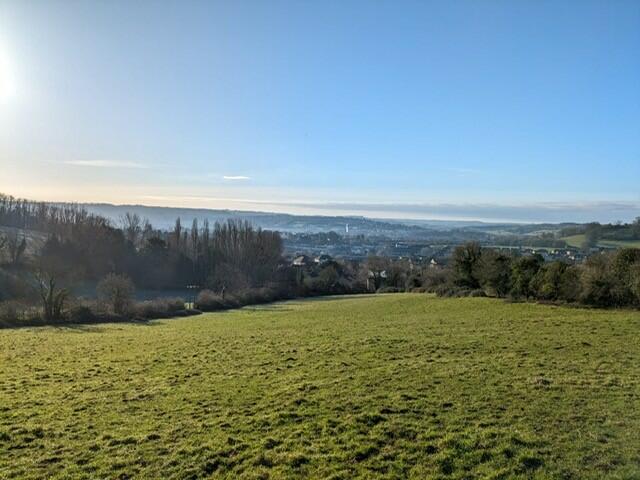
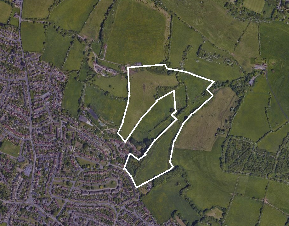
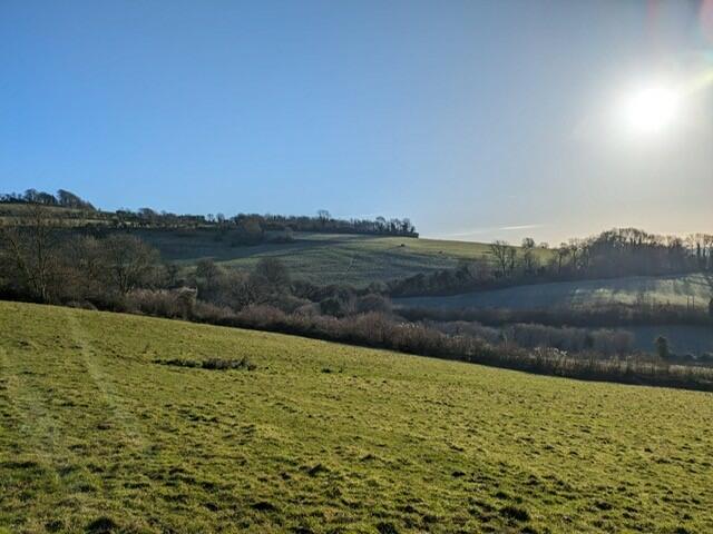
28.9 acres (11.73 Hectares) This 28.9 acres (11.73 Hectares) parcel of land is located on the Southern slopes of Lansdown elevated above Weston providing far reaching views over the City and beyond. Comprising of four enclosed fields currently used for grazing. With direct road access with ...
Property Oracle says ..
This property listing presents a unique opportunity to purchase a significant parcel of land (29.9 acres) in Weston, Bath. The land itself appears to be in excellent condition, as evidenced by the provided photographs, showcasing a well-maintained, expansive grassy area with scenic views. The location offers a balance between rural tranquility and accessibility to nearby urban amenities, including schools and transportation links to Bath. The absence of building structures means the sale focuses solely on the land’s potential for development or other uses, such as agriculture or conservation. While precise pricing comparisons are limited due to the lack of square footage data for comparable land sales in the immediate area, the listed price of £750,000 is arguably reasonable, considering the substantial size of the plot and the high land values characteristic of the Bath area. Investors or individuals seeking significant land holdings in a scenic location near Bath would be the ideal buyers for this property. The absence of buildings and utilities makes this a ‘raw land’ purchase, meaning buyers must budget for any future developments or infrastructure requirements. Further due diligence regarding planning permissions and potential development opportunities is essential before proceeding with a purchase.
Therefore, we give this property 8 / 10. *Disclaimer: This is our option and does constitute a recommendation or financial advice. Do your own research. *
- Price
- 7
- Condition
- 9
- Location
- 7
- Land
- 10
- Bedrooms
- 0
- Bathrooms
- 0
The heatmap indicates the level of crime in the area. The color of the heatmap indicates the crime severity and recency.
Metrics Year-on-Year
- Average area value
- 642,000.00 £Increased by 16.43 %
- Average area rental value
- 1,065.00 £/moDecreased by 51.26 %
- Est rental Yield
- 1.99 %Decreased by 58.11 %
- Crime Rate
- 18.00 %Unchanged by 0.00 %
Agent Activity
holland & odam created the listing.
Nearby Schools
| Name | Type | Ofsted | Distance |
|---|---|---|---|
| Weston Children'S Centre | Children's Centre | 0.69 KM | |
| St Mary'S Catholic Primary School | Voluntary Aided School | Good | 0.69 KM |
| Weston All Saints Cofe Primary School | Academy Converter | 0.81 KM | |
| Newbridge Primary School | Community School | Good | 1.57 KM |
| Kingswood Preparatory School | Other Independent School | 1.83 KM |
Images
Nearby Streets
| Name | Average Price | Average Sqft | Distance |
|---|---|---|---|
| Mortimer Close | £ 0 | 0 | 0.00 KM |
| Beresford Gardens | £ 0 | 0 | 0.00 KM |
| Manor Park | £ 0 | 0 | 0.00 KM |
| Oakfield Close | £ 0 | 0 | 0.00 KM |
| Rosslyn Close | £ 0 | 0 | 0.00 KM |
Nearby Transport
| Name | NLC | TLC | Distance |
|---|---|---|---|
| Oldfield Park | 3219 | OLF | 2.45 KM |
| Bath Spa | 3271 | BTH | 4.31 KM |
Nearby Listings
| Address | Price | Type | Score | Distance |
|---|---|---|---|---|
| Weston, Bath (29.9 acres) | £ 750,000 | BUY | 8 / 10 | 0.00 KM |
| The Weal, Bath, Somerset, BA1 | £ 300,000 | BUY | Unknown | 0.10 KM |
| Prospect Place, Bath | £ 420,000 | BUY | 6 / 10 | 0.23 KM |
| Lynfield Park, Bath, BA1 | £ 650,000 | BUY | 7 / 10 | 0.24 KM |
| Purlewent Drive, Weston, Bath, BA1 | £ 405,000 | BUY | 7 / 10 | 0.30 KM |
Nearby Properties
| Address | Price | Distance |
|---|---|---|
| 12 The Weal | £ 286,006 | 0.10 KM |
| 30 The Weal | £ 197,500 | 0.10 KM |
| 42 The Weal | £ 185,000 | 0.10 KM |
| 46 The Weal | £ 300,000 | 0.10 KM |
| 8 The Weal | £ 160,000 | 0.10 KM |