IN
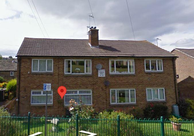
Lingfield Road, BD15
By Incommunities
£ 450
Incommunities says ..
A 1 bedroom, first floor flat in a highly sought after area.
- Bedrooms
- 1
- Bathrooms
- 2
The heatmap indicates the level of crime in the area. The color of the heatmap indicates the crime severity and recency.
Metrics Year-on-Year
- Average area value
- 278,173.00 £Increased by 4.57 %
- Average area rental value
- 980.00 £/moIncreased by 13.69 %
- Est rental Yield
- 4.23 %Increased by 8.74 %
- Crime Rate
- 31.00 %Unchanged by 0.00 %
from 266,011.00 £
from 862.00 £/mo
from 3.89 %
from 31.00 %
Agent Activity
Incommunities created the listing.
Nearby Schools
| Name | Type | Ofsted | Distance |
|---|---|---|---|
| Wilsden Primary School | Academy Converter | Requires improvement | 0.31 KM |
| Harden Primary School | Academy Converter | Good | 2.66 KM |
| Sandy Lane Primary School | Community School | Good | 2.94 KM |
| Thornton Primary School And Children'S Centre | Children's Centre | 3.42 KM | |
| Thornton Primary School | Academy Converter | Good | 3.44 KM |
Images
Nearby Streets
| Name | Average Price | Average Sqft | Distance |
|---|---|---|---|
| Moorside Road | £ 0 | 0 | 0.00 KM |
| Anderson Street | £ 157,500 | 0 | 0.00 KM |
| Smithy Lane | £ 0 | 0 | 0.00 KM |
| Mayfield Grove | £ 240,000 | 0 | 0.00 KM |
| Dean Lane | £ 0 | 0 | 0.00 KM |
Nearby Transport
| Name | NLC | TLC | Distance |
|---|---|---|---|
| Bingley | 8553 | BIY | 3.83 KM |
| Crossflatts | 8554 | CFL | 4.40 KM |
| Keighley | 8468 | KEI | 7.08 KM |
| Saltaire | 8561 | SAE | 7.74 KM |
| Shipley (Yorks) | 8347 | SHY | 9.46 KM |
Nearby Listings
| Address | Price | Type | Score | Distance |
|---|---|---|---|---|
| Main Street, BD15 | £ 750 | RENT | Unknown | 0.12 KM |
| Main Street, Wilsden, West Yorkshire, BD15 | £ 900 | RENT | Unknown | 0.20 KM |
| Victoria Street, Wilsden, Bradford, West Yorkshire, BD15 | £ 875 | RENT | Unknown | 0.23 KM |
| Low Wood, Wilsden | £ 795 | RENT | Unknown | 0.34 KM |
| WELLINGTON ROAD, WILSDEN, BRADFORD, BD15 0LP | £ 1,450 | RENT | Unknown | 0.42 KM |
Nearby Properties
| Address | Price | Distance |
|---|---|---|
| 10 Lingfield Road | £ 38,000 | 0.00 KM |
| 48 Lingfield Road | £ 175,000 | 0.00 KM |
| 42 Lingfield Road | £ 130,000 | 0.00 KM |
| 47 Lingfield Road | £ 222,000 | 0.00 KM |
| 43 Lingfield Road | £ 230,000 | 0.00 KM |